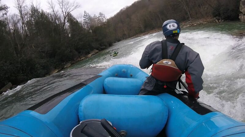
Jul 16, 2026
Several new trees from summer storms are now in the creek, all are avoidable. The worst is hanging down in the rapid below Little Splat and above Big Splat.
Jul 11, 2017
It appears the guy in the white house with the repeat offender white Pittbull has moved. As of last week it looked like new people were moving in. No dogs seen. Run/bike safe, I still recommend a big stick or can of pepper spray for this shuttle by foot.
Jul 11, 2017
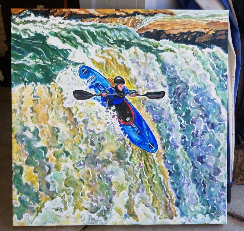
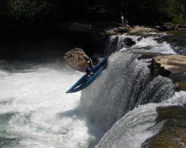
Acrylic painting of Amry Szymanski on Wonder Falls by Dennis Huntley
Apr 6, 2017
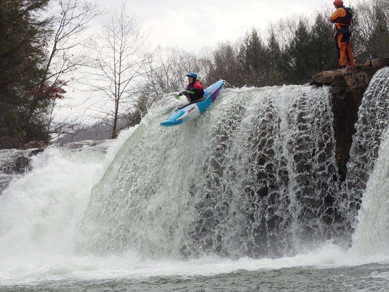
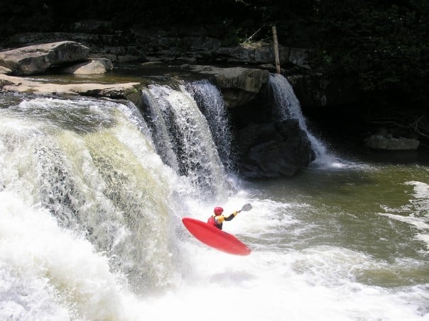
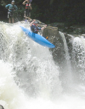
Kelly's first Wonder Falls launch
Apr 6, 2017
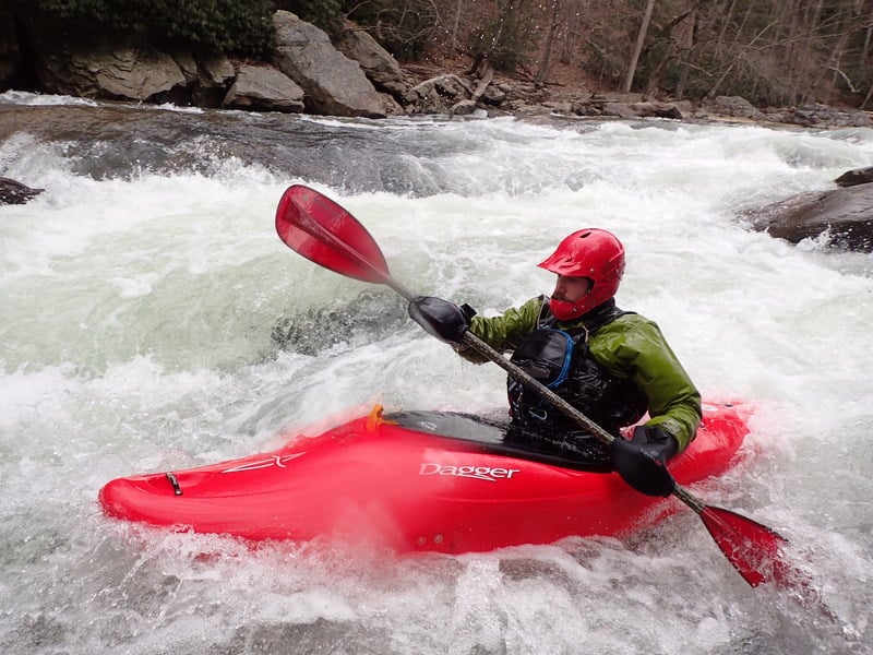
John at Little Splat
Apr 6, 2017
Nancy at little Splat
Apr 6, 2017
Joe at Little Splat
Aug 4, 2011
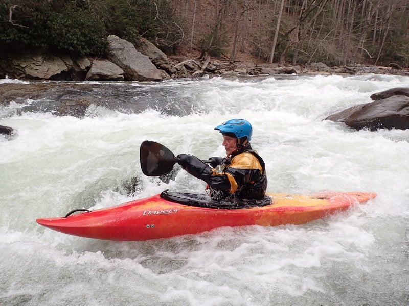
Bob Heckler on the Big Sandy
Sep 28, 2010
Seal Launch
Feb 2, 2010
Rob F----Hey, so I noticed some people have finally caught on to the northern approach to the put-in from the Morgantown-Bruceton Mills road; you have to turn south at Laurel Run (unmarked), near the bridge that you drive over. This approach is good only if you have a high-clearance vehicle to run the shuttle. People with low-clearance vehicles should maybe park on the south side at the top of the hill and walk the 1/2 mile or so down to the put-in. The problem is that many of us can't drive up the hill alongside Sovern Run, the short, direct shuttle route. Running the shuttle via the north side adds about 40 minutes each way. (Please don't drive like maniacs---it's bad PR, you know!) P.S. That tree at Graveyard Rock (downstream of 'First Island') is still quite potentially hazardous at low water, despite the fact that the streamkeeper keeps deleting my warning!
Nov 29, 2007
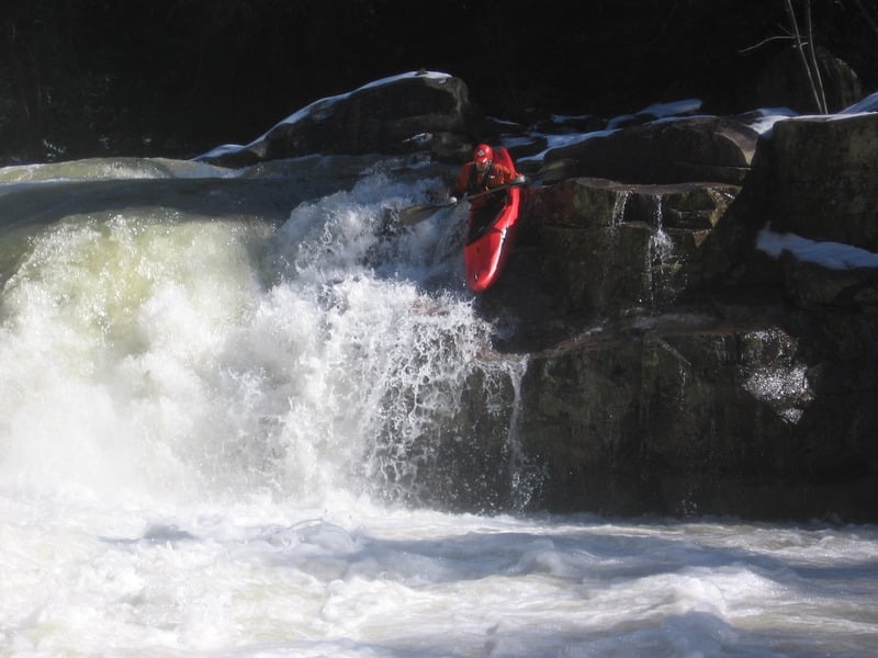
I think Matt likes this drop!
Nov 29, 2007
Charlie peeling out after the Big Splat portage.
Oct 30, 2007
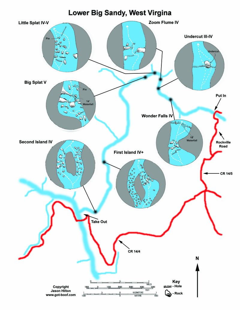
Here is a detailed rapid map for the Lower Big Sandy. Enjoy!!!
Aug 13, 2007
Bill Running 1st Island. What a Awsome run this is.
Aug 11, 2007
Summertime on the Sandy...
Apr 2, 2007
Jay Ditty on his preferred high water line at Wonder Falls. It's pretty conservative and by that I mean far to the right.
Ed Gaker looking good on the center line at Wonder
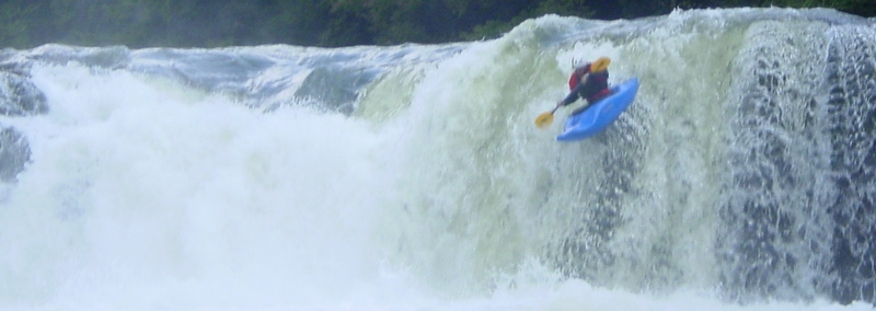
Jay Ditty styling the main line at Splat at high water
Jay Ditty, nicely done
Ed Gaker on Splat
Jan 9, 2007
The directions above don't seem to make any sense to me. Here are some better directions:
Starting at Bruceton Mills, go south on 26 about 5 miles or so (estimate) until you come to Little Sandy Creek (unmarked).
Immediately south of the creek, turn right on Little Sandy Creek Rd, drive through a small community and past a large-ish church.
Follow this road. After a mile or so, stay right at an unmarked fork near the crest of a hill.
Shortly after you crest a very steep hill, turn right (downhill) on Sovern Run Rd. (unmarked). If you cross the one-lane bridge over Sovern Run, you've gone too far. Drive down Sovern Run to Rockville (i.e. the put-in bridge, unmarked).
Takeout: Drive up Sovern Run Rd. Turn right at the top. Cross the one-lane bridge.
The road basically comes to a T. Turn left. Continue to the Mt. Nebo Church.
At a funky, four-way intersection at the church, stay right, and go up the hill. Follow this road to the bridge across the Cheat (Jenkinsburg).
Jun 29, 2006
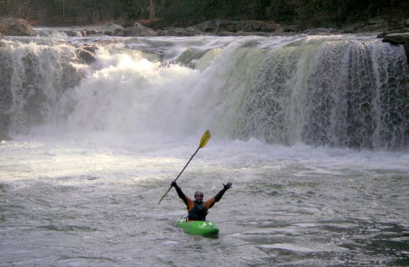
Ryan's First Decent of the Falls
Jun 4, 2006
I don't know anyone who calls Big Splat 5.1, at least, not anyone who actually runs it, but maybe I'm not cool enough to sandbag people. (Streamkeeper note: This is not my rating but it is AW's rating, see link: http://www.americanwhitewater.org/content/Wiki/safety:class5benchmarkrapids for a list.)
I and my friends call it Class 6, at moderate levels and above. Certainly, even at ideal levels it's no easier than 5+. This includes the upper part.
-Don't confuse running the approach rapid to the (Big Sandy/Wonder) Falls with running the Falls. I have stood on rocks at the base of the Falls that are only one foot below water level, right in the middle of the right-side chute. To run that side is to risk a serious piton injury.
-And I enjoy the Sandy down to 4.7.
-Oh, and, probably, portaging Big Splat on the left is a good idea at or above 6.0, due to the eddy fence on the right, at the must-make eddy. Sneak left well-upstream to increase your longevity. FYI.
I noticed that someone rated Undercut Rock Class 2+. This is ridiculous and very dangerous! The left side is Class 3, while the Undercut Rock itself is Class 5-6!!! The description implies that the right side might be Class 2+, and that could get someone killed!!!
-And it is too harder than the Upper Yough and the Watauga!
Also, for you hard-core boaters out there, please note that the second ledge in Big Splat is changing. Where there used to be a flat, smooth slab, much of the slab has broken off and is tilting perilously. This creates piton spots on the formerly-smooth bench above the U-hole. Note that the water pushes more to the right, now. This slab is undoubtedly the next Big Splat Rock, waiting for a big flood to move it farther downstream.
Jan 15, 2006
learning to kayak...
Feb 21, 2005
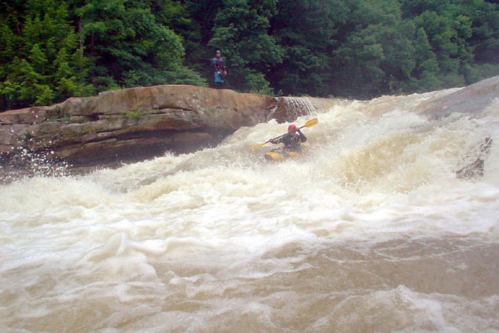
This was mikes first run of Big Splat
This is how it's supposed to be run.
Dec 28, 2004
You can run the Lower Sandy pretty low. My minimum in a glass boat is 5.3; locals in creek boats go down to 4.8'Rafter like 5.8 or more.
Sep 10, 2004
Hurricane Frances
Hurricane Frances.
Hurricane Frances.
Jun 18, 2004
This is a view from river right looking back toward Big Splat.
It’s hard to get an idea of the vertical drop with images taken from above. So, I'll try this one. It's fast! Guess that's why they call it 'Zoom'.
Mar 13, 2004
Jen Franko is right on line for the last part of this 3 part drop.
Nov 24, 2003
That's fatter than a Thanksgiving Turkey
Nov 22, 2003
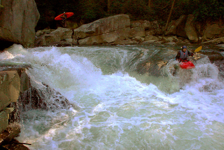
Jon is doing a rock launch. The 'run line' will drop you much closer to splat rock (just visible at the bottom of the drop). The 'horseshoe' is in the background.
DON'T screw-up in the horseshoe!
Sep 21, 2003
This is Martin doing the boof at the Horseshoe. Don't mess up here or you could be in for a very bad line at Big Splat.
May 15, 2003
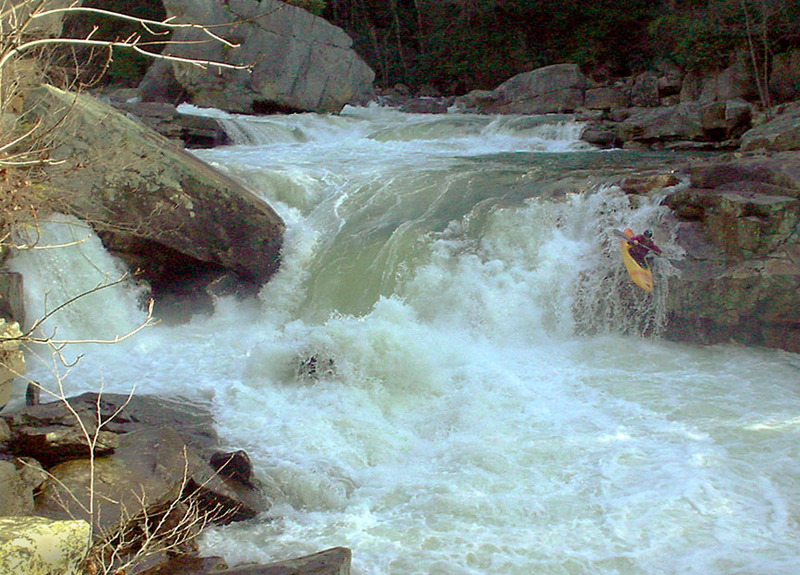
Amy running wonder perfectly.
Apr 15, 2002
Mike Giddings and Tom O'Keefe hanging out.
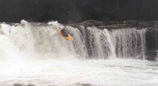
Personal first descent of Wonder Falls. Whoo boy, that was fun. Think I'll do it again.
Jul 15, 2001
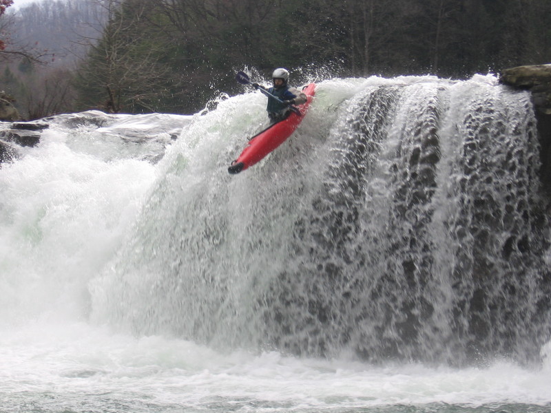
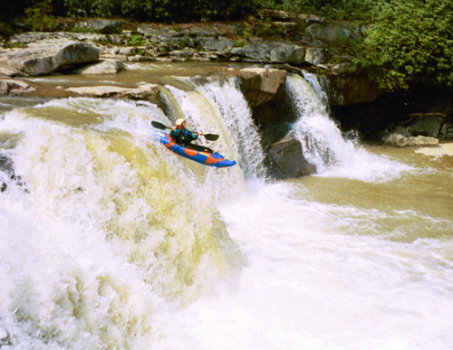
Tim Bromelkamp drops over 17-foot Wonder Falls on his first descent of the Lower Big Sandy.
Apr 1, 1999
You can see the first gun-barrel drop at the beginning. Wilko's finishing up the rapid just fine, boofing the final drop to avoid the rock and hole in the middle.
Jan 1, 1900
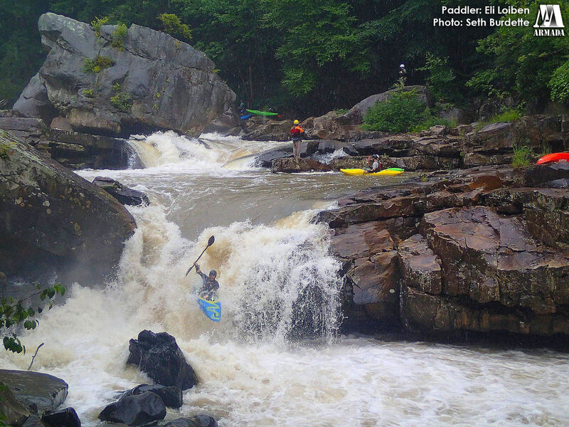
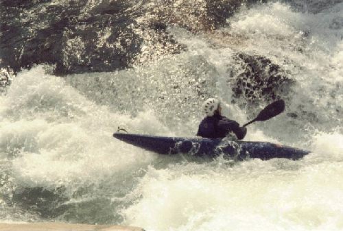
Eli Loiben always runs Big Splat with style.
Jan 1, 1900
R1 Poop Chute of Wonder Falls, accepting a gentle fail into the soft embrace of froth.
Jan 1, 1900
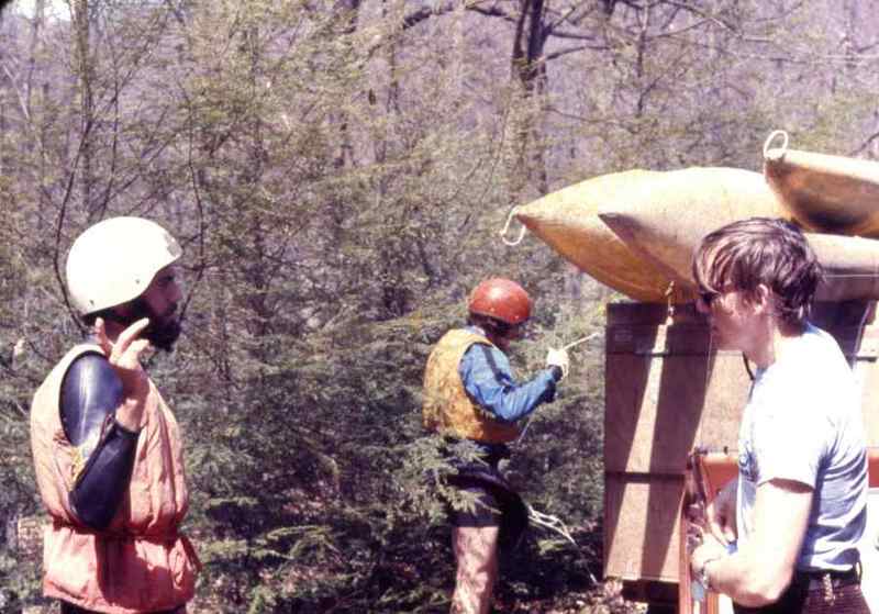
Jack's famous truck in the background.
Jan 1, 1900
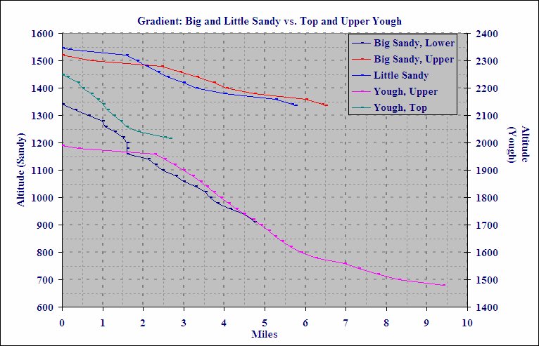
Plot generated from USGS topo maps. The Top Yough and Upper Yough have very consistent gradient through the meat of the runs, while the Lower Big Sandy has some big drops punctuating the run. The gradient of the Little Sandy and the Upper Big Sandy is similar.
Jan 1, 1900
Our first Low water run on the Big Sandy. A wee bit tougher but a Lot of fun!
Jan 1, 1900
Beginning of route.
Jan 1, 1900
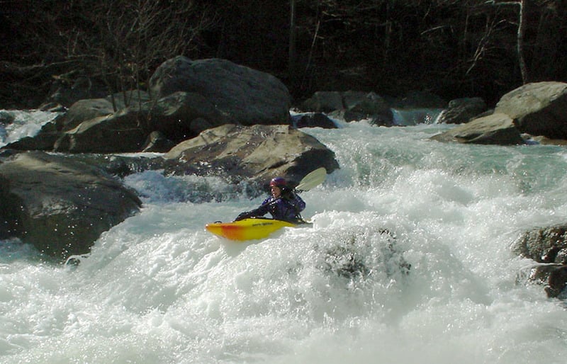
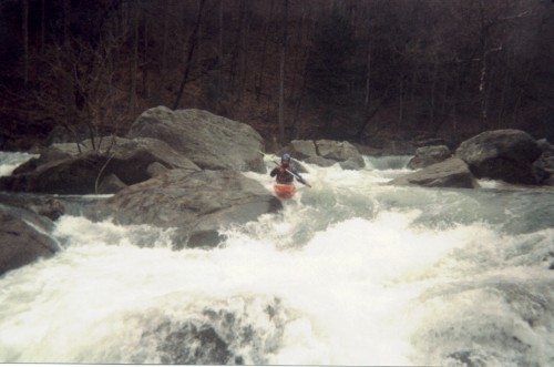
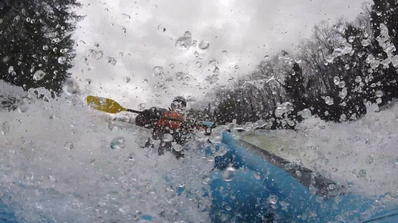
This is only part of a good-sized rapid. Kelly is entering the tongue of some fast water. As long as you ride the left edge of that tongue, you should be okay. Get over to the right, and the cheese-grater rock might spank ya.
Good line by Kelly. No green slime on her this time!
This is one of the key moves in the annual Big Sandy Attainment Race.
Jan 1, 1900
The almost perfect Boof and landing. What a sweat river !
Jan 1, 1900
R1 on the Poop Chute route.