Cheat
1. (Narrows) Rowlesburg to Friends of the Cheat takeout lot(Narrows)
| Difficulty | II-III |
| Length | 7.9 mi |
| Avg Gradient | 20 fpm |
| Gauge | Cheat River Near Parsons, Wv |
| Flow Rate as of 20 minutes | 576 cfslow runnable |
| Reach Info Last Updated | December 1, 2025 |
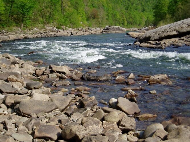
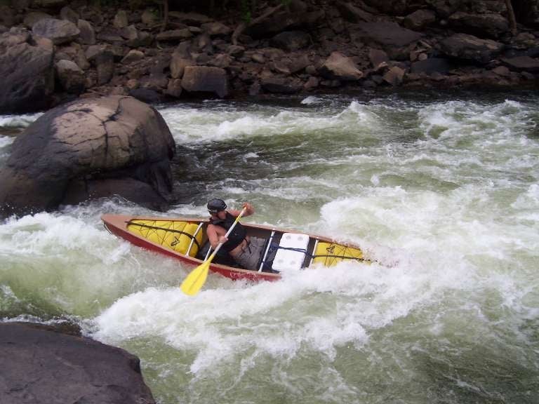
Source: Connelly (Editor), Appalachian Whitewater : The Northern States, 4th Edition. Text used with permission. The putin for the Narrows is opposite a worked-out limestone mine approximately three miles below Rowlesburg. Here you encounter the first big waves below Rowlesburg called Cave Rapids. For the rest of this five-mile [actually 3.8-mile if you take out at Lick Run; 3.5 mile if you take out at Pringle Run] trip, the rapids become increasingly more difficult. There are good rescue spots after each rapids, but in high water (three to four feet), it's not so easy. After passing several Class II-III rapids, the paddler enters a long series of similar rapids, properly called the 'Narrows.'
In the first significant rapids, the entire river is necked down by the presence of an automobile-sized boulder (Calamity Rock) in midstream which makes passage at any level difficult...Usually this boulder should be run through the passage to the right. At very high levels, however, it's best to run along the left bank...
Though you can putin and takeout at several spots along the road (Rte. 72), the typical takeout is at Lick Run, about 3-4 miles South of Kingwood. The river pretty much flattens out after that.(2025Update: Takeout is now a parking lot built by Friends of the Cheat just south of Preston and just North of Lick Run)
Downstream is the more difficult and more committing Cheat Canyon. For bad craziness, you might want to grab a look at Pringle Run, which drops into the Cheat just upstream of Lick Run.
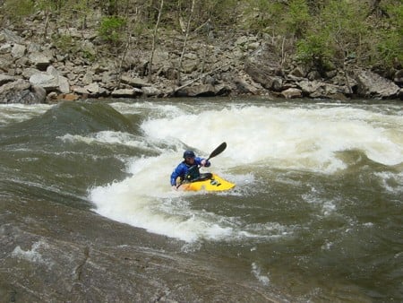
A huge rock, which creates a rapid that's totally out of character for this reach. It makes a bad pourover hole, especially at higher water levels. (Boofing right of it is the normal line.)
At lower levels, the edge of the hole is a good play spot.
May 9, 2023
Great level to run the narrows at, wasn't much to have to avoid besides 2 big holes you can doge by staying river left. Finished the run in about 45 minutes, big wave trains that are super fun.
Feb 3, 2010
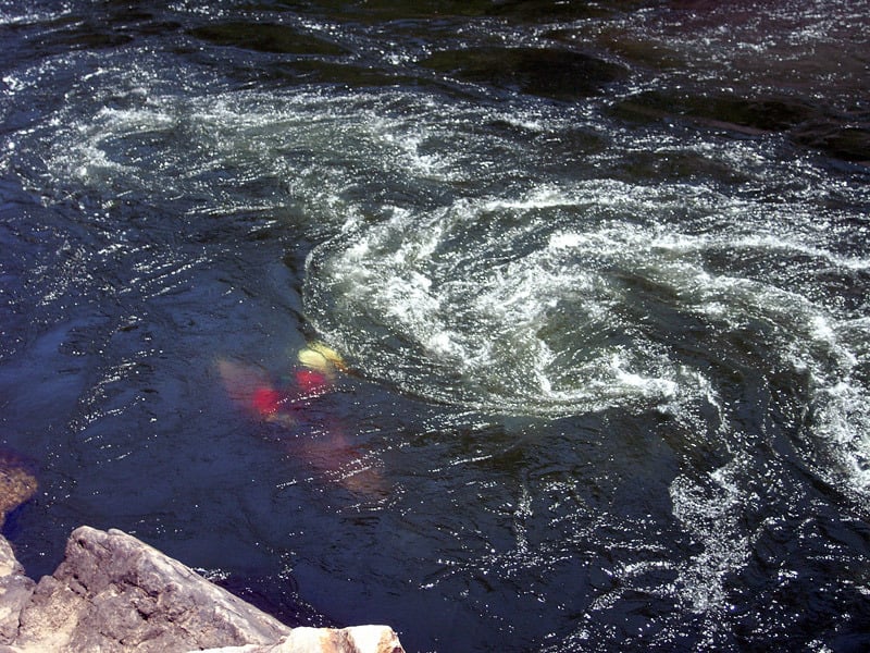
Jim Albano going down for a Mystery Move at Fascination Alley
Jun 15, 2006
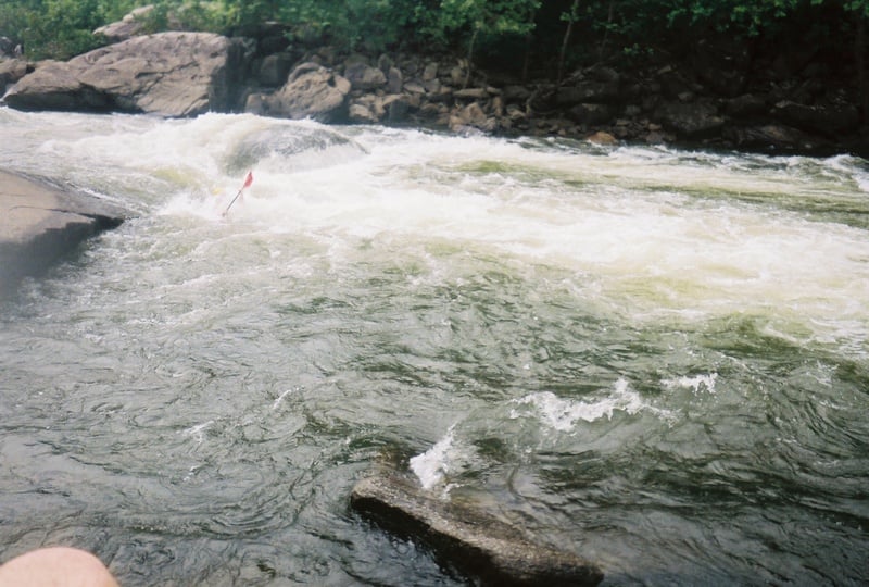
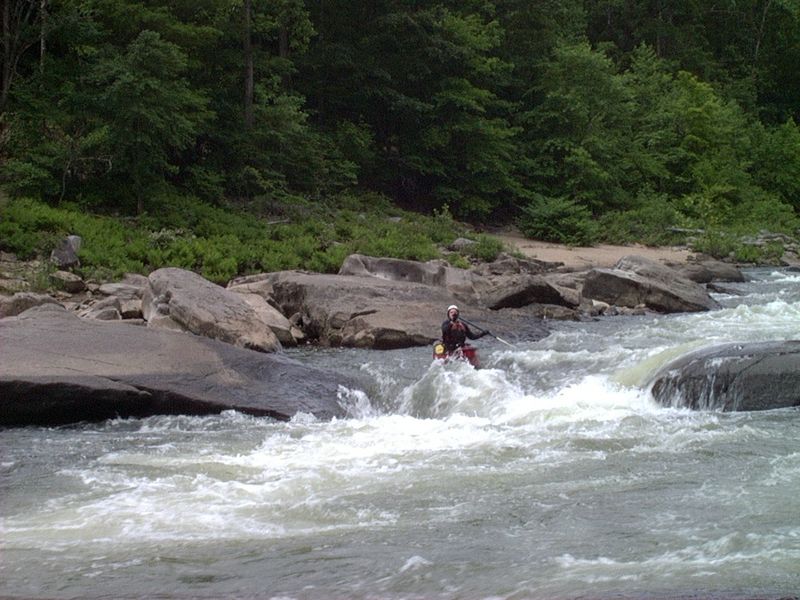
Ran this section 6\4\06 with the GBCC 'beginners class' at 3.5 ft. Plenty of swimmers but everyone had a blast. Calamity rock was completely covered with a rooster tail coming off it so most of us walked it except one in a ducky who missed the eddy beforehand. She made it through fine. Big waves and holes abounded but had excellent leaders so no extreme carnage. Would like to try again at a lower level.
Jun 10, 2006
Gauge Used - 6.37 ft, 1190 cfs - CHEAT RIVER AT HWY 50 NEAR ROWLESBURG, WV & 1.9 at Albright Bridge Gauge
Gauge Used - 6.37 ft, 1190 cfs - CHEAT RIVER AT HWY 50 NEAR ROWLESBURG, WV & 1.9 at Albright Bridge Gauge
Gauge Used - 6.37 ft, 1190 cfs - CHEAT RIVER AT HWY 50 NEAR ROWLESBURG, WV & 1.9 at Albright Bridge Gauge
Gauge Used - 6.37 ft, 1190 cfs - CHEAT RIVER AT HWY 50 NEAR ROWLESBURG, WV & 1.9 at Albright Bridge Gauge
Gauge Used - 6.37 ft, 1190 cfs - CHEAT RIVER AT HWY 50 NEAR ROWLESBURG, WV & 1.9 at Albright Bridge Gauge
Gauge Used - 6.37 ft, 1190 cfs - CHEAT RIVER AT HWY 50 NEAR ROWLESBURG, WV & 1.9 at Albright Bridge Gauge
Jul 13, 2003
From Boygenius on Boatertalk:
Cheat Narrows Hole:(8.5 on the Cheat at Rowlesburg, 2.5 at Albright up to???)
Drove a few hours to the Cheat Narrows. I had received reports for Joe Stumpfel of a good hole on the Cheat Narrows. I'd never run this section before, and after pulling over 5 or more times to look at the river, I finally found it! It's a rockin pit-hole in the middle of a HUGE flatwater eddy in between real rapids. I arrived around 12:00 and played for 2 hours. This hole was AMAZING!!! It's as wide as Center Chute on the Potomac at 5.2, is a retentive and powerful pit, but is REALLY deep. Approximately 15' wide of break, fluffy pile recirculates from almost 10 feet back, steep inflow, lots of push, easy to escape either side, LOTS OF FUN!!! I tried several loops, never hit bottom, but never got tons of air either...I'm beginning to think that wave/holes give up the biggest air because the water has a more solid rise behind the seam so the boat corks out of the water from a much higher point, but I digress...It was possible to throw ends anywhere, but the surfer's left and middle were most retentive. Entry moves are definately possible: I had fun trying entry-loops, which usually just resulted in my getting trashed. It's easy to get out of control here, because the ends go so fast, but every hole move is possible in this perfectly-formed pit hole. The hole can be a little intimidating if you're not used to big holes. The eddy access is HUGE. It's well worth a drive. I can only imagine that as it gets higher, it gets even better and eventually forms a wave, but I don't know. On Friday, the Albright Bridge on the Cheat appeared to be around 5 1/2 feet right after I played. There was no one else around...I LOVE WV!!!
How to get there:
From Rowlesburg, WV, follow 72 North for approximately 4 miles. The road parallels the river. You will pass SEVERAL little pull-offs, which could all serve as put-ins, passed the abandoned mine on the left 1/2 mile or so, begin to look closely at the rapids as you pass them. You will pass a few class 2 rapids prior to this hole. After one such unnotable clas 2 rapid (with a large, sloping pour-over on the far river right), you will see a LONG (100 yards +), flat eddy on the river left and most of the center of the river. This is a CALM, DEEP eddy. The only real current pushes past the eddy on the river right side of the eddy. In the middle of this current is a big, obvious pit-hole. You can park right next to it :)