Cheat, Glady Fork
2. US 33 Bridge to CR 12 bridge near Sully
Jun 8, 2020
Ran this section of the river on June 7, 2020. As stated by other reviewers, this is approximately a 9-10 mile float. The scenery is absolutely beautiful and this is a fun, easy, remote run in WV's high country. The first few miles are mainly comprised of Class I rapids and the last several miles are comprised mainly of Class II water. However, about 2 miles into the float, an ignorant land owner placed three strands of barbed wire across the creek. One strand is literally neck high. The river was on the low side of runnable and this occurrence was in Class I water. When you start seeing livestock fencing on the left bank, keep your eye out. We didn't see the wire until we were almost on it because this section of the river is also very shaded by hemlocks. We were able to slide underneath the wire, but in high water, this situation could be extremely dangerous to paddlers. Also, as stated by other reviewers, this river is prone to strainers. Because there are many glades (hence the river's name), it often breaks into small channels. There were many times where one or more channels would be blocked by strainers, but others channels were open and passable. There were only two sections (about 6 miles into the float) that were blocked completely by strainers or blow-downs. In the first instance, the river breaks into approximately 5 small, short channels and all paths were blocked; we were able to hop out of boats and cross a glade (located in the center) to get around this. This could be a problem in high water though. About a half mile past the first obstruction, there was a small tree blown across another part of the river. The water was low so we could easily hop out of the boats and 'limbo' underneath it. But in high water, this would be an issue. The float took our party (i.e. 3 experienced boaters) about 3 hours. I would recommend giving yourself and your party ample time to run this section just because of the strainer issue.
Apr 30, 2013
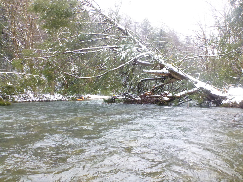
Typical blow-down of 2nd 5miles, before CR-12 bridge, with many strainers at 275cfs.
Apr 29, 2013
2013 - This section of the Glady Fork of the Cheat is 10 miles from the Rt.33 put-in to the CR-12 bridge near Sully; the shuttle is only about 2.5miles. The first 5 miles is mostly slow meanders as the posted picture; water levels pictured at ~275cfs. In the second 5 miles (example picture posted) we encountered many river-wide blow-downs with some strainers. It appears as if a microburst was recently in the valley, bringing down many full-size trees and many across the river. It significantly slowed progress to the bridge and the 10 mile run took us about 5 hours. Even if there were interest in clearing this river section of the most dangerous strainers, it would take concerted effort and a long time to accomplish. The map indicates a dead end road on the east bank of the river, but we found it barricaded by the Sully Rd. Bridge and it seemed perhaps little used. The river bank was mostly mature mountain laurel which looked little disturbed. If the river were over 300cfs and swifter it should induce great caution about the strainer hazard over the second 5 miles to the CR-12 (Sully Rd.) bridge.
Apr 28, 2013
mileage map from Rt.33 to CR-12 bridge:
http://www.gmap-pedometer.com/?r=5860370
Mar 18, 2013
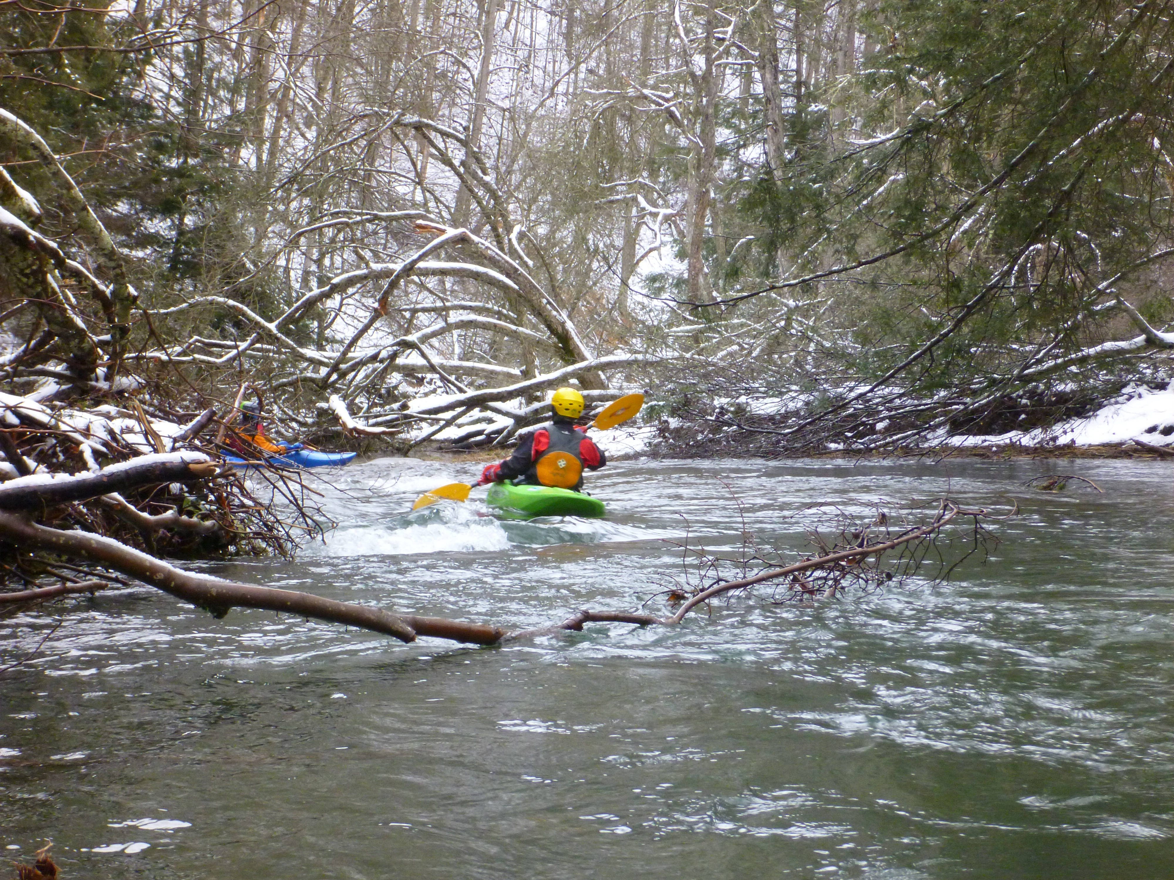
Typical of the first 5 meandering miles from the Rt.33 put-in, before the blow-downs, strainers, and storm damage.
May 23, 2012
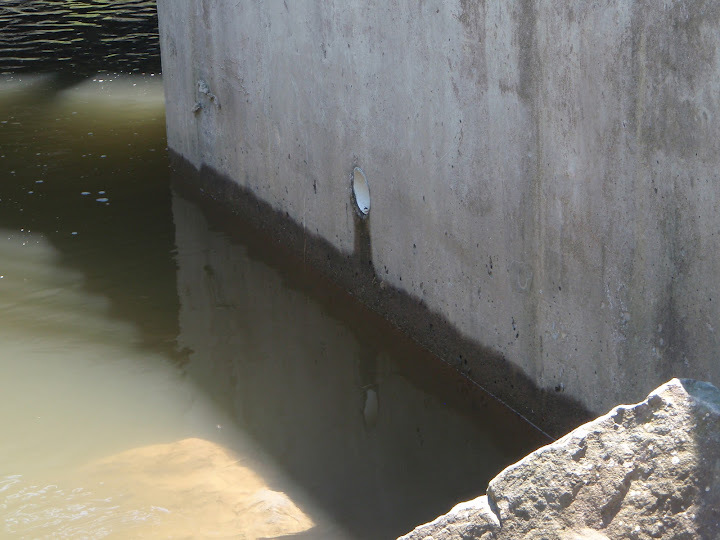
Use this PVC pipe coming out of the Hwy. 33 bridge abutment next to the parking area to judge flow on-site. Water level should be no more than 8' below the pipe.