| Difficulty | I-III |
| Length | 11.2 mi |
| Avg Gradient | 20 fpm |
| Gauge | Shavers Fork Nr Cheat Bridge, Wv |
| Flow Rate as of 1 hour | 4.27 ftbelow recommended |
| Reach Info Last Updated | September 19, 2016 |
River Description
This reach does not have a description. If you know about this reach, please tell us about it!
River Features
Put-In - US Route 250 (Cheat Bridge)
Access PointDistance: 0 mi
Put-in - US Route 250 (Cheat Bridge)
Take-Out - McGee Run
Access PointDistance: 11.15 mi
Take-out - McGee run is marked on the river with a sign saying 'Leaving Catch and Release Area' cabled over the river. You can also see the parking lot on left if you're keeping an eye out.
Trip Reports
Log in to add a reportLM
Linda McLuckie
Aug 30, 2016
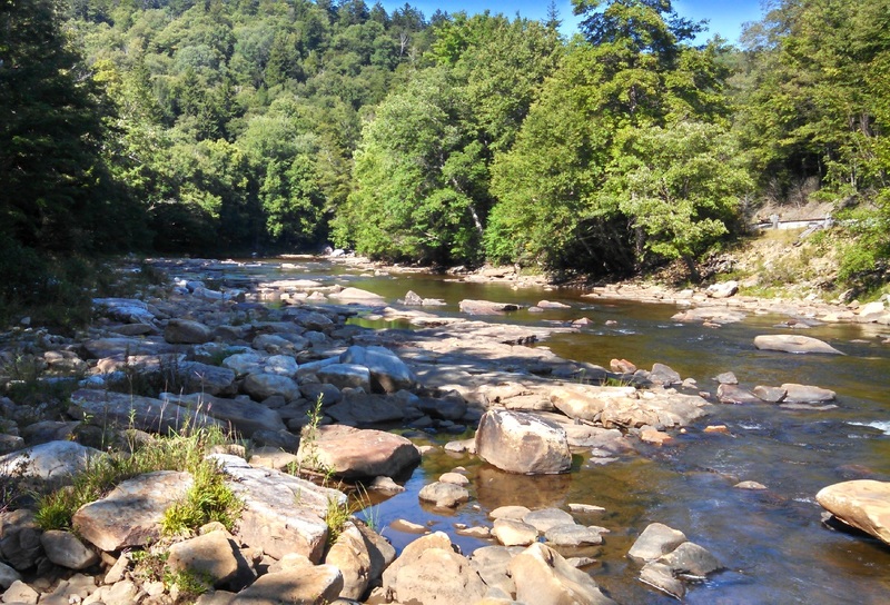
View downstream from the take out at very low water.
PW
Pete Whiteis
Apr 10, 2011
Ran this section at 6.2 yesterday in a 14' paddle cataraft. The first 6-7 miles were class 1 rock garden style rapids. Very scenic. After a reclaimed strip mine area, you pass an abandoned bridge and the river starts to take on a ledge-drop character with the rapids gradually increasing in difficulty. There were probably 3 or 4 I'd rate a class 3. There was some question about whether or not we had missed the takeout, and would end up walking out at High Falls (next section). Turns out, McGee run is marked on the river with a sign saying 'Leaving Catch and Release Area' cabled over the river. You can also see the parking lot on left if you're keeping an eye out.