Cranberry
AB (Middle): Cranberry Recreation Area to Big Rock
| Difficulty | III-IV |
| Length | 6.9 mi |
| Avg Gradient | 80 fpm |
| Gauge | Cranberry River Near Richwood, Wv |
| Flow Rate as of 28 minutes | 2.66 ftbelow recommended |
| Reach Info Last Updated | September 10, 2016 |
River Description
This section of the Cranberry is known by local paddlers as the Middle Cranberry. Some paddlers who have not paddled the section above this call it the Upper Cranberry.
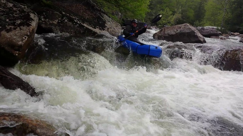
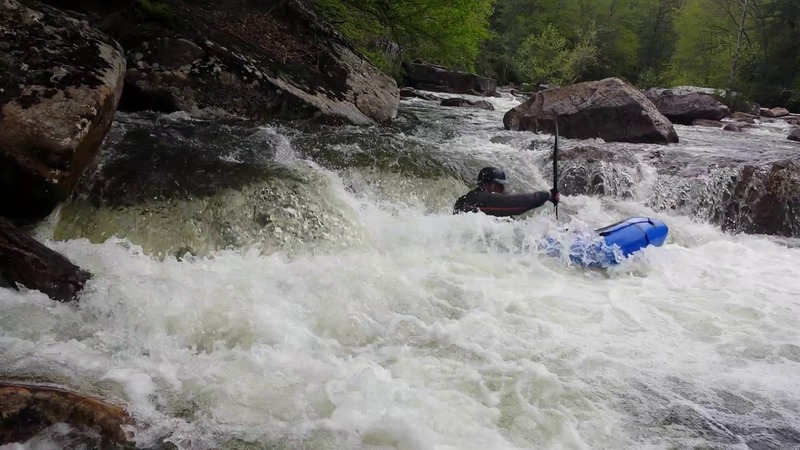
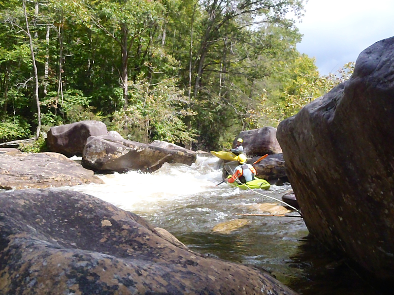
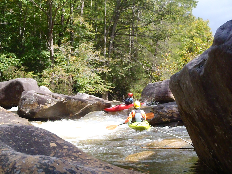
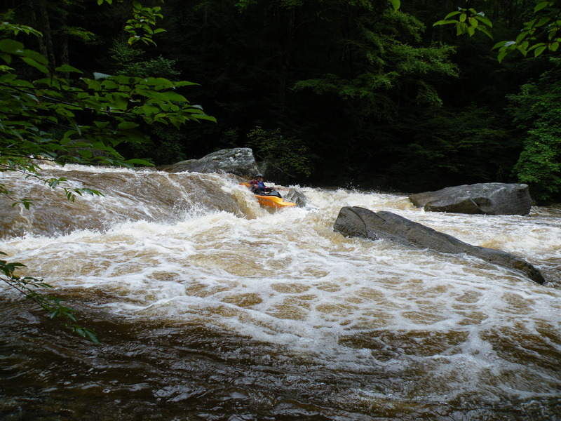
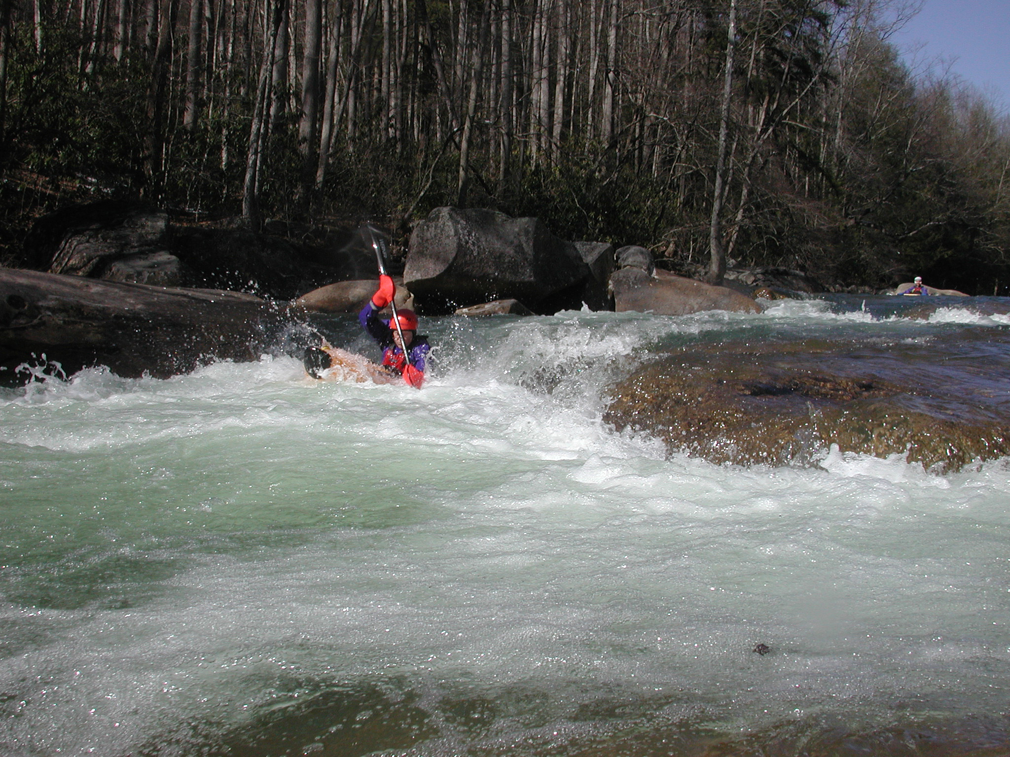
This is classic creek boating in a beautiful wilderness setting. It is almost continuous class III+ ledges and boulder gardens. Probably the biggest and most difficult rapid is S-Turn (class IV at moderate levels). It is located about 2 miles downstream from the altermate putin (or about 3 miles above the takeout). It is a good idea to road scout this rapid on your way to the putin and shore scout it again on you way down the river. After this the river mellows out just a bit the rest of the way to the takeout.
FS 76 follows the river closely for the entire run, offering numerous options for putting on or taking out. In addition to Big Rock and Cranberry campgrounds there are about a dozen individual campsites right along the river, immediately off the road. Facilities are limited to fire rings and picnic tables, but there are vault toilets located at a few spots along the road. As of 9/16 these sites are just $5 per night.
Putin: Cranberry Campground on FS 76
Alternate Putin: Picnic area (about 2 miles downstream)
Takeout: First pulloff on the right upstream of where FS 76 crosses the river.
River Features
Put In
Take Out
Trip Reports
Log in to add a reportAs of 9/13/18 this run was free enough from wood to go down the whole thing without portaging in a 12' raft. The flow was 4.45. Here's a video about it https://www.youtube.com/watch?v=\_6pCgCcAAXM
flow ~4.5ft.
flow ~4.5ft.
4/24/06 (sorry: edit didn't preserve original post date) It seems as though there is always at least one log on this river. I would call this section Class 4+(5), not Class 3-4, especially considering the logs that are always there. I ran S-turn, and it was clear, but could always change.
The Keelhauler Canoe Club
Keelhauler Canoe Club
Ran this at about 4.6-4.7 (800ish cfs). Agree with the other comments, this is a solid IV run that could be considered IV+ in a spot or two. Several blind drops that were tough to see the line, and some wood in inconvenient places. Also, there are a LOT of sieves. Most of them aren't in the main lines, but, swimming would be especially dangerous.
The one log of note was a branch that stuck out into the current in one of the early rapids. It sticks out just enough that it can catch your edge and spin you (as one of my river mates found out)
There's a weird cave/sieve on the bottom left of S-turn as well. A swimmer would likely flush through, a boat would not. It'd probably be in play at higher flows (1000+), as the current does push there.
Brian H. (k1)
To credit the last post on stuff changing....I did the run my first time at 4.9 on the scale, this last July on a freak rain...i would have put that last big drop in cl V range, very tough ferry lines and hole dodging...granted we didnt know the lines. Other hard rapids too with dangers above cl IV but solid cl IV maybe IV+-V moves. We had clean lines, but definately lots of places you did not want to be. The wood was not a problem at 4.9 but it was there as described.