Gauley
7 Summersville Dam to Woods Ferry(Upper Gauley)
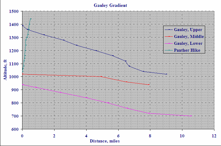
Plot generated from USGS topo maps. Note that, while none of the reaches has a lot of gradient, the Upper has the most and the Middle has the least. Note also that the Panther Mountain hike out of the Upper G involves a 400-foot climb in half a mile. Feels good!, especially if you're carrying your boat.
Ratt Boy (KHCC, FLOW)
n/a