Gauley
7 Summersville Dam to Woods Ferry(Upper Gauley)
| Difficulty | IV-V |
| Length | 12 mi |
| Avg Gradient | 36 fpm |
| Gauge | Gauley at Summersville (cfs) |
| Flow Rate as of 19 minutes | 698 cfslow runnable |
| Next Release | Thu, September 17, 2026 |
| Reach Info Last Updated | May 26, 2025 |
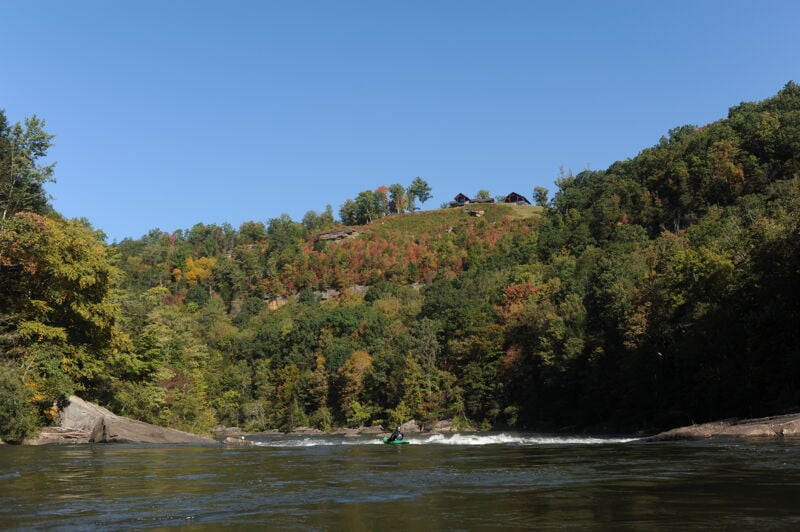
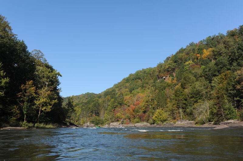
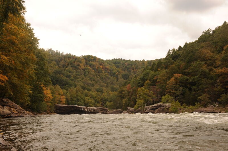
The Gauley River is considered by many to be the ultimate big water river in the eastern US. The river, largely protected by the National Park Service, flows through a beautiful forested canyon and among massive house-sized boulders. The Gauley has become the economic backbone of an otherwise rural [...]Read More
Fun Fact: Every fall, the six weekends of Gauley season provide the biggest whitewater party of the year. American Whitewater's GauleyFest, is held on the third weekend of the month of September, is the world's largest whitewater festival.
Hazards: There are several dangerous pinning spots on the Gauley. Three of the most famous are the sieve on river right at Initiation, Shipwreck Rock, and Conestoga Wagon.
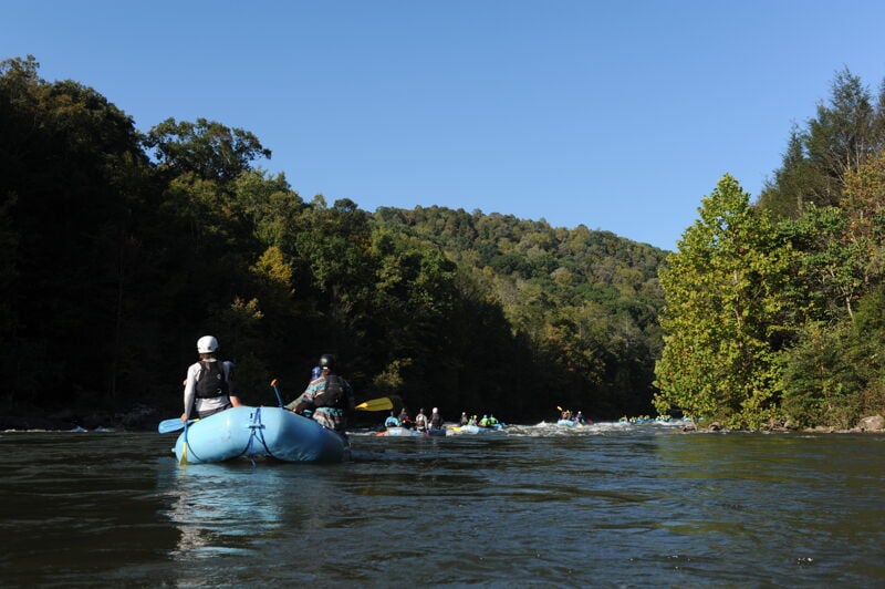
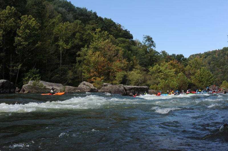
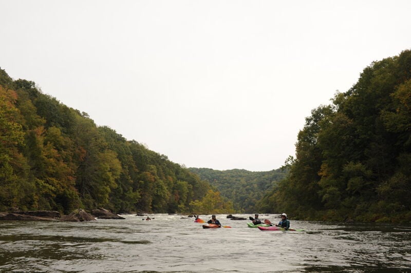
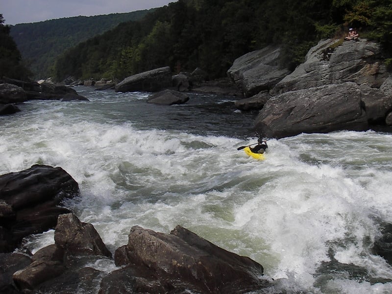
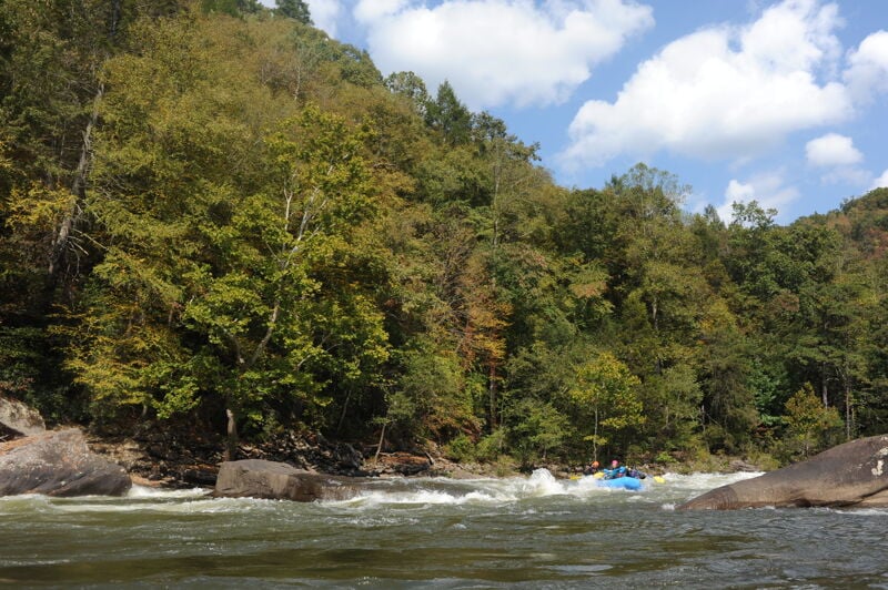
Description: The Gauley is a wonderfully busy river with an outstanding number of high-quality rapids throughout its 24-mile length from the Summersville Dam to Swiss. The character of the river is pool-drop and on the upper 9.8-mile section from the Summersville Dam to Mason's Branch, the most challenging rapids are at the lower limit of class V. Several other rapids on this river come in just a hair below this and are rated class IV+. The implication is simple. A paddler will need excellent endurance and very solid skills to prevent trouble on this long, powerful river. Bomb-proof bracing and 2-sided rolls, along with big water skills and precise maneuvering, are required to have reasonable assurance of a safe and an enjoyable run.
While many paddlers have the skills to enjoy the Gauley safely, there's still the occasional paddler who will have a great day until a certain point and then run out of steam. It seems that this point is sometimes reached about half way down Pillow Rock. Watch out for your friends. Once this level of fatigue is reached, mistakes and trashings occur much more often. Your friend may require some watchful assistance (and perhaps a few more rescues) before the day is over. PLEASE be careful! And remember, there's no shame in walking. The rapids won't be going anywhere.
The rapids on the Gauley are legendary. Insignificant, Pillow Rock, Lost Paddle, Iron Ring, and Sweet's Falls are wo
...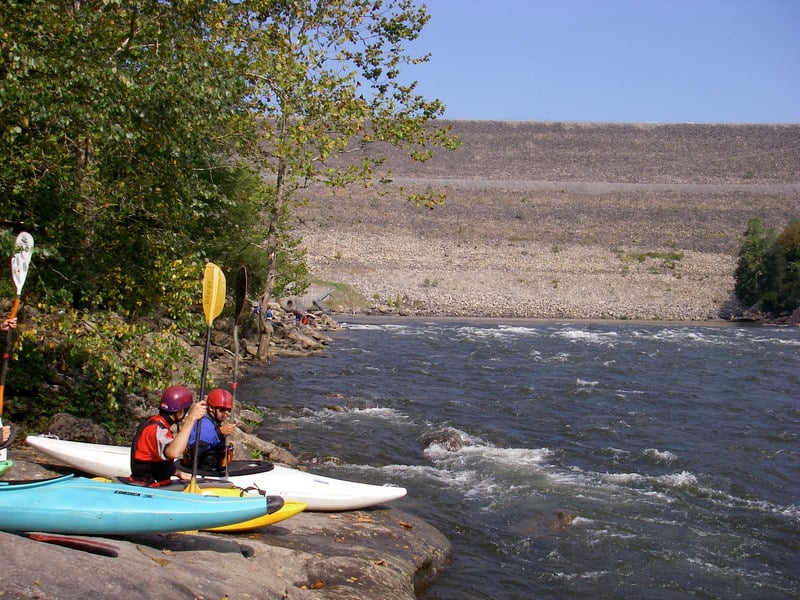
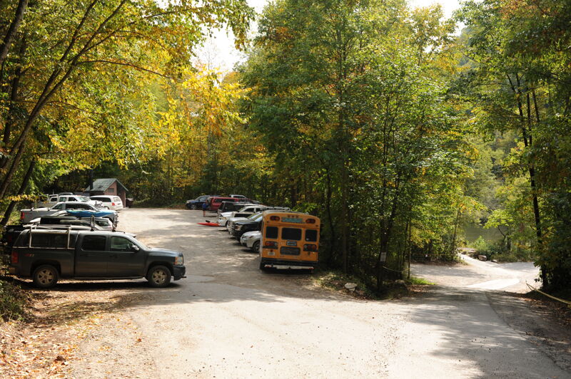
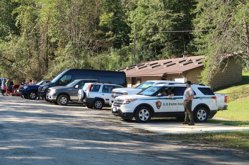
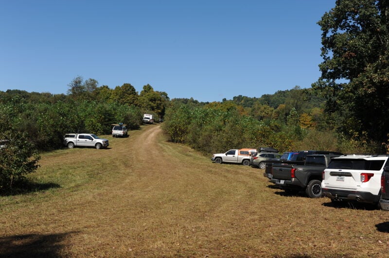
The Tailwaters Access is at the base of Summersville Dam on river right. The access site is administered by the National Park Service and has a large parking area, toilets, changing area, blower for inflatables, and a small 12 site campground. Outfitters use the most upstream access point and boaters have a couple access areas at the upstream end of the parking lot and mid-way down near the gage station. Make sure your group has clarity on which point your group is accessing the river; confusion happens when some of the group enters at one point and others enter at another point and everyone is left waiting and wondering where the rest of the group is. On busy Gauley season weekends the campground will be full and the parking can also fill up. During weekends with heavy traffic the National Park Service will often implement traffic control and it can take a long time to drive down to the river. Consider an early start on busy weekends.
As long as you run the recommended line, this rapid isn't as difficult as the IV rating suggests; however, the hazard involved is one of the most dangerous on the river. The proper way to run this drop is down the left side of the long, wide, steep tongue on river left. There is a deadly sieve on the right side of the drop.
Despite the notoriety of this rapid, several people have found their way into the sieve ( photos), and two have drowned in it. What makes this rapid even more sinister is the inviting surf wave at the top. The wave has a slight right diagonal that would appear to send a surfer into a large and deceptive eddy. What is not obvious are the hidden black rocks on the right end of the wave. These will sometimes catch the surfer and pivot the boat directly into the sieve. Don't even think about surfing this top wave; avoid this hazard by taking the safe route down river left. There are numerous excellent play spots as you continue downstream.
After initiation is Funnel, an easy drop with a rather large hidden hole about a hundred feet down the outflow. The hole is hidden by a pillow that looks like a wave. You don't want to begin your bad day here. Insignificant is at the other end of this long pool.
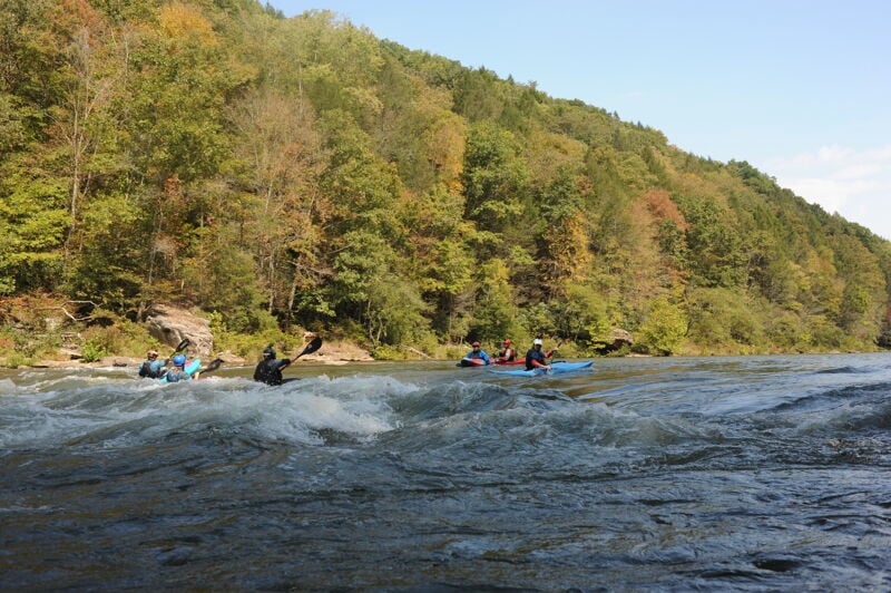
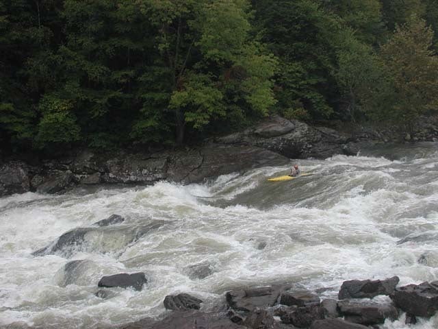
A popular playspot on river left and the first spot where you are likely to see several kayakers lined up for a chance to play in the wave.

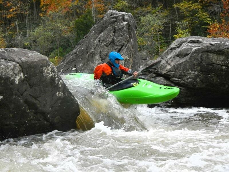
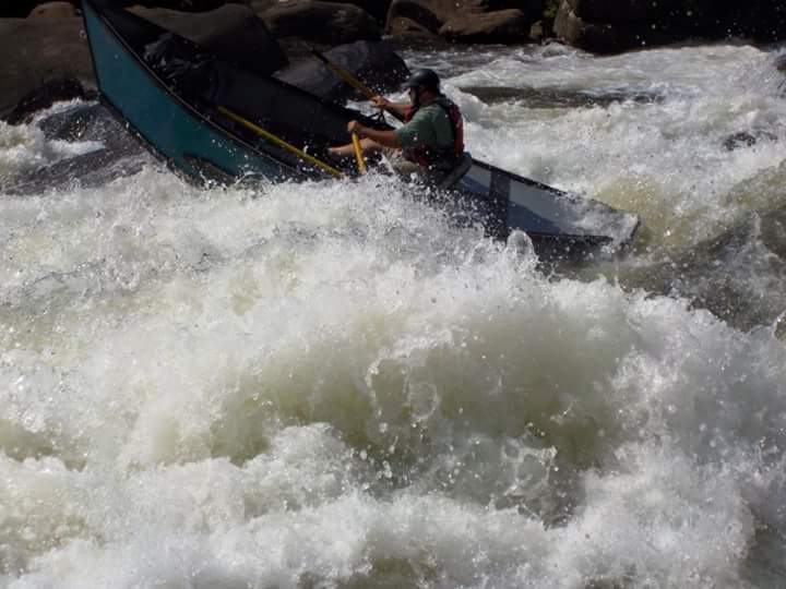
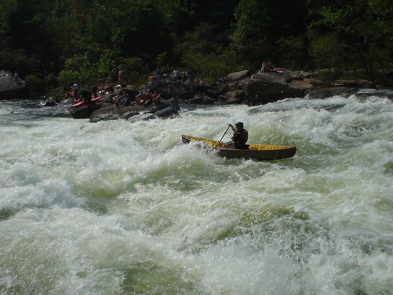
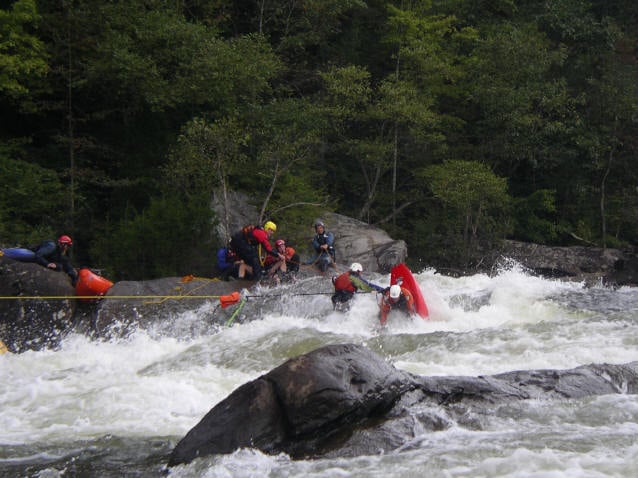
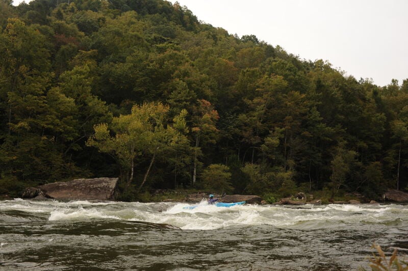
Insignificant is a big, long rapid and the first of the Gauley's big drops. The rapid gets its name from the fact that the party who completed the 1968 descent at slightly lower flows reported 'no significant rapids' upstream of Pillow Rock. At fall releases of 2800 cfs, however, this is your first big challenge. The rapid is a series of ledges with undefined horizons, large waves, and irregular holes--often the site of long swims. The holes in this one are hard to spot until you're in them. If it's your first run down you will want to follow someone who knows the line. Scouting from the right is also an option.
Insignificant, when broken up into parts, isn't too bad. You will most likely start this rapid from the center of the river. You can't see it all from the tippy-top-top, so you'll have to negotiate some class-2 ledges and holes to get to a calm eddy just right of center, before the heavy stuff starts. Rafts do not generally catch this eddy, nor do all boaters. From this eddy, look downstream and you will see: what looks like your basic wave train down the center, and way below, A HUGE sloping rock on the river right shore that a lot of water is hitting, on which some video boaters might be sitting.
Behind one of those waves, and you can't really tell which one from there, is Hole #1 which is near the center of the river. Many unsuspecting paddlers end up in the hole because they didn't exactly know where it is. It's a pretty big hole capable of flipping 12-man rafts and holding more than one boater at a time, and it gets bigger as flows increase. If you do end up in the hole, you will eventually flush, but you will have to work for it and if you are unsuccessful you will be quickly separated from your boat--resulting in a long swim. You want to get left of that hole, but just barely because the next big hole is downstream on the left. In fact, it's helpful to use the wash from that first hole to start moving to the right, towards the sloping rock. Take a few big strokes, moving right, just after Hole #1, in what appears to be a bit of calm water in the middle of this storm. Another option is to sneak this first hole by taking the river right line around it.
As you pass the first hole, you want to move river right to avoid Hole #2, which sits about 15 feet from the river left shore. It's a really bad pourover and not a place you want to be. You will be headed towards the big sloping rock on river right. Don't hit it, or even get too close, because it is undercut. When you get a clear visual on Hole #2 on your left, you can then put the hammer down, heading left, away from the big sloping rock. You are now done for all practical purposes and you have a couple options to finish off the drop: Paddle down the middle through the big waves, dodge the dude surfing the wave, and catch the big eddy on the right, or paddle really hard through the waves, dodge the surfer, and catch the very turbulent river-left eddy to cue up for your turn at the best surf on the river.
There's usually a long line for the incredible surfing wave but you need to watch out for rafts coming at you at warp speed! There have been a number of collisions and swims resulting from this. When you stop to enjoy the surf, please remember that the oncoming boater has the right of way and that you have much more time than they do to get out of the way. Please also remember that many of these boaters, while ready enough to run this rapid, may not be ready enough to run it with someone in the way.
Below Insignificant: Watch for pinning rocks and undercuts if you're an explorer or find yourself off line in the next several rapids. One hair move in particular is an arcing slot move in the left bank where the turn should be made as tight as possible.
Iron Curtain: This rapid is named for the iron oxide stains that have formed on the sandstone wall along river right. This one is probably more devious than dangerous, but in the event of a long swim, watch for the house-sized undercut, Sperm Whale Rock, way down in the run out. Why would someone swim? Hit the bottom left eddy line wrong and you'll find out. It's a mean one.
Recognizable by a rust-colored stain in the cliffs high above the river, this is just a big-ol' wave train.
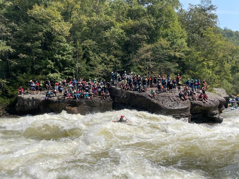
If you made it through Insignificant without a problem, you've probably loosened up quite a bit. You're probably more relaxed, and ready for a little funny water. Well, you'll need to be loose and relaxed for Pillow Rock. After you've run the few rapids below Insignificant, you'll find yourself in a short stretch of flatwater, working your way around a left-hand bend in the river. If you look high on the river right wall, on the rim of the gorge, you can see a small gap in the trees, with a small overlook. That's the [Carnifex Ferry Battle Monument](http://www.carnifexferrybattlefiel
dstatepark.com/), and it signals Pillow Rock. About the time you can see the overlook, you'll start hearing the actual rapid. There is an unofficial trail from the monument down to Pillow Rock providing an access for those who wish to hike in and watch the action (Caution: The trail to the river involves some serious scrambling).
The basic deal with Pillow Rock is that a large portion of the river slams against a house-sized rock on river left--Pillow Rock--creating a huge pillow, rebounds off, and slithers around another huge rock down below known as Volkswagen. The screw-up potential is enormous, but the actual danger is quite low.
Start off by catching an eddy just to the right of center, in the flatwater above the rapid. At this point, if you are unsure of the line you can always get out on river right to scout the drop and watch the show. You will always find a crowd of spectators here and the video cameras will be rolling so take a deep breath and make sure you look good as you peel out. The typical line is to start center entering just right of a boulder at the top, then hug the left side of two successive boulders downstream (one mostly dry and the next mostly covered at 2800 cfs). If you are getting hammered already, more than likely you didn't listen to your guide and you're too far left already and are in some big juicy holes in the center (the hero line). Once you pass the third rock, ride the current to the left to avoid the nasty shallow hole on the right. At this point you should be on the 'green highway' and you will find that amidst the chaos of holes, waves, funny water, rocks, and other nasties, there is tranquility.
At this point things are moving fast but if you've planned your route and are still on line you have two options to finish out the rapid. You can turn hard right and run like hell away from Pillow Rock. If you do this, you will simply need to paddle to the right to avoid the toilet bowl below Pillow Rock, and ramp up on Volkswagen rock, go around it and be happy that you are done.
The second option is the big splat move on Pillow Rock on river left and this is what the crowd has come to see. If you choose the splat, you should know that you will be swallowed in the toilet bowl. It's not really a problem, but it catches some off guard. You want to aim right at the corner of the rock. Not the upstream side, that's the Room of Doom. If you do it correctly, you probably won't even hit the rock itself. You will definitely flip, and you will get flushed immediately below. Roll up just in time to go around Volkswagen, and you are done.
The Room of Doom is actually a wedge-shaped eddy just above Pillow Rock. It is formed by a gap between the next rock upstream of Pillow, and Pillow Rock itself. The only way to get out of the Room of Doom is by rope, or by paddling/swimming out of the eddy. The rocks on both sides are 8-10 feet vertical and smooth. The exit is not easy because water is constantly being slammed into the Room, causing an eddy fence that is challenging--but not impossible--to cross. Complicating matters is the fact that the water in the Room is super turbulent and aerated. The water surges several feet up and down. Don't go in there unless you plan on doing some spectacular rodeo work, and understand the hazard (if you know enough to go for the Room of Doom for entertainment value--and many folks do--you don't need this guide).
One of the favorite playspots. It's a big ledge hole on river left, which looks trashy and which many people pass up. Rumor has it, it's been easier to get out of it on the river-left side lately.
Straightforward rapid just upstream of the Meadow River confluence.
Lost Paddle and Tumblehome begin at the end of the Carnifex Ferry pool, which is also the confluence with the Lower Meadow. Historically this was a strategic location on the river, particularly during the Civil War, as one of the few places the river could be safely crossed. Check to see how much water is coming out of the Meadow. If you are paddling a regularly scheduled release, you probably won't have a lot of inflow from the Meadow, but if it's been raining this major tributary can pump up the flows considerably (at times, more than double).
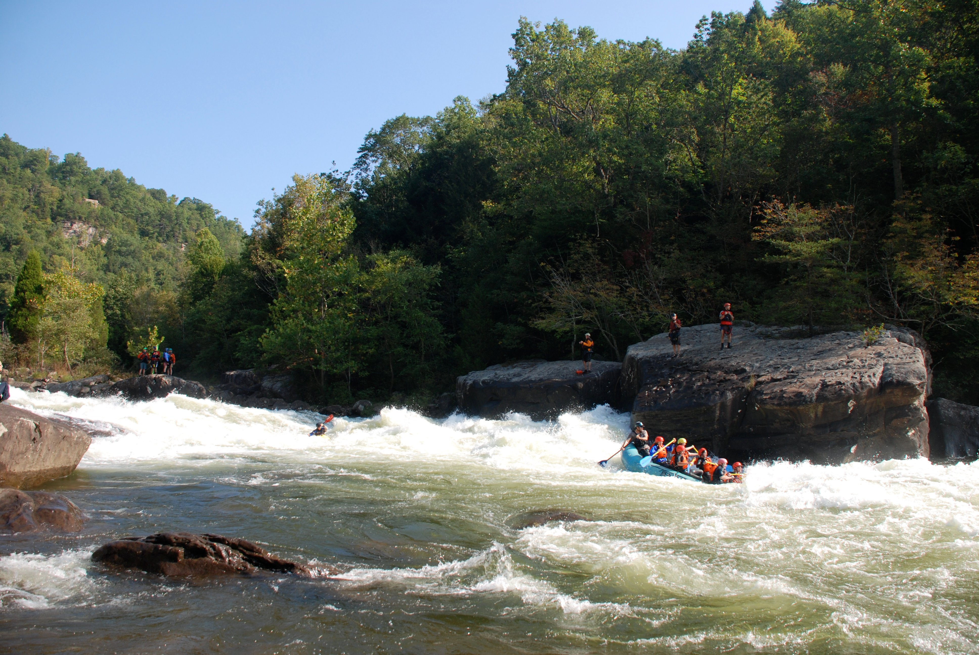
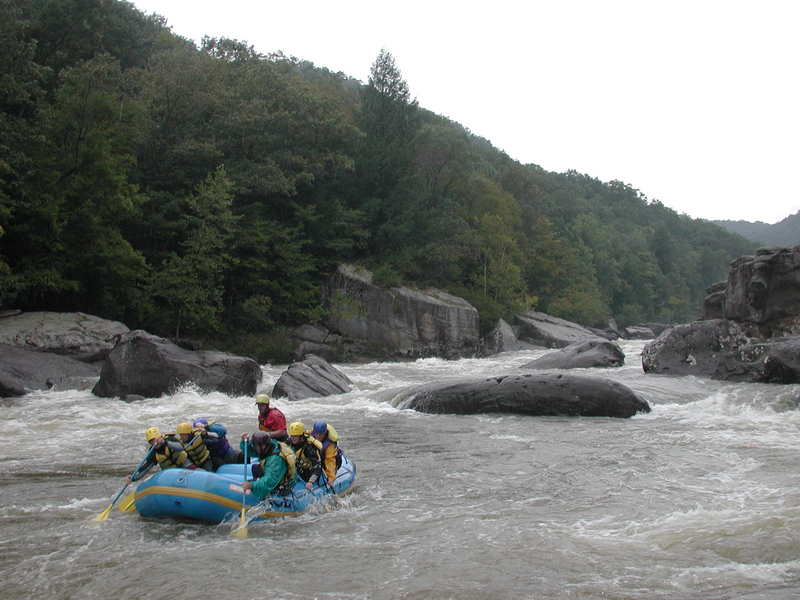
This very long series of rapids consists of the 3 drops of Lost Paddle (4 at low levels) and the boiling, twisting drops of Tumblehome at the bottom. Of all the major rapids, Lost Paddle is the most difficult to portage. The undercuts are legendary and the drops are big, boiling, and shallow all at the same time. Swims here are very long and serious with a risk of flush drowning or being swept into one of the dozens of undercuts lining the banks. Help swimmers as quickly as can safely be done. While this is a complex and demanding rapid, if you've made it this far without significant problems, Lost Paddle probably won't give you too much trouble. Most people get really worked up about Lost Paddle, and end up doing just fine. Just follow your guide and grab eddies as they become available. The descriptions below of each section are not the only way to run these rapids, and as with all the rapids on this run it is more important to be prepared with solid river-reading skills than to remember all the details.
1st Drop:
You will start 1st drop from the center of the river. Directly downstream you will see: Lots and lots of rocks, so forget that. The river sort of splits here, going around an island of sorts. Left is the creek line (Do not run the creek line blind!), and right is 1st and 2nd drop. Heading right, you will work your way from the flatwater through a series of tiny holes and waves, looking for a wave train of sorts. There is a hole on the left side of the wave train that is usually avoided, and ultimately a hole on the river right as you start to bend back to the left. When you pass the hole on the right, you'll want to start moving to the right to catch the eddy above Second Drop, which will appear to you, at this point, as a horizon line.
2nd Drop:
Now, you are sitting in the eddy on river right, about 25 feet above 2nd Drop. As always, during Gauley season, you will have to wait for umpteen million freakin' rafts before you get your chance to go. From the eddy, you can see: A curling wave sticking out from the river left shore, a horizon line just right of the curler wave, and as usual, lots of big boulders everywhere. You'll want to go just barely to the right of the curling wave. You should be able to brace on it if you want to. This will put you just to the right of a big hole that the curler hides, and just left of another hole on the bottom right. Hold on tight, be flexible and be prepared to brace hard as you get shot down the middle. It's awesome, white foamy water everywhere as you descend the tongue and ramp up and over the next few breaking waves. Be extremely careful here. 2nd Drop is very shallow at release level. If you flip at the top, you're gonna hit something. Do not flip at the top and you're golden. If you flip at the bottom of the initial tongue, you'll be OK, just roll fast, cause you've got work to do. The wave train you are now on slams into a big undercut boulder called 6-pack. Go left or right, but make up your mind and do it. Right is a good option, as the entire left shore here is undercut, plus it is easier to go right.
3rd Drop:
Third drop is best run in conjunction with 2nd Drop. There are no really good eddies between them, and both shores are lined with undercuts anyway. After 6-pack, you'll be in a short stretch of fast-moving, surging funny water, but generally flat. You'll want to move just left of center to run 3rd drop. This drop consists of one big hole in the middle and a tiny hole above it on the left. The top left hole is your friend. Look for it, and clip it on the right side. You can use the eddy behind it to move you left to avoid the big hole (which is also very shallow). Caution: Do not eddy up in front of the first large rock on the left shore, as it is undercut. Eddy below it. Eddy out in the big eddy just downstream on the left, after a few waves and a slide type hole (good play here, but beware).
Tumblehome:
There are a few different ways to run Tumblehome. From the eddy after 3rd drop look downstream and to the river right, you will see: A dry boulder, with a wet boulder about 10 feet immediately downstream, a few holes, a bunch of funny water. You want to ferry almost all the way across the river, moving between the dry boulder, and the wet, gnarly-looking boulder(s). You'll have to avoid some small holes, but nothing too serious. The ferry will dump you into a whole lot of funny water, with some holes that surge, and some neat waves. If you need a break, keep ferrying to the river right and hop in the eddy. Assuming you don't eddy out on the right, you'll want to start moving back left, looking for a big slot in the middle of the river. Again a word of caution: it is the big (6 feet wide) slot on your left, not the smaller center slot. The small slot is an advanced move; a sideways pin here would not be good. Again, you're avoiding some holes and such. The main slot is fun. It's about 6-8 feet wide, and offers no real consequences, so it's time to let loose.
The rock on the left side of the slot offers great rock spins, swipes, and meltdowns. You can also wavewheel down the slot. Just make sure you hit the bottom of the drop dead vertical. You'll go deep and hopefully, get sucked down by one of the whirlpools. As you float calmly downstream, be sure to turn around and look back. It's the best view of Tumblehome, and it's really quite beautiful.
Conestoga Wagon: As the next large rapids below Tumblehome, this two-drop rapid is marked by a wagon looking rock on the left. A dangerous ledge on the right side includes a bad hole on the far right and a deadly undercut slot towards the middle end. There have been one drowning and several near misses in this slot--and several bad recirculations in the far right hole.
Next (and the second rapid below Tumblehome) is a long wide rapid marked by a long flat rock blocking the river at the bottom. It is a huge rock in the middle of the river. This one is more a danger to rafters than to kayakers. Swimmers can be swept into the upstream face of the rock, which is terribly undercut. If you swim, stroke aggressively for the riverbank. It's your life that's at stake.
The rock itself is severely undercut. The left end is known as the Orange Juice Squeezer. There have been many near misses here, some requiring emergency breathing. There have been at least two rafting passenger deaths. The problem is that there is an eddy under the undercut that catches swimmers and keeps them from being swept out to safety. While paddlers have run this side, precision is of utmost importance and anything that might compromise precision is enough to seriously consider paddling the other, safer, right side.
While there is a cheat route all the way down the right side, most people start in a narrow left bank channel through the first half of the rapids and then cut across the wide, turbulent waves back to the right side. For most paddlers, there is plenty of time to make this move.
Think of Iron Ring as a huge wave train with big holes on both sides. The river crams itself into about 1/2 its normal size, and drops over 2 ledges, both about 5 feet, all in about a 50 foot distance. At low water the drop is distinctly broken into two drops and there are more exposed hazards. Many don't run this drop below 1500 cfs due to the pin hazards particularly along the left, although there are still plenty of boaters who do run it at lower flows (just make sure you understand the hazards and can make the moves). At levels above ~2000cfs the two ledges merge to form an enormous wave train.
It's important to know some history behind Iron Ring. Loggers in the early 1900's tried to blast part of it out to make a log flume. The Iron Ring that gave this rapid its name was part of the logging operation and set into the rocks. It was stolen in 1988. The result of the blasting activity is that part of the bedrock has broken off and is sitting at the bottom of the wave train. There is now a gap between the rock--known as Woodstock Rock--and the left bank. The danger is on the left side of Woodstock Rock where a narrow boat wide slot makes a 90 degree bend through a slot that is 2-3 feet wide and takes a 90-degree bend halfway through. This spot is most hazardous at low water where there is a signifcant risk of getting flushed into this channel, but it's underwater at fall release levels and relatively easy to sail right on by. Note that some of the eddies in the rock pile on the left bank have serious drains in them, especially at lower levels.
To run the drop, start from the river-left eddy, take a few paddle strokes (but make sure you get there) through some very small ledges/ holes to gain access to the main flow of the river. Hint: Look for two white holes coming off the left shore, the second further right than the first. Use these markers for your initial approach. Hit the right side of each hole and then You will see a large wave in the middle of the flow with a big V on it. You want to hit that V angling and paddling right, because the water on the left side of that wave is heading for Woodstock hole/rock. It's tempting to stay on the middle of the that wave, its so nice and smooth. Resist the temptation. However, it's a tightrope, because there is an ugly pourover on the river right, too. So, you don't want to be too far right. Also, the water on the far right slams up against the right wall. If you are on line, it will feel like a cool wave train. If you are too far left or too far right, you will get worked, but generally not for very long.
If you don't know the line, you should absolutely scout this rapid from the river left; it's very easy to do. This is particularly important during lower flows.
Just upstream of Sweets Falls which is just around the bend downstream. Take this one down the center and avoid the fingernail rock to river left.

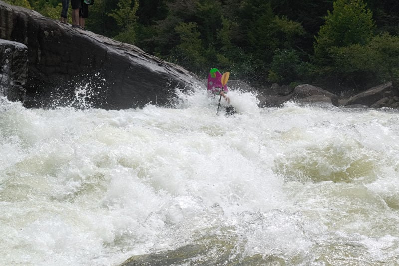
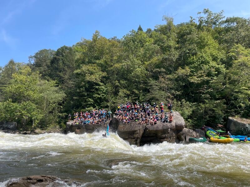
Sweet's Falls is the last of the Upper Gauley's big rapids and is considered the easiest by most. The rapid is named for John Sweet, who was the only person to run this drop on the 1968 exploratory run. The drop is easily recognized by huge rock walls on river right. You can see them as you round the last big bend in the river just prior to the easy class 3 before Sweet's. This easy class 3 will leave you on river right, lined up perfectly to enter Sweet's Falls. If this is your first time, you'll want to eddy out on the left below a pair of small holes in the large staging eddy. There will be a handful of boaters there, but rafts generally don't catch this eddy. From the eddy looking downstream, you will see: a small smooth wavetrain just right of center, a horizon line dead center, Dildo Rock sticking up just left of the horizon line, and more horizon left of Dildo Rock--this rock gets its name from a time when a raft was turned into a very large condom here.
The standard line down is to run the eddyline between the small wavetrain and the eddy you are in. If you are truly on the seam, you will be right on line to enter the flume, dropping 8-10 feet down into a chaos of water folding and twisting onto itself. You want to be right in the fold. If you are, you'll get spat out like a pumpkin seed. If you are too far right, you could drop right into a huge ledge hole that is pretty gnarly looking. If you're too far left, you'll rebound off of Dildo, bounce down the shallow drop, get worked for a second in the hole, and then flush. There will be a million rafters sitting on both shores, drinking beer and eating barbeque. It's classic West Virginia.
You might as well make the most of it and go for the monster splat on Postage Due Rock, the massive boulder just downstream of the drop. It's a great splat; you can slide all the way down it, even throwing some wheels. If you screw up the splat, you can attain on the river right bank, ferry across, and go for it again.
As you continue downstream, you'll pass the squirt boaters doing mystery moves on a great eddy line. The take-out is on river right here. If you are paddling on a weekend release during Gauley season, you'll be able to load your boat on a truck for the trip up to the parking area (make sure you bring your money for this sweet service that also serves as a fundraiser for West Virginia rivers). If you're paddling during any other time load your boat on your shoulder and prepare yourself for the long slog up and out of the gorge.
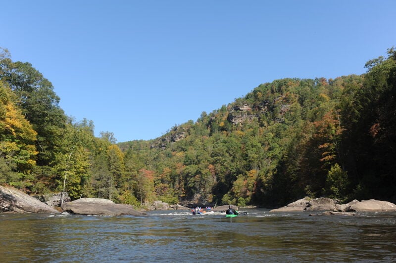
You can continue downstream on the Middle Gauley or even all the way to the Lower Gauley.
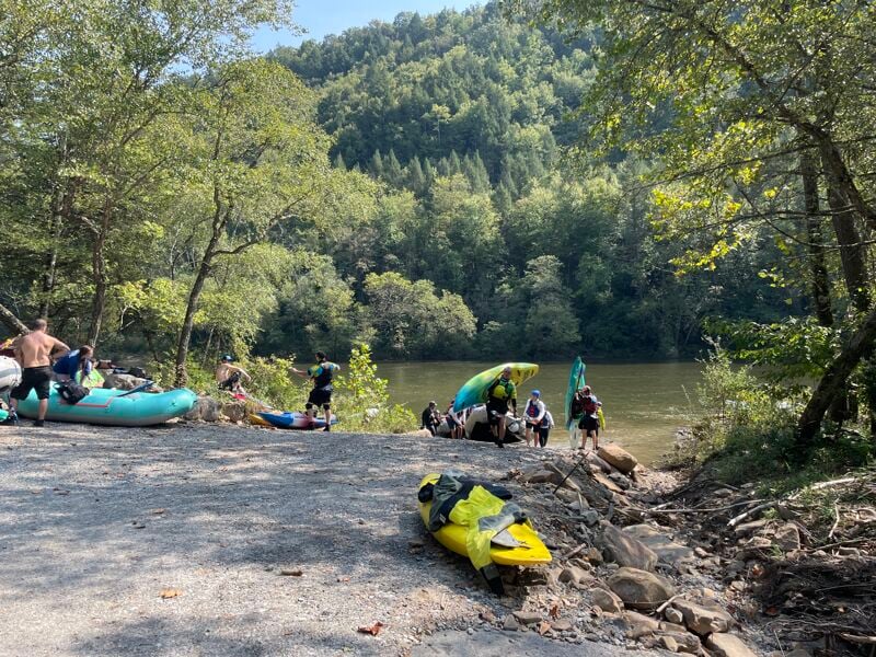
For many years, this has been the standard take-out just downstream of Sweets Falls, the final major rapids, and remains popular for river exit. It also serves as the put-in for the Middle Gauley section. Formerly private, the site was acquired by the National Park Service in 2008 with support from American Whitewater, ensuring public boater access to the Gauley River. Now managed by the Park Service, it features a parking area for 30 cars (tight parking is necessary) and restroom facilities. During peak Gauley season, the lot fills daily, prompting traffic control and limited access until spaces become available. Boaters can still drive down to load/unload. American Whitewater leases Legg field for overflow parking, requiring a steep, slippery quarter-mile hike with boats. Alternatively, boaters arriving late or avoiding the hike can continue downstream to Woods Ferry.
Legg Field is privately owned. American Whitewater leases the field during Gauley season to provide parking. It is available for parking but not camping during the fall Gauley season. It is not available to the public outside of the fall Gauley season.
This one sneaks up on you. If you get close to the rock on river right, you might be surprised by a sudden Mystery Move. There's a big keeper hole on river right at the top of the rapid, too.
Wood Ferry Access has replaced the Mason Branch take-out for many paddlers. This access point was privately owned for many years and was not available to the public until it was acquired in 2008 by the National Park Service, with advocacy from American Whitewater, to provide public boater access to the Gauley River. Using the Woods Ferry take-out, the paddler avoids the torturous hike up the Mason Branch trail as a large parking area is available at river level. The shuttle is considerably longer however. Some groups coordinate with a trip doing the lower and offer to pick up cars of those putting in for the Lower Gualey. These vehices can be used to shuttle back to Summersville Dam and then left at the roadside park on Highway 129 at the top of the dam.
Sep 21, 2024
Saturday of Gauley Fest weekend can get very busy so plan an early start if you want to avoid the crowds. We set a car at the Woods Ferry take-out first and passing by Mason Branch we learned from NPS personnel that the parking there was filled by 6am. We got to the put-in around 9:30am. NPS had traffic control in place and was only letting 10 cars in at a time with approximately 10 minutes between waves. It took us about an hour to get down to the dam, geared up, and on the water for a 10:30am launch. We mostly cruised down to Woods Ferry and with a couple swims we were there just before 2:00pm.
Sep 20, 2024
We were at the dam around 7:30am and set shuttle in time to get one of the last parking spots at the lower lot at Mason Branch. We were on the water at 9am and reached Mason Branch at 11am for a two hour run. We caught a couple surfs but mostly we were just cruising to get back and get set up for Gauley Fest.