Little Sandy Creek
2. Rt 26 to Big Sandy Creek
| Difficulty | III-IV |
| Length | 4.9 mi |
| Avg Gradient | 31 fpm |
| Gauge | Big Sandy Creek at Rockville, Wv |
| Flow Rate as of 40 minutes | 3.89 ftbelow recommended |
| Reach Info Last Updated | June 22, 2021 |
While the distance of the Little Sandy from WV 26 to the Upper Big Sandy is 2.7 miles, there is no access at the confluence. So the run continues for an additional 2.1 miles on the Upper Big Sandy, to the next river access at the Rockville bridge, for a total of 4.8 miles.
This very pretty run is a good option for those who don't feel up to the Lower Big Sandy, or those who want a longer run could keep going for the additional 5.3 miles of the Lower Big Sandy. It's mostly a ledgy run, mostly boat-scoutable. The best play is probably at the Upper Big Sandy confluence, where there are plenty of ledges and holes. As noted in the Upper Big Sandy description, the last mile or so above the Rockville bridge is the toughest.
Directions:
Take I-68 to Bruceton Mills. Head South on WV 26. Put in at the bridge crossing the creek, just before Little Sandy Creek Road.
To the Rockville takeout: hang a right onto Little Sandy Creek Road. Follow the road for a couple of miles, and hang a right onto a rutty dirt road just after a triangular grassy parking area. The Rockville takeout is at the bridge. Parking is limited at Rockville, as the Lower Big Sandy is getting more popular each year.
May 20, 2011
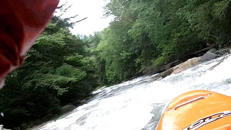
top of last rapid before confluence with Big Sandy
May 20, 2011
If you make it through the little sandy fine, then run on the Big Sandy to rockville wont be a problem. The first part of the Little Sandy is about 1.5 miles of flat water, then you hit about 3 ledges (first is biggest I think). Then there is one tough slide that pushes you toward a rock on the right, while there is another troublesome rock on the left. Run off the pillow coming off the rock on the right and punch through the holes. If you flip watch your head. At the very bottom of the creek, before reaching the Big Sandy there is a long rapid all the way to the confluence they can be tricky. The first part has a few offset holes that may cause problems, but after that Its mainly just a lot of waves. The whole run down to rockville took about 2 hours at a fairly easy pace.
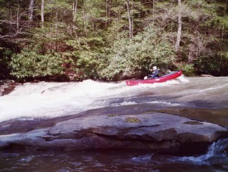
Mar 18, 2007
Some of the ledge holes can be sticky, so be aware. Also, there is one (obvious) ledge that is often portaged.
May 7, 2004
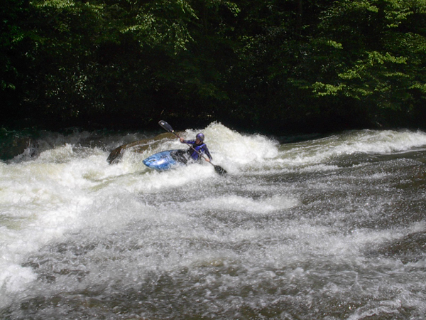
This is a fun drop and it's not far downstream of the first 3-4' ledge you pass on the trip. It's easier than it looks when you get there and the scenery is wonderful the whole way.
May 15, 2002
Check out the full-sized version of this picture at http://www.americanwhitewater.org/photos/?photoid=2324.