| Difficulty | III-IV |
| Length | 4.3 mi |
| Avg Gradient | 50 fpm |
| Gauge | Gauley River Near Craigsville, Wv |
| Flow Rate as of 57 minutes | 10.65 ftbelow recommended |
| Reach Info Last Updated | October 23, 2004 |
River Description
A paved hiking/biking trail runs along the creek. Watch out for trees and constricted rapids.
Putin: Behind Comfort Inn on Route 19 in Summersville
Takeout: Old Route 39 bridge (just upstream from current Rt 39 bridge)
River Features
Put In
Access PointDistance: 0 mi
Take Out
Access PointDistance: 4.3 mi
Trip Reports
Log in to add a reportDB
Dave Bassage
Jan 15, 2020
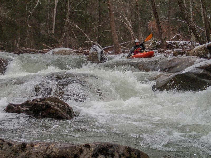
I ran this yesterday at a nice medium level when this page ruled it 'too low'. I find that whenever the Cranberry gauge is 200 or better Muddlety is worth a look, which can be checked from the midpoint at the West Webster Road park, where the toughest rapid can also be scouted. If that rapid looks good to go so is the rest of the run. It's also worth noting that the Muddlety headwaters are a wetland, so this run is slow to rise after a rain but holds longer than most other local creeks.
I use the access behind the animal shelter, where you can drive to the creek edge, then takeout a few inches above the outflow for the sewage treatment plant on 39 at the Muddlety public access for Summersville Lake. In winter the gate to this access is locked so there's a hundred yard carry to the upper parking area.
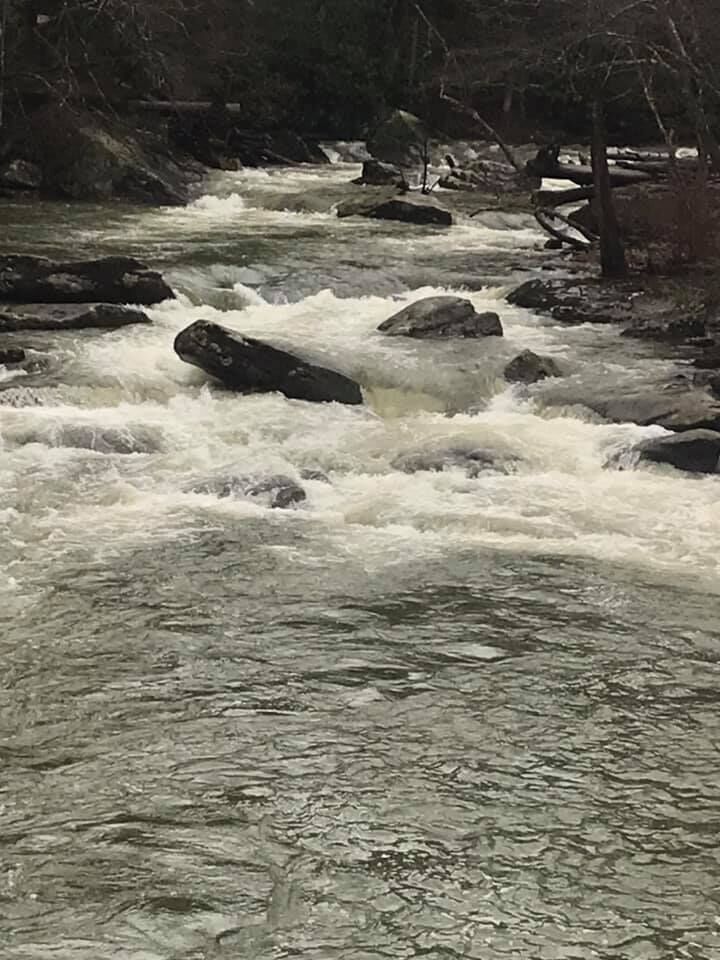
As of yesterday there was some minor wood in the first mile, very visible from upstream, that I hope to remove soon. There are also some new home sites river left sporting 'no trespassing' signs facing the creek, but it's still a fun class 3+ easy shuttle creek with beautiful scenery.
This run does seem to collect new wood regularly, which I do my best to keep up with, but it's always good to stay alert. The triple island rapid a mile from the takeout is currently clear in all channels, providing a number of fun slot options.
JM
Jeff Macklin
Feb 12, 2014
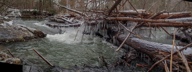
We paddled Muddlety a couple times a few years ago (pre Super Storm Sandy). It was, and still is, a surprisingly scenic and easy class 3 -4 run. Sandy left many trees fallen into the river and on the trails. There is a HUGE log jam at the W. Webster Rd. Community Park
( 38.296235,-80.825694 ) . NOTE! NOTE! NOTE! There are 3 private homes just upstream of the park and log jam with MANY 'No Trespassing' and 'Beware of Dog' signs. We talked with one resident to ask permission to portage around the jam on river right. She thanked us for asking and said 'OK'. Keep a low profile and be respectful!
As of Feb. 8, 2014, all wood below that point is passable, with caution.
It's an ideal short run if you are passing through Summersville.
After paddling, we hiked most of the river upstream Webster Rd (more like... limbo under and over logs). Again, much downed wood in the river, but everything we saw was passable. Next time, we will use the our normal put-in at the animal shelter
( 38.31203,-80.833118 ).
Take-out, we hike up the waste treatment plant 'through-way'
( 38.277304,-80.828569 )
to the hiking trail parking lot.
BTW, I don't think the Craigsville Gauge is a good indicator for this run. Get a visual at the rapid at the W. Webster Rd. Community Park ( 38.296235,-80.825694 ).
JM
Jeff Macklin
Feb 8, 2014
Log jam at Community Park.
JM
Jeff Macklin
Feb 8, 2014
This is the last part of the rapid at the Community Park. This park is accessible on West Webster Rd... Google maps: 38.295664,-80.825897 ... Top of rapid is still choked with wood as of December, 2014.
JM
Jeff Macklin
Feb 8, 2014
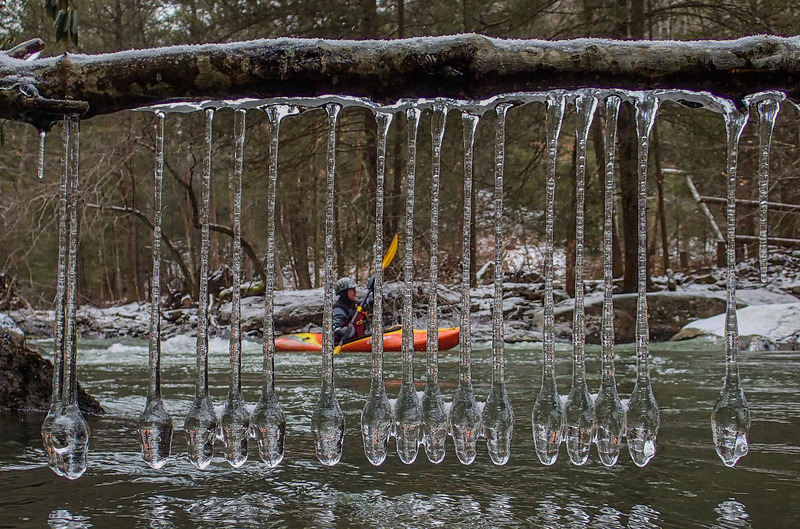
Being so close to Summersville and busy Rt. 19, this run is surprisingly scenic with relatively easy access.
?
Untitled
Dec 19, 2008
This is a nice run if you are in the area. We ran it when Peters Creek which is nearby was 200cfs and the Gauley was 12.9. We had medium water but it could be run with much less water. The putin is super easy. Just go behind the Comfort Inn and you will find a road leading right down to the creek. At first is floats through a nice glade and then drops at a nice pace. Lots of read and run class III action. There were a few down trees but all could be easily avoided. The run is more like 3 miles. The best takeout is at the water treatment plant. There is a parking area there for the Muddlety Creek Bike/Run trail. This creek runs often due to the large watershed. If there are small waves at the putin you probably have good water. There is a nice trail the runs the entire length. Bike shuttle and or run shuttle are possible.
Heath Damron
DB
Dave Bassage
Jan 1, 1900
This rapid is halfway through the run, easily accessed via West Webster Road (between the hospital and strip mall on 19). One could put in or take out here if you wanted an even shorter run.