Muddy Creek (Cheat trib.)
2. WV 26 Bridge to Cheat River(Lower)
| Difficulty | II-III+(IV) |
| Length | 3.1 mi |
| Avg Gradient | n/a |
| Gauge | Big Sandy Creek at Rockville, Wv |
| Flow Rate as of 24 minutes | 68 cfsbelow recommended |
| Reach Info Last Updated | May 6, 2022 |
Put In: At the junction of Highway 26, Woolen Mills road and a smaller road, There is a large open area between Woolen Mills road and Muddy Creek. Paddlers tend to park here or further north along Woolen Mills Road.
Take Out: The Cheat Festival site is on creek left at the confluence of Muddy Creek and the Cheat River. There are parking areas, informational kiosks and changing rooms. From Interstate 68, head South on Route 26. After about ten miles, take a sharp right into Teter's Campground. Drive through Teter's campground to land owned by Friends of the Cheat. This is an AW paddlers' easement.
Kevin Williams relates:
Fun run with 2 slides- one narrow and reminiscent of the last slide on Meadow Run (but not as steep). Watch out for the undercut ledge along the left side and a piton rock near the bottom. The other slide (right at the old furnace) is 25 meters long with a ledge on the left side, a consistent slide on the right and what looks to be a really nasty pinning rock jumble right in the middle. Portage on the right. . The run was pretty low for us. Take a look at the 2nd slide at the furnace; if there is enough water to run the right side, it will probably be a nice level. Take out at the Cheat putin.
Water Quality Improvments:
For years, heinous water quality deterred paddlers form running the lower section of Muddy Creek. This Creek had been severely impacted by Acid Mine Drainage (AMD) from abandoned coal mines for decades. The volume of AMD, commonly known as “yellowboy” was overwhelming after the 1994 blowout at the T&T Mine. However, this stretch of whitewater is now runnable again with excellent water quality.
In 2018 the West Virginia Department of En
...
Launch near near the junction of Woolen Mill Road and Highway 26p . There is a bit of parking on the north east corner of the intersection. Woolen Mill Road follows Muddy Creek upstream.
The remains of the old furnace appear to be on river left towards the end of the slide.
The take out is a public access point located on the Friends of the Cheat property. The takeout includes a moderately sized parking area with information Kiosks, bathrooms, and changing rooms. This is also considered one of the Cheat Canyon put-ins as well.
From Interstate 68 at Bruceton Mills, head south on Route 26. After about ten miles, take a sharp right into Teter's Campground. Drive through Teter's campground to land owned by Friends of the Cheat. This is an AW paddlers' easement.
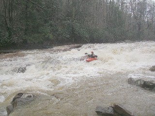
Mar 12, 2006
Ledge drop by old iron furnace
Ledge drop by old iron furnace
For the full-sized version of this photo, click here.
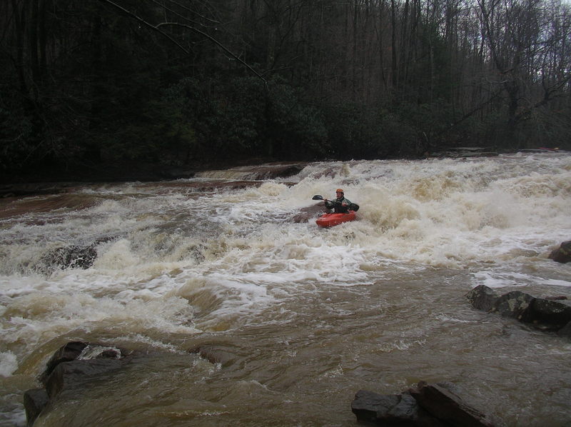
Apr 7, 2003
Funs run with 2 slides- one narrow and reminiscent of the last slide on Meadow Run (but not as steep). Watch out for the undercut ledge along the left side and a piton rock near the bottom. The other slide (right at the old furnace) is 25 meters long with a 5
