New
12. McCreery to Thurmond(Upper New)
| Difficulty | II-III |
| Length | 13 mi |
| Avg Gradient | 8 fpm |
| Gauge | New River at Thurmond, Wv |
| Flow Rate as of 1 hour | 6.78 fthigh runnable |
| Reach Info Last Updated | June 3, 2024 |
The National Park Service calls Silo Rapids class 3. Ledges is also a class 3.
NPS Guide to paddling the New River
NPS map of the New & Gauley Rivers
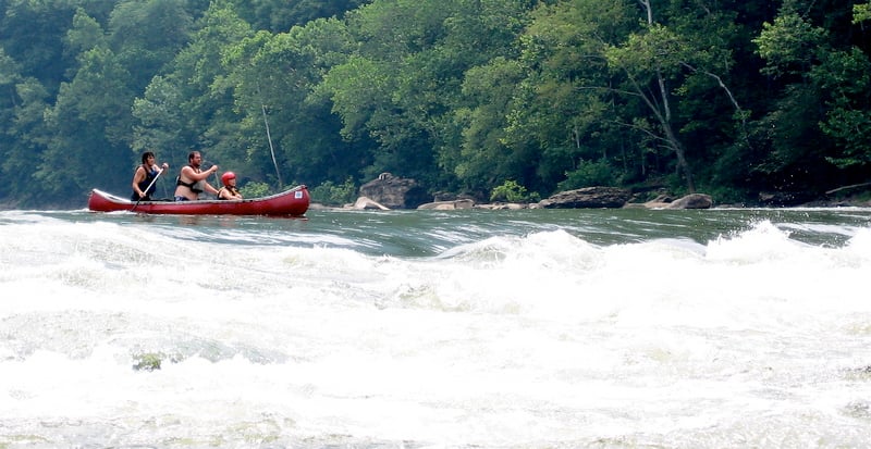
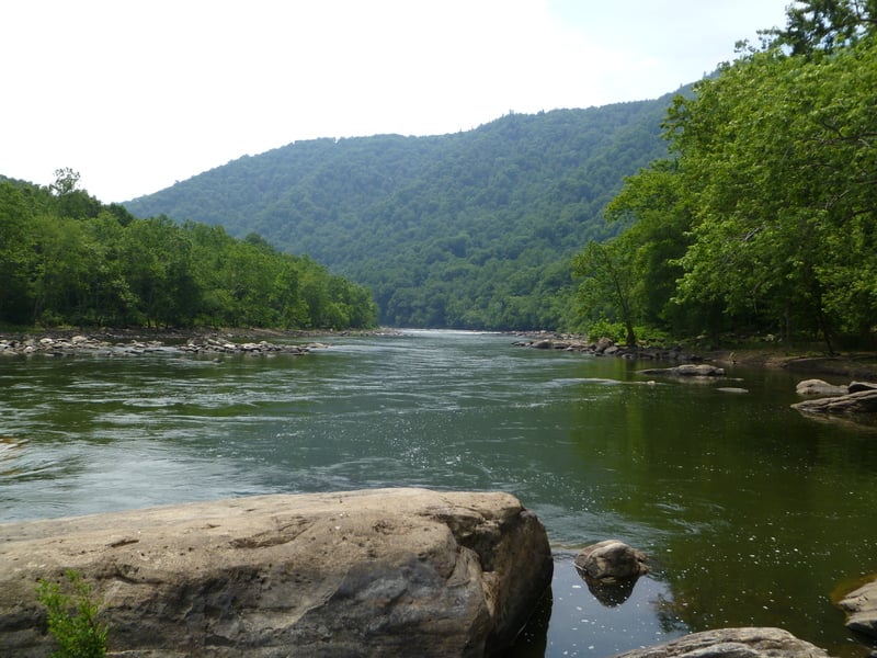
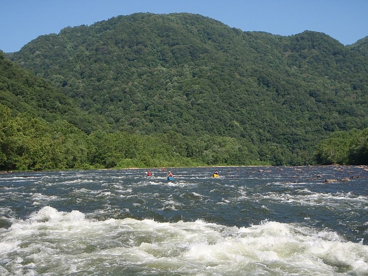
This is a great mild whitewater run. For instance, it's a good run for those who don't feel up to either the Upper or Lower Gauley at fall release levels. All rapids are straightforward and are easily boat-scoutable. The few mild holes and hazards can all be avoided by staying river center. There is supposedly an undercut rock on the river-right bank at the bottom of Silo rapid.
There is a great side excursion about halfway into the run. Dowdy Ck enters on river right through a tunnel and there is waterfall you can walk up to and underneath ( picture of waterfall). Commercial trips often stop here to eat lunch on river left and afterwards take their guests to the waterfall across the river.
Posted by UncleFuzzy to BoaterTalk:
McCreery to Stone Cliff (most paddlers take out at Stone Cliff for an 11.1-mile float, not at Thurmond for a 12.5-miler)
Cross to the river-right side on Route 41 and turn left onto CR-25, then follow it all the way to Stone Cliff.
Or take Route 41 south (toward Beckley) and then go right on Route 61. When you get to Glen Jean, find CR-25 and take it down to Thurmond.
When you get to Thurmond, CR-25 will turn right and follow the New upstream to Stone Cliff.
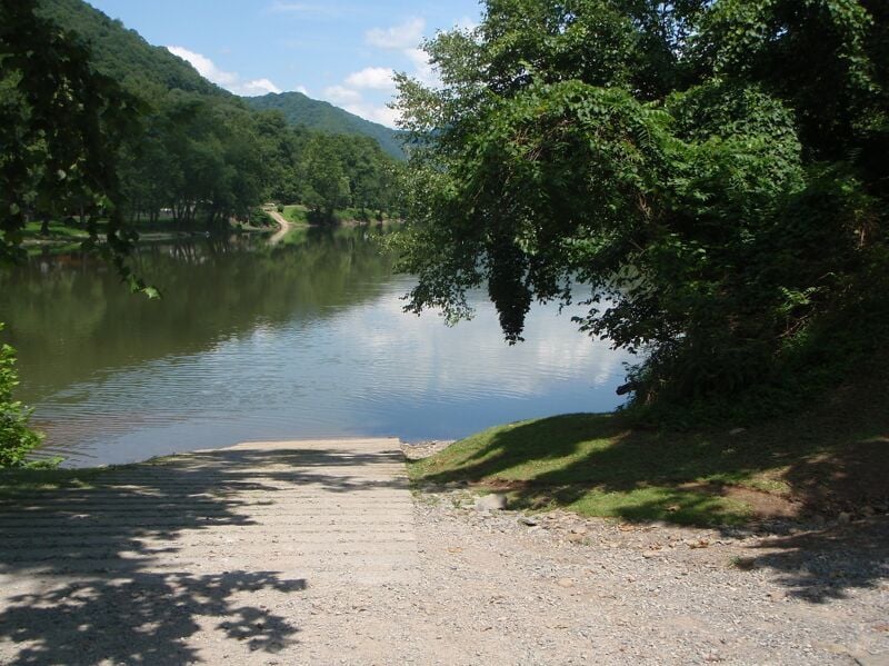
McCreery River Access - River left. Ramp and porta-potty. Parking is across the highway.
McCreery Rapids are immediately below the put-in.
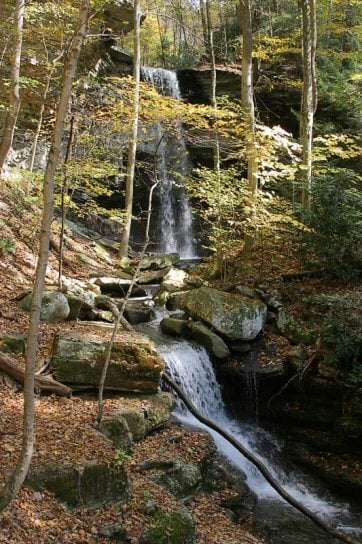
Dowdy Ck enters on river right through a tunnel and there is waterfall you can walk up to and underneath ( picture of waterfall). Commercial trips often stop here to eat lunch on river left and afterwards take their guests to the waterfall across the river. Stop here for a short hike and a look at Dowdy Creek Falls.
Lat/longitude data from TopoZone.com; not checked with GPS.
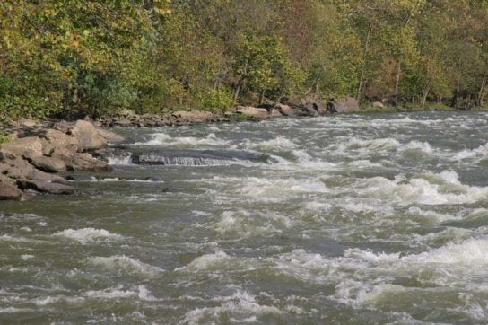
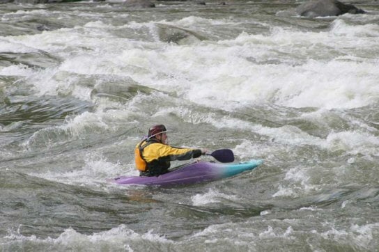
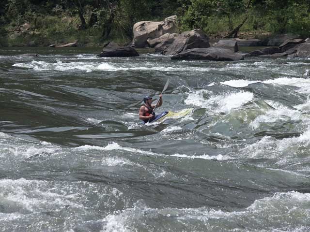
Silo is a wave/hole extending from the right bank, and can be avoided by staying left. There's a long pool before it and after it. Named for the silo on river right just upstream.
The Stone Cliff take-out is on river left, just upstream of the bridge, approximately 1.5 miles earlier than the Dun Glen access at Thurmond. Ramp, parking, changing room, pit toilet.
Thurmond Take-out - Dunglen River Access - river left. The Thurmond take-out is about 1.5 miles lower than Stonecliff. It is not such a long way to paddle on a nice day. I did it many times in a large commercial raft.
May 17, 2018
The comment about it being four miles from Stonecliff to Thurmond is way off. I remember it as being around a mile. Google Earth says 1.25 miles. It is not such a long way to paddle on a nice day. I did it many times in a large commercial raft. Stonecliff is certainly more convenient if you don't live at the Thurmond takeout.
Jul 2, 2011
the waves at silo can waterlog u did it in open 14 ft canoe next time ill throw a couple of strn pry in the stroke mix
Nov 13, 2010
Just wanted to post some rapid names. These are the rapids from McCreery or Prince. These are the names used by most outfitters, but some have multiple. If you know them by other names, feel free to ad to this list.
Rapid Name- Class.
Entrance Rapid- 2+
Photo Rapid- 2+ (photos taken on left)
Army Camp beach on Right
Ripple 1- 1
Ripple 2- 1
Zipity Do-Da- 2+
Duckie Muncher- 2+/3
381- 2+ (Named for the long gone railroad mile markers)
382- 2+/3
(Dowdy Creek tunnel on Right)
Little Ripple- 1
The Ledges- 2+/3
Thayer Pool- about 1.6 miles long
Silo- 3/3+
Metel Chunk- 2+
Clairmont Ripple- 2/2+
No Name Rapid- 2+
Upper Sandstone Rapid- 2+
Sandstone Rapid- 2
Sandstone Take-Out- River Left
Sep 28, 2009
I've ran this river 8-10 times, sometimes in a kayak and some in a duckie. I agree with one of the previous boaters. The type of boat can make or break a day here. I actually started paddling on the Mcreery to Thurmond section in a kayak. My take on the Upper New is that it can be a good beginner run if you are in a kayak or IK. A roll is nice but as long as you can wet exit you will be fine. An open canoe, especially with no floatation could lead to a bad day. As far as holes go, low water levels are the worst for sticky ones. A good level (In my opinion is 7ft on the thurmond gauge)just big waves at this level and the rapids all end in deep pools, so if you swim you have plenty of time to collect your stuff. S. Sage
Sep 30, 2003
From Boatertalk:
Date: May 30 2003, 2:38 GMT
From: unclefuzzy
McCreery to Stonecliff
Cross to the river right side on Route 41 and turn left onto CR-25, then follow it all the way to Stonecliff.
Or take Route 41 south (toward Beckley) and then go right on Route 61. When you get to Glen Jean find CR-25 and take it down to Thurmond. When you get to Thurmond CR-25 will turn right and follow the New upstream to StoneCliff.
Meadow Creek to McCreery
From I-64 take exit 138 and follow CR-7 to Meadow Creek. To get to McCreery from there you can go back to I-64, take it to exit 124 (East Beckley). Then go right and the road you are on will join with Business Route 19 (Eisenhower Drive). Take that road to US 41 and turn right on US 41 to go down to McCreery.
Another way to get to McCreery from Meadow Creek it to stay on river right. Take CR7-1 from Meadow Creek thru Claypool. When you get to Rt 20 turn left and and go a short distance to CR-31. Turn left onto CR-31 and take it to Route 41 (going thru Danese on your way). When you get to Route 41 turn left and drive down to the New. Croos the New and you are at McCreery.