Potomac, North Branch
4. Barnum, WV to Bloomington, MD(Bloomington Section)
| Difficulty | II-III |
| Length | 6.2 mi |
| Avg Gradient | 30 fpm |
| Gauge | North Branch Potomac River at Barnum, Wv |
| Flow Rate as of 12 minutes | 301 cfsbelow recommended |
| Reach Info Last Updated | June 18, 2026 |
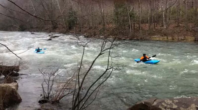
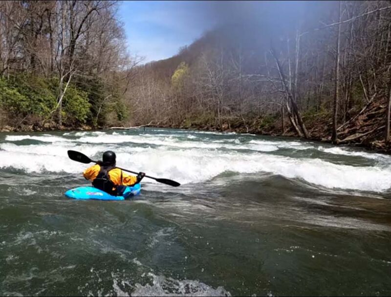
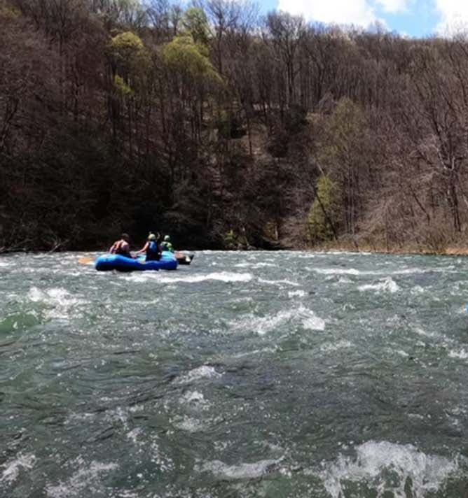
This section of the North Branch Potomac has fairly continuous whitewater consisting of primarily open Class II-III rapids with waves and holes. The water is cold, however, because it is usually drawn from deep in the reservoir. Be prepared for 50-55 degree water anytime of year. Short pools break up the rapids. Releases are posted [here](https://www.nab-wc.usace.army.mil/nab/northBranch.html). The rapids start right below the put-in. A little more than half-way down is the most difficult rapid: 'Robin's Nest. After 'Robin's Nest' the rapids become generally progressively easier down to the town of Bloomington, MD and the take-out, on river left.
Camping Opportunities in Area:
Barnum Camping (Mineral Co. WV): [https://www.mineralwv.org/parks-and-recreation-barnum] (https://www.mineralwv.org/parks-and-recreation-barnum/)
Savage River State Forest Camping (MDDNR): [https://dnr.maryland.gov/forests/Pages/publiclands/SavageRiver/Camping.aspx](https://dnr.maryland.gov/forests/Pages/publiclands/SavageRiver/Camping.aspx
...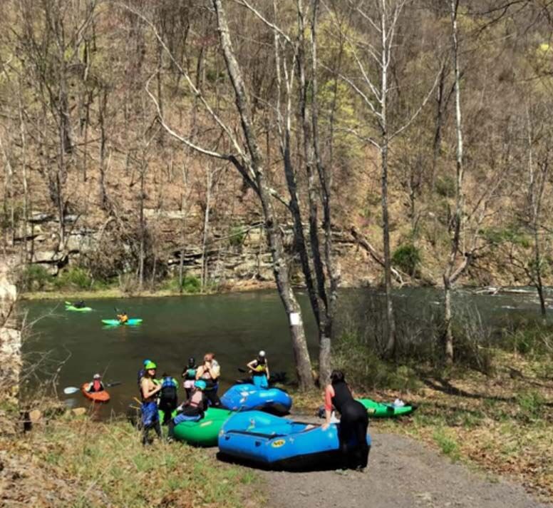
Mineral County, WV manages the Barnum Whitewater Area, at the bottom of Barnum Road, which offers a large grassy field to park and get dressed for the river. The put-in is at the base of what looks like an old bridge pier, at the bottom of a short pool before the first rapid. Begining in 2023, the charge for access to the Barnum Whitewater Area increased from $2.00 to $5.00 per boater per day on release weekends.
!["Woodsmoke" [Boulder Garden 1]](https://images.americanwhitewater.org/photo/medium/WSEBQxoGK1cWzcysBbjQ5.jpg)
Called 'Woodsmoke' because in cold weather paddlers can often smell the campfires of the camping area downstream from the put-in. Just below the put-in, the river splits in two around a small island and the natural line from the put-in is to stay to the right of the island. In this channel, stay on the right side tongue to avoid a large rock/hydraulic in the center left of the channel. After you pass the rock, there are eddies both left and right to catch. The remainder of this first boulder garden rapid has offset eddies, waves and rocks - no more than class II-. The rapid continues until you reach the pool where the Barnum automated gage is located.
!["Rocks & Rhododendron" [Boulder Garden 2]](https://images.americanwhitewater.org/photo/medium/h5ypkCypVdcmhBeEpzrPt.jpg)
This rapid starts at the end of the Barnum gage pool. It is a fairly long class II+ boulder garden, ending with another short pool with eddies both left and right, the right eddy under the boughs of Rhododendron and a couple of Pine trees. Both eddies (particularly the right one) have rocks just below the surface that can flip a boater on the eddy turn - keep an eye out on the eddy turn.
!["Easy Out" [Boulder Garden 3]](https://images.americanwhitewater.org/photo/medium/guRQb8p5NO4MenxFx6eJf.jpg)
Class II+ boulder garden, very similar to the one before it, ending with a short pool. If you're having a bad day there is a nice eddy behind a fairly large rock on river right and a trail up to the road back to the put-in, that provides an 'Easy Out' if you'd like to walk back to the put-in.
![Lead in to "The Slides" [Boulder Garden 4]](https://images.americanwhitewater.org/photo/medium/jT2q6QZKMzwbVdCXEkluH.jpg)
Class II boulder garden, very similar to those before it, followed immediately by 'The Slides'
AKA 'The Ledges.' Immediately follows the fourth boulder garden, but then the river forms a series of nearly river wide surfing ledges. All the ledges can be surfed, but the first two are pretty powerful, so if you don't want to surf them, keep your boat pointed downstream, paddle hard and solidly punch them.
'The Slides' Playspots:
'First Slide' (Ledge) (riverwide) -- First long riverwide surfing wave. Has a bit of a tongue center right.
'Second Slide' (Ledge) (riverwide) -- Second long riverside surfing wave. Also can be broken center right if you want to run straight through.
'Zen Wave' -- Easy gentle surfing wave just above the last series of surfing waves.
'Disneyland' -- Last series of surfing waves before the pool.
Named for the creek, called 'Folly Run,' that comes in from river left, just above the rapid. AKA 'Folly Run Shoal,' AKA 'Shoal and Eddies.' After a longish pool, the river shoals up on the right, so the line is to move river left with the main current. There are a series of eddies against the left shore that can be worked, then the river comes together at the bottom and dissipates into a pool.
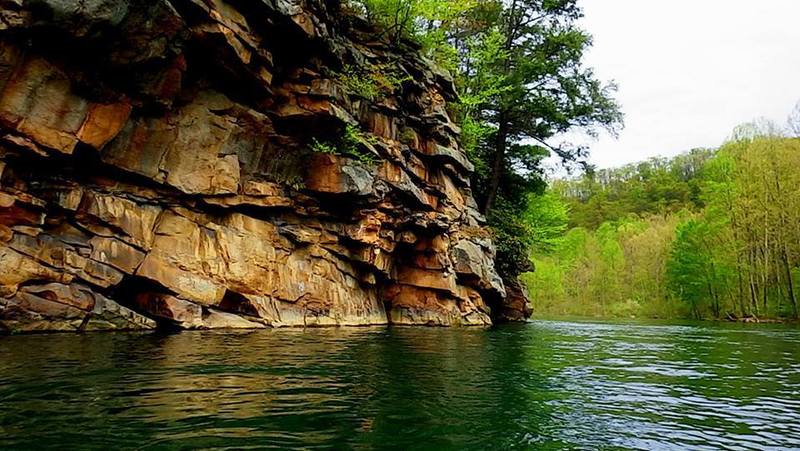
A sweeping turn to the right with a pool at the bottom and cliffs to the left. The name 'Blue Hole' actually refers to the pool at the bottom, but has to some extent migrated to the rapid that leads into it. The river access at the 'Blue Hole' pool is the last road access to the river (on river right) for a short take-out.
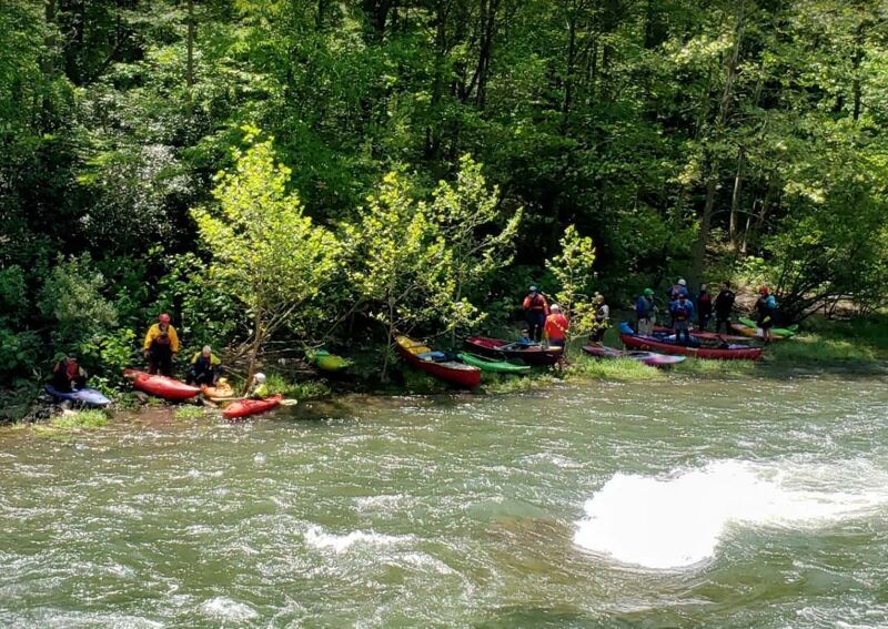
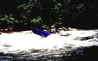
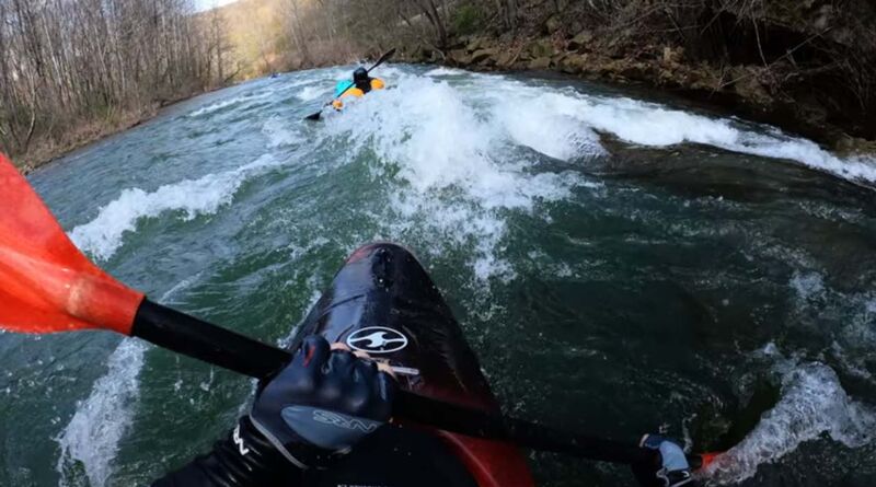
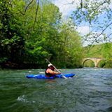
A rocky rapid that makes a sharp left turn at a concrete wall (from which the picture was taken) which continues after the turn. After the sharp left turn, there is a playhole, which can be surfed to the enjoyment of the paddlers that gather on river left to eat lunch.
'Lunch Stop' Playspot:
'Lunch Stop Hole' (center of channel after the river left turn at the concrete wall) -- Rather powerful wave for surfing, spinning and 360's.
Proceeding from the 'Lunch Stop', the river makes a sweeping right hand turn with the current pushing to the left. If you move center to right, there is a large easy-to-catch eddy on river right. But on river left, there is a smaller eddy just upstream of where the current washes up against the rocky left bank. The late Rick Tegethoff used this left eddy to train beginning whitewater paddlers to catch tighter eddies just off the main current with harder eddy lines, so this rapid is named for Rick.
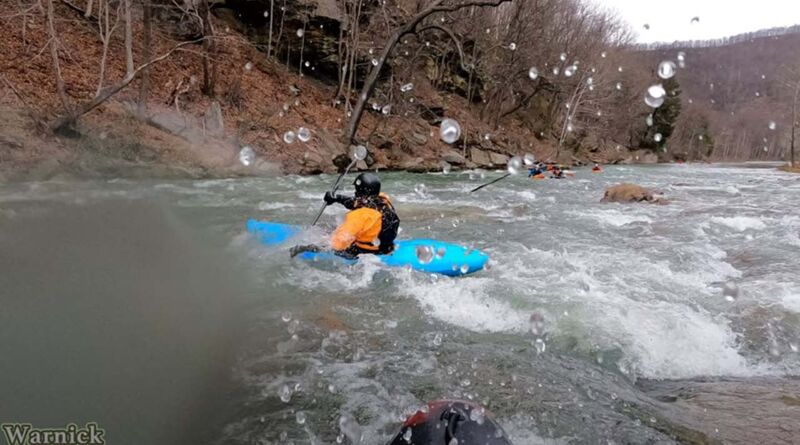
Named after the town of 'Warnick' that was once on the river right side at this rapid. There is a little boogie water before you get to it. Basically, 'Warnick' rapid is a riverwide shoal that the paddler has to find a way through. The traditional line is to start at center, then work to the left, passing just to the right of a rock that appears to block the channel. The river right side of this rapid has been opening up in recent years and there is a line down river right, as well, which can be rocky at the bottom. I have been told by one paddler that there is a way (at 1,000 cfs) to run a clean line through the center of the shoal and I've actually seen another paddler that seemed to pull it off, but I don't know how to describe it here. It's up to your river reading skills. (There are spelling variations of 'Warnick' such as 'Warnoch' and perhaps others.)
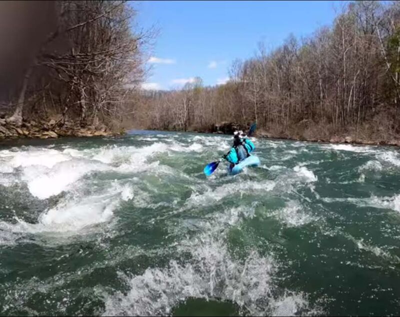
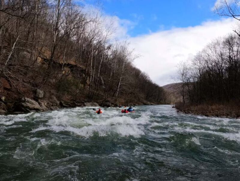
AKA 'Bear Ledge', AKA 'Bear Falls', AKA 'The Falls'. The most difficult rapid is 'Robin's Nest' which occurs near the bottom of a river right channel formed at the split of an island. Avoid the near riverwide hole center and center right. Run this rapid mostly river left. Look for a rock* (sometimes appearing as a hump of water) that breaks this riverwide hole. The current line is to be close** to this rock, then be prepared to make a sudden move to avoid additional rocks or holes below. (There is a far right side eddy hopping line for those that like to be challenged, but this line involves clipping the right side of the upstream hole in one of the hops. On this right side line, if you don't make the move with enough power, or if you lean back, you're in for a surprise.) Today, most paddlers call this rapid 'Robins Nest', but there are older names: 'Bear Ledge', 'Bear Falls', or 'The Falls' (Thanks Lindy for the history) that locals and fishing guides use to refer to this rapid.
*This rock has been subtly changing (splitting or moving) over the last few years (2023/2024 to the present). The traditional line (Attributed to the late Gail Bradshaw) was to go slightly to the right of this rock, where there would be a tongue of green water that would get the paddler past the first big hole. With the change in the rock's position, this tongue is either gone or hard to see as you come over the horizon line. Despite this, the hole is still somewhat weaker on it's left side next to the rock if punched assertively. Use your river reading skills as you approach the top of the drop.
**Either left, right, or over a split in the rock -- but have some speed -- indecisiveness that results in sliding into the rock sideways will flip you. Should someone in your group flip, the best eddies for recovery below the rapid are to river right.
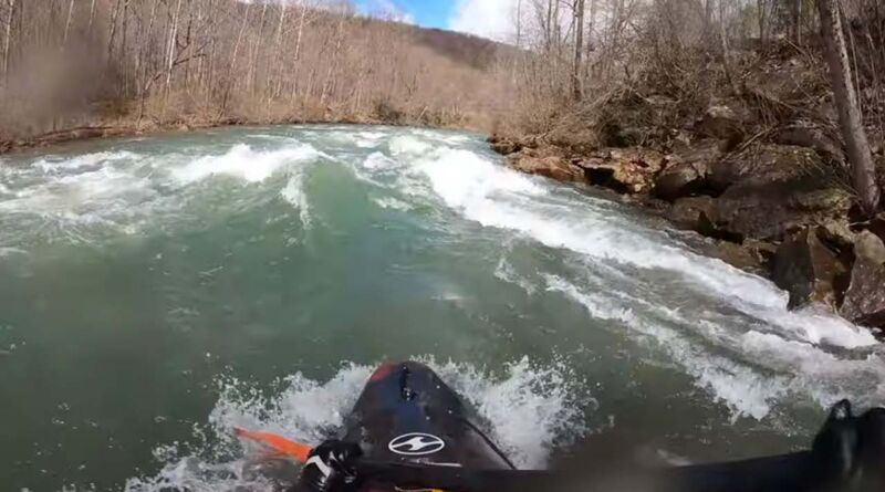
'Top of the World' is a fun and bouncy wave train. The rapid is located below a long low staging rock which is above a short pool. A creek ('Laurel Run') comes into this pool from the left, just above the rapid. Occasional historic floods from 'Laurel Run' have created a rock and gravel delta shoal on the left at the beginning of the rapid. As a result, the run begins center to right. At the bottom of the river left upper rapid shoals, stay right for big waves that are not stoppers, but if a dryer run is desired, move back to the center/left for the runout. AKA 'Wave Train'
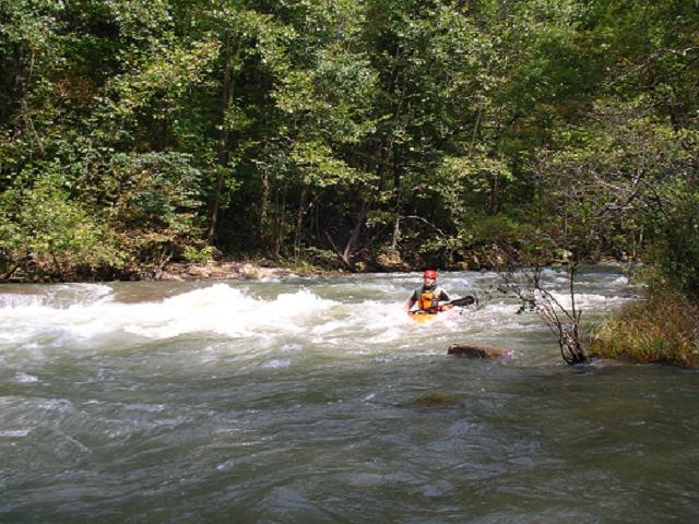
This rapid has a pretty easy line just staying right, but there's also a line down the left that has more current and involves more hole dodging and wave punching. At the bottom center of the rapid is a pretty big hole ('No-Popup') that you wouldn't want to float into, and the water is a little boiley on river right below the hole. AKA 'Under-Rated'. Last significant rapid until 'Bloomington'.
In 1996, when the Piney Swamp Run watershed was being logged and surface mined, there was a summer thunderstorm that blew out the creek and created a huge delta of rocks and silt that blocked the center and right of the N. Br. Potomac. This created a (then) new rapid which has been named for the creek. For about a decade after the rapid was formed, there was a pretty good long standing surfing wave here, but lately the channel has been widening and the wave lost its downstream curler, so that surfers slide off the river right side. The delta continues downstream becoming a shoal. The shoal blocks the center of the river and the river left side is blocked by strainers, but there is a line through the shoal generally river right.
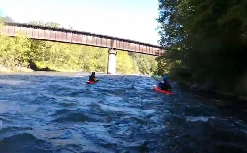
Not really of interest, except this is not the take-out railroad bridge. This bridge was part of the re-routing of the railroad line higher up from the river so it could get over the Bloomington Dam, which was completed in 1981.
AKA 'Last Rapid'. As the river approaches the Bloomington, MD take-out, the main channel goes over a shoally gravel bar, which begins a turn to the left. At the top, behind an island, there is a far right side channel that sneaks behind the island. Either way, at the bottom of the island, the two channels come together and form a series of standing waves against the right shore, much like a less steep, but longer 'Top of the World'. The take-out is at the bottom of this rapid on the left, just upstream of the arch railroad bridge.
The Bloomington, MD take-out is on the left, at the wastewater treatment plant, just upstream of the arch railroad bridge.
Oct 14, 2025
As noted by others, there are a few additional rapids upstream of the normal put-in at Barnum. To get to these, the 'easiest' way is go upstream on river right (the left side of the river as you go upstream) via the trail that goes by directly by cabin #4 (cabins #9 and #10 will be off to your right 50 m off in the woods reached via another trail). You can take this trail all the way to the base of the dam (no trespassing signs are present right at the very base of the dam). It's about a mile. You can walk or theoretically drive a vehicle though this likely isn't encouraged or even allowed. I have not tried to access this area by going from the dam downstream but it is likely to be challenging to do so without trespassing in plain view of the dam. Trying to get there from Barnum Rd. isn't good either -- it might be a shorter distance than the trail but would be very steep and very overgrown (for example down the hill where the power lines are). The trail seems like the best access. There are about 4-5 rapids including a couple of class II+. Probably not worth it for most paddlers but just FYI for those who share the irresistible itch to try new sections.
May 27, 2023
Picture taken by Pete Martin of Lunch Stop on the N. Br. Potomac, Bloomington Dam release.
Aug 31, 2010
Fantastic release last weekend. Robin's Nest was in full form and the paddling was great!
The final big left-hand bend in the river where the channels split around several islands holds some downed trees in the left channel. Stick to the main channel or the right. Definitely a fun run!
Feb 21, 2007
Link to release schedule: click here
Main COE link: click here
Lots of photos of this section: click here