McCloud
Fowler Camp to McCloud Reservoir(Upper)
| Difficulty | III+(IV) |
| Length | 11 mi |
| Avg Gradient | 60 fpm |
| Gauge | Mccloud River Near Mccloud |
| Flow Rate as of 20 days | 762 cfsstale data |
| Reach Info Last Updated | May 25, 2023 |
A unique run with beautiful scenery, terrific water quality and clarity, and fantastical architecture from the 1% (all of the run past the put in is bordered by private property – 'Wyntoon' – owned by the Hearst Corporation).
The distance, starting at the boat launch area downstream of Lower Falls, is about 7.5 miles of river, plus 3 miles of lake paddling. Starting near the Class IV/V Lower Falls adds another half mile.
During late summer and fall, launching on this run involves boat dragging or such till you get to Little Springs. These springs add just enough water that boaters can scratch down the creek the next mile to get to Big Springs where a lot of water comes into the river.
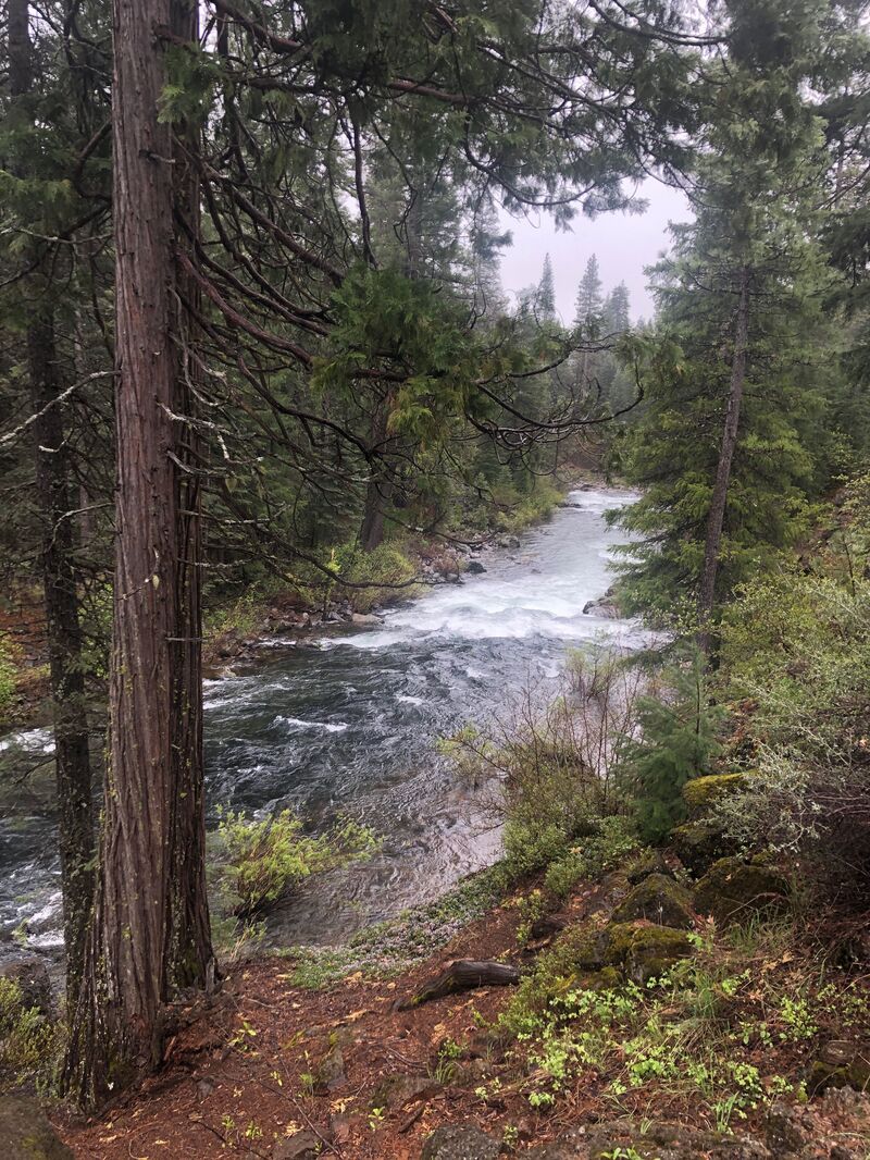
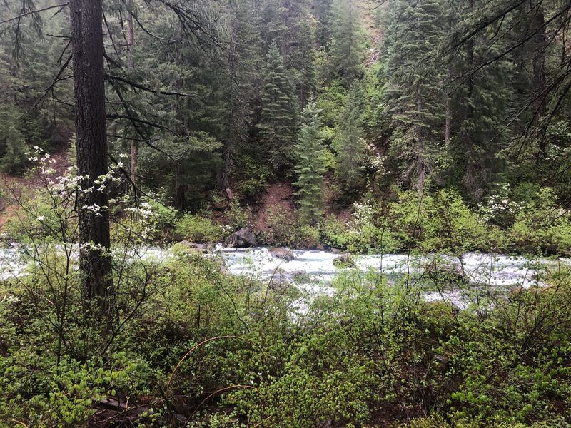
The first rapid below Big Springs is the steepest of the run with multiple rocks and pourovers to avoid. Below that, the river eases for a ways then picks up with a very long section of continuous class 3. The gradient eases gradually as the river goes downstream creating longer sections of slower water, between the mostly continuous 2 rapids. A few steeper rapids appear along the way.
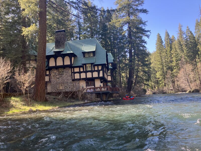
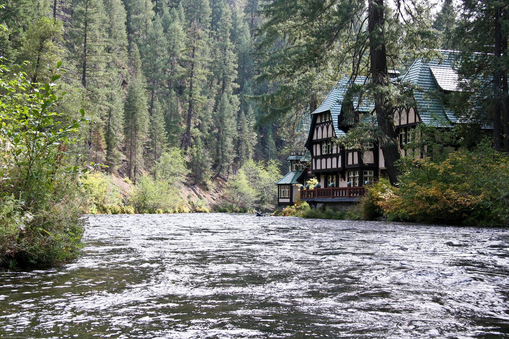
Near the end, it is a treat to float past the exotic buildings of Wyntoon, the Hearst Corporation's private resort.
Getting There: The town of McCloud is about 10 miles east of Freeway I-5 on highway 89. The take out is about 10 miles south on Forrest Rd. 11. The put in is 5 miles east of McCloud on highway 89, then about a half mile south to Fowlers Camp.
Put in: On Highway 89 there will be signs to Fowlers Camp and the McCloud Loop drive. Turn right (south) and drive about 1/2 mile. Just befor Fowlers Camp turn right again at a fork towards the Lower Falls picnic area. A gravel road leads to a designated boater launching area. It is just a dirt clearing in the woods for parking up on a bluff above the river. A trail leads down to the river and a small somewhat less bushy area suitable for launching. This launch site i
...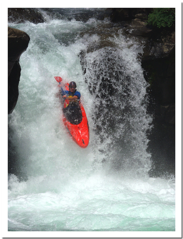
Mileages to landmarks along the river are measured from this point simply because it is an obvious landmark. Lower Falls (Nurunwitipom) is runnable at some flows. There is a bit of a cave behind it and the cliff to river right is severely undercut.

From the lower falls picnic area follow signs down a gravel road to a left turn and a parking area on the bluff above the river. A gradual trail leads down to the river in a short distance.
Follow a rutted and dusty dirt road to the National forrest - private property boundary, then follow side roads towards the river. User trails lead down to the river. A fence line is visible in spots allowing people to stay on public property.
If you have been dragging your kayak or IK over rocks up to this point, these springs should provide enough flow to scrape down the rapids to Big Springs. They don't provide a lot of water, but just enough to allow boaters to sort of boat.
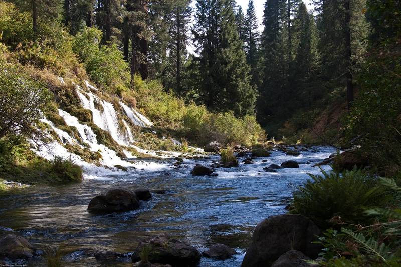
Several hundred cfs are added to the river at this location. Some of the springs cascade down from above the river, but a lot of springs flow up out of the ground just above river level. From here on down the river usually has boatable flow all year round.
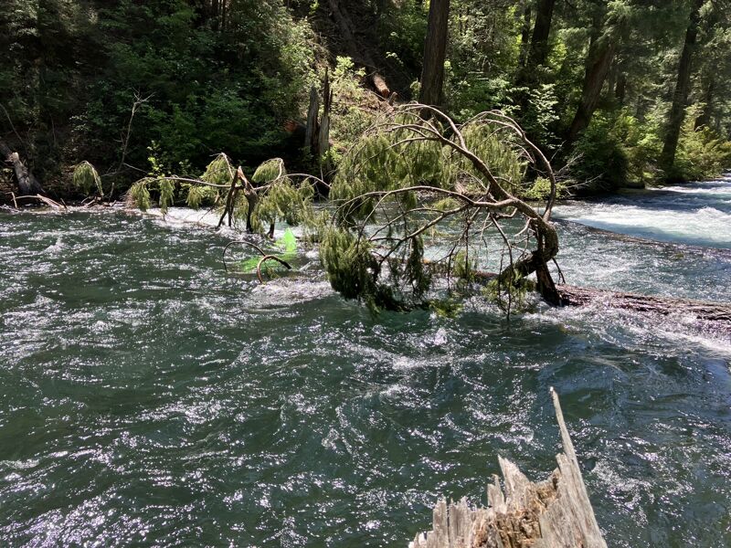
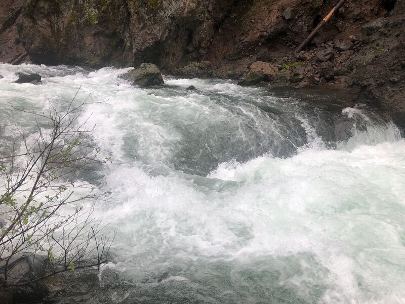
The steepest rapid of the whole run starts immediately past Big Springs. The rapid is a long fairly steep slalom, past (depending on the flow) rocks and pour overs, or big holes and big waves. A big log was across the river at the bottom of this rapid in 2009. The left end was high with very low clearance above the river, while the right end was submerged enough to allow boat passage without stopping.
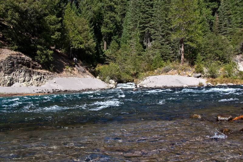
Mud Creek comes in from the right. I think this is an area of lower gradient following a particularly long section of continuous class 3. There are a few spots in this area to pull over and take a breather.
Mud Creek has its headwaters near the summit of Mt Shasta. It is said to be much more prominent during high flow periods, when it lives up to its name. It runs silty year round, but during low flow periods most of the flow is diverted into a ditch several miles upstream near highway 89. The ditch empties into Huckelberry creek near the reservoir.
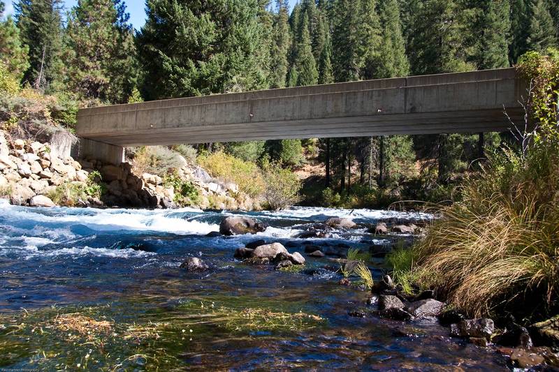
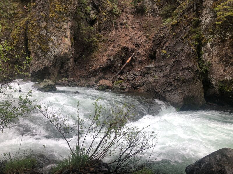
The gradient gradually lessons below Big Springs. After a long section of somewhat easier water you will see the first bridge of the Wyntoon property. The rapid beneath the bridge is a bit steeper than just upstream or immediately downstream.
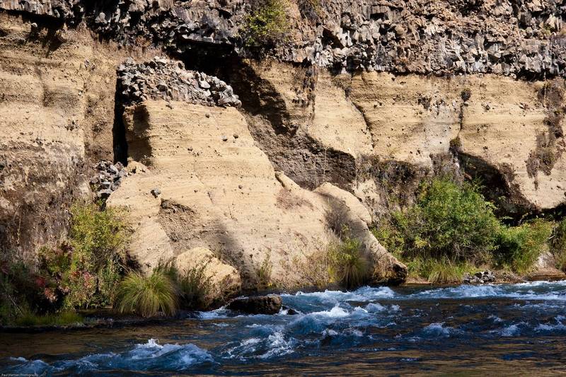
A short ways past the bridge the river bends to the right and drops down a steep and wide rapid towards a distinctive wall. At the bottom the rapid bends sharply left. The distinctive cliff on the right has a layer of volcanic basalt resting on top of a thick layer of mudstone or sandstone material.
I don't know what name the locals may call this rapid.
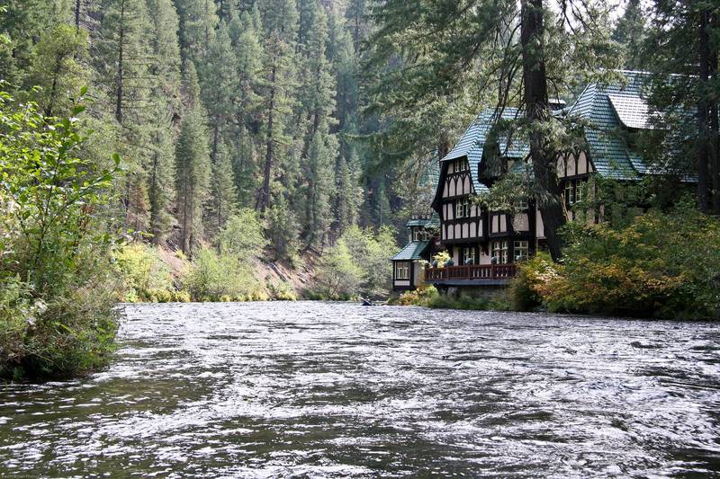
You may not notice the creek coming in on the left, but the amazing challets on the right will certainly catch your attention. Several, including the Cinderella cottage are built on the edge of the river. Murals decorate the sides of some buildings. Around the right hand bend, a steeper rapid flows underneath a bridge.
A couple hundred yards past the last of the Wyntoon buildings, Huckleberry Creek comes in from the right, carrying a load of gray silt. Huckleberry Creek is naturally spring fed so its flow should be crystal clear. The silty flow is from Mud Creek which has been diverted into a ditch and directed to Huckleberry Creek. This confluence also marks the high water level of McCloud reservoir. Flat water paddling starts here or a short ways downstream.
When McCloud reservoir is around 24,000 acre feet of storage, riffles extend to this area and the river current extends a bit further.
This bridge across the reservoir serves as a distance marker. From here it is about 1.7 miles across the lake to the Tarantula Boat Ramp.
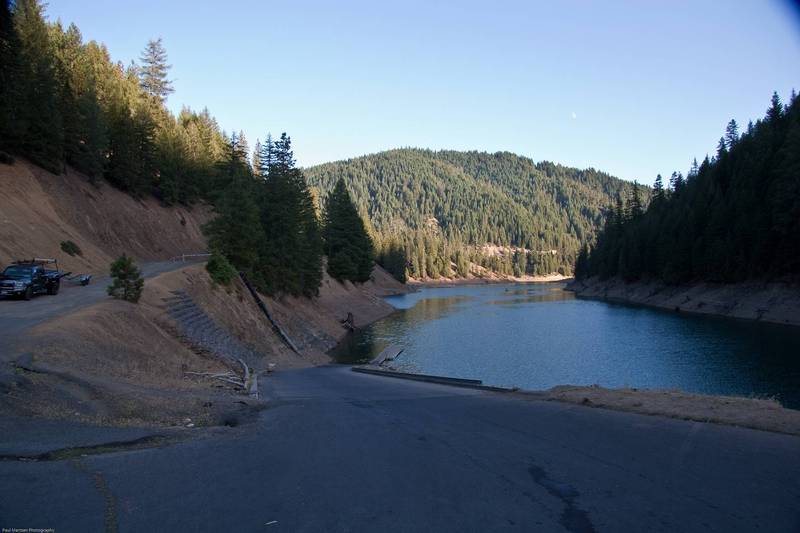
There is a large parking area here, with picnic tables and pit toilets. The boat ramp is a self servic fee area and costs $5.00 to park. The locked gate on the road marks the boundary with the Hearst Corporation property.
Jun 4, 2023
June 2 2023
McCloud at put in 0.6 miles below Lower Falls to reservoir
CFS 1350
Wood frequently seen in river.
(2.2 miles below put in) At 0.2 miles below Big Springs wood across most of the river. Easy to see. In hard shell kayak narrow sneak on right.
(2.4 miles below put in) At 0.4 miles after Big Springs wood across most of the river. Easy to see. In hard shell kayaks ran a fairly wide route on the river right.
It seemed closer to Big Springs than this. Miles are according to AllTrails (3.6 miles below put in) At 1.6 miles below Big Springs MAJOR hazard. Wood across the entire river. From river level it looks runnable on the left. However there is a second tree 10 feet down river. We portaged on the right. Two kayaks stuck in the river in this area.
At 0.2 miles below the bridge there is significant wood in the river. We ran it, but I'm not sure what line to take once the water level goes down.
Apr 29, 2023
Two of us packrafted this and were very wood-alert given the recent snowmelt and flooding. A rare chance to paddle this above the ~700cfs that it usually is due to the springs. We didn't do Lower Big Springs or even the section right below due to high water and lack of eddies right from the get-go. Putting in at Fowler's, there were 3-4 portages around wood, one of which wasn't very fun – even for light packrafts. Otherwise the run was as described – mainly continuous class III.
May 8, 2013
There is an new shop in McCloud which offers shuttle services for this run. They are very cool. The shops name is McCloud Outdoors & Gear Exchange. I found them online at www.mccloudoutdoors.com
Sep 30, 2009
Boated two days in a row on this pretty river. Launched near the National Forest boundary to minimize the distance to Little Springs. Probably 20 cfs above Little Springs and maybe 50 to 75 cfs below. Big Springs added several hundred cfs to fill out the river. Several more springs came in along the way. Side creeks added minor amounts of water. The long sections of continuous water were super fun, but tiring.
Paddling across the reservoir was hard the first day as there was a strong headwind. On the second day, winds were light and usually behind me.