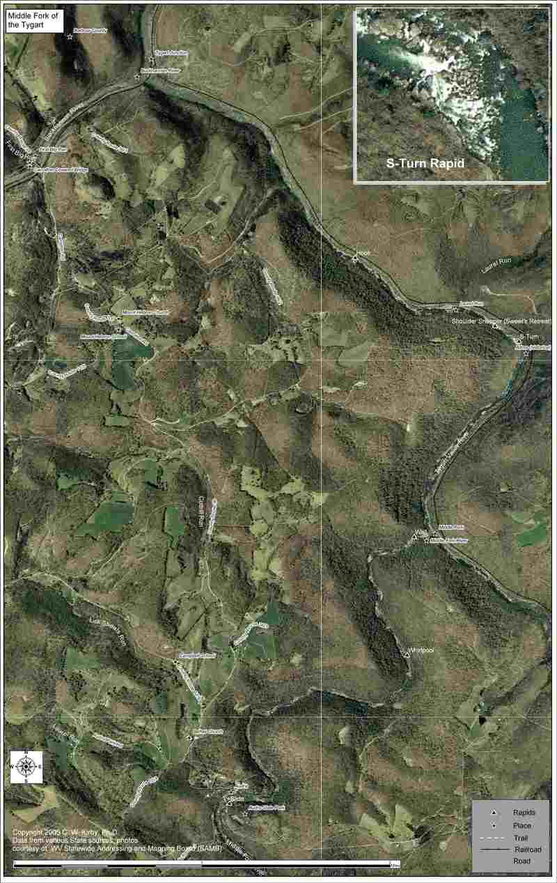
Middle Fork
3. Audra State Park to Tygart River Confluence
Aug 22, 2017
If you plan on running the normal shuttle out of the Tygart gorge, walking up the tracks to the Carrolton covered bridge, do not drive around the 'ROAD CLOSED' concrete barriers even though there is room. The state police were waiting for us at the railroad crossing by the remains of the burnt down covered bridge, and gave me a ticket. I'm sure one of the locals called the police. There is nowhere to park above the barriers so I'm not sure what the other options are, possibly paying for the shuttle service from the Tygart river outfitters. They pick you up I believe river left just below LEFT HOOK on the Gorge.
Apr 18, 2011
There is a new tree down that crosses the whole river on the first half of this section. It's about halfway down the Middle Fork section. You can see it from a distance and there is plenty of time to eddy out and portage it on the bank. Our group portaged on RL but RR might be a better option - simply more space as the trunk of the tree and the larger part of the tree are on RL. There was only room for 1-2 boats at a time to put back on once getting over the tree on RL.
Aug 27, 2009
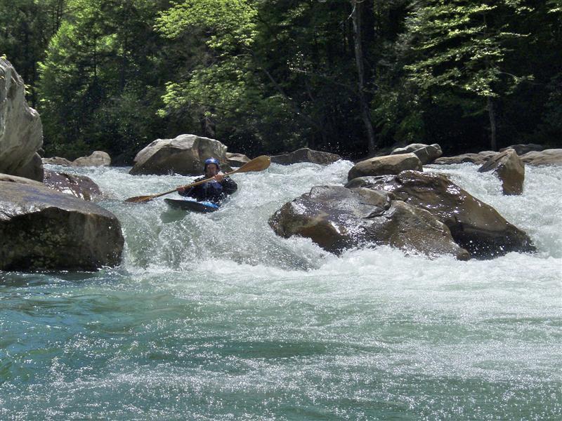
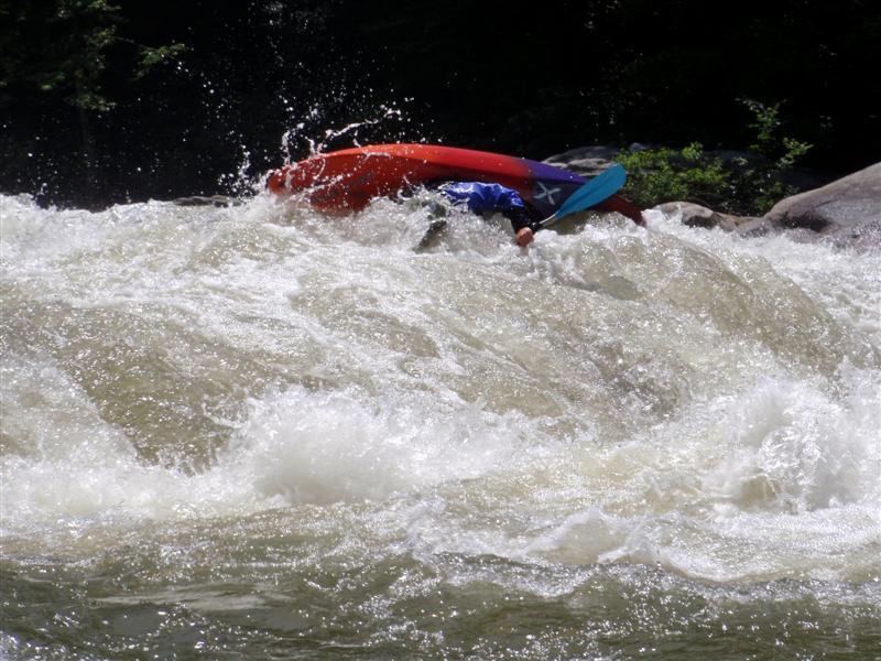
Jim Murtha runs the rapid where I had my accident at a low water level. The water level was 3.8 feet on the Audra gauge. The rock I hit is one of the two exposed rocks on Jim’s left (right side of the picture).
Jun 17, 2009
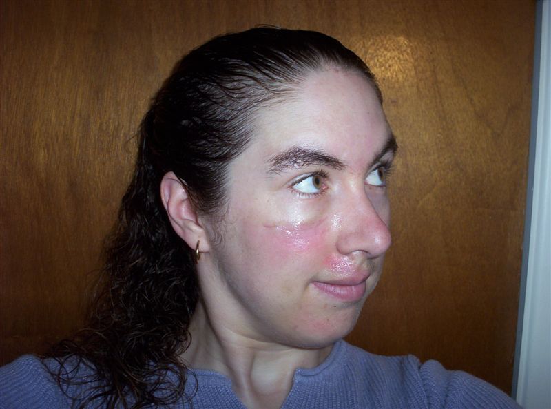
This picture was taken on 6/17/09, 11 days after the accident.
Jun 7, 2009
The same rocks are partially submerged at a medium water level. They are the closest rocks to the camera, slightly left of the center of the picture. The water level was 4.2 feet on the Audra gauge.
Jun 7, 2009
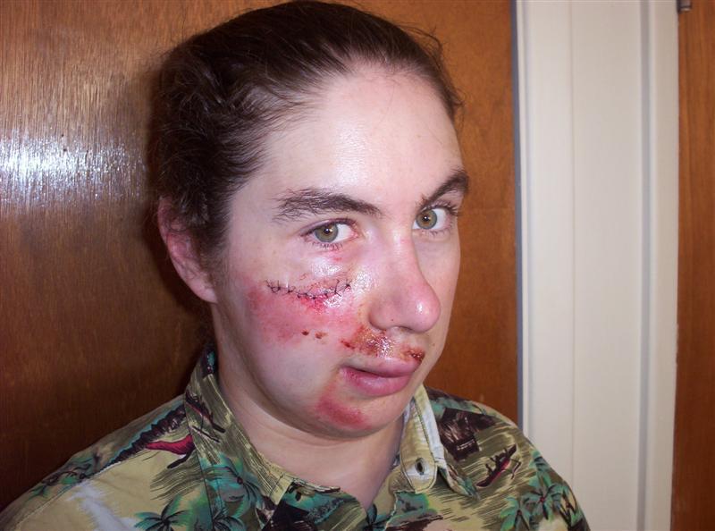
This picture was taken on 6/7/09, 1 day after the accident.
Jun 6, 2009
We believe this picture was taken of me at or around the moment of impact. I washed over the rock at the same moment I was trying to roll which is why my face was so exposed. At this (high) water level the rocks are completely submerged (but not very far!) The water level was 5.2 feet on the Audra gauge.
Apr 12, 2008
A more direct route from the Audra picnic area put-in to the railroad tracks take-out: cross the Middle Fork on CR 11 (bear right after the bridge and head up the hill). About a mile or so, bear right on CR 36 (Carrollton Road?). This takes you directly to the covered bridge take-out in Carrollton. This is the route that is about 4-5 miles, not the one given in the river description.
May 28, 2007
The comment below sounds like Hook Drop, a 90-degree left turn. It is very dangerous. Stay about 4-6 feet from the left side at the turn, stay straight, and paddle hard! The hole is backed by a rock on the right. Too far left, and I've heard that there's a submerged passage, or something. Or maybe it's a different one.
Jan 3, 2006
!!!!WARNING!!!!
Near the end of this run(on Tygart) about a mile from the takeout(railroad bridge) there is a NASTY HOLE in the
center of the main channel. This hole is
VERY STICKY AND VERY DANGEROUS ! I got
caught in it and thought I was going to
drown. Was in for about five min. before
friends roped me out. Tygart level was
slightly over 4000 cfs. If you end up in
this hole your friends better have thier
ropes ready ! THANKS TO BEN TAYLOR AND
FRIENDS FOR SAVING MY BOAT, PADDLE AND
ASS !!!
Mar 25, 2002
Monday morning we were up and driving back to the state park. It was looking a little low at the put-in, but the run turned out to be just perfect. The rapids were similar to those on the Big Sandy. The run starts out with a very creek-like feel for the first 3 miles and there were some great boulder gardens with fun little chutes and some nice surf waves. I took lead for most of the day and everyone paddled strong. The run changes dramatically in character as you're dumped out on to the Tygart. It takes on a bigwater feel comparable to the Clearwater up in Canada although the class IV sections are separated by decent stretches of easier water and there are good places to scout. We pounded and weaved our way through mazes of holes and waves. Everyone had a great time. The only downside is the run finishes with a walk out of 3/4 mile on the railroad tracks. We finished up with dinner together and then began the drive home. I finally settled down in my bed at 2 am.
Jan 1, 1900
Designed for downloading and printing on 11x17 paper.
Designed for downloading and printing on 11x17 paper
Jan 1, 1900
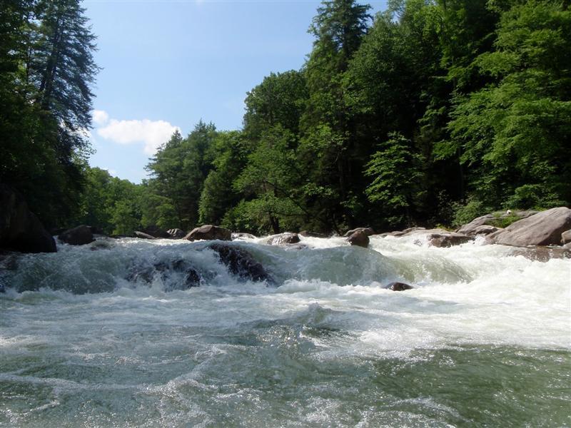
This rapid is typical of drops in the bottom half of the Middle Fork.
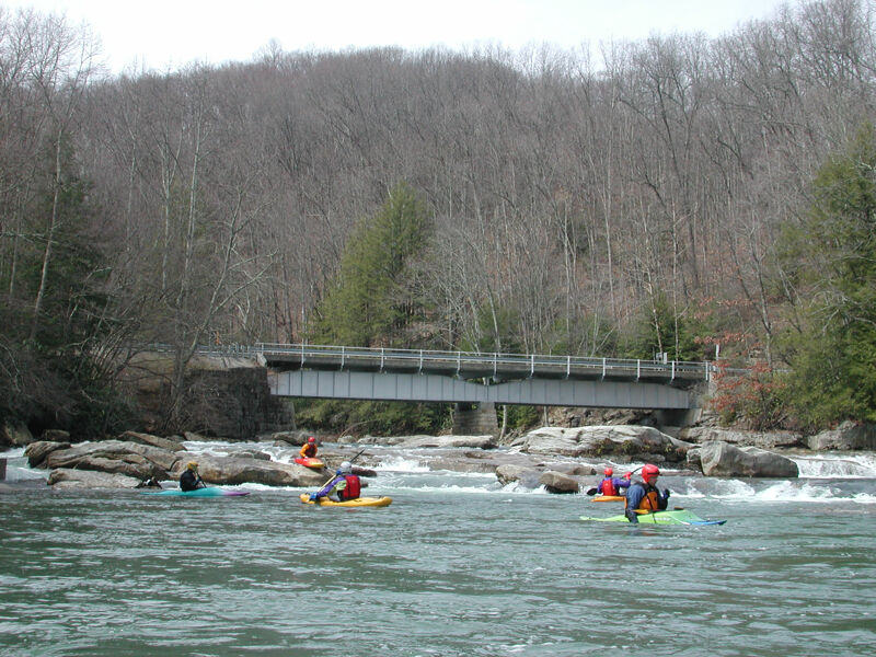
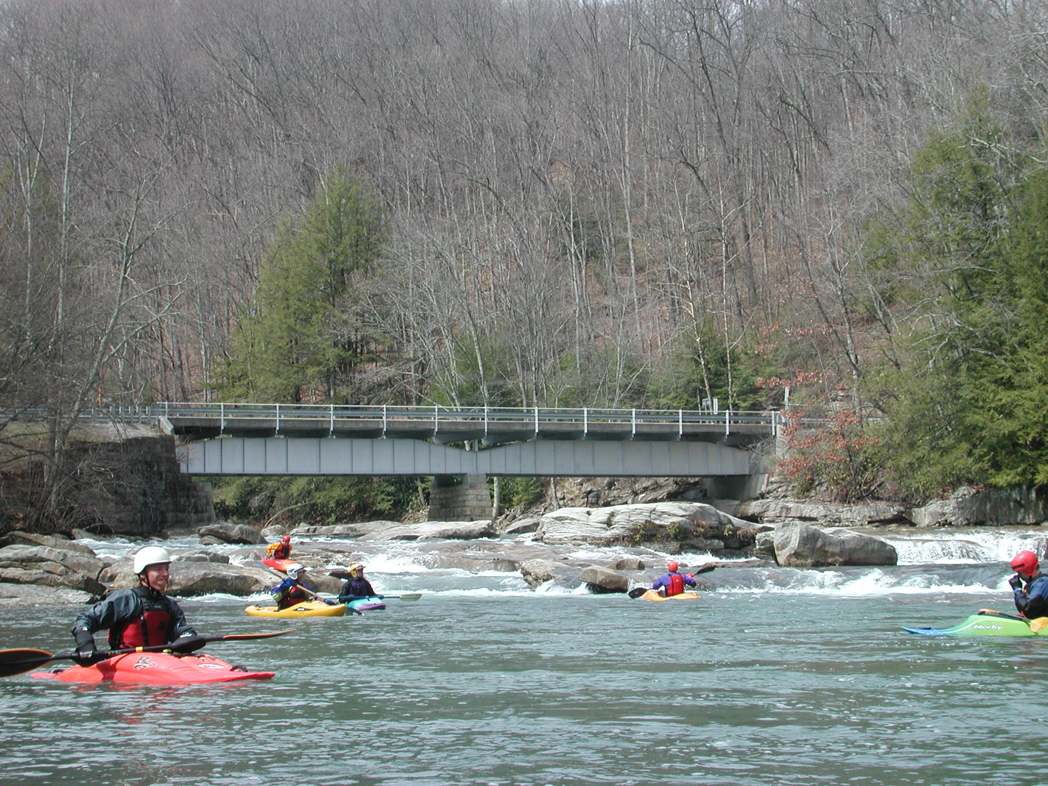
Mark and Brian stairstep down through rapids typical of those found on the lower section of the Middle Fork just before it joins the Tygart.