Merced
5) Redbud to Briceburg
| Difficulty | IV |
| Length | 14.3 mi |
| Avg Gradient | 40 fpm |
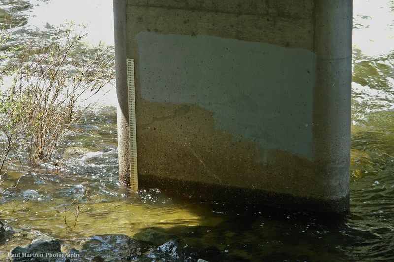
| Gauge | Merced R a Pohono Bridge Nr Yosemite Ca |
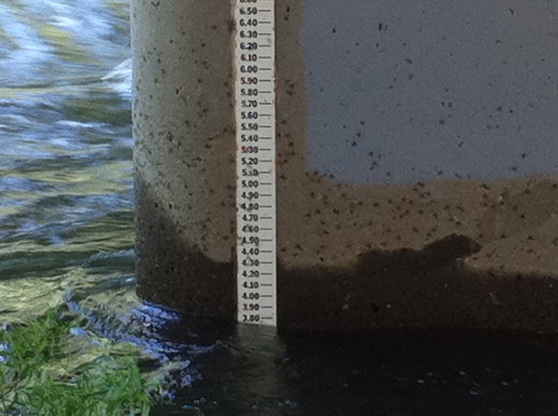
| Flow Rate as of 1 hour | 164 cfsbelow recommended |
| Reach Info Last Updated | June 13, 2025 |
GENERAL INFORMATION
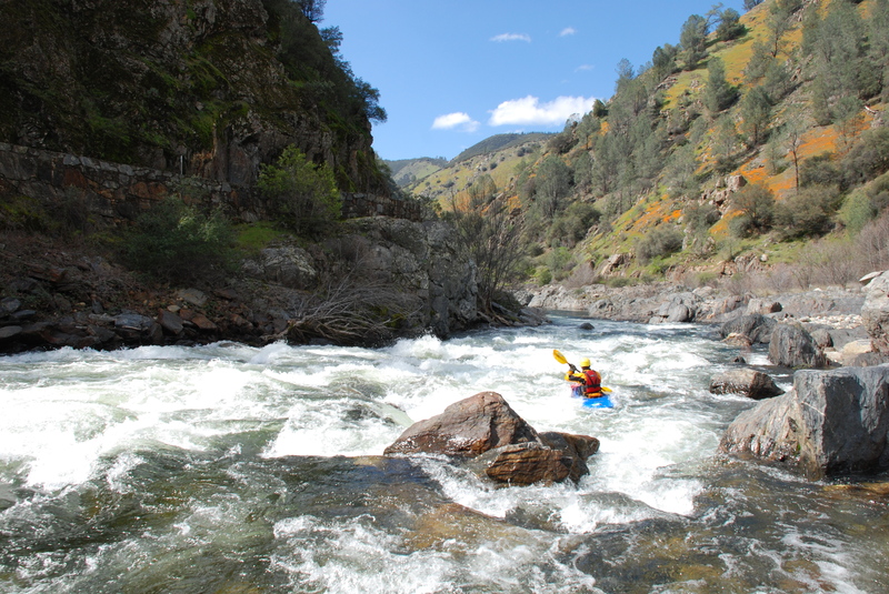
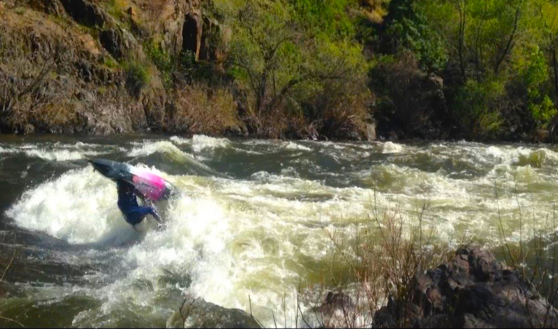
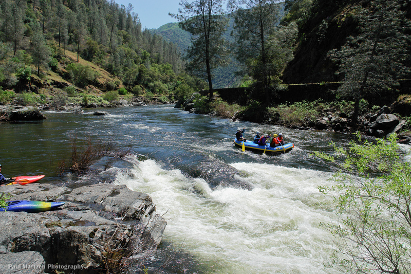
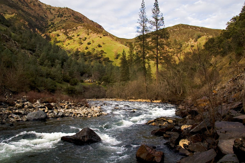
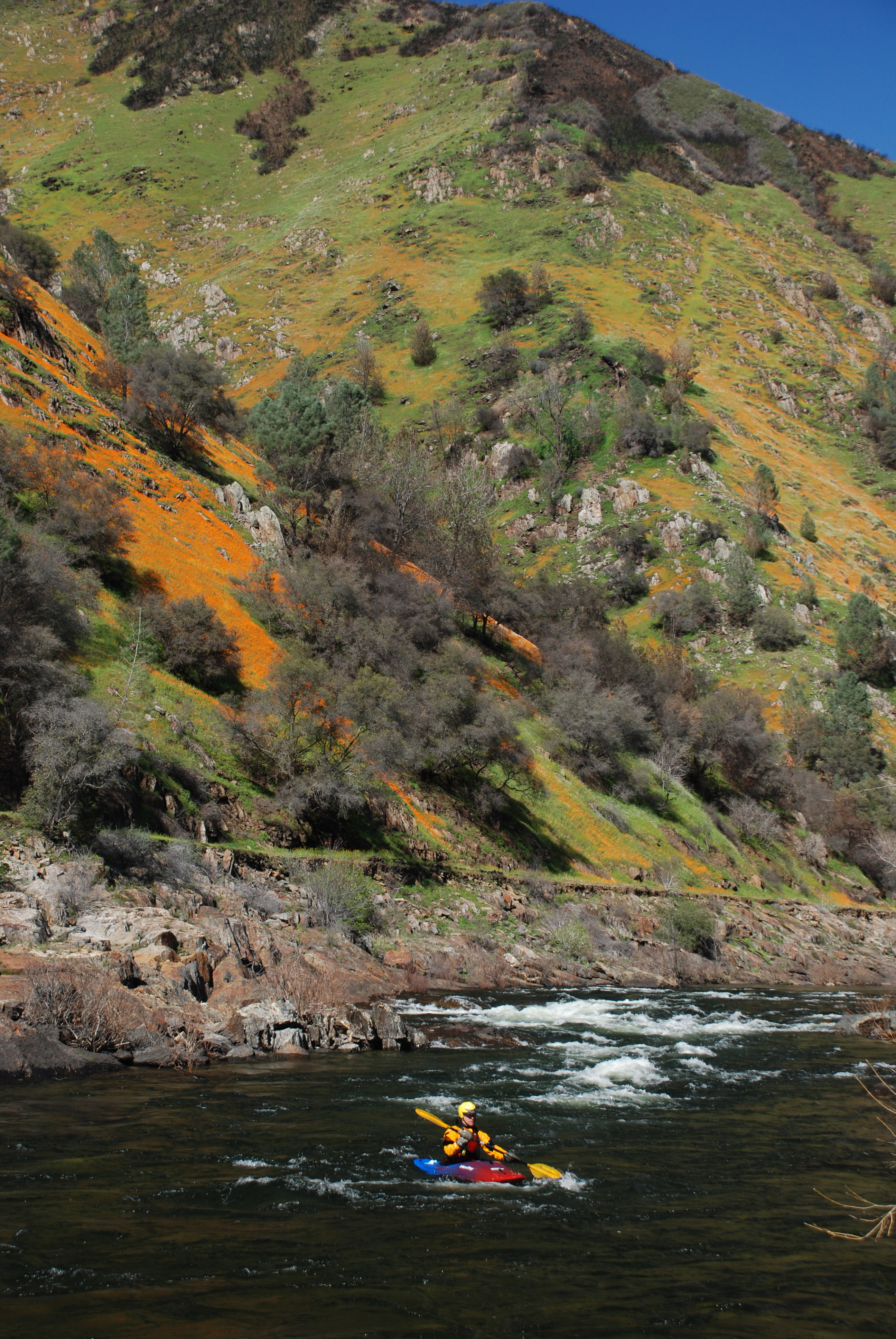
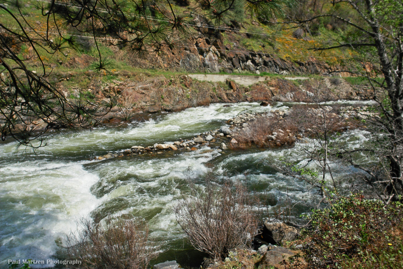
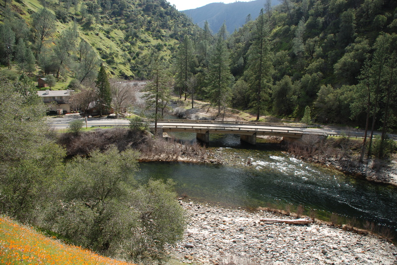
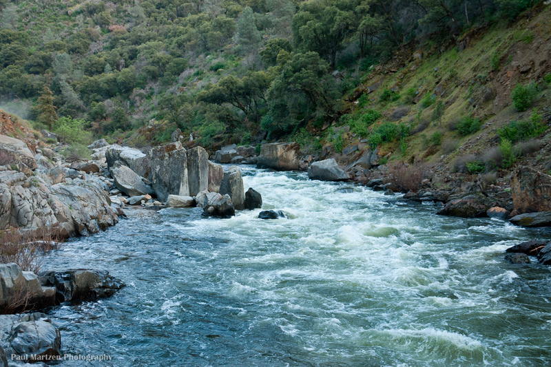
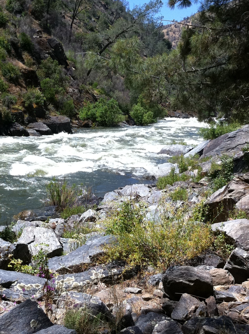
Because State Hwy 140 goes essentially continuously along the bank of the Merced, one can take-out and put-in almost anywhere that the berry bushes and poison oak allow. This means that, flow levels allowing, one can choose as easy or hard, and long or short, a day as one wants, from scary expert stuff higher up to a great novice run in the miles above Briceburg and below. The Gauge Hole just upstream from the Slate Creek Bridge (approx. 3.5 miles above Briceburg, 10+ miles below Red Bud, actually Feliciano Creek on the topo maps) is a great park-and-play spot at any flow above about 600 cfs or so on the Briceburg gauge.
The Main/Central Fork of the Merced River is one of the originally designated federal Wild and Scenic Rivers. Curiously enough in light of this, the majority of the river segment in this reach has essentially 100% man-made banks on both sides. The river-left bank is defined by Hwy 140; river-right is the remains of the old Yosemite Railroad bed. This 'man-made bank' is primarily manifested by a great amount of artificial (boulder and cement slurry)stabilization on the highway bank by CalTrans, and some 'rerouting' of the river's course, most notably in the section above the Foresta Bridge (Red Bud). Surprisingly and thankfully, the road is not particularly visible from the river level, and is not as intrusive as it could be. There is still a plentiful supply of drive-by spectators. The railroad bed is eroding away and not a big visual issue at all any more.
The Merced is steepest and most difficult on its upstream end, leading up into Yosemite National Park where paddling is banned/illegal except for a short flat segment in the midde of Yosemite Valley, per the Park Superintendent's decree; ask and I'll answer questions honestly and as best I can based on more experience than I should have, but this is outside the boundries of this reach. As one goes downstream from Parkline and El Portal, th
...
This is a common put in for people who wish to boat the many class 4 rapids between here and Redbud. Put in at the small parking spots on the down-canyon end of the bridge, better on the upstream (east/upcanyon lane) side of the bridge. There is room for 3 cars if all think/plan accordingly when parking on this side.
At high flows the section from here to Redbud is continuous Class 5.
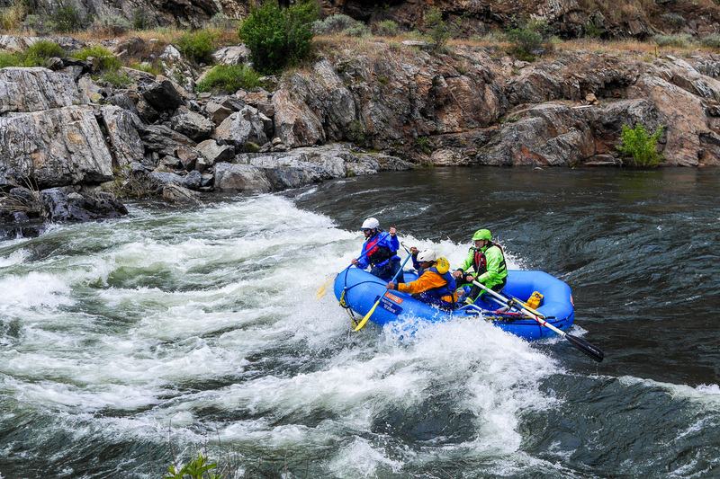
This is a heavily used launching area during the whitewater season. A launching area across the bridge on the north side of the river tends to get used the most. There is parking on either side of the river and it is possible to launch on the south side as well.
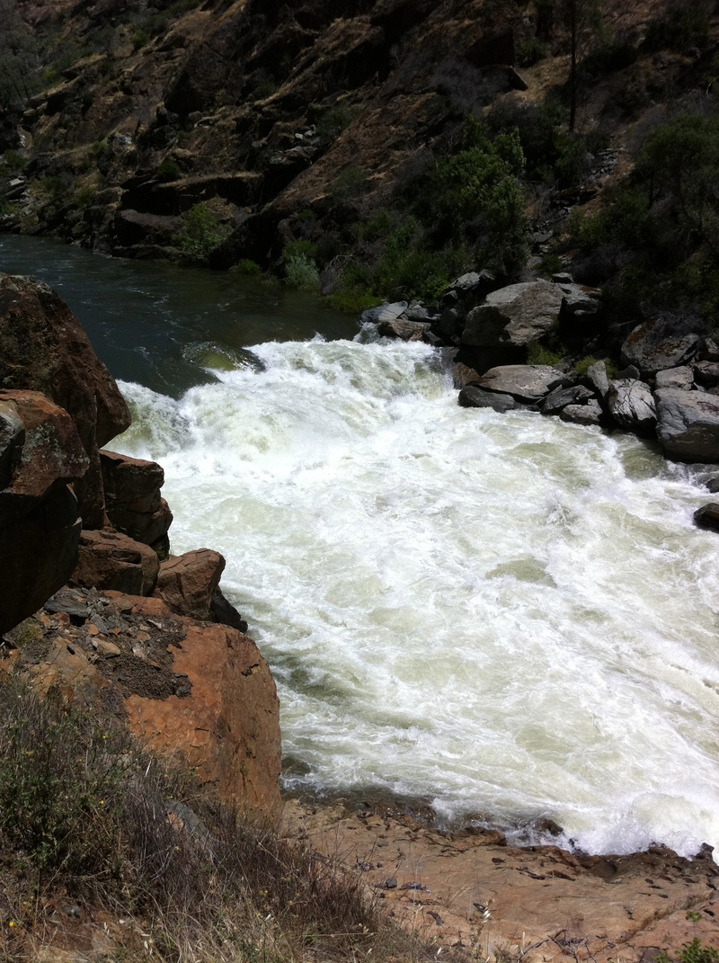
The river splits around the island, with the left channel as a sneak route, and the right channel with two Class IV drops. The two drops are formed by jagged rocks that can have some pin/carnage potenial at lower flows. At higher flows both channels have large holes that are difficult to avoid.
Chipped Tooth comes very quickly after Nightmare Island, with only a short distance of fast water between them. The river starts off wide then drops through a steep boulder field towards a narrow exit. The middle is congested but right and left sides are more open.
The right side of Chipped Tooth seems moderately easier than the left [highly subjective, I admit]; at low-moderate flows, it can be eddy-hopped down small right bank eddys up to the steep boulder pour-throughs; at moderate-higher flows, this route still works to paddle through if you can't or don't hit the narrow bank eddys. The left side goes as well at most flows, but the sudden large left-right 'reversals' - waves, not holes - towards the bottom can be hard to manage.
BEWARE - the largest drop and the 'Chipped Tooth' is formed by a group of large boulders going across the river bed, with very real sieve/trap potential if one were out of the boat or in a bad position at most flows.
In 1999(?) a local paddler and friend in a relatively small boat missed the boof over the middle; he penciled, and found himself pinned flat, still in his boat, at the bottom of the river. He escaped barely, and spent the next day and a half retrieving his boat via high line and hook-and-pole.
An alternate access point that can be used particularly when flows are low.
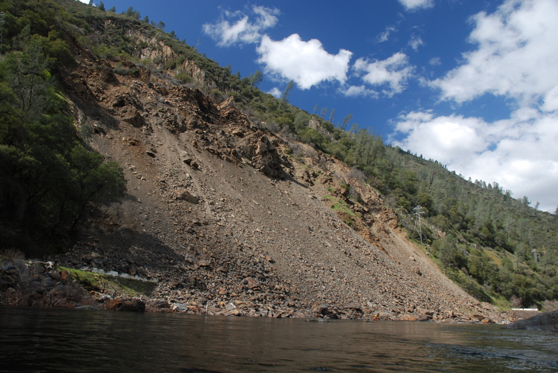
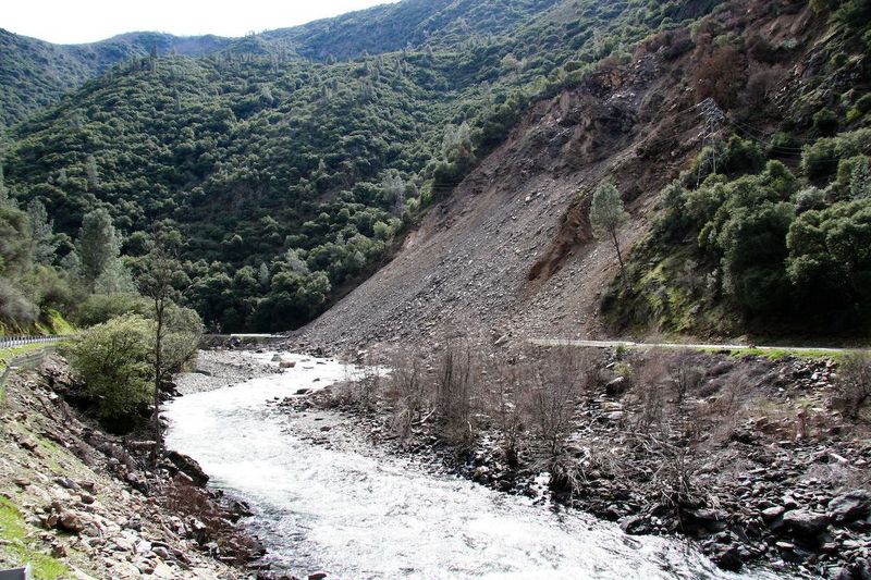
The Ferguson Rock Slide came down in spring 2006 blocking the highway.
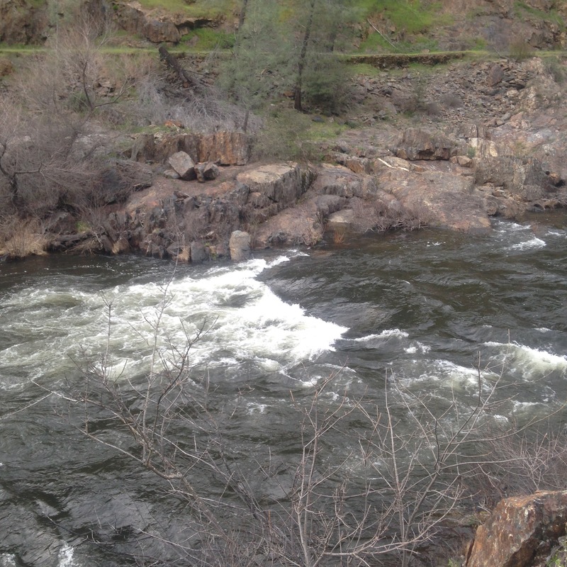
Briceburg is where highway 140 comes down to the river from Mariposa. There is a river access area with a toilet. An old stone building is now a museum run by the BLM. A gravel road follows the river downstream for several miles to a number of campgrounds along the river.
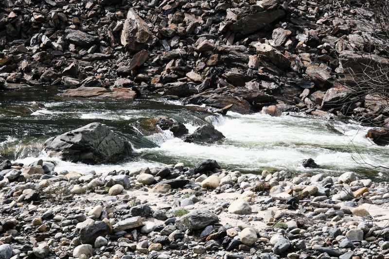
Split Rock can sneak up on the unwary. At low/moderate flows, this shouldn't be a problem as the route is pretty much straight down the middle in the tongue. At moderate/higher flows, some scary holes can form, and this rapid becomes essentially one with the next rapid, a somewhat harder (at most flows) rapid called 'Corner Pocket' for very good reason.
Corner Pocket can be scouted and portaged at the campground on river right, McCabe Flat. It is a rocky angular pore-over several feet tall, at the bottom of a rocky lead-in. If one enters or gets pushed too far to the left, you end up in the Corner Pocket at the bottom, river left. The first time I saw this feature, I watched six kayaks follow into this like lemmings. All six ended up swimming out, with the boats tumbling in the pocket for later retrieval. The current below the pore-over splits, and the left flow goes up against a flat wall that forms a very strong recirculating eddy. Bank access on this side is not as easy as it could be, and like everything else along this reach, infested with poison oak.
It is common to take out at the campground immediately below Corner Pocket.
Quarter Mile Rapid has a tighter channel with continuous pool and drop features that can be boat scouted along the way, eddy hopped and dropped with continuous amusement at low to moderate flows. At higher flows, the drops blend together and there is the great danger of being swept into North Fork Falls.
Immediately - 50 ft? - at the end of Quarter Mile is an impassible Class 6 called North Fork Falls, where the North Fork of the Merced joins the Main Merced. At the base of the falls, there are several very large flat and blocky boulders. Much of the river flows UNDERNEATH these BOULDERS! If there is even the slightest chance of missing this mandatory portage, don't boat the rapids above it!
At North Fork Falls, there is a pipe skid rig up the right side for rafter use.
House Bill HR 869, submitted in 2011 will amend the Wild and Scenic Rivers Act to allow filling McClure Reservoir to an elevation of 877 feet. This will extend the reservoir into the Wild section and past the FERC project boundary.
The FERC boundary for McClure reservoir is a short ways past NF Falls and upstream of the reservoir full pool elevation. River elevation at this line is approximately 876 feet.
The maximum elevation of the reservoir is 867 feet. If the reservoir is full, flat water will back up to this point on the river. The river is declared Wild down to this point in the Wild and Scenic Rivers Act amendment: Public Law No: 102-432 enacted on 9/29/1992
Apr 15, 2017
Red Bud to McCabe Flat Spring 2017
Feb 1, 2017
The January floods have changed my favorite local playspot. Felix (guage hole) has dramatically shifted and lost its lower water form. At 2250cfs. It's now a super sticky hole that's shallow in all but the middle with a boil line that's 8 feet back though its pretty level and on thr gentle side with exits on both shoulders. Used to be one of the best natural playspots in cali from 1350 to 2500cfs with all hole maneuvers possible and wavy shoulders.. So beginners beware, this is no longer a good spot for learning to surf. I imagine the playspot will come into better form around 3500 or higher. Maybe even making the higher, waiver flows better than ever as the feature shape is way more retentive and uniform. But it's a sad loss as it may take another flood to move the rocks to give us a low flow playspot again. No more early fall aerial play sessions without bigger storms and it will definatly take significant snowpack to keep the level high into the late spring.