Granite Creek
Wooden Bridge to mouth

| Difficulty | III |
| Length | 7.8 mi |
| Avg Gradient | 60 fpm |
| Reach Info Last Updated | March 11, 2022 |
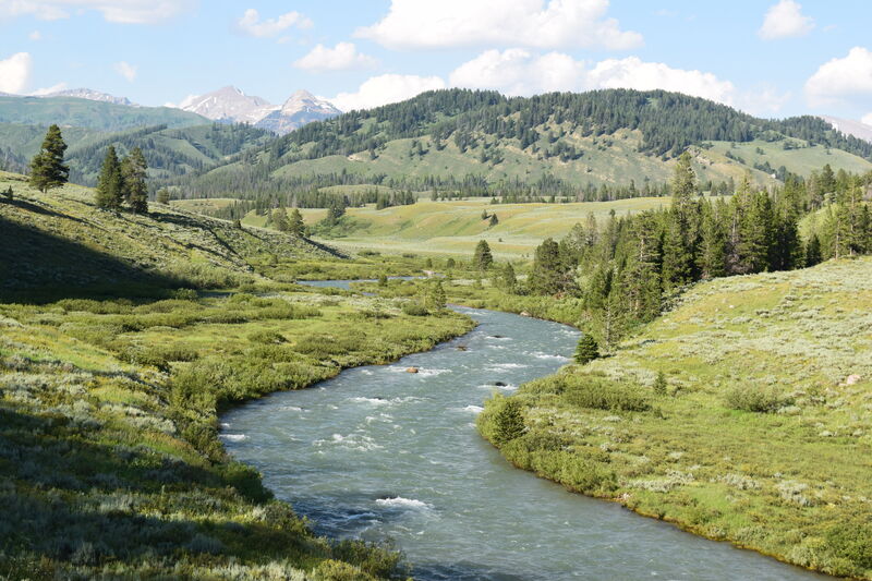
Granite Creek drains south off Pyramid Peak and the east flank of Pinnacle Peak and holds the typical Wyoming threats of private land ownership and gun display.
Timber and landslides are part of the geography in Wyoming, so, expect wood on the upper run.
This snowpack dependant creek is shallow and typically low-volume with a visual gauge.
There are two sections to Granite Creek:
The upper section requiring a hike in from above the hot springs and the lower section being lower gradient.
Granite Creek Road (FR 30500) follows Granite Creek and there is a river right take out before making confluence with the Hoback River.
Jun 23, 2021
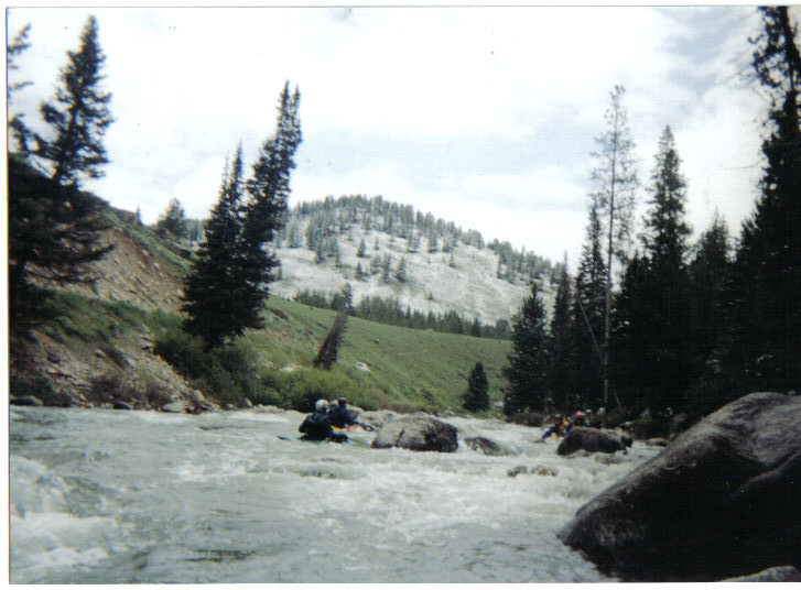
Fun fast class III from Granite Falls to the Hoback, about 10 miles, with the biggest rapid near the end and quite straightforward. Hiked an additional 3.3 mi upstream from the Hot Springs (end of the road) with packrafts to put in. There was a fair bit of wood with 4 or 5 portages, one fairly burly. Solid Class IV with some consequences. Potentially nice upstream, but lots of wood hazard. Much easier to take the first (unmarked) left trail fork at a little under 2 miles to add some excitement with only 1 or 2 easy portages.
Jun 6, 2003
This is a fun intermediate run. The scenery is spectacular and the water moves along pretty quick. The water is usually best from late May to mid June, but I've run it as late as mid July and still had enough water. The section above the falls is impressive and the hotsprings make for a nice way to warm up.
Jan 1, 1900
A mellow section of Granite Creek with spectacular views.
Jan 1, 1900
ohio boaters on granite creek