Cuyahoga
F. OH 303 to Boston Mills Road(Peninsula)
| Difficulty | I-II |
| Length | 2.4 mi |
| Avg Gradient | 15 fpm |
| Gauge | Cuyahoga River at Jaite Oh |
| Flow Rate as of 37 minutes | 448 cfsrunnable |
| Reach Info Last Updated | August 22, 2017 |
Introduction:
In addition to the run down the river there are other recreational options to consider as well. This section runs through the Cuyahoga Valley National Park which mentions five current and past methods of transportation. The river is bordered by remnants of the Ohio & Erie canal (1820’s to 1913) and its Towpath trail which was once used by mules to pull canal boats. Now it is a recreational route for bikers and hikers. Bicycle rentals are available in Peninsula near both the towpath and put-in. A more challenging hike between Peninsula and Boston is a segment of the Buckeye Trail which is a 1,444 mile trail wandering around the state. The park and river can also be viewed by riding the Cuyahoga Valley Scenic Railroad. There is a boarding station in Peninsula and at the take-out in Boston. Appalachian Outfitters is a local outfitting store located within 5 miles of the Put-in site for the consideration of new gear or meeting last minute needs.
The run:
A good place for novices and for non-whitewater open canoes. Be sure your Ohio registration is current, because the rangers are always looking for it!
The put-in site is below the remains of the low head dam in Peninsula. There is a parking lot for towpath trail users just to the north of the put-in site.
View From Put-in, Lock 29 Trail head Parking Lot
The section is roughly split into thirds in terms of length defined by bridges crossing the river. The first 1/3 to the railroad bridge. The second third to I-80 bridge (part of the Ohio turnpike which is then closely followed by the I-271 bridge), and finishing at Boston mills Rd. bridge.
The general char
...
An alternate takeout is available at the bridge on Vaughn Road.
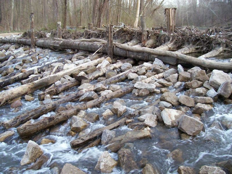
Take out before the dam (a serious drowning machine!) at Rte. 82.
Jul 21, 2011
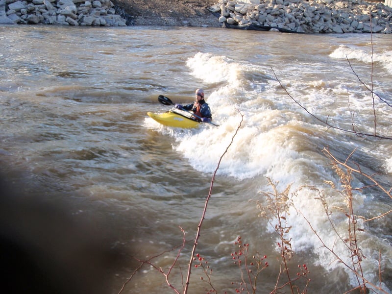
Most paddlers that do this stretch know the 271 surfing waves, but there is another, steeper, taller and more aggressive wave about .75 miles upstream from the 271 bridge at flows around 1000-1500 cfs. It's tough to get into, but once you're in, it's decent surfing. I think it's worth the short trip from 303 to boston mills instead of doing a park and surf.
Dec 28, 2008
Shawn enjoying the upper wave below Rt 271 in Boston Mills
Jan 1, 1900
Put-in site located south of the Lock 29 Trail head parking. The Bridge across the river is the Towpath trail, and next to it are the remains of the Ohio & Erie canal aqueduct abuttments. Lock 29 is also right there.
Railroad bridge marking roughly the end of the first third of this section.
I-80 bridge roughly marking the end of the second third of this section.
It has been speculated by some that Jimmy Hoffa is buried below the pileing immediately east of where Big Foot was last sighted.
Seeing the Goodyear blimp, is a more likely sighting than seeing Big Foot or finding Jimmy Hoffa.
Its not uncommon to see beaver along the towpath trail.