Imnaha
Imnaha to Snake River
May 30, 2013
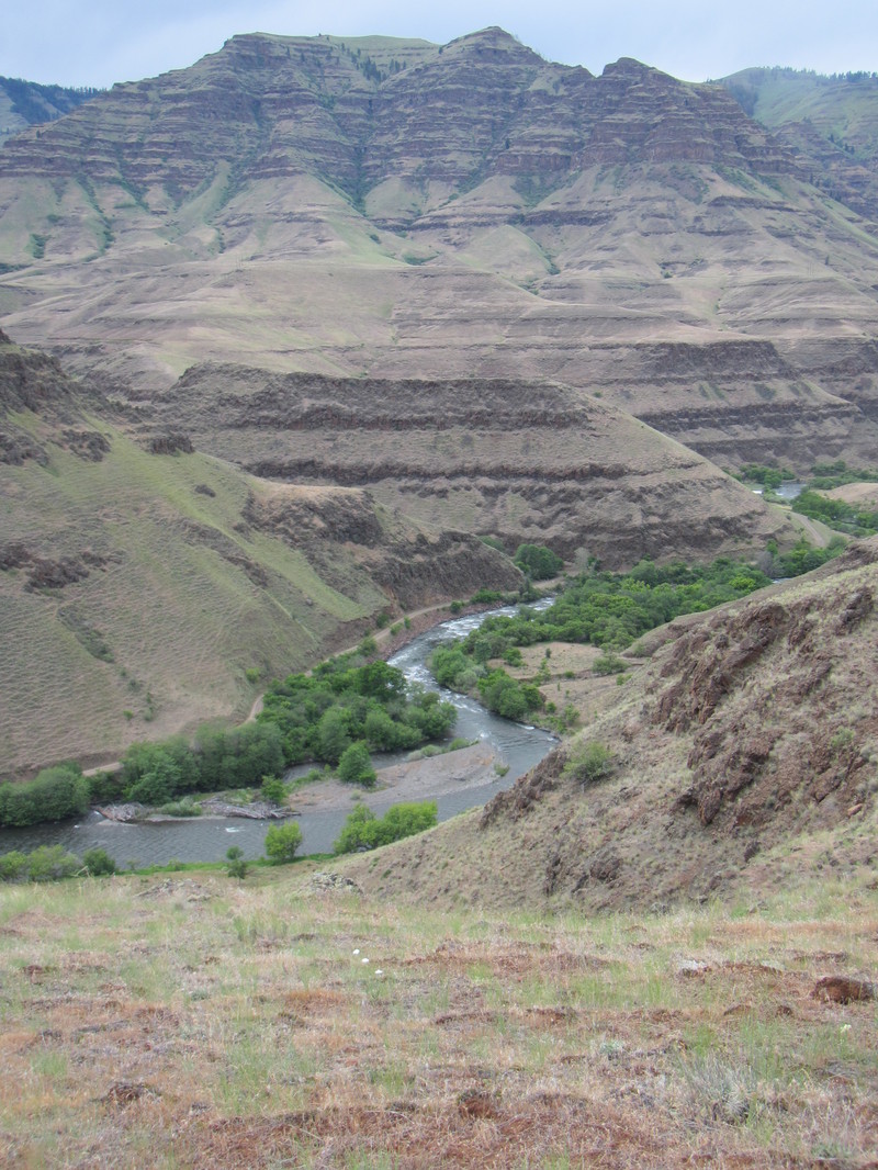
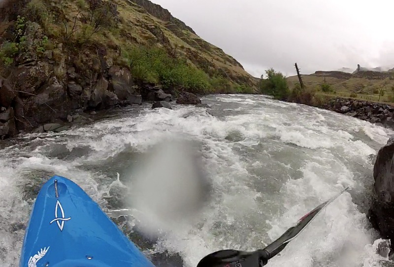
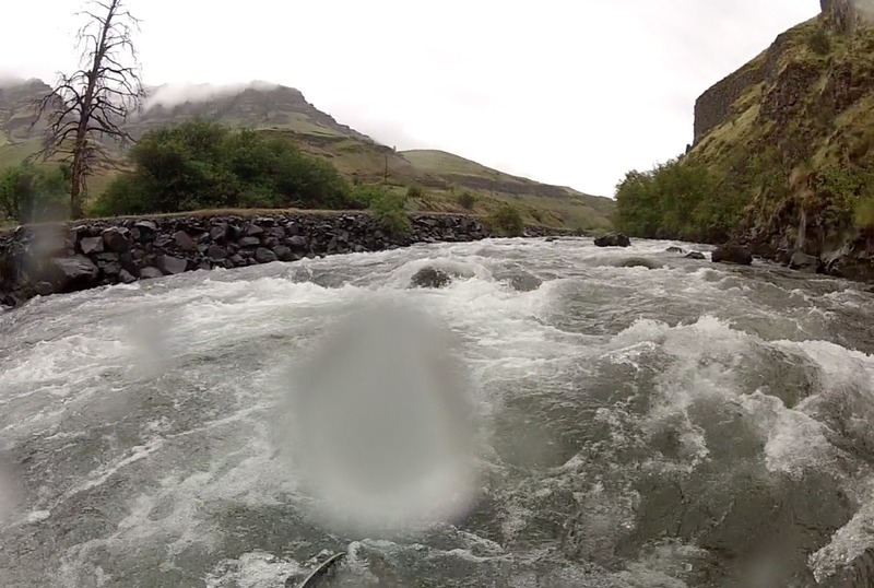
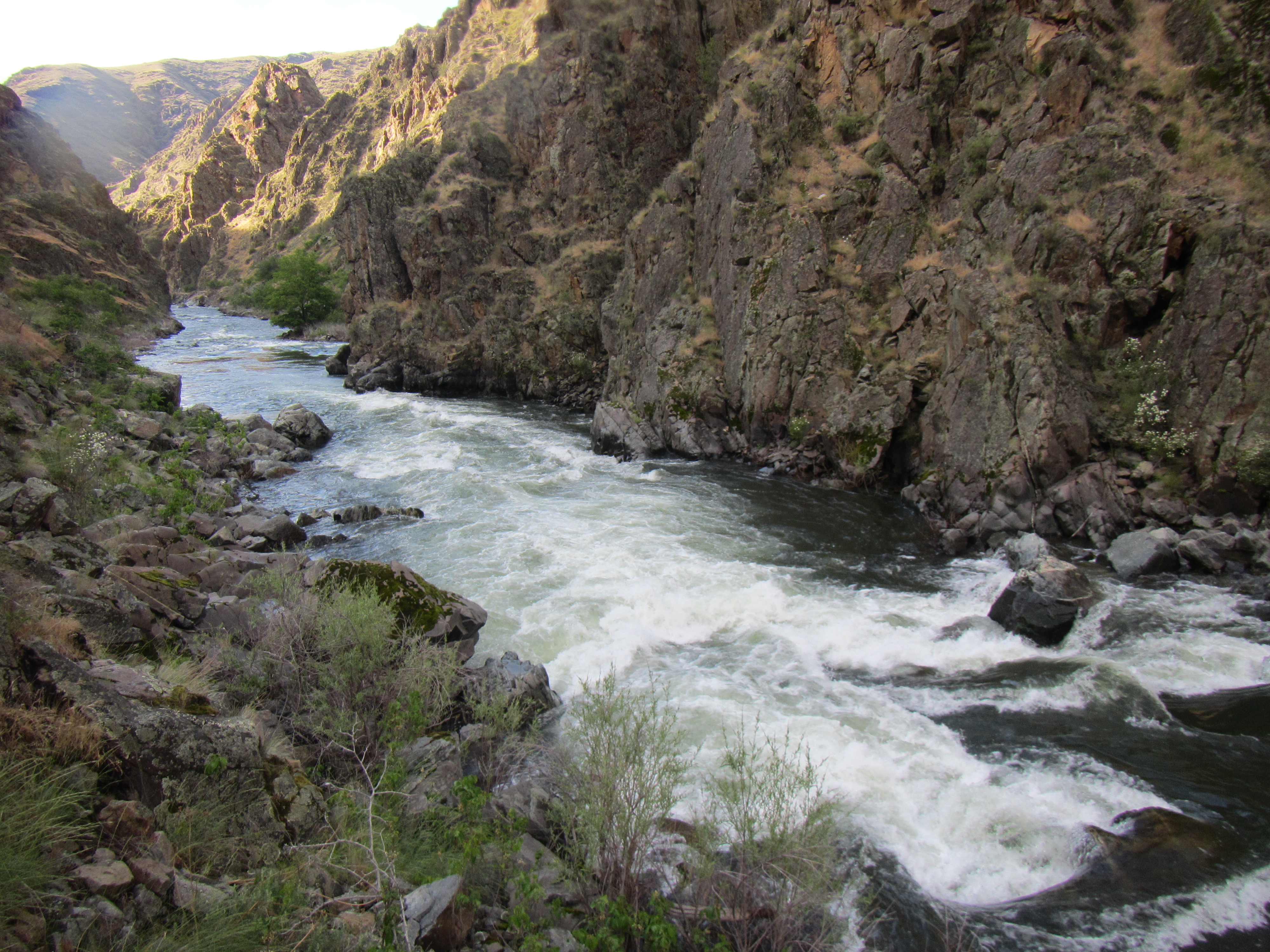
We ran from 1/2 mile above the town of Imnaha (river right) to Heller Bar on the Snake in three easy days. At launch the Imnaha flow was 950 and falling, which was medium-low for kayaks; rafters would want more. Ranches line the banks until Cow Creek where there is a toilet and currently also a fish trap. After Cow Crk the terrain is more rugged and isolated. There is a good trail along the river left bank from Cow Creek to the confluence, and that section of whitewater is the best part of the run with lots of great eddies and some surf spots. It was fairly continuous class III at this flow, requiring class IV skills to stay out of trouble. There was no problematic wood. Camping at the Imnaha-Snake confluence allows for a hike back up the trail. The 20+ miles on the Snake was mostly flatwater with jetboat exhaust and vacation homes on the banks. You do get to see the confluence of the Salmon and Snake not far below the Imnaha confluence, and the Grand Ronde joins the Snake immediately above Heller Bar.
Mileages and gradients:
Our put-in to the lower Imnaha bridge: 6.5 miles, average gradient 35'/mile.
Lower Imnaha bridge to Cow Creek bridge: 13.6 miles, avg gradient 43'/mile.
Cow Creek bridge to the confluence: 4.2 miles, average gradient 53'/mile.
May 30, 2013
ANOTHER RUN. There are more whitewater runs in the upper reaches of the river. We ran from Indian Crossing to a campspot just below all the campgrounds, 11.4 miles with an average gradient of 53'/mile. The first 6-7 miles were meandering and full of beaver-wood, scenic but lacking in actual whitewater. The gradient is mostly in the last 3 miles before the bridge between the campgrounds----it is very continuous class II+ thus earning a III rating, with wood hazards to keep you honest.
May 29, 2013
about 11 miles downstream of Imnaha
May 28, 2013
884 cfs
May 28, 2013
884 cfs
Jun 15, 2009
I just ran the sections from the town of Imnaha to the confluence of the Snake at 1380cfs. The 7 miles below the town of Imnaha is pretty flat (mainly class I and II with an ocasional class III move). This part of the river flows through degraded farm and ranch land. The scenery picks up at fence creek. This is where the road turns to dirt and where I would reccomend putting it. Below here the scenery is stunning! The whitewater is mainly class II and III. After cow creek the river pick up a bit. Class II and III with a few class IV moves thrown in. No big rapids, mainly one move type scenarios. Lots of fun eddy catching moves in this strecth. Not too hard, but really fun. The hike back up to cow creek is not bad. Mostly flat with a few small uphill sections. Bring long pants for the hike due to poison ivy. If your in the area, this run is well worth it for the stunning scenery alone. The fun somewhat technical whitewater is a bonus.
Apr 24, 2006
Great trip for kayak or cataraft. Recommend 1500+ for catarafts. Beautiful canyons, lots of cowpies. Mostly Class 2-3, last 5 miles is Class 3-4. We launched at bridge on paved portion of the road.