Saline (Howard County)
2) Dierks Lake to Hwy 70 (5.6 miles or 0.75 mile loop)(Lower)
| Difficulty | I-II |
| Length | 5.7 mi |
| Avg Gradient | 15 fpm |
| Gauge | Saline River Near Dierks, Ar |
| Flow Rate as of 13 hours | 4.40 ftbelow recommended |
| Reach Info Last Updated | April 29, 2015 |
Note: This stream had debris from a major ice storm in 2000. Watch for trees, especially below the low-water bridge.
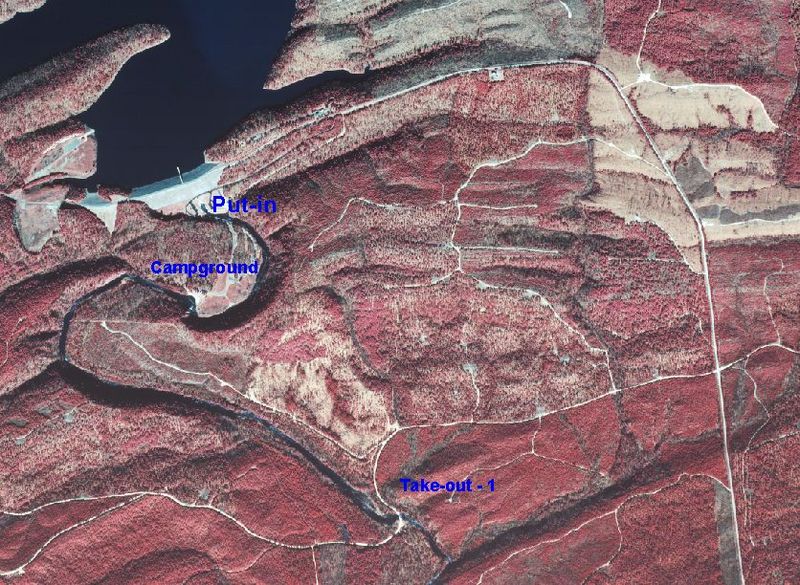
Put-in: Below Dierks Lake at USCOE Campground. Follow the signs to Dierks Lake Dam from Hwy 70 just West of the town of Dierks. There is a $3.00 day use fee at Horseshoe Bend Rec Area.
Take-out: Three options:
There is a nice trail along the river in this section which allows for easy scouting, portages or multiple runs.
NOTE: This access is not always open due to timber company gate at the main road entrance. Usually only available during special releases. Paddle down to the low water bridge at mile 2.6. Access from road #30,000 about half-way between the Dam and Hwy 70. This stretch offers some smaller class I-II rapids. A nice eddyline below the campground next at the first bluff on the right. Portage the low-water bridge if continuing downstream. The low water bridge is a danger. Beware and take-out well away from the culverts. People have been sucked through the culverts. (not pretty)
Hwy 70 bridge West of Dierks. This section includes mainly class I rapids.
Whitewater features have been enhanced at the campground loop area.
There are some nice eddys and eddylines in the area near the campsites. This is where the willow jungle was previously. A small surf wave is present at flows from 250 to 450 cfs.
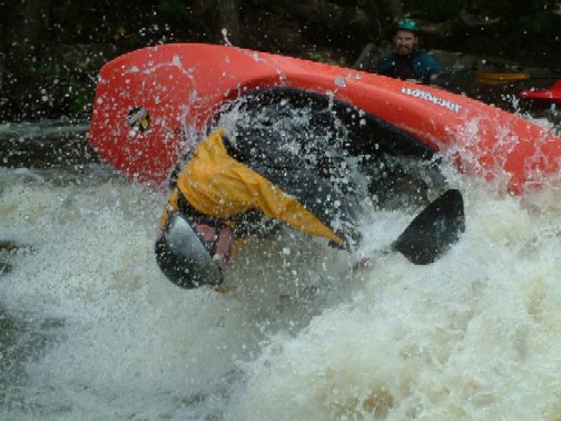
The main area consists of 3 features:
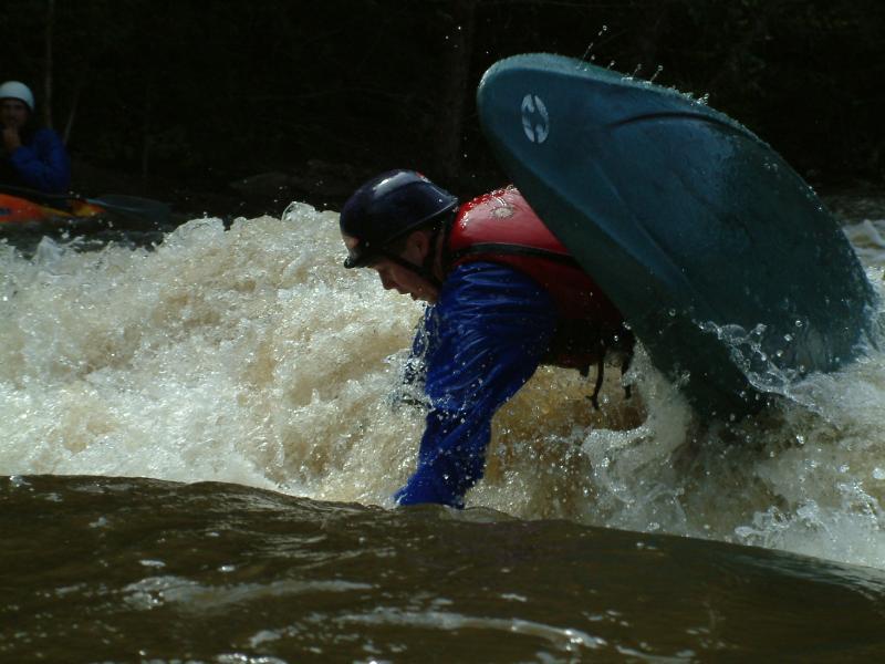
#1 Is a fairly retentive wave/hole. Bypass the meat on river right. This drop is called 'Butter'. It is smooth and easy and offers nice eddies on both sides. Good at flows from 300 cfs and up. Starts to flush a little more above 500 cfs.
#2 Is a fast frothy
...Oct 2, 2004
One of the primary boaters working with the USCOE to enhance the whitewater play at this site.
Jan 1, 1900
The 0.7 mile loop below the dam. The Arkansas Canoe Club and USCOE are coordinating efforts to enhance the whitewater features in this section and provide more scheduled releases.
2.5 mile section (Class II) from Dam to low-water bridge. Beware of the culverts at the bridge and take-out well upstream on river right.
Can continue another 3 miles of Class I-II to Hwy 70.