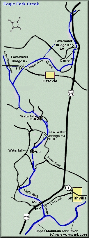
Eagle Fork Creek
Low Water Bridge to D4710 near Smithville (12.5 miles)(Big Eagle Creek)
| Difficulty | II-III |
| Length | 12.3 mi |
| Avg Gradient | 22 fpm |
| Reach Info Last Updated | December 12, 2009 |
Original stream description and map courtesy of Southwest Paddler. Used by permission. Reach description updated by David McDonald.
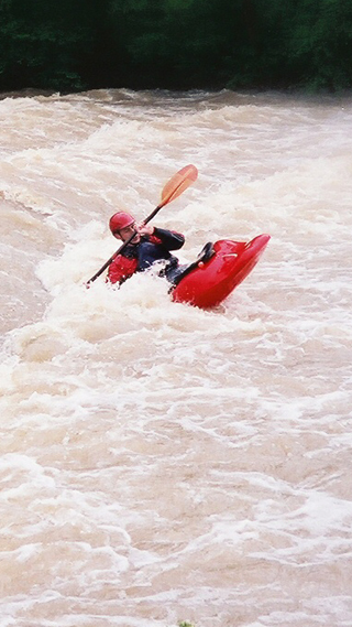
Braided channels, many with rocky shoals, some very narrow with blind turns and overhanging trees. Other river sections are characterized by wide pools ending with ledge drops and waterfalls. Unless you are quite familiar with this stream at many different levels, you never quite know what to expect around the next bend. Even then, you may be in for a surprise. This is a first-class stream reminiscent of Colorado or other places out west. Many have said 'It's hard to believe this is Oklahoma'.
This stream is alternately known as Big Eagle Creek. Fed by run-off from the Kiamichi Mountains, Eagle Fork Creek is only runnable after recent local rainfall. At normal flows, the stream is a beautiful emerald green; while high water levels typical of recent heavy rains will tint it brown a bit, but it rarely stays that way for long.
At normal water levels the creek is runnable by almost anybody with basic experience, but higher flows require at least some good intermediate whitewater skills. Although there are some populated areas nearby, there is virtually no development along the banks. Once on the creek, paddlers are pretty much 'on their own', so some swiftwater rescue experience / training wouldn't hurt. Because of the remote nature of the stream, it's not a good idea for newbies to try this one unless accompanied by a group with strong paddling skills, especially at higher levels.
There are two low-head dams that must be portaged to avoid a 'death sentence'. Both come shortly after the put-in at the low water bridge # 1 off Highway 259 above Octavia. The creek is a beautiful stream fed by many waterfalls along the banks, rocky terrain with high bluffs all around, and rolling hills typical of southeastern Oklahoma.
Access is very good and shuttles ar
...Jan 2, 2007
Paddle 12/30/06...it had peaked the day before, but still flood stage. both low water bridges were underwater. There were several wave trains, and catch on the fly play spots. River wide 3+ foot glassy wave and a fairly sticky pour over...I'll be back!
Apr 15, 2006
Ledges / Waterfalls located about one mile into section 3.
Jan 1, 1900
This is the correct map for Eagle Fork Creek. DM - 5-2006