Washita
Dougherty to nr Gene Autry (9 miles or less)
| Difficulty | II-III |
| Length | 10.2 mi |
| Avg Gradient | n/a |
| Gauge | Washita River Near Dickson, Ok |
| Flow Rate as of 1 hour | 234 cfsbelow recommended |
| Reach Info Last Updated | January 21, 2009 |
River flows from the TX panhandle thru Oklahoma for hundreds of miles, gathering a watershed of 7000 sq mi before cutting thru a granite ridge creating 1.5 mi of whitewater.
The Washita River forms in Hemphill County in the Texas Panhandle, just south of the Canadian River, then flows several hundred miles to Lake Murray and the Red River. The section that is suitable for recreational paddling is a stretch of about 22 miles located in southcentral Oklahoma, near Turner Falls and Price Falls, adjacent to the Chickasaw National Recreation Area.Oklahoma has its own version of the Grand Canyon, where (southeast of Davis) the Washita cuts through the granite in the Arbuckle Mountains, carving out a river valley with 350 foot walls running for about 15 miles. The trip is scenic and colorful, with significant rock formations near the Arbuckle Mountains. The area is steeped in ancient Native American cultures and many members of old tribes still live in the area (as well as all over Oklahoma).
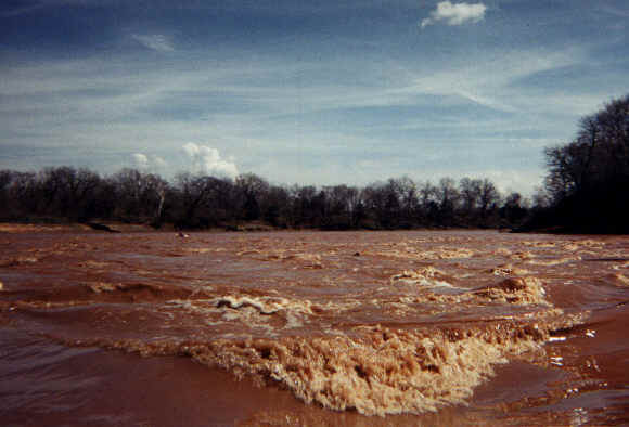
The Washita is a tame river for all but 1.2 miles of its 21.9 total miles. The section called 'Big Canyon', starts 11.3 miles below Highway 77 below Davis, Oklahoma, can have standing waves of several feet that can swamp an open boat or capsize any boat if not run properly or portaged around. The standing waves may reach 6 feet or more in high water conditions. Aside from this, the rest of the river is enjoyable by familes or paddlers with little to no previous paddling experience.
Hazards to navigation: Heavy local rainfall will reach dangerous proportions as the waters reach Big Canyon. Big Canyon is a series of rapids in the Class I-II+ range packed into 1.2 miles inside a deep canyon with six-foot standing waves that can swamp or capsize a boat quickly, sending you swimming in a fast current over a rocky roller coaster (and you forgot to wear your steel cup!) The E-ticket ride ends at 12.5 miles downriver, after which there are no hazards other than downed tre
...May 11, 2009
LEGALLY, to make the Big Canyon trip shorter, you can...
Put in at the Dougherty Bridge. And take out at Hollenbeck Rd or 1851Rd. See a map. I myself have a shorter route, but will not publish that.
Aug 24, 2007
Here in Big Canyon the trains run frequent and occasionally the waves run huge.
Jul 21, 2007
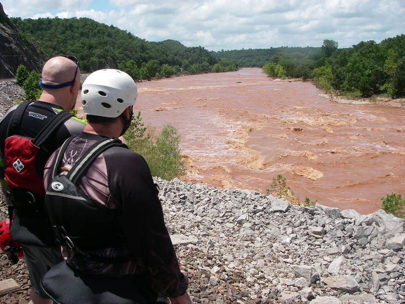
First look at big canyon from the train tracks
Apr 12, 2006
River description from Southwest Paddler (http://southwestpaddler.com/)