Rock Creek
Rock Creek Park [a subsection of 2. Beach Dr. below East-West Hwy. to the Potomac](Beach Dr. above Military Road to Pierce Mill Dam)
Sep 8, 2008
Ran it today at 2.75 on the Military Rd gauge. It was fun and not too scrapy, but I would not go too much lower (this is my first time, but 2.5 sounds like a good lower bound given our experiences).
Correlation point: When we returned from our takeout shuttle the bridge gauge was down to about 2.65. Checking online, the online gauge at Sherrill Rd read 3.29 at that time.
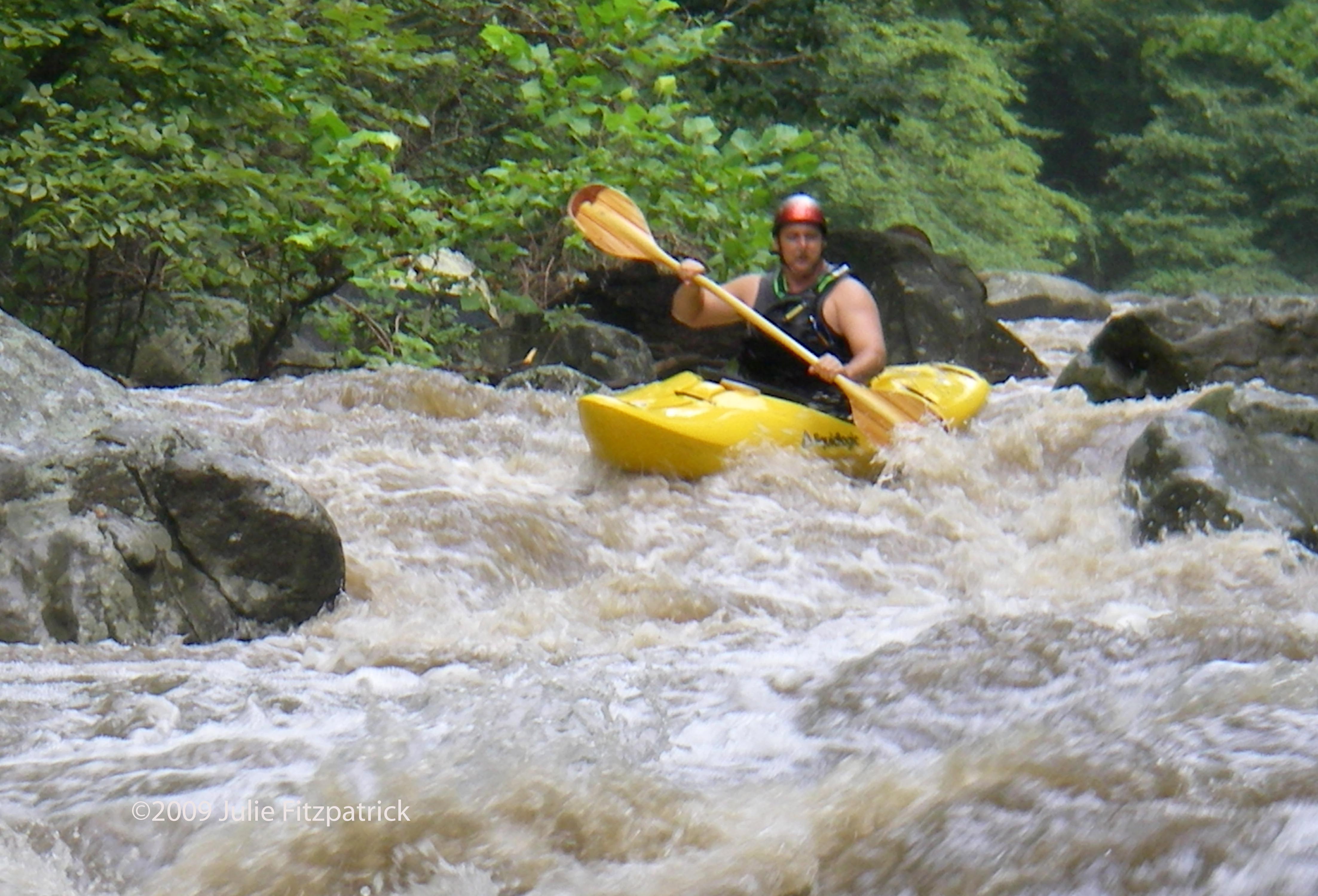
Apr 22, 2007
The Rock Creek Park website states (in the FAQ) that boating is allowed when the level is greater than 2 ft.
Today, the level was exactly 2 ft and with the exception of two fallen trees completely blocking the creek and a few shallow spots, it was a good ride.
Aug 9, 2005
There is a USGS stick gauge on Rock Creek. It is located at on the southwest side of a smaller bridge on Joyce Road that crosses the creek near the intersection of Beach Drive and Joyce (Joyce provides access via ramps to Military Road, which has a larger and higher bridge just to the north).
A reading of 2.5 feet on this gauge is a good paddling zero.
I have found Rock Creek to be running numerous times when Difficult Run is up. While I can't offer an exact correlation, I will say Rock Creek is worth looking at whenever the Difficult Run gauge spikes.
Mar 3, 2002
There appears to be a new USGS stick gauge on Rock Creek. It is located at on the southwest side of a smaller bridge on Joyce Road that crosses the creek near the intersection of Beach Drive and Joyce (Joyce provides access via ramps to Military Road, which has a larger and higher bridge just to the north).
A reading of 2.5 feet on this gauge is probably a good paddling zero.
Nov 14, 2001
While the water quality is unquestionably questionable, the combined sewer overflows on Rock Creek are located south of the commonly-run whitewater section. The first overflows are on Piney Branch Creek and there are almost 30 from here to the mouth of the Potomac River. D.C. health warnings and decisions to boat this creek should be taken in that context. North of Piney Branch, Rock Creek is subject to more routine urban surface runoff ills, park service officials say.
There is another gauge located on a footbridge near the bottom of the whitewater section and accessible from Beach Drive. One to three feet is good on this gauge.