Silver
C) Lower Silver: Arvon Rd to Silver Falls Park (4.2 miles)
| Difficulty | III-IV+(V) |
| Length | 3.5 mi |
| Avg Gradient | 62 fpm |
| Gauge | Silver River Near L'anse, Mi |
| Flow Rate as of 32 minutes | 55 cfsbelow recommended |
| Reach Info Last Updated | March 13, 2026 |
A sweet run by itself (for 'newcomers' to the L'Anse area, unsure whether they are ready for the more challenging 'upper' run), or a great continuation of that upper run for a good full day! Also, often 'paired' with a warm-up or 'chaser' run on the Falls River.
Most folks tend to meet up (or stay overnight) at the Hilltop Restaurant (and motel). Shuttle is somewhat long (13.2 miles and about 27 minutes, each way!), having to come back through L'Anse. If all vehicles go to the put-in to offload, then have to drive shuttle (down and back) before anyone puts on, folks will be sitting at the put-in for at least a full hour! You may wish to consider (at least some drivers, from the Hilltop) swapping boats onto other vehicles, then going to the take-out, to leave drop-vehicles there before driving up to put-in. (It should shorten the wait at least 15-20 minutes!)
Driving Directions to the Put-in:
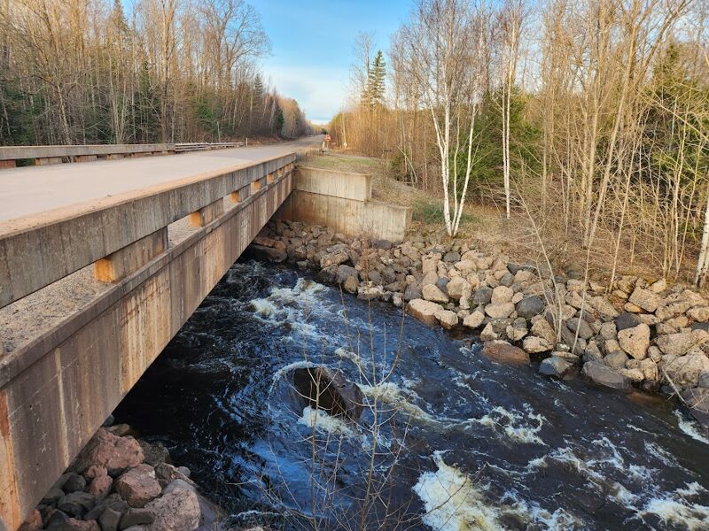
From Hwy 41 on the south side of L'Anse, a short distance south from the Hilltop Restaurant, turn east on Dynamite Hill Rd. This will twist and turn somewhat, but stay on the main road for about 4 miles. There will be an obvious 'Y' in the road. Bearing to the left will put you on Arvon Rd (same Arvon Rd as used to access the Slate River but opposite end) and bring you to the take-out bridge after 1/2 mile.
Driving Directions to the Take-out:
As you head north into L'Anse, Hwy 41 will veer to the left but you will continue straight on Broad Street. Proceed to the main intersection in downtown L'Anse and turn right on Main St. As you leave town, this will become Skanee Rd. After about 7 miles, look on the right for a small road with sign for Silver River Falls. Turn to the right here and drive about a half mile to the park which is the take-out. This road may be impassable early season as it is not maintained. If this is the case, continue about a mile on Skanee Rd until you come to the bridge over the Silver for
...
USGS lists a sampling site at Arvon Road (put-in for this section), showing drainage area at that point as 34.5 square miles, or just more than half the drainage area as at the gauge. Thus, flow in the early going may actually be more nearly half the gauge reading!
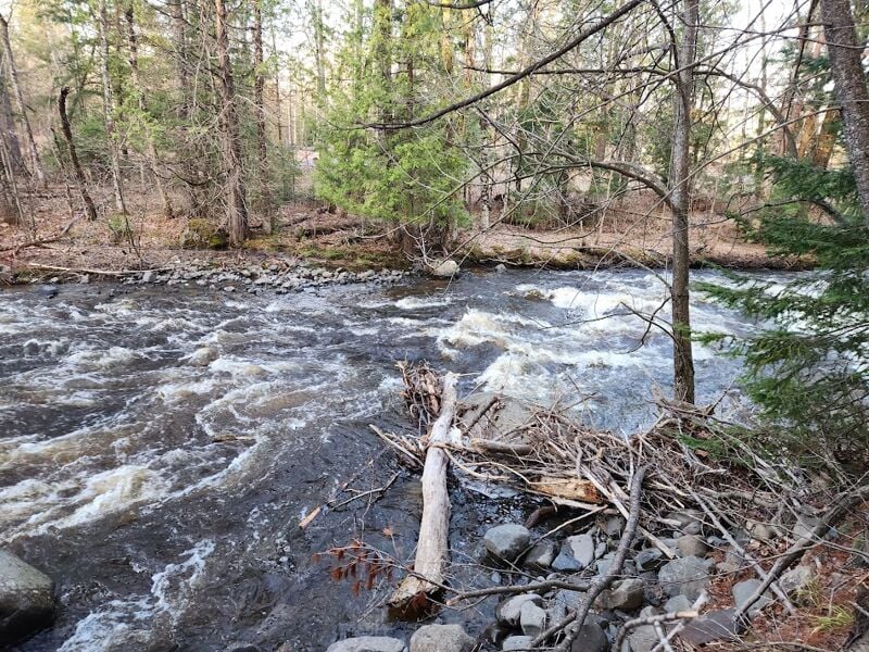
From the putin (which will be somewhat boney at most runnable levels), one shortly comes to the first drop. A narrowing in the river harbors a deceptively tricky/sticky pair of holes. At higher levels, the eddies here will surge and boil and draw you back into the hole, so paddle hard to make sure you punch through. While safely in the eddy below, enjoy a small sidestream cascading in on the right.

Just downstream of the first little dells, prepare to scout (river-left recommended, right is ok) as the river takes a sharp bend to the right. It drops down a confused rock jumble (with possibly a few offset holes), into a channel where it is abrupty directed ninety-degrees to the left. A few small waves and holes in this 'alley' lead to a small pooling up before a congested ledge where a rock splits the flow (at most flows). One usual route is to catch a left eddy above this, ferry into a tight-right 'hanging eddy', then peel-out, charging toward the rock to drop over the ledge into a wild wrapping hole, charging toward center-stream below. While the move is simple, it never fails to get my heart pumping.
A few easier ledges and holes lead to the next big drop, a triple which is usually scouted (river right). While a right side sneak on the first drop is sometimes used, there are piton rocks to be aware of. The (more usually run) left side of the first drop is a round-house slide with a couple of holes, the second drop is a sharp, short ledge (great boof), then one slides to down a smooth alley to run the final sloping ledge fairly well to the left for an 'off-ramp' into the pool below.
Not far downstream, the next triple drop is found. Scout from the left. Traditional route on the first drop was well to the right, however there is a rock at the base of the drop for a serious power-piton. A bump-and-thump alternative may be found down the center or left. Second drop is usually run tight to the left wall, with a sweet launch partway through. The final drop is a short sliding ledge into a usually fairly forgiving wave/hole.
Make certain to turn and look back upstream when you finish this drop to look at the gradient you have just run. It is a wonderfully impressive sight!
Downstream, the gradient peters out and you have a (much too) long stretch of flatwater. Be aware there will be one 'false-alarm' riffle which punctuates the otherwise almost 3-mile long peaceful float.
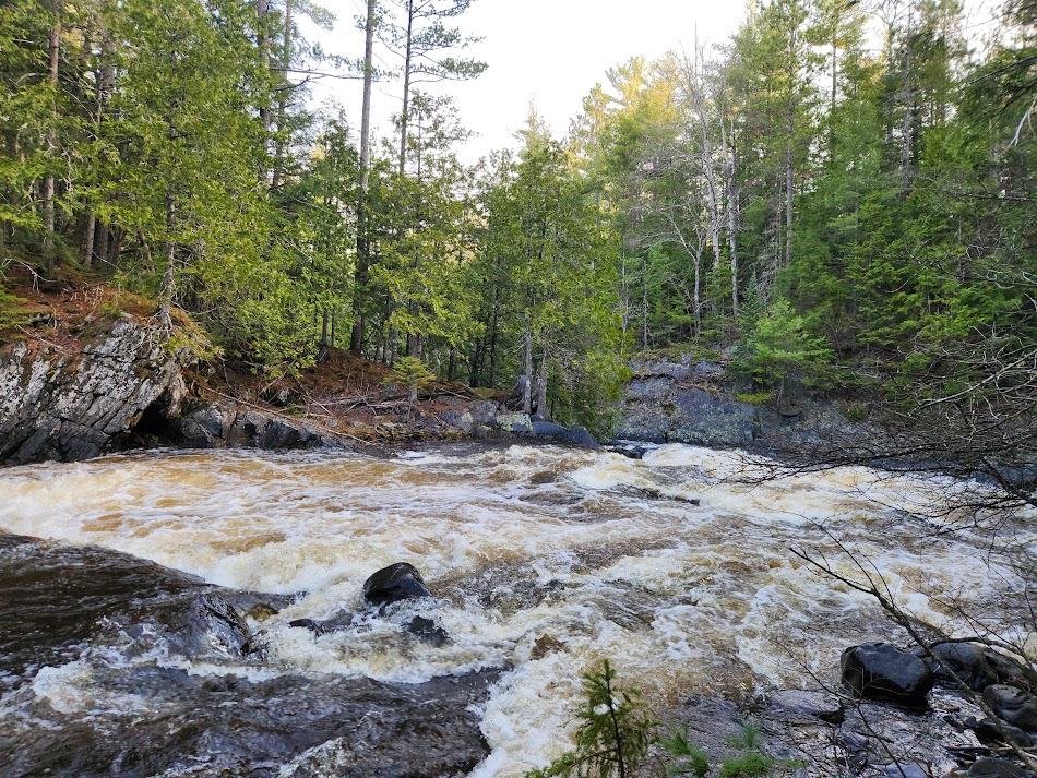
Take out river right when you hear the next drop. The river accelerates down through offset waves, gets squeezed and twisted to the left past an old bridge trestle, then jumps through a couple waves into a brief hanging pool. The main current pushes straight through the pool toward the brink of the second pitch of this drop. (Boaters usually opt to catch an eddy in this pool before picking their line down the next section.) Flowing out of this pool is a wide jumbled rocky slide. A series of ill-placed rock lies right in the main current at the lip of the drop, leaving fairly narrow gaps to thread before spilling down the frothing slide. Watch out for the 'trip rocks' which will try to spill you if you get sideways down this slide. The best line is usually by threading between a couple 'guard-rocks' well to the right, and keeping a straight boat angle to avoid being tripped up by jutting rock on the slide. As the waters (from across the width of the slide) collect, the river flows through additional series of waves, holes, and diagonal ledges.
Another (thankfully briefer) bit of flatwater brings you to the finale, Silver Falls. The upper part of this is a sweet brief dells, as the river narrows significantly and accelerates through a series of holes (generally not sticky). For some, it will seem that there are few, if any, eddies, though I've heard of some boaters at some levels, 'working' the drop, catching a few eddies, before the drop breaks out across shallower bedrock into a short pool at the end of the first pitch. The river then hooks sharply to the left. Most boaters will take out immediately after this tight bend, before coming to the main part of Silver Falls. This drop has been run, but is very nasty looking at most water levels. Most will be content to just look at it before carrying up to the parking lot.
Apr 28, 2025
Didn't paddle today but scouted the river. It was high, but runnable.
Aug 19, 2017
Seemed like a good level to run. It was a little boney at spots, but no problem. The day before it had gone up to over 2,000 but it drops really fast. Maybe the only time in years it could be run in August. We got lucky.
Mar 19, 2012
Correction:
In the 'rapids' section for the Lower Silver...
'The river narrows significantly through a fine dells, through numerous waves and holes, with few eddies (though I've heard of some boaters at some levels, 'working' the drop, catching a few eddies). At the end of the first pitch, the river widens a bit and spills across some shallow bedrock before cranking tightly to the left. Most boaters will take out immediately after this tight bend to carry up the hill to the parking area. Downstream lies the 'Silver Bullet', which has been run a good number of times, but is not recommended at most levels for most boaters.'
That should read Silver Falls.
The 'Silver Bullet' is in the cabin section on the Upper Silver.