Broken Bow Spillway Channel
Broken Bow spillway to Mountain Fork River (1.2 mile)
| Difficulty | II-III |
| Length | 1.2 mi |
| Avg Gradient | 104 fpm |
| Reach Info Last Updated | December 16, 2020 |
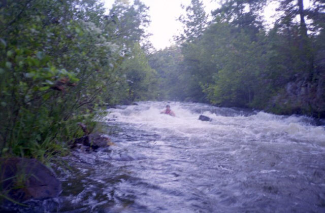
Creek below spillway gates tumbles 130 ft in 1-1/4 miles, and is basically one rapid from top to bottom.
At present, paddling the creek is not officially allowed.
Per Tom Porter:
Put in - Alternate 259 - where it crosses the spillway (34.15605 N 94.70296 W)
Take out - Beavers Bend State Park Road (34.14376 N 94.69152 W). This is about 250 yards upstream of the intersection with the Lower Mountain Fork. From this point, you can also take out along the LMF, inside of the State Park.
Outlaw Creek is the spillway diversion below Broken Bow Lake. Due to the requirements for cold water to keep trout alive 140 cfs is supplied during the hot summer months, which is runnable although more would be nice. The creek drops 105' in the mile above the lower foot bridge. Although I've run the creek 3 times, it is prohibited by law.
No trip reports yet.