| Difficulty | III-V |
| Length | 3.4 mi |
| Avg Gradient | 80 fpm |
| Reach Info Last Updated | February 27, 2015 |
River Description
Quick Facts:
Location: 13 miles NW of Marquette.
Shuttle Length: 4.7 miles. (See details in 'Directions' Tab.)
Character: Northwoods bobble, with chunks of gradient in ledges and slides.
Put-in is approximately 964' elevation.
Take-out is approximately 648' elevation.
Thus total elevation change is approximately 316'.
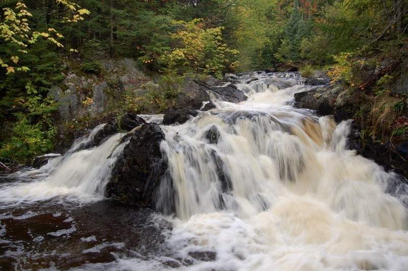
This tiny river tends to take its gradient in big chunks. There are four sections of elevated gradient, each dropping 50-60' fairly quickly.
Unfortunately, the lower portion of the first good gradient sequence is essentially unrunnable due to an overhanging rock at the bottom of a tight, steep slot/flume. (Can you say 'high speed cranial impact'?)
The not-so-steep portions of the run are essentially a pleasant bobble through the woods, and are fairly clear of wood for a stream this small. However, logs tend to gather in quantity in some of the drops, rendering them unrunnable in part or whole. As a result (when we were there) a wonderful sliding drop mid-run had a huge tree across midway down, so we had to settle for sliding off shore to run just the bottom half.
The final big drop may be runnable at some flows, but most of the water slides into an overhanging wall in such a way as to dissuade most folks at most flows. This falls could be seen by walking several hundred yards up from the 550 bridge but keep in mind that here (as along much of this run) the property is privately held.
Bottom line? We did it once, and it was interesting to explore and see its drops, but it's doubtful it will make anyone's 'must do again' list.
River Features
Put In
Access PointDistance: 0 mi
Confluence, unnamed creek
OtherDistance: 2.63 mi

An unnamed (on maps I find online) creek enters from river-right. If you take note of it, it signals your approach to the next good shot of gradient/falls.
Falls Sequence
OtherDistance: 3.83 mi
Have a look at the main slide in this sequence at Waterfalls of the Keweenaw.
Take Out
Access PointDistance: 4 mi
USGS sampling site
OtherDistance: 6.18 mi
USGS lists a sampling site showing drainage at this location of 15.9 square miles.
Trip Reports
Log in to add a reportNo trip reports yet.