Tomahawk Creek
Troy Grove Blacktop to Little Vermilion (2.8 +4.7 miles)
| Difficulty | II |
| Length | 7.6 mi |
| Avg Gradient | 25 fpm |
| Gauge | Tomahawk Creek |
| Flow Rate as of 55 minutes | 33 cfsbelow recommended |
| Reach Info Last Updated | March 3, 2025 |
Quick Facts:
Location: Northcentral IL, about 5 miles NE of LaSalle.
Shuttle Length: 5.6 miles. (See details in 'Directions' Tab.)
Character: Rural wooded corridor (with a few estate backyards).
Put-in is approximately 598' elevation.
Confluence with Little Vermilion is approximately 528' elevation.
Thus elevation change on Tomahawk is approximately 70' (average gradient, 25 FPM).
Take-out is approximately 450' elevation.
Thus total elevation change is approximately 148' (average gradient, 20 FPM).
Google Maps has excellent resolution aerials of this reach. We highly recommend going to the 'Map' tab, clicking 'Satellite', double-clicking near (not on, but near) the put-in location icon, zooming to the maximum resolution (without losing image), and doing a 'virtual tour' to 'walk' down the reach.
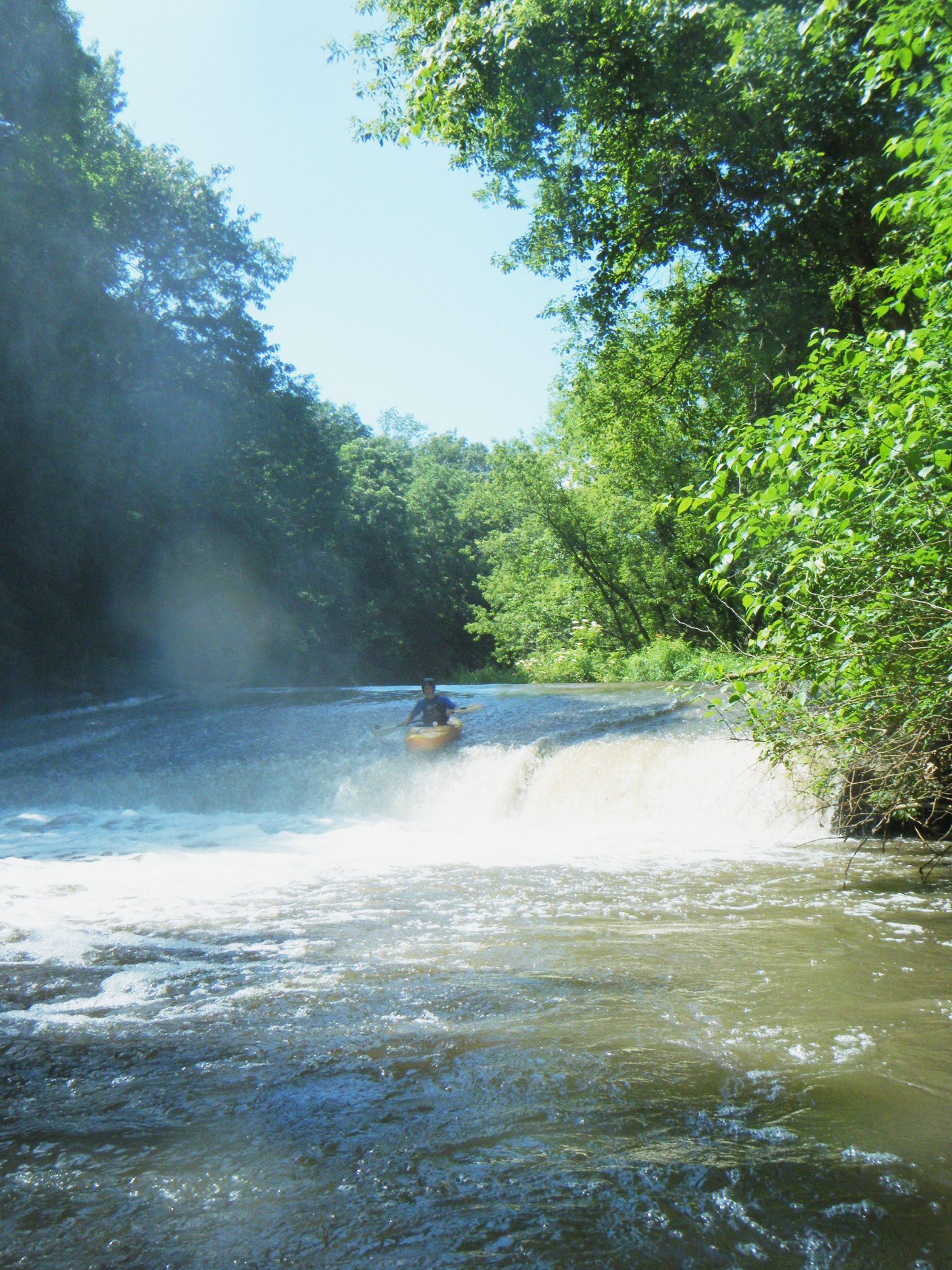
Ask permission at farm house to put on. Beware low bridge 0.7 miles down, and dam (run at own risk) at 2.3 miles.
Running this creek brings you into mile 1.8 of the Little Vermilion, where you will finish with 4.7 miles of that run, including its 'mini-canyon'.
Richard DeGroat, Sugar Grove provides (2009-04-24):
I've run this many times and each time I do, I have alot of fun. It has a lot to offer for the almost intermediate paddler (II) to the solid intermediate (III), and I presume would be fun for the more advanced at higher water. Check out Bob Tylers description as it is more exhaustive.
There is a dam about a mile before the confluence with the Little V which I just ran this last past week. Extremely fun slide to about a 5 and a half foot boof provides alot of excitement for those prepared and those willing. There is also another fun slide a bit more downstream that can be challenging for a beginner.

Drainage area at our listed put-in is ~36.4 sq.mi. (as calculated via USGS StreamStats Beta software).
The text warns of a low bridge, 0.7 miles from the put-in. It appears (from online satellite view) there may also be a couple of other bridges just upstream in this vicinity (or maybe the others are some sort of image anomoly). In any event, be watchful and prepared to deal with this (or these) possible hazards.