Waxahachie Creek, South Prong
Lake Waxahachie Spillway To Pigg Rd (3 miles)
| Difficulty | III-IV(V) |
| Length | 3.6 mi |
| Avg Gradient | 19 fpm |
| Gauge | Waxahachie Ck Nr Bardwell, Tx |
| Flow Rate as of 40 minutes | 0 cfsbelow recommended |
| Reach Info Last Updated | August 27, 2021 |
Waxahachie Creek, South Prong (AKA 'South Prong Creek') is impounded to form Lake Waxahachie, and the spillway of the lake creates an intense, steep hair run that, at certain levels, can be a full-on Class V monster. This run should only be attempted by very experienced whitewater paddlers. A boater is reported to have died while attempting to run the spillway in the early 2010's, although details are not available.
Numerous smaller drops, some in the 3-6 foot range, and slides occur in quick succession on the spillway and culminate in the crux of the run, a 17-foot waterfall. Below the waterfall, the creek is all flat or moving water down to the Pigg Road takeout. For more information, see Texas Whitewater.
Access:
Distances and gradient measured using GIS tools in 2015. Max. gradient of 252 fpm is measured from the top of the spillway to the base of the 17-foot waterfall (approx. 1000 river feet.)
There is no gauge for this run (the listed gauge is downstream of Lake Bardwell, so it doesn't reflect the release from Lake Waxahachie.) You can use the Lake Level Page to get a rough idea of when Lake Waxahachie might be releasing. Water starts going over the spillway above 531 feet, but the correlation between lake level and a runnable level on Wax. Creek has yet to be determined. Past trip reports from paddlers seem to show that it is too
...Jun 18, 2007
Check out vids here:
http://www.youtube.com/watch?v=ZY-KSHlofpc&mode=user&search=
Jun 17, 2007
This is the start of the run.
This is the middle of the run
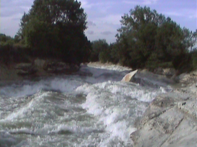
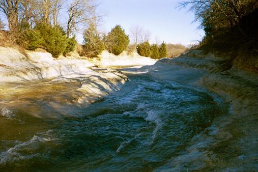
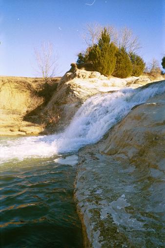
Feb 13, 2005
looking upstream at the spillway from the first drop
Looking downstream from the second drop
Looking upstream at the second drop
The book says its a 17 foot drop.
The ladder on river right is private property. Public takeout is 2 miles downstream at pigg rd.