Pike, South Branch
A) Old County A to primitive camp off FR510(USB Pike/Upper South Branch)

| Difficulty | II-III |
| Length | 4.7 mi |
| Avg Gradient | 24 fpm |
| Gauge | Pike River, Upper Branch Runs |
| Flow Rate as of 1 hour | 30 cfsbelow recommended |
| Reach Info Last Updated | June 2, 2025 |
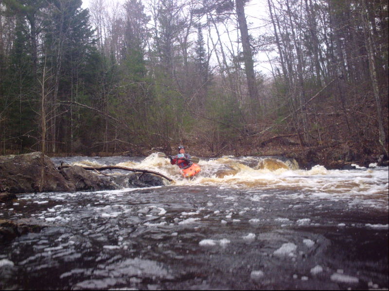
USB (Upper South Branch) Pike is a very scenic paddle, with a few interesting fairly large drops. Drops include Erratic Ledge, Split Falls, Horseshoe Falls, Double-Drop Dells.
Could be used as a 'warm-up' or 'chaser' for a run on the Four Falls Section of the North Branch, which is very nearby.
Early season access to the take-out for this section can be problematic due to snow on the Forest Service roads. Again, the proximity of the various other runs on the Pike should ensure that you will not be totally 'skunked'. If you try for this reach, and find the road to the take-out impassible, try the Lower South Branch, Four Falls (North Branch), or the Yellow Bridge (main Pike).
For those who may wonder, there is about 6.5 miles of largely uninteresting water (from a whitewater perspective) from the recommended take-out for the 'Upper South Branch' (this run) to the recommended put-in for the 'Lower South Branch'. So, while it could be paddled, those looking to maximize their whitewater experience will do best to stick with these listed stretches.
From the put-in, you'll have relatively shallow low-grade (class I-II) boulder-bed rapids leading nearly a half-mile to a culvert crossing under the road. Another one-third-mile of the same (class I-II) brings you to a large glacial erratic (a huge boulder, probably deposited here by a glacier) on the river-right shore, where the river takes a sharp left-hand bend, is signal of the first significant drop.
Less experienced boaters may wish to get out to scout, but others should be able to boat-scout this drop. Some minor play is possible here (depending on the flow, of course). A decent pool follows.

After passing the meandering section you will come to a powerline overhead, which will signal the start of the gradient on the lower part of this run. Not far downstream, you will encounter (at least the best that I can guess) what may have been a logging dam. Large timbers are embedded in the river, complete with LARGE metal spikes. There has long been a huge pile of deadfall accumulation here, making the river impassible. As you portage (or in the rare event you may be able to run it), be VERY CAREFUL about the spikes. They could easily rip a hole in a boat or snag your clothing.
Note: It may be possible to drive back to here via dirt/sand roads from near the powerlines. (I have never actually investigated to see if it is possible, or whether the roads are private or gated at any point.) If feasible, this would cut out the flat stretch of river (and of course skip the first ledge and the mile or so of boulderbed class I-II which start this run), and would give you quickest access to the two main drops on the river.
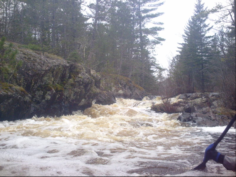
Yes, it's a rather long stretch of flatwater from the put-in sequence to the next significant drop. Hopefully you can enjoy the up-north scenery along that way. As you come to a power-line clearing you will soon encounter some minor boulder-bed rapids. Not far downstream, a rock/island splits the flow and you'll find a horizon line. Scout (river-right). This split falls should delight most intermediate whitewater paddlers.
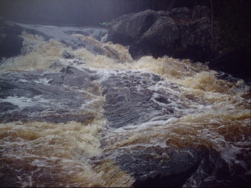
Having been flowing mostly west-to-east, the river will do a big zig-zag, south-east, then north-to-northeast, around a hairpin to south-west, and to south-east again. Not far beyond, it will sweep around a horseshoe bend, dropping down a fine sliding falls as it does so. Get out to scout (river-left) to see the assortment of ledges and rocks which lay around the bend beyond the falls proper, ready to trip you up (should the falls and bend not be sufficient to do so first).
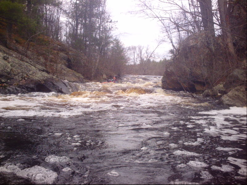
The final 'significant' drop (though much less consequential than the middle pair of drops) comes where a mini-dells constricts the river. A couple of pitches/waves precede the pool below. (Note: Exact location uncertain. The resolution on maps.google.com is not adequate and my recollection is not sufficient to place this accurately.)