Pike, South Branch
B) LSB Pike: Mathias Lake Road to Dave's Falls(Big South Falls/LSB Pike/Lower South Branch)
| Difficulty | II-IV |
| Length | 4.9 mi |
| Avg Gradient | 19 fpm |
| Gauge | Pike N.br. at Bull Falls |
| Flow Rate as of 40 minutes | 36 cfsbelow recommended |
| Reach Info Last Updated | June 2, 2025 |
NOTE: From the recommended take-out for the 'Upper South Branch' run to the put-in for this stretch, there is about 6.5 miles of largely uninteresting water (from a whitewater perspective) which we do not list.
LSB (Lower South Branch) Pike ... main attractions on this reach are Big South Falls, Surprise Ledge, and Dave's Falls. You may also wish to take a 'side trip' to view a falls on the Little South Branch. (Look for it entering on your right, just downstream of Big South Falls.) At some levels, some boaters may run Dave's Falls, though it is likely most will take out between 'Upper Dave's Falls' and Dave's Falls. Keep in mind that flow here will be double the 'virtual gauge' reading shown on this section (I.E., it will be equal to the regular USGS gauge, as listed on the two main-stem reaches of the Pike downstream).
The take-out at Dave's Falls is accessible via Dave's Falls County Park. In appreciation for the facilities provided here (parking, bathrooms, improved trails, etc), please be honest and pay the requested fee. (If I understand things correctly, paying one fee gets you legal access to as many different parks in Marinette County as you can visit in one day. Thus, if you might plan to look at and/or run the nearby 'Four Falls' section of the North Branch Pike, either before or after this run, one fee would cover both parks.)
Regarding Dave's Falls, Brock Royer reports (2005-11-17): Mark Hattendorf and I have run this falls multiple times and found that even at higher flows the left line toward the wall at the end is much more benign (flushy) than it looks...even at higher flows. I still however would suggest remaining upright regardless of the line you take b/c there are a few rocks not far below the surface. It is a fun drop and much easier than it looks. Enjoy!
Peace
Brock
That said, many runs we're aware of go rather less-successfully than was hoped for:
However, here
...
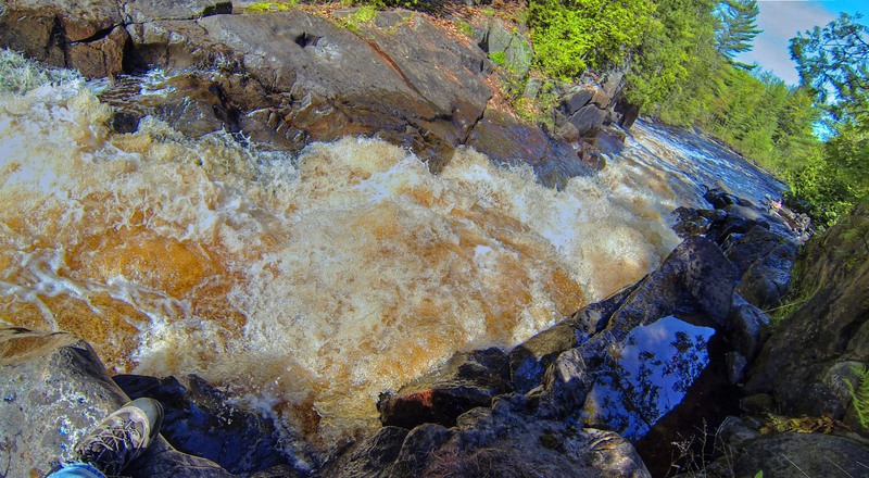
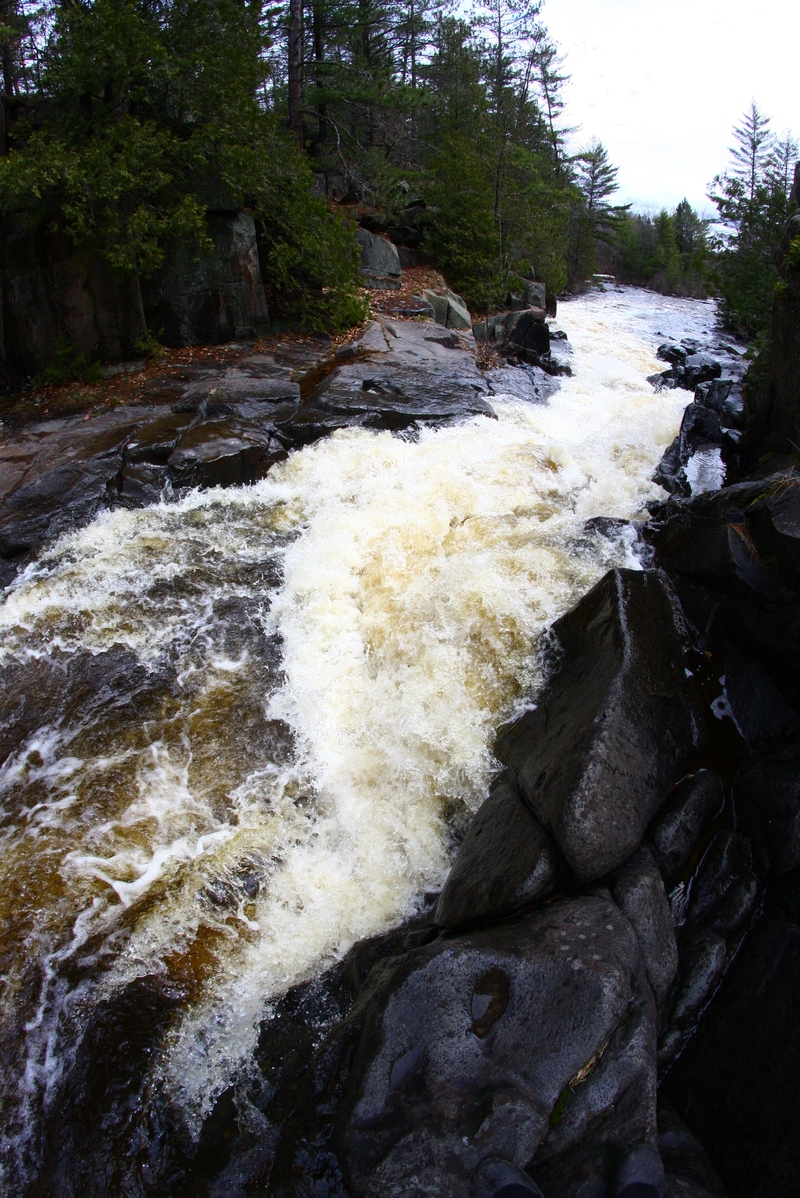
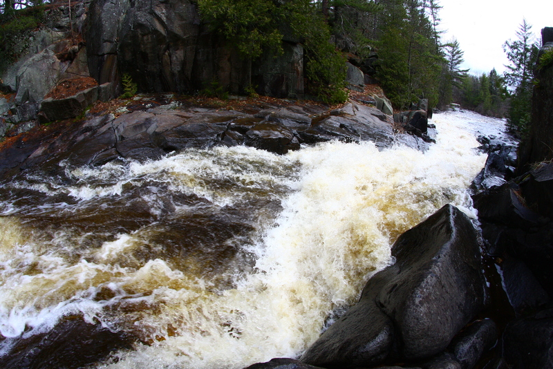
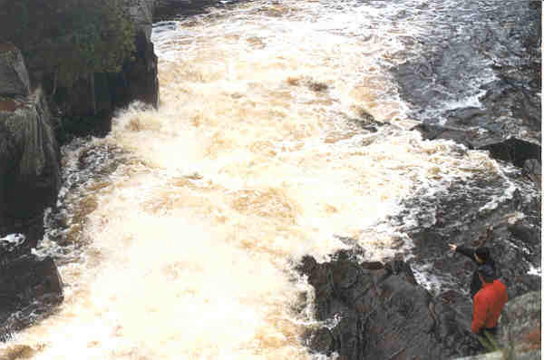
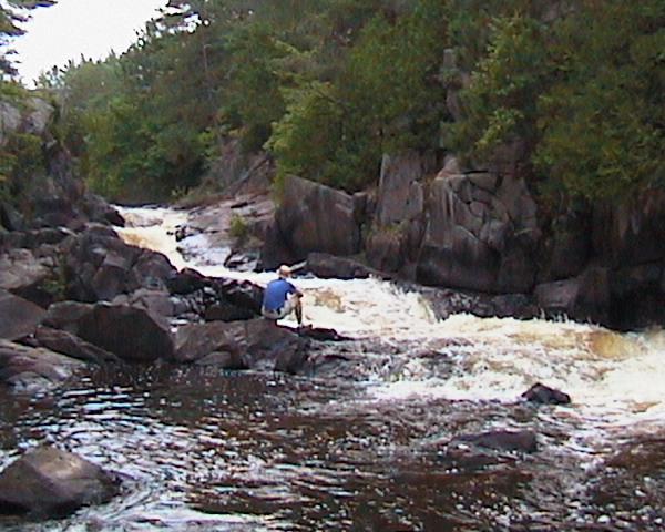
At about 1.4 miles into the run, the river makes a sharp (90-degree) right turn (changing from NNW to ENE). This signals your approach to Big South Falls.
The river spills a bit to the left, then narrows through a short, steep slide into a pool.
Less than a tenth-mile downstream, two short ledges will be encountered to end this sequence. My recollection is that the first of these can become a bit aggressive (sticky) at some flows. ('Surprise!')
If you look for the confluence of this tributary, if there is decent flow in it, you may wish to paddle/hike upstream to check out a falls (maybe 100 yards long, about 0.1-0.2 mile upstream on it), which may be runnable, to add some more variety to your run.
(At the confluence, the drainage area for the Little South Branch is 26.5 square miles, so ... it's a decent sized tributary.)
Topo maps show a rapids marked at this location. Aerial view shows a very brief rocky intrusion.
At this point the South Branch meets the North Branch, together becoming the Pike River. This could be used as an access point (as it is our listed take-out for the lower North Branch Pike run). However, most folks will wish to proceed to Dave's Falls to finish their run there.
Topo maps show a 'rapids' on S.Br.Pike just above this confluence (as well as one on the N.Branch). My recollection (confirmed by aerial views) is that there is no rapids on the S.Branch before the confluence, and the area immediately after the confluenc does have relatively light boulder-bed rips for nearly the next half-mile.
Potentially an alternate access/egress point, a fine little wayside exists just south (on the downstream side) of CTH.V.
Very light rips preceed a railroad trestle, which serves as indicator you are nearing the finale -- Upper Dave's Falls is just around the corner.
After you pass under a railroad trestle, the river bends right (south) and head into Dave's Falls County Park. A large rock outcropping (small island) splits the flow. The left side is more gradual, but (at most flows) grungy. The right has a couple small 'set-up waves', then plunges about 4' into a pool. The hole at the base can be quite 'keepy' at good flows.
The river bends left (east) after the pool, and heads under a footbridge with a sweet little wave under it. A brief pool precedes the main drop of Dave's Falls. Most boaters will take out before dropping down this steep rather violent-looking chute.
Dave's Falls has been run many times since at least back in the 1980s, if not earlier. (I've even heard rumor of at least one early daredevil intentionally running it backwards!) While some who have run it have claimed it's much smoother/easier than it looks, there are at least as many reports of nasty/ugly runs.
There is a fine pool below (to have a safety boater staged to collect any 'yard sales' which may occur). Exit river-right for a fairly easy short carry back to the parking area for Dave's Falls County Park.
Oct 1, 2011
Lead it to the slide toward the middle of the drop