Ontonagon, Cisco Br.
Kakabika Falls (Thayer Rd) to FS Rd 178 (Park-n-Huck to 9.7 miles)
| Difficulty | I-II(IV) |
| Length | 9.8 mi |
| Avg Gradient | 27 fpm |
| Gauge | Cisco Branch Ontonagon R at Cisco Lake Outlet, Mi |
| Flow Rate as of 39 minutes | 1 cfsbelow recommended |
| Reach Info Last Updated | June 29, 2025 |
The Chippewa name for a waterfall is 'ka-ka-bi-ka,' thus this is yet another example of Anglo-redundancy (much like the many 'Bull Falls', where 'bull' is an Anglicised version of a French word for rapids or falls). While the overall run is class I-II, the opening drops of this reach (the Kakabika Falls sequence) rate the parenthetical class IV. As a result, many advanced boaters will prefer to do this as a 'park-and-huck', carrying back up to their vehicles after running just the opening sequence (Kakabika Falls), while less experienced boaters may either carry down past Kakabika (enjoying the view) or use an alternate put-in (as described below).
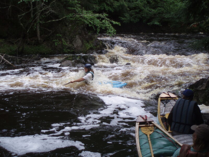
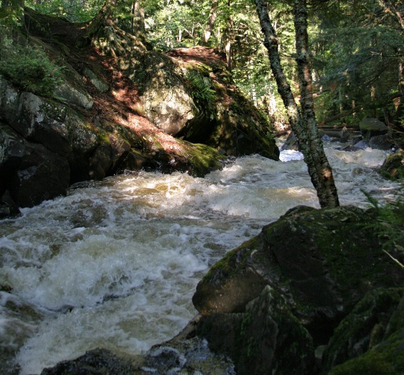
From the put-in (road), the river soon enters an increasingly steep series of ledges, dropping almost 50' in the next quarter mile into a mini canyon (~200 FPM equivalent for this quarter-mile!). As it makes a hook turn to the right, it flumes down into a complicated mini-gorge culminating in a near vertical drop of about 8', with a wicked spline of rock in the landing zone to punish boaters who may be just slightly off their line. Eddies are tiny and rare through this sequence, and wood may be present in the confined course. (This may push into class V range at higher flows.)
Many who float the full/longer reach simply put-in below. The river is primarily moving water for the next several miles, followed by a long stretch of rockbed rapids culminating in Wolverine Falls (though see *'side note' below).
An alternate put-in (avoiding Kakabika and the the low-gradient section) may be found from a logging road which is about 4.1 miles from Kakabika Falls by road, turn to the left and drive (if possible, else carry) a quarter-mile to the river. This abbreviated section has a length of 4.9 miles and gradient figures of 37'/mile average, 62'/mile max.
Satellite image resolution is fantastic for the bulk of this reach. (Unfortunately, that does not include the put-in and the class IV mini-gorge section
...
Topo maps have marked Wolverine Falls at this location, 0.7 mile upstream of the listed take-out.
There is very little apparent on 'Satellite'/'Aerial' views (at any resolution) at this location. A friend and I hiked a good ways upstream from the take-out (river flow too low for a run), and saw nothing but riffles and rips.
(Maybe we just didn't get far enough upstream? Or perhaps this is nothing more than the very minor rapids we saw. Can anyone provide any info? Add a comment!)
While the section name says 'to FS Rd 178', I do not see anything on maps with that designation. The road appears to be labeled FS6930 (maybe designation has changed over the years?).
Downstream of the listed take-out, viewing the 'USGS Aerial' map, it appears there may be a rapis or falls, and it looks possibly more significant than what is in the area where Wolverine Falls is marked on the topo maps. Perhaps this is mislabeled (mislocated)? Or perhaps the aerial view deceives.
Anyone ever checked downstream and have a report?
May 9, 2026
I found the question about location of Wolverine Falls, today as I was doing research for a presentation on W\&S Rivers in the UP. Its been > 10 years since I ran the Cisco, but have run it numerous times. Wolverine is farther UPSTREAM than the maps show. It is runnable, similar to the lower drop on Kakabika, but turns opposite. We used to put in off US 2, in the Tenderfoot or in between on a forest road near an old gravel pit
Aug 26, 2006
The entrance rapids to this section.
Sneak route around a large strainer.
The strainer below first ledges.
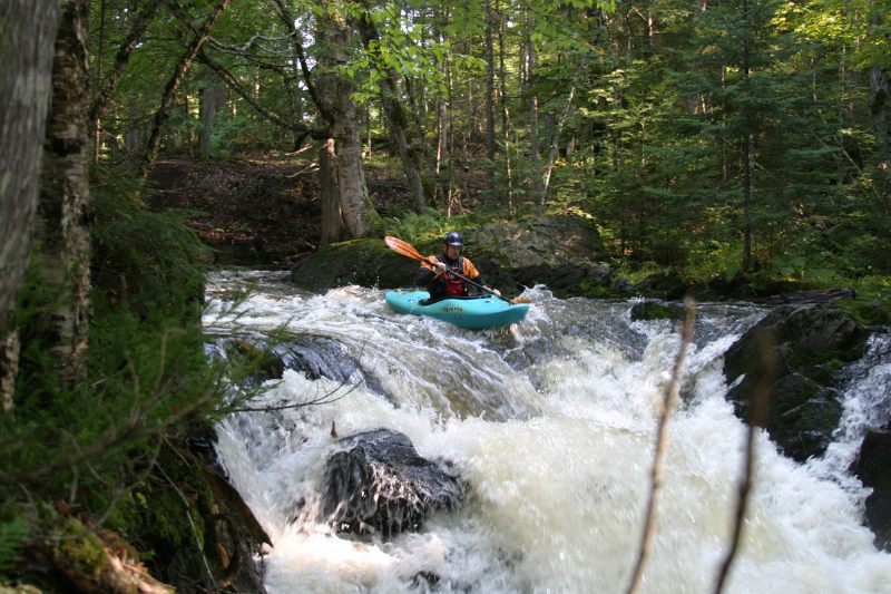
The second drop is a pretty sweet slide. River left has a generous eddy perfect for setting up for the third drop.
A 4.5-6 foot drop. It was fun but rather grungy at 125cfs.
Shortly after the drop river left has a small eddy that is good to catch in order to set up for the final sequence. Paddle aggressively to make the eddy.
A 4.5-6 foot drop. It was fun but rather grungy at 125cfs.
Shortly after the drop river left has a small eddy that is good to catch in order to set up for the final sequence. Paddle aggressively to make the eddy.
The final sequence has one “must make move” at the very end to avoid a rock spine landing, however, the current tended to push you in the correct direction making it a fairly easy move.
The final sequence had one “must make move” to avoid a rock spine landing, however, the current tended to push you in the correct direction making it fairly easy. We each ran it one at a time with two people on ropes for the final sequence.
A hard day of work for Andy.