Sacramento
1) Box Canyon Dam to Dunsmuir(Box Canyon)
| Difficulty | III-IV |
| Length | 7.7 mi |
| Avg Gradient | n/a |
| Reach Info Last Updated | February 12, 2015 |
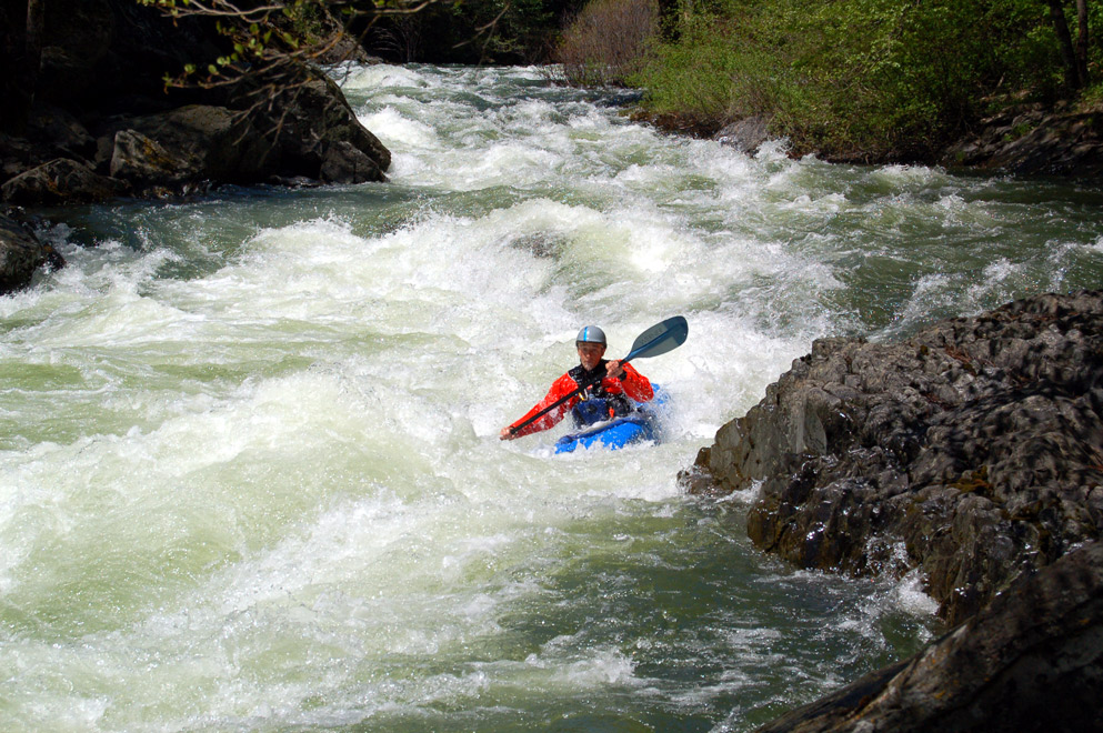
This run is a class 4 classic. Beautiful rapids are set in a deep, impressive box canyon of high cliffs. In several areas, curtains of water cascade down the cliffs from large springs.
It's just off I-5 and if you're driving though in season it makes for a fun paddling diversion. It is tough to figure out if it's running by using the Sacramento @ Delta gauge as a guide as that gauge is close to 40 miles downstream from the put-in. There are too many variables to come up with a simple formula using that gauge as a guide, but there is a good rule of thumb. As the season progresses the flow in box canyon will be an ever increasing percentage of the total flow at the gauge. In season paddlers will often post the height of the Cantara Gauge on Dreamflows.com (The Cantara guage is the stick gauge at the end of Box Canyon on river left). It's a good bet that Box will have boatable flows from late March thru May.
Take out: Beneath the Dunsmir Avenue bridge in Dunsmir.
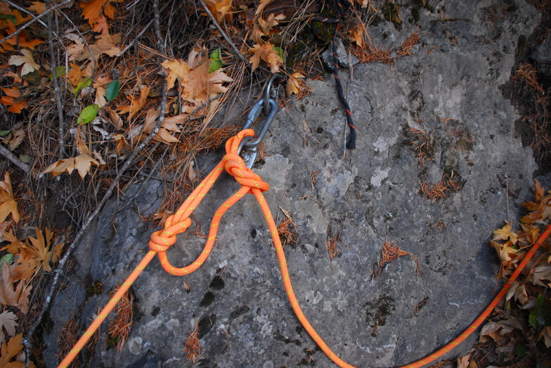
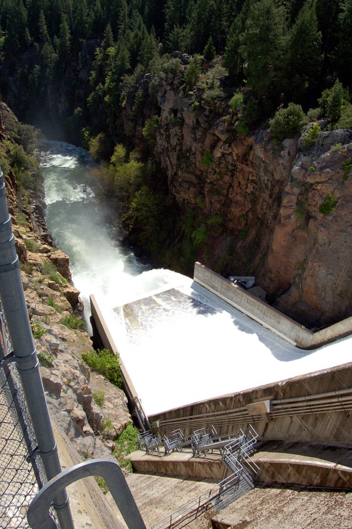
Put in: The furthest upstream put in requires the use of ropes to descend to the river. From the left side of the dam, hike downstream a short ways to a clearing, then look for an improvised system of ropes and ladders leading down to the river. Alternative put ins are at: Ney Springs Fishing Access, Stink Creek and Cantera Loop.
Other Information Sources:
...
Hike downstream on a trail on river left till you see a clearing. Find a rope system leading down to the water.
If the dam is spilling, some rafters drop their empty rafts in the reservoir and let them go over the spillway rather than lower them down the ropes. Of course people have to be waiting below to catch the rafts.

This is an alternate put in and access location on river right. This access point is probably more suitable for rafts than the roped descent close to the dam.
Boaters sometimes run laps from the put in to here, making a short and quick run.
Water from a large spring cascades down cliffs on river left.
Nov 6, 2017
Scouting trip to evaluate access situation at the put-in for Box Canyon.
Jun 23, 2011
Great news! Siskiyou Co now has the flow out of Box Canyon dam online at;
www.co.siskiyou.ca.us/GS/docs/Box Canyon/FlowRate.pdf
If this link doesn't work dreamflows has one on the Box Canyon notes page.
Like everyone else who frequents this run I've always used the stick gauge to determine the flow and it will take some time to find the correlation between the two.
I'll guess that if it's over 450cfs you are more than good to go
Mar 8, 2011
This run is a class 4 classic and one of my favorites. It's just off I-5 and if you're driving though in season it makes for a fun paddling diversion. It is tough to figure out if it's running by using the Sacramento @ Delta gauge as a guide as it is close to 40 miles downstream from the put-in. And there are way to many variables to come up with a simple formula using that gauge as a guide. A good rule of thumb is; as the season progresses the flow in box canyon will be a ever increasing percentage of the total flow at the gauge. In season paddlers will often post the height of the Cantara Gauge on Dreamflows too (The Cantara guage is the stick gauge at the end of Box Canyon on river left). It's a good bet that it will be running late March thru May. Jefferson State Creeking has an excellent write-up on the run with pictures, logistics.