Bad
B) Red Granite: Hwy.169 to Devil's Gate (PnH or 6.3 miles) ** ACCESS ISSUES **
| Difficulty | III-V |
| Length | 3.6 mi |
| Avg Gradient | 40 fpm |
| Gauge | Bad River Near Odanah, Wi |
| Flow Rate as of 55 minutes | 2.25 ftbelow recommended |
| Reach Info Last Updated | May 18, 2022 |
The full listed section would consist of two sections of major gradient, with otherwise flat water and light rapids. From Rte 169, there is 1.5 miles of flatwater before the beginning of the Red Granite falls sequence. After Red Granite, there is again only light rapids and flat water down to Copper Falls. Access to Copper Falls (being anywhere within its canyon) is restricted. Thus, most paddlers will be content to do Red Granite as a park-and-huck/park-and-play, followed (optionally) by driving down to the park to hike and look at Copper Falls, the canyon, and Brownstone Falls. Thus, we have changed the coordinates of the put-in and take-out to (respectively) the road which gives access to the base of the Red Granite sequence and the parking lot at Copper Falls.
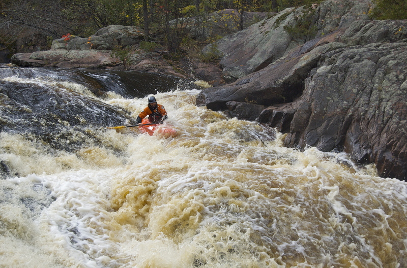
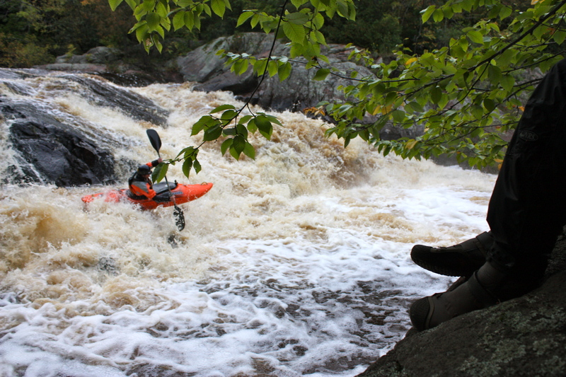
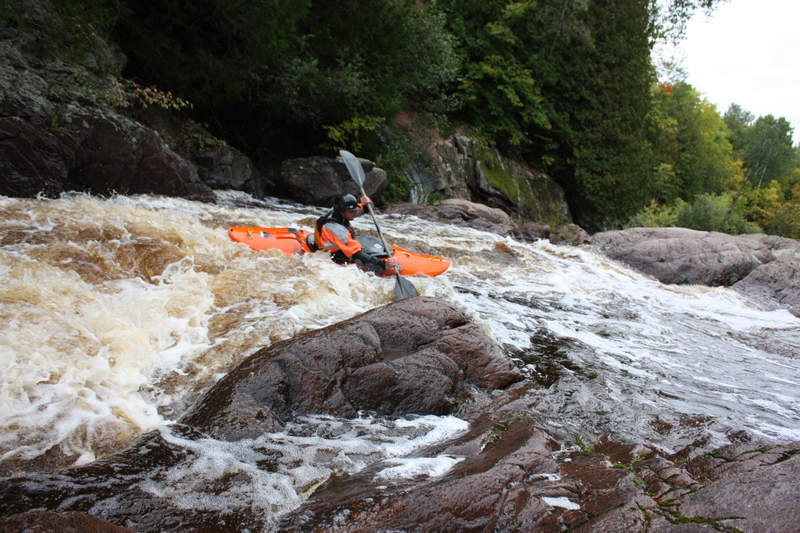
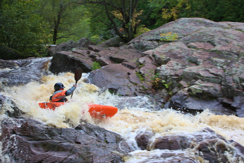
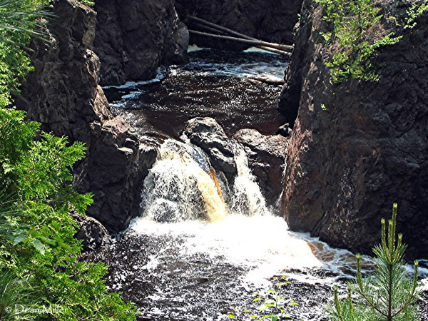
Red Granite Falls consists of high angle slides and boulder bed, class IV in low water, class V at higher flows.
The 'access issues' referred to in the header/section-name refer only to the canyon below Copper Falls (28'), where access is prohibited by Copper Falls State Park. Attempts to run the final mile to Devil's Gate may result in conflict with rangers. Access to Devil's Gate footbridge (the first approved access point downstream of the falls) is via hiking trails in the park.
Video of that section: https://www.youtube.com/watch?v=3gtpS9sdCkA&t=156s
(Note: the above link has been queued to a run of Copper Falls Canyon. Prior to that point, the video features runs of Wren Falls (on Tyler Forks, a tributary which drops into this canyon nearly the end of the video), and nearby Potato River Falls.)
A different run of it: https://youtu.be/dgPTHFs7IP4

We are marking this location for reference and consistency with the full listed reach, though we sincerely doubt many (any?) boaters are likely to do the full run.
USGS lists a sampling site at this location showing drainage area of 105.5 square miles.
From Rte 169, you'll encounter 1.5 miles of flatwater before the beginning of the Red Granite falls sequence. Red Granite Falls consists of boulder bed interspersed with high angle slides, class IV in low water, class V at higher flows. Alternate put-in and/or pre-run scouting is available at this point by driving to the base of the drop and hiking up.
We have set the 'put-in' coordinates to the end of the park road from which you can access Red Granite Falls. Park here and hike upriver, scouting the drops as you go, then (if it looks good to you) run it down to (and take out near) where your vehicle is parked.
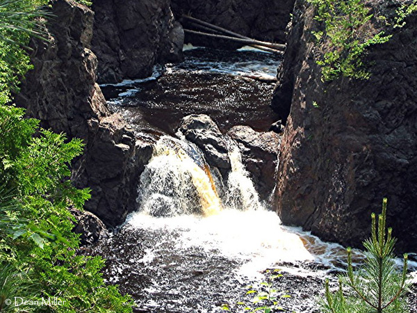
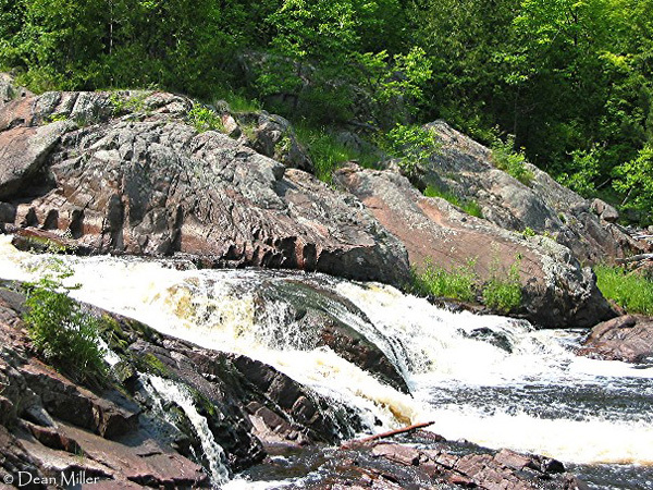
Access into the canyon below Copper Falls (listed as 28' total drop) is prohibited by Copper Falls State Park. Attempts to run the final half-mile to Devil's Gate may result in conflict with rangers. Access to Devil's Gate footbridge (first approved access point downstream of the falls) is via hiking trails in the park. Copper Falls itself appears to be a fairly simple drop (as falls go). The canyon downstream (at moderate-to-high flows) appears it could be a major handful. Scouting is anything from awkward, to difficult, to impossible.
Yes, there are folks who have gotten into the canyon and made this run. The 'featured video' (mentioned in a comment below, and listed in the 'Quick Facts' above) begins with multiple runs of Wren Falls, then progresses to the lead-in, Copper Falls, and the canyon. (Wren Falls is on Tyler Fork which is a tributary of the Bad River which (many miles later) cascades over Brownstone Falls toward the end of the gorge and towards the end of this video.)
Immediately after a tight twist to the left, Tyler Forks cascades down Brownstone Falls and slams into the Bad. Major wrapping currents take place here at moderate-to-high flows. (Though appear amazingly mild in the video above.)
This is the exit-point for those who would snag a bandit-run the gorge, and it is the first legal entry point to the river below the park headquarters.
Nov 13, 2015
Here is a video that shows the bad river starting around 2:35 into the video. The canyon section has two rapids with a 3-4 foot ledge hole at the end of the first rapid that could be problematic with too much water. Once you drop into the canyon you are committed to running everything blind, because you can't really scout it from the top. Warning for people with children, there is a little swearing in the last ten second of the video. https://youtu.be/3gtpS9sdCkA
Mar 28, 2011
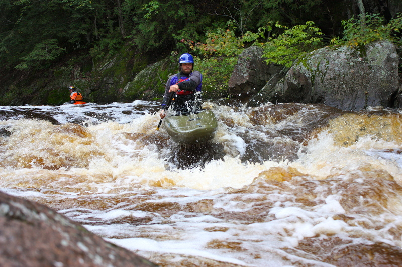
John LaGow drops into The Dome.
Mar 28, 2011
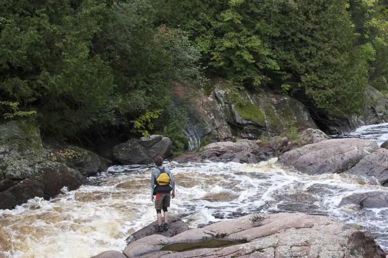
Thomas Bernard scouting the Birth Canal