Brushy Creek
1. Chisolm Trail Rd to CR 122 (Red Bud Ln) (5.5 miles)
| Difficulty | II+ |
| Length | 5.7 mi |
| Avg Gradient | 13 fpm |
| Gauge | Brushy Ck at Kenney Fort Blvd at Round Rock, Tx |
| Flow Rate as of 1 hour | 108 cfsbelow recommended |
| Reach Info Last Updated | June 22, 2024 |
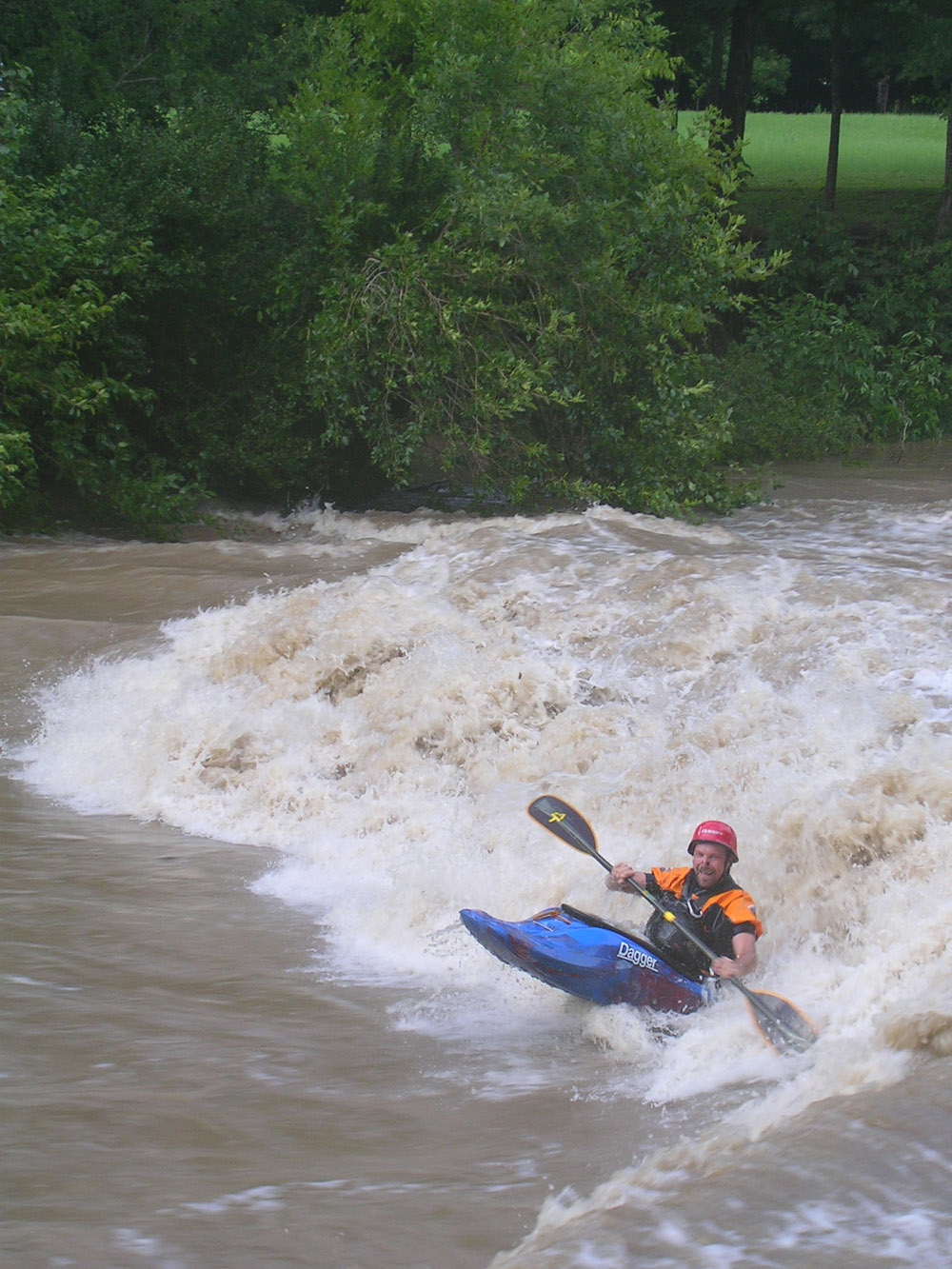
Scenic urban run in Round Rock, north of Austin. The upper part of the run has flat water and a 10-foot runnable dam, but the lower part of the run has some good play at certain levels. Whitewater boaters may choose to put in below the Veterans Park dam to avoid the first mile of mainly flat water. Texas Whitewater describes mostly small rapids but mentions some 'fine surf spots' in the last mile.
Beta from local paddlers suggests that 400 cfs is a fun level, but 200 cfs can get scrapey (especially in a canoe.) Strainers are a danger but not quite as bad as in the upstream section.
Distances and gradient measured using GIS tools in 2015.

Parking is available at Chisholm Trail Crossing Park, just south of the creek on the west side of the road, or behind the businesses directly along the little lake formed by the dam. Put in below the dam. The dam has a potentially deadly hydraulic even at flows as low as 400 cfs. At those flows, there is still enough headroom to pass through the tunnels under Chisolm Trail Road (but be on the lookout for potential debris piles, especially if the creek has flooded recently.)
The namesake round rock of Round Rock is located just downstream of Chisholm Trail Road. After the round rock, you will immediately enter shallow, spread-out rapids in which you might drag the bottom at lower flows. Look for the ruts on the left bank, left over from the days when wagons crossed the creek here.
Cross under I-35 and a pedestrian bridge. You’ll enter a short flat section by Memorial Park.
This low-water crossing has a culvert in the center, which is a potential sieve hazard. Portage on river right.
Public access and parking on river right (Memorial Park)
This is the most technical set of rapids on the creek. Lots of boulders and some broken concrete make it difficult to pick the right line, especially in a canoe. After the rapids, you enter the lake by Veterans Park.
Texas Whitewater suggests that this ten-foot dam can be run in the middle 'with momentum', but beta from local paddlers suggests that no one has done so in recent years. Portage river right.
Immediately after the dam are more fun rocky rapids. After that, there are no more rock gardens, but the creek still flows nicely.
Public access and parking is available on river right (Veterans Park)
Must-portage hazard. This low-water crossing was the site of a rec boating fatality in 2010, during which a paddler flipped and swam and was pinned against debris on the upstream side of the crossing. Stay aware and portage river right.
After Lance Ln, there aren’t as many rapids, but the creek still flows and has plenty of turns.
Public access and parking on river left
Parking and access on river right directly under the CR 122 bridge. Stay within the county easement next to the bridge. Do not access the creek using the low-water crossing just downstream of the bridge, as it abuts private property and can represent a hazard to navigation at certain flows.
May 28, 2024
BE CAREFUL!
Recent rains have downed large trees creating very dangerous situtions. Large tree down before lance st low water crossing.
Aug 27, 2017
Floated at 660 and 460 cfs. Nice surf-able waves to catch on the fly. At 460 long fast moving stretches where a swim might be longer than expected. Lance Ln low water crossing is fast and dangerous at these levels. Multiple strainers that appear at different places from flooding. At 460 took some novice kayaks and are lucky to have made it out with everyone. HIGHLY RECOMMEND experienced paddlers. At lower flows may be more technical.
Aug 11, 2005
No description needed
