Salmon, South Fork
Near 15-Mile Marker to Matthews Creek River Access(South Fork Gorge)
| Difficulty | IV-V |
| Length | 5.6 mi |
| Avg Gradient | n/a |
| Gauge | Salmon R a Somes Bar Ca |
| Flow Rate as of 42 minutes | 273 cfsbelow recommended |
| Reach Info Last Updated | May 20, 2025 |
One of the more challenging and scenic runs in the watershed, the South Fork Gorge has technical and powerful Class IV-V rapids intermixed with easier rapids all the way from the Lagarde river access put-in immediately upriver of the 15-mile marker on Cecilville Road to the take-out at Matthews Creek upstream of the nine-mile marker. It can be run at a wide range of flows and its character ranges from tight and technical at low water to stout and powerful at medium to higher flows.
Wood hazard warning: the river left side of this entire run burned in the 2021 River Complex and the 2020 Red Salmon Complex. You'll see signs of the burn along the river. Be aware that there's a significant increase in wood entering the river here after the fires. The wood is dynamic and moves frequently. There's an abundant amount of wood lining the banks that will move at high spring runoff flows. Be alert!
There's a nice warm-up section below the put-in that builds slowly as the river winds its way toward the soaring Limestone Bluffs. The pace begins to pick up as the river flows toward the base of the bluffs with riverside walls that offer challenging rock climbing on the river right bank. Look for the white chalk marks and bolts that climbers have left behind on this overhanging pitch known as the Fly Froggie Wall.
About a half mile below the put-in, the river squeezes through a very narrow micro-gorge with a fun but short set of drops. Locals sometimes put in here using a path that comes right to the micro-gorge from Cecilville Road. Smaller rapids and moving pools are interspersed for the next bit. Be sure to turn around to look upstream in this stretch: the biggest views are behind you and you don't want to miss them!
The pace continues to build in alternating rapids and pools until the rapids start getting longer and you've reached the first significant Class
...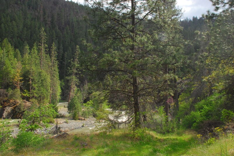
Located just upriver and within sight of mile-marker 15, a steep dirt road angles off Cecilville Road to reach a small parking area with a double track path from there to the river. The dirt road can only be accessed if you are driving in the upriver direction, so if you're coming from Cecilville rather than Forks of Salmon, you'll have to go to the pullout out a short ways downstream and swing a U-turn.
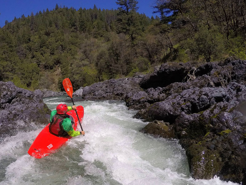
The river gets very narrow for an extended reach and culminates with a steeper drop before exiting this little gorge.
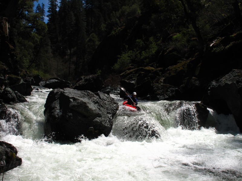
This rapid involves a long lead-in and culminates with a five-foot ledge drop that features a nice launch flake right of center. The approach can be technical and there's a hazardous undercut rock right above the ledge that has sadly claimed the life of a kayaker. The final part of the drop is best run by stopping in the last river left eddy then peeling out and charging to right of center to launch the flake boof.
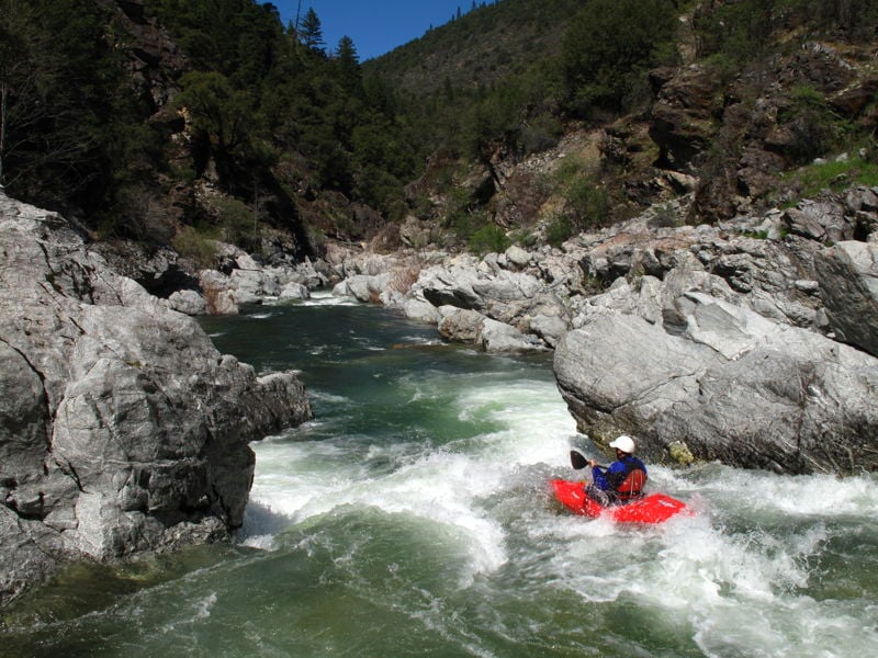
This is a good one to scout from the left if you're unfamiliar with the run. At medium and higher flows there's a stout hole at the bottom, backed up by a rock that aids recirculation. The line is on the right, following a fold of water that leads you to a ramp or flake at a break in the hole. At low flows the ramp is bumpy and the hole isn't as big.
As the name implies, this isn't Amusement Park but it has some similarities. The current zig-zags and just when you think it's done, there's one more part of the drop. A long pool separates this fake from the real ride just downstream.
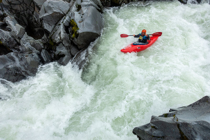
Amusement Park dishes up a boisterous ride as the river narrows down to a tight gorge and the water zig-zags and richochets off the walls. If you're in sync with the zigging and the zagging the ride is fun. If you're out of sync, watch out for a couple corner pocket eddies that are surprisingly stong and can detain you against the vertical rock walls as you struggle to regain the main flow.
There's a short lull in the rapid after its narrowest part and then one more part where the river drops over a rocky ledge before you're done.
A long, complex slalom course through boulders. This rapid changes more than others and is fed by a landslide on river right. There are plenty of options to collide with rocks here but there are elegant clean lines too. Beware of pin potential and wood in narrow slots.
This rapid is just above the final gorge and arguably could be considered the entry rapid to the gorge. Most of the river is pushed over to the river right by large rocks on the left. The water ramps down onto a pyramid-shaped rock that splits the current. If flows allow, launch right over the left side of the pyramid rock.
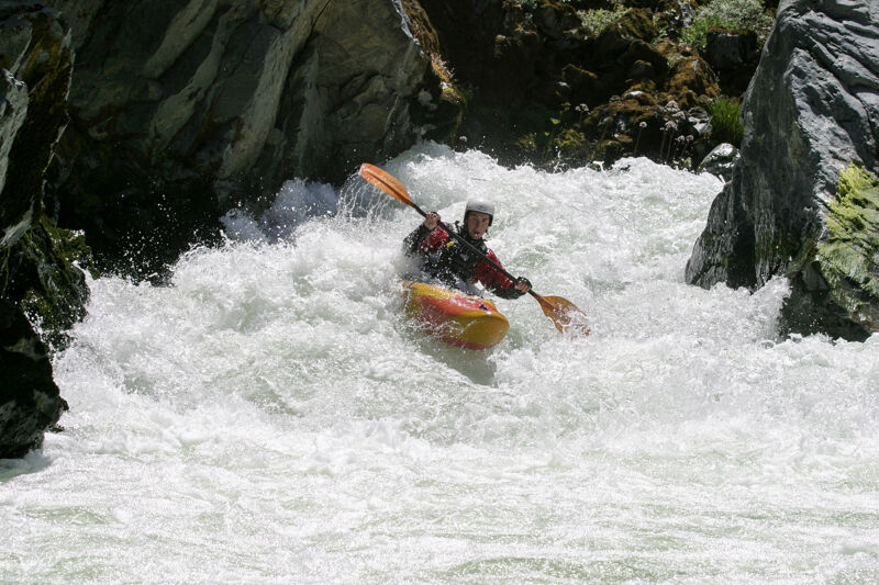
The first of the final three drops is also the most blind. You can boat scout from the pool at the top, but this doesn't yield a conclusive view of the line. The middle and the left side of the river are chunky, bouldery, and contains undercuts and sieves. Don't go there. Instead, follow the current toward the right. It makes a 90º left bend where it is forced that way by the river right canyon wall. Follow the water and build speed to punch the speed trap hole at the bottom. There's a short pool before the next drop.
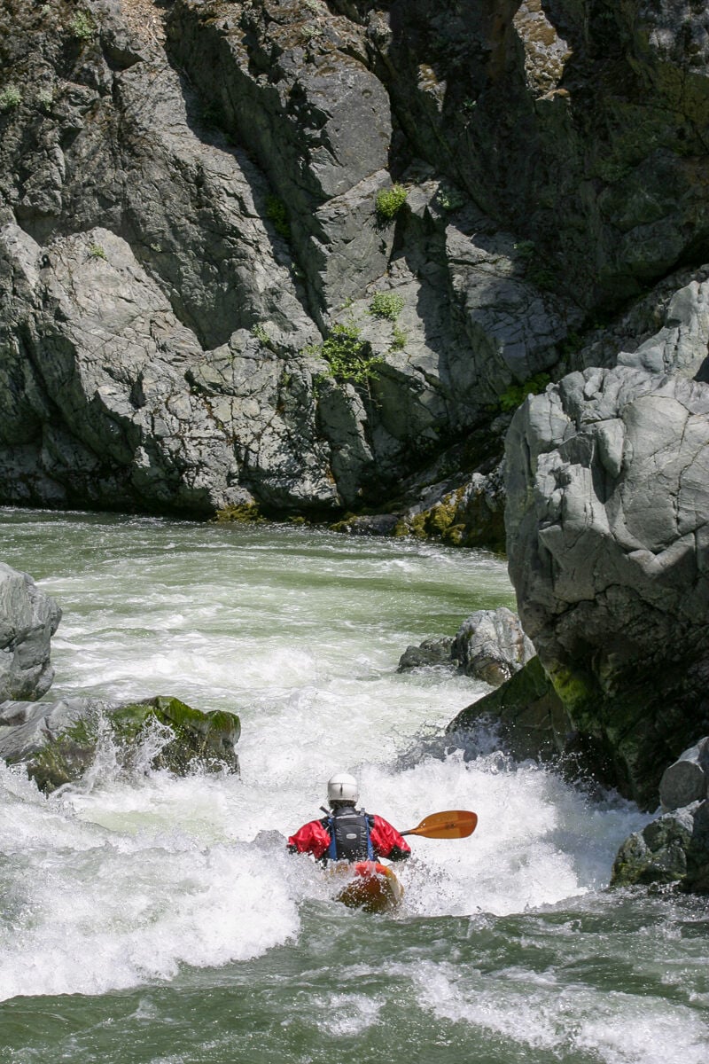
The shortest of the final three drops, this one is anarrow and boisterous pinch between rocks on the left and the canyon wall on the right. In the old days of long boats, kayakers feared this drop as several suffered the fate of getting caught sideways and having their boats fold in half at the pinch.
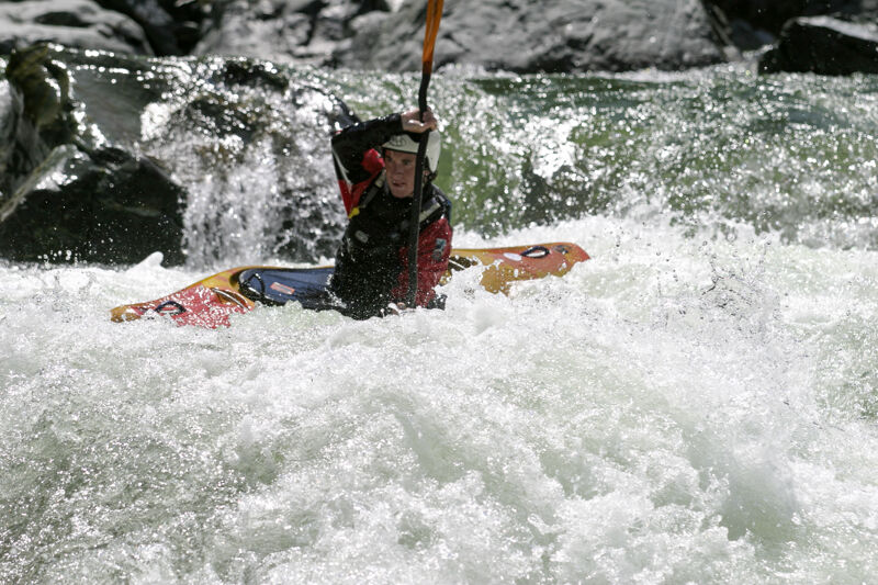
If this had a name, maybe it would be Final Falls. It is the last rapid of this run before the take-out at Matthews Creek. The prominent feature of the rapid is the ledge drop at its entry, which forms a stout hole at certain flows. There are a couple variations on a sneak entry on the right to avoid this hole or you can run it and try to skip over. The rapid continues below this ledge before one final plunge into a deep rock-walled pool at the bottom.
Take out at the Matthews Creek River Access. Follow US Forest Service road 54D0022 downhill from Cecilville Road (near mile-marker nine) to reach the river. This is downstream of Matthews Creek itself as well as downstream of the campground. As of May 2025, the river access road is marked by a sign along Cecilville Road.
Feb 19, 2019
A great day on the river in February, prime time for Salmon River boating. Recent rain and a warm spell brought flows up above winter base flows and made for a good run. At 2,600 cfs on the Somes Bar gauge all the rapids have ample water but some of the in-between sections where the river widens and flattens out felt like they could use a little more. I call it the low end of medium flow. Paddlers run this section much lower and much higher than this flow.