Peshtigo
B) Burnt Bridge (FS2134) to Goodman Park Rd (FS 2136) (6.1 miles)
| Difficulty | I-II+(III) |
| Length | 6.2 mi |
| Avg Gradient | 18 fpm |
| Gauge | Peshtigo Approximation at Ccc Bridge |
| Flow Rate as of 39 minutes | 78 cfsbelow recommended |
| Reach Info Last Updated | September 7, 2020 |
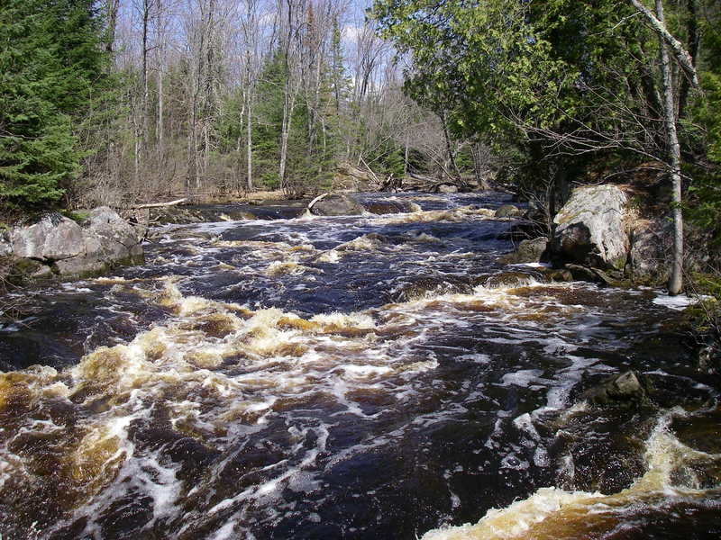
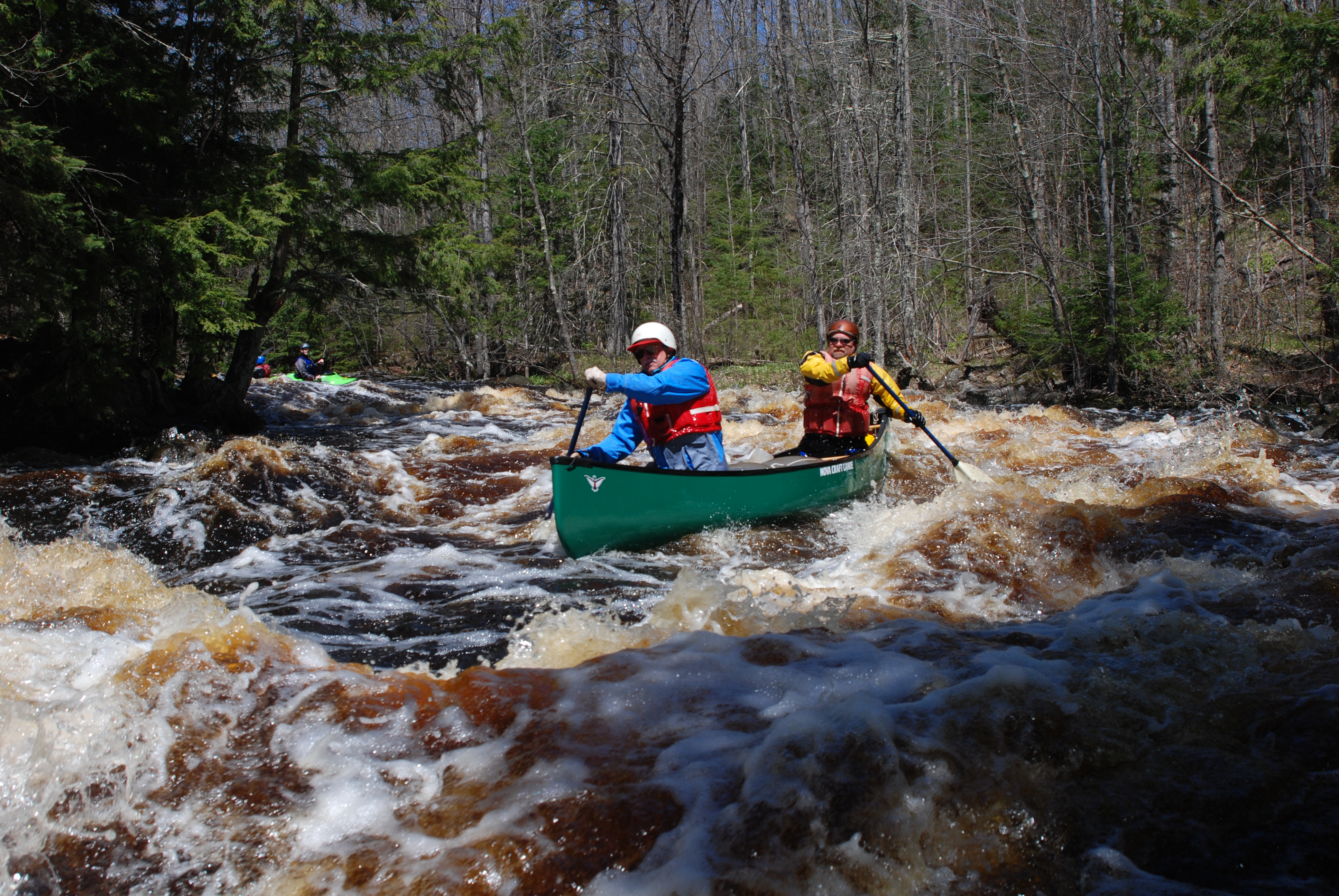
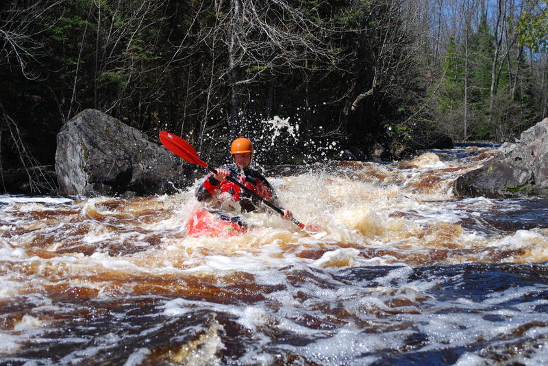
This upper section of the Peshtigo is a scenic run through the Nicolet National Forest. It is a good run when flows are most with several long sections of class II and two distinct class III rapids.
The put-in at Burnt Bridge provides convenient access on the downstream river right side of the bridge. There is also a primitive camp site here.
After a short warm up you pass Armstrong Creek on river left and then the river drops into Michigan Rapids, a distinct horizon line with the river taking a hard turn to the right. A portage and scouting trail are available on river right. There is a good recovery pool at the end of the rapid but the river continues through a long section of class II.
The river continues through more class II and short sections of flatwater but maintains a good consistent flow as you pass through mixed deciduous and conifer forest.
As you approach a major island about halfway through the run you will see the distinct horizon line at the river right channel that marks Ralton's Rip also known as the Dells. You can scout the rapid by getting out on the island and it is a good idea to check for wood hazards. The first half of the rapid is visible from the top but then the river channel bends to the left and out of site around the corner. The run out below includes more fun class II.
Below Ralton's Rip there are some more sections of class II before you start to see more cabins and the gradient begins to taper off. The Goodman Park Road Bridge soon comes into view. Good access is available on the downstream river right side of the bridge where you can also find a primitive campsite.

USGS lists a sampling site at our listed put-in with drainage area of 203 square miles, or .454 times that of the active gauge, thus flows here could be about 4/9ths or 5/11ths that gauge's reported flow. By our take-out, drainage has increased to about 269 sq.mi. (an increase of ~33%).
An island splits the flow. To the left, the river is (fairly) tame. To the right, a complex series of maneuvering awaits. A series of ledges and waves ensues until the currents from the other channel rejoin. At high flows, this will be a hand full.
This rapids lies downstream of the listed take-out, and just upstream of the recommended put-in for the next section of river. Since it is such a minor rapids (easy boulder garden rapids), and nothing else is gained but flatwater mileage, we recommend using the listed take-out for this reach.
Mar 30, 2017
Two videos from this run
Dells - https://www.youtube.com/watch?v=Subpvotgpcc
Michigan Main - https://www.youtube.com/watch?v=adYTrvVKML0
May 3, 2009
One of those things you see on the river!
Looking up to the Dells entrance filled with trees as usual.
Looking down the dells.
Apr 21, 2002
Running Michigan Rapids and the Dells.