Eau Claire (Wisconsin R. trib)
A) Spring Brook Bridge (Nolan Rd) to Hwy.52 (2.8 miles)(Quarry Section)

| Difficulty | II |
| Length | 2.9 mi |
| Avg Gradient | 13 fpm |
| Gauge | Eau Claire River at Kelly, Wi |
| Flow Rate as of 38 minutes | 0.42 ftbelow recommended |
| Reach Info Last Updated | September 7, 2020 |
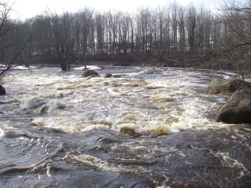
Old river guide books called the two drops on this run 'Master Ledges' and 'Bader Ledges'. (Ahh, the old sense of humor.) More modern books list them as 'Ledges' and 'Three Row Falls'.
Bryan Foster offers:
The first ledge is signaled by a bolder garden, and has a nice hole for play. This is followed by a small island, with the right side offering more interest at higher levels.
After some boulder gardens you come to the first drop of Three Row Falls. At medium to low levels the right side is scrapy and the left side offers some side surfing at the base. A short rapids leads to the final drop of Three Row Falls, which is a 4' ledge. The right side is a sheer drop, and can provide some stern squirt possibilities. The left side is a class II rapid.
You can paddle this at levels down to 1.4' if you don't mind technical boulder gardens, as the main rapids and access paddle are quite runnable. (Mind you the gauge is down river a ways and after a dam).
Thanks, Bryan!

Our listed put-in is actually on Spring Brook, a tributary of the Eau Claire, with 66 square mile drainage.
Combined drainage area at the confluence with the Eau Claire is about 280 square miles.
By our listed take-out it is 295 sq.mi. (an increase of just over 5%).
At the gauge (a long ways downstream of these whitewater sections of river), drainage is listed as 375 sq.mi.
Thus, flow at the confluence of Spring Brook and Eau Claire might be expected to be very nearly 3/4ths that gauge reading.
Rock-garden rapids may continue about a quarter-mile here.
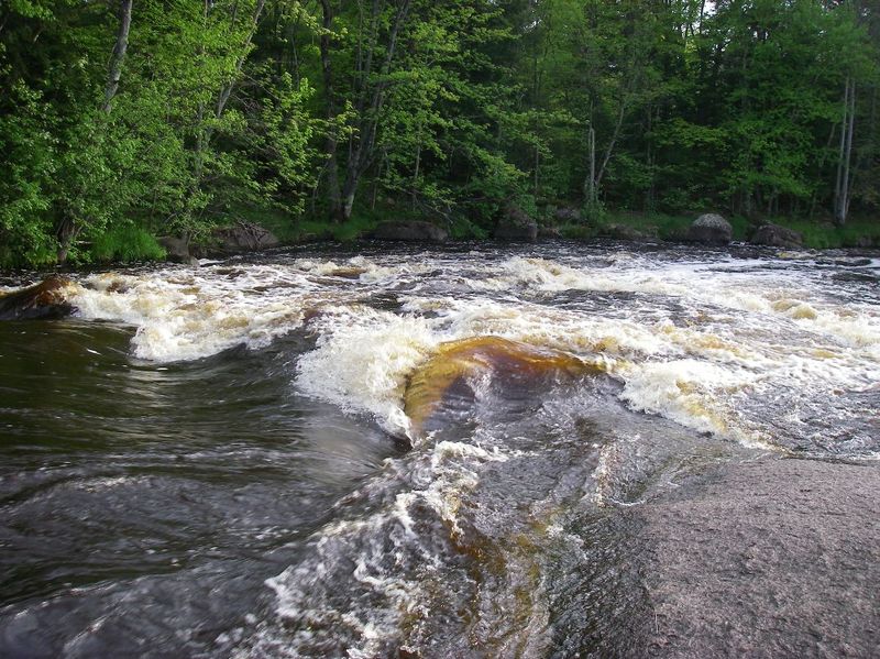
A very nice bit of bedrock and boulders make (with good flows) some interesting wrapping waves and good surf spots as the river takes a good zig-zag.
Boaters interested in the briefest, most concentrated trip and generally best rapids on the upper stretch of this river will likely take out at Hwy.52.
Boaters wanting a longer run may continue downstream to the parking area above the dam in Eau Claire Dells County Park.
This will add very nearly 4 miles, mostly flatwater, but with some areas of boulder-gardens (likely class I rock-dodges, though at some flows perhaps a couple class II-ish rapids).
(I will confess, I've never paddled that four miles. The above characterization is based solely on aerial views from Google Maps. Anyone who has paddled that section of river is encouraged to either confirm the above or provide better description!)