White (Bayfield/Ashland)
B) Hwy. 112: Dam to Powerhouse (0.25-0.43 mile)
| Difficulty | II-III |
| Length | 0.2 mi |
| Avg Gradient | n/a |
| Gauge | White River Near Ashland, Wi |
| Flow Rate as of 1 hour | 184 cfsbelow recommended |
| Reach Info Last Updated | April 2, 2019 |
Short, but interesting intermediate run, routinely runnable due to generation demands. The best section is a short, dewatered bypass reach which can be run without doing a shuttle by taking out just below the power plant (river-left) and hiking back to the put in.
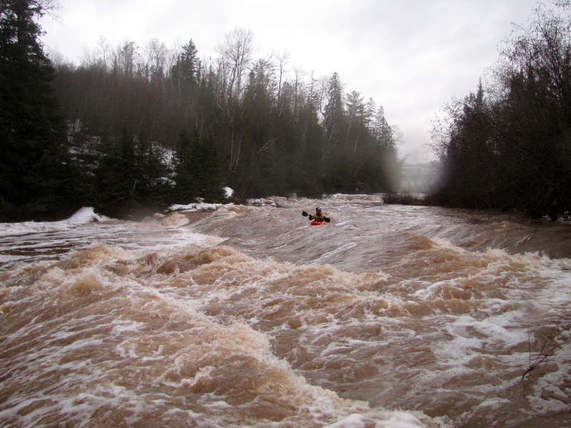
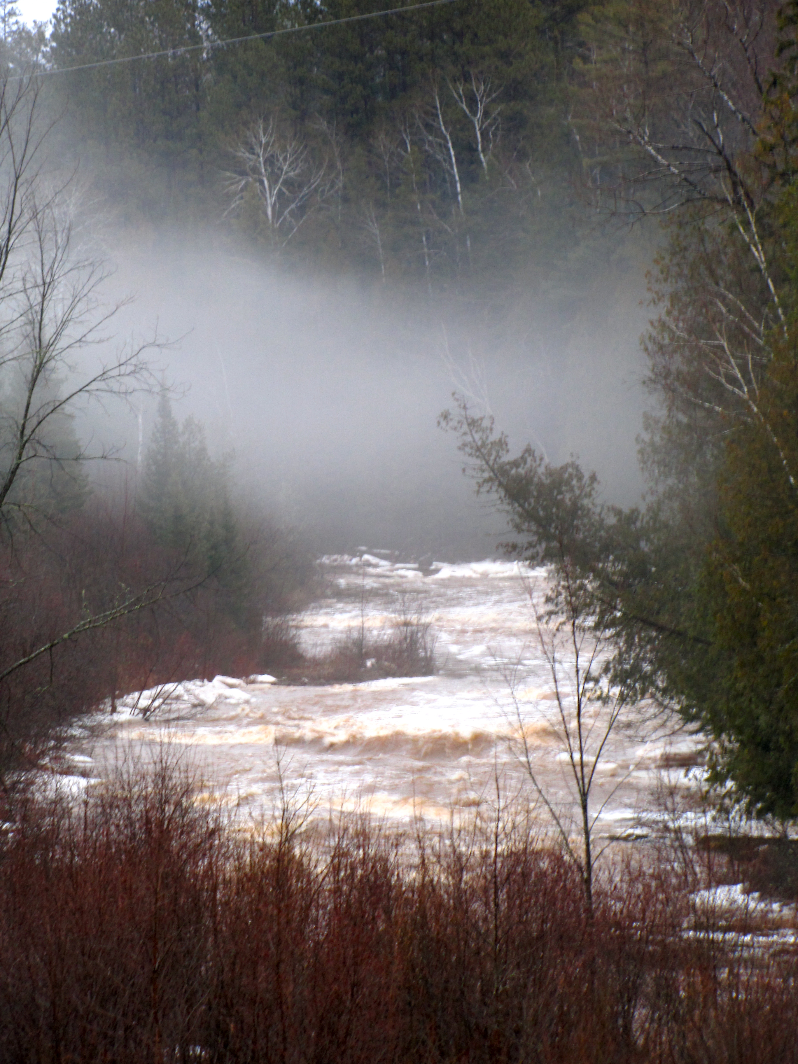
This will be pretty shallow at flows below 500 CFS. At higher flow it can be very pushy with very powerful eddies and will likely be a bit intense for beginner paddlers. This quarter-mile has a series of diagonal ledge-drops with interesting waves and holes. The river bottom is very sharp and has given a number of paddler’s bloody knuckles after a flip/swim. (Be very aware of this especially if play boating!) This run generally opens ('ices off') before other south shore runs, and makes a great after work or school run.
Be aware that the large eddy at the put in can be very powerful and can surprise a beginner paddler. Also, at most flows, make sure to stay well-away from the powerful hole at the base of the dam!
(Note: GoogleMaps seems to have mislabeled the river downstream of the dam as the Bad River rather than the White River. Many, many miles downstream at Odanah, the White does flow into the Bad.)
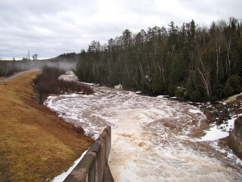
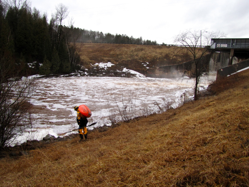
You'll likely want to park down near the powerplant and carry up from there. Put in well away from the dam (and the wave/hole at its base/outflow) and be ready to rip-snort out of the pool into the immediate action.

There appears to be one additional small ledge downstream of the powerplant. We have no information regarding whether it creates any whitewater (runnable or playable feature) at any flow which would make the other three listed ledge/sequences interesting. It appears likely to be far less interesting than the other three, and more-than doubles your walk back to your vehicle, making it unlikely to be worthwhile, though we have no confirmation of that. However, since it lies downstream of the powerplant, at times when all ledges in the main series are dewatered, there may be flow to this final ledge which could provide play (if the ledge, indeed, creates a wave or hole).
Anyone have any info? Add a comment, report, or photo/video!
Jul 17, 2016
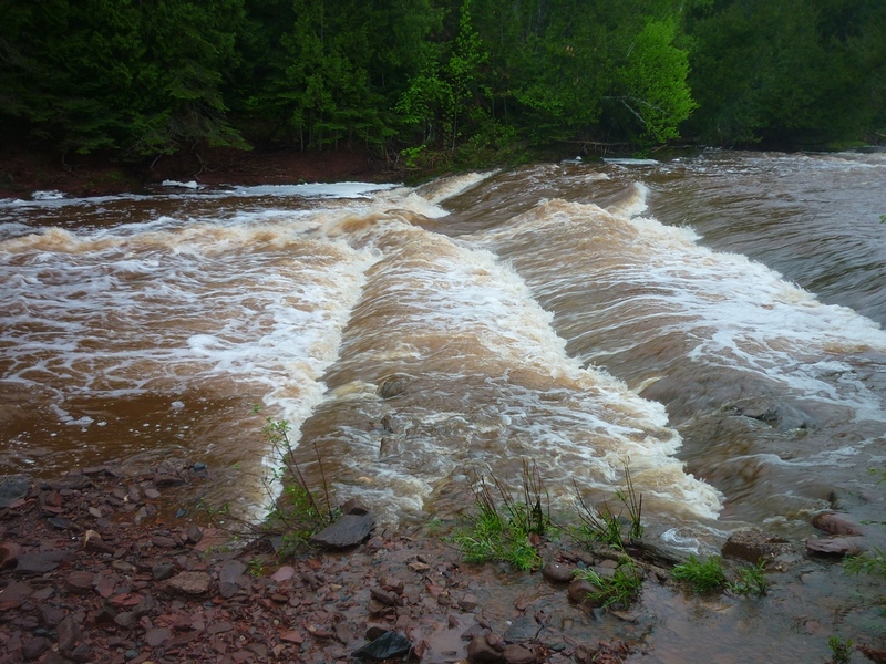
I included a look at this section as part of a 2016 Memorial Weekend outing. As shown in photos uploaded and linked into features/rapids detail, at a gauge reading while I was there of 660 cfs (below the powerplant at the end of the bypassed/boatable reach), this looked very boatable . . . even a bit meaty/juicy in places. (I didn't boat it since it was late in the day and I was eager to get someplace for dinner.)
May 28, 2016
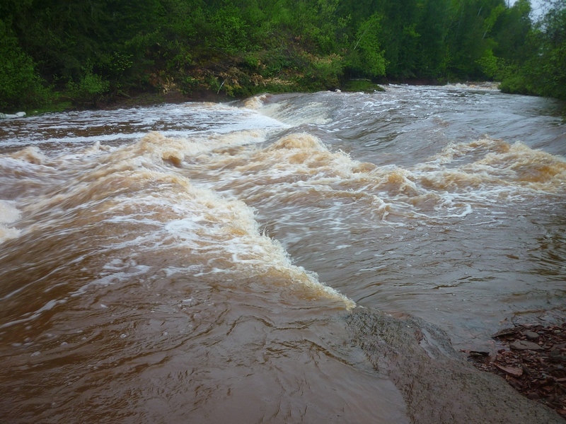
Smoothest down the middle, a bit dicey (depending upon flow) to the left.
May 28, 2016
Very similar to the second ledge sequence, with the likely 'best' route down the middle, and potentially sticky ledge/holes to river-left.