Salmon, South Fork
4. Methodist Creek to Forks of Salmon(Methodist Run)
| Difficulty | III |
| Length | 6.7 mi |
| Avg Gradient | n/a |
| Gauge | Salmon R a Somes Bar Ca |
| Flow Rate as of 1 hour | 277 cfsbelow recommended |
| Reach Info Last Updated | March 11, 2026 |
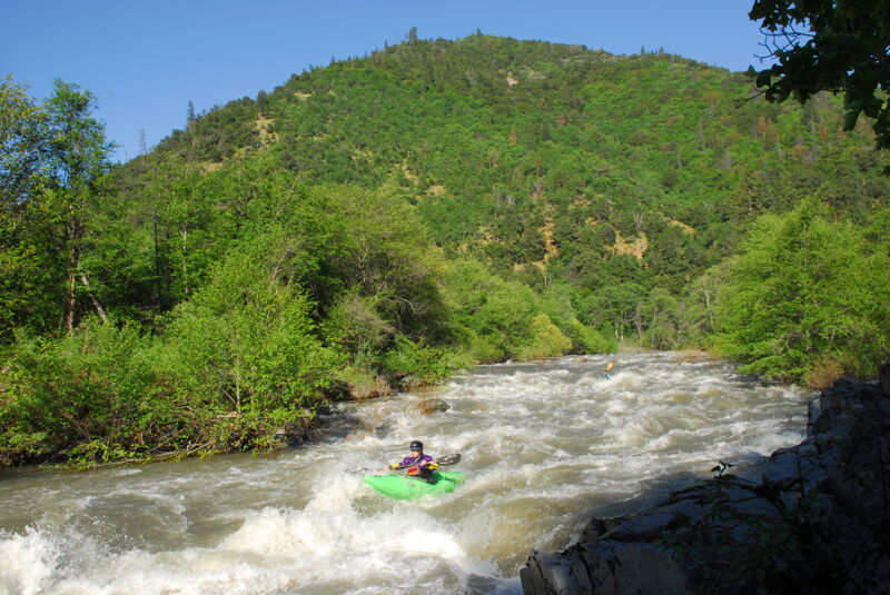
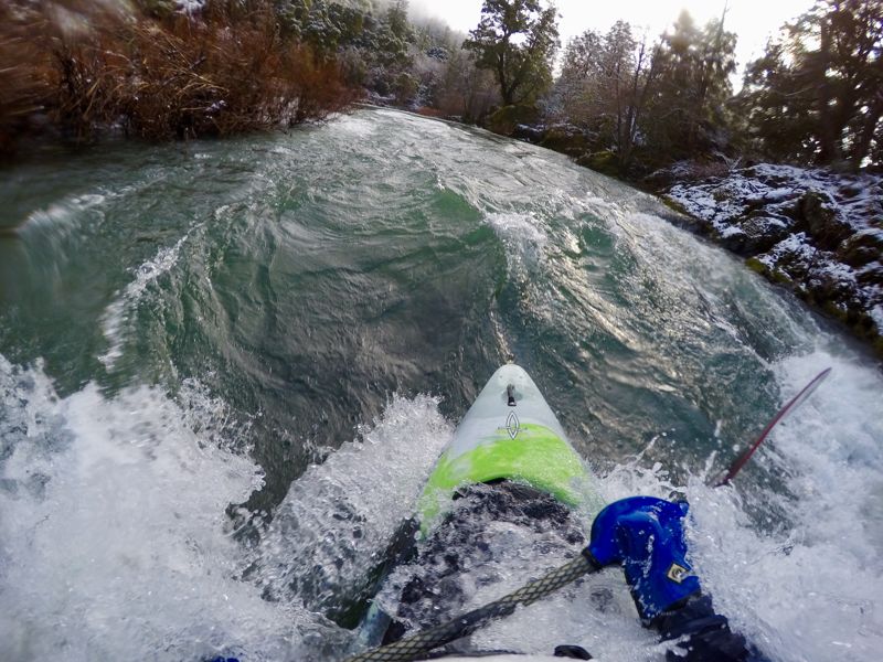
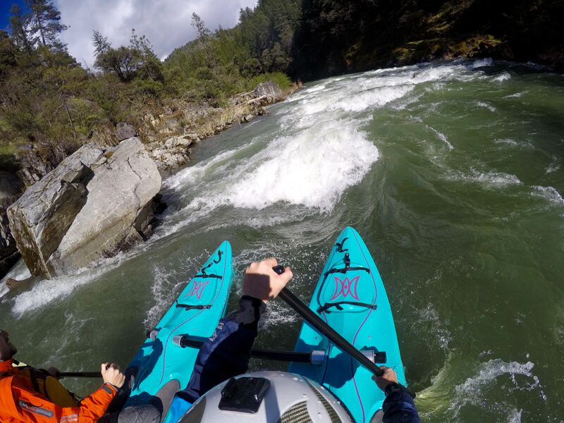
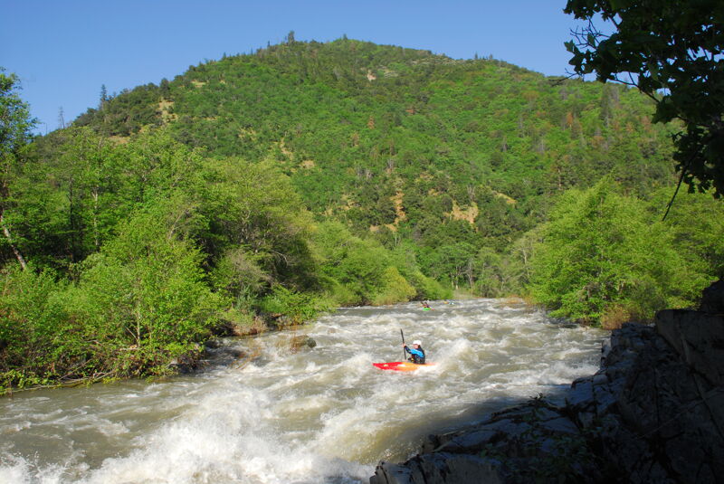
Perhaps the most popular run on either of the Salmon River’s two forks, the Methodist Run from Methodist Creek River Access to Forks of Salmon offers six miles of intermediate difficulty whitewater suitable for all types of whitewater craft. The run is technical at lower flows, full of play at medium flows, and has lots of large waves at high flows.
Class II rapids begin just below the put-in and keep up their pace in the first half mile before the first long pool on the run. The river then bends right and the gradient increases slightly and the river picks up pace, but always in a pool-drop arrangement. At high water, rapids start to flow together.
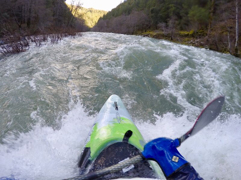
The Elvis Trilogy provides the first taste of the Class III drops on this run with Elvis Presley's Mother (III), Blue Suede Shoes (II+), and Graceland (III). After this trilogy, the river continues with mostly Class II and easy IIIs for a couple miles, going underneath Cecilville Road along the way. The gradient decreases slightly in the middle section of this run but there's enough to keep anyone interested. Most of the rapids in this middle section of the run are unamed, but the longest one is named Highway and can be easily seen from the road during shuttle.
About a quarter mile below the confluence with Knownothing Creek (river left) the river flows over a wide boulder bar that is shallow at all but high flows. Rafts may need to offload and push and even kayaks and packrafts will have to bounce their way across the boulders to get to the main flow that re-accumulates on river left. This is the only boulder bar in the Salmon River system that challenges boaters in this way at regular flows.
After the boulder bar, the river passes Missouri Bar and enters a narrower gorge. The gradient increases, the river narrows, and rapids become more exciting. It is this section, the lower two miles of the South Fork Salmon, that offers the greatest concentration of rapids on the Methodist Run. Named rapid
...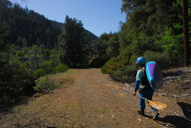
The put-in is located at the six-mile marker on Cecilville Road, immediately on the upriver side of the bridge over the SF Salmon on the river right. Most kayakers park in the narrow pull-out and walk the short but steep user trail to the beach below. Rafters often use the short spur road about 150 feet upstream of the bridge where there is a small parking spot and an undrivable old roadbed from there to the beach (do not try to drive to the beach: vehicles get stuck and tow trucks take a very long time to get here).
This straightforward but sometimes bumpy rapid is unusual because it is on the inside of a bend in the river, a quirk of the bedrock slope and boulder accumulations. There's a big eddy on the bottom left with a fun stern squirt eddy line at certain flows.
First rapid in the Evlis Trilogy, recognizable by a long, short cliff wall on river left that leads to the top of the rapid at the top and a large boulder on the left at the entry. Avoid the hole by the boulder and navigate the rapid below on the left or left of center.
Second and shortest rapid in the Elvis Trilogy. The eddy on the right provides service to a surf waves at some flows.
Third and final rapid in the Elvis Trilogy. Run center to left and back to center, avoiding the hidden rock in the middle near the top by moving left in time.
Long rapid in plain view of the road. There's a dilapidated swinging bridge over the river at the bottom; this used to provide access to a home on a mining claim on river left.
Short rapid with a sizable hole on the left at some flows. There's a smaller play hole just below on the left, upstream of the Cecilville Road bridge.
Long constant gradient rapid below Windy Bridge (Cecilville Road).
Rapid on lefthand bend in river. Begins as constant gradient over bouldery riverbed and ends with a sloping ramp into a short pool. A large hole forms at the bottom of the ramp at high flows.
Long, technical rapid that flows through a boulder garden before narrowing down and making a hard right turn where flows converge at the bottom. This rapid is highly visible from Cecilville Road, the 'highway.'
This free roadside and riverside campground also provides walk-in river access. The site has a bathroom, tables, and fire pits but no potable water or trash service.
This rapid is marked by the obvious retaining wall along Cecilville Road on the left. Current piles up on a boulder on the left bank, creating some weird currents and seams. Wood sometimes gets lodged to the left of the boulder in a swirling eddy. A few rocks, holes, and waves are in the long runout, and there are some surf waves at high flows.
Upper Indian Crossing is a long rapid that goes around a left-hand bend in the river. It starts as a broad current passing over a bouldery river bed but as it swings around the bend, the river is pinched by bedrock and boulders on the right, focusing the flow to the left where it passes thorugh a pinch with either a wave or a decent-sized hole depending on water level. There's another hole/wave below then the river enters a pool separating this rapid from Lower Indian Crossing.
Lower Indian Crossing is a fairly short ledge-style drop but with a pillow rock that forces the flow hard to the left. At low to medium flows the boating line cuts right to left immediately in front of the boulder. If there's enough water pillowed on the rock, the pillow can be banked or boofed. The pillow rock is submerged at high water and at flows above about 7,000 the line is to the far right of the boulder and ledge. There's a short pool at the bottom left then a bouldery drop follows quickly.
The river drops over a chunky boulder bar immediately below Lower Indian Crossing. At lower flows expect some hard bumps through the rocks. At medium flows there are narrow, clean lines through but the challenge is seeing them from above. At high flows the rocks are submerged. A large pool is below.
McNeal Creek enters on river left at the top of this bouldery rapid that hosts an obstacle course of holes, rocks, and eddies. An assortment of overhead cables and pipes across and high above the river provide a visual landmark. It is the last significant rapid of the Methodist Run.
The town is named Forks of Salmon, but where the South Fork and the North Fork converge is the forks of the Salmon River. There is often a volume and color difference between the two forks, with the South Fork being slightly higher flow and usually less transparent than the North Fork.
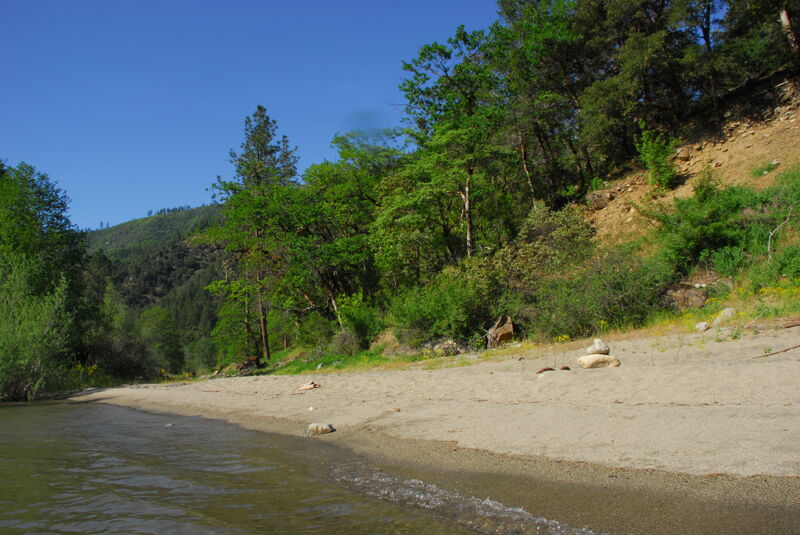
The take-out is on the mainstream Salmon River, about 1/3 mile downstream from the confluence of the two forks. From the river, look for the large sand beach on river right just before the current picks up into Horn Rapid (II). In essence, this beach is directly below the Forks of Salmon Elementary School, although the school cannot be seen from the river.
To find the take-out by vehicle, follow the dirt road downhill from the 17-mile marker on Salmon River Road, next to the school field and directly across from the white Community Club building. Keep heading in the upriver direction to reach the beach take-out; the road ends here. Park on the side of the road, not on the beach.
May 18, 2023
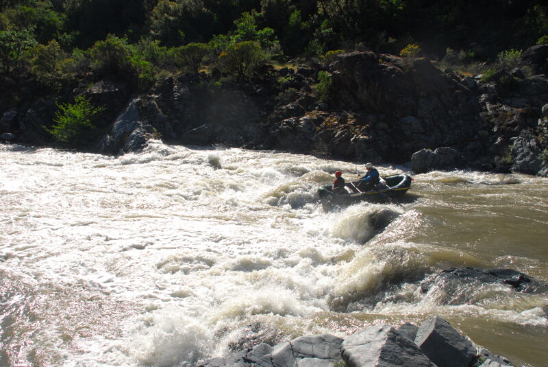
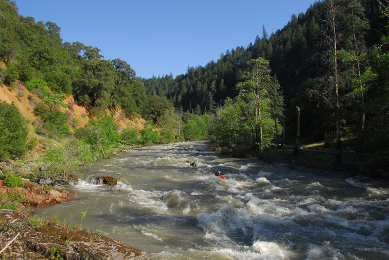
American Whitewater staff got our for an evening trip on the Methodist run that continued on down to Otter Bar. It was a great flow for this run with lots of bouncy fun whitewater and a few holes to avoid. For the most part the run was high-water class III+ with small eddies and swift current. Opinions differed on the rating of the last two miles but at this higher flow I would call it class IV, with Lower Indian Crossing being a particularly tricky rapid with a line that was not easy to see without getting out on river left to scout. We had a raft flip here but were able to pick up the pieces and continue on down the run.
May 16, 2023
American Whitewater staff got out for an evening trip on the Methodist run that continued on down to Otter Bar. It was a great flow for this run with lots of bouncy fun whitewater and a few holes to avoid. For the most part the run was high-water class III+ with small eddies and swift current. Opinions differed on the rating of the last two miles but at this higher flow I would call it class IV, with Lower Indian Crossing being a particularly tricky rapid with a line that was not easy to see without getting out on river left to scout. We opted to boat scout and follow the lead of Scott, our local guide who knew the run. Total float time for the run was 1:40 ending at Otter Bar Lodge where we caught a couple of surfs at the Otter Bar Surf Waves.