Pine (Wisconsin trib.)
Pine Dells: Center Rd to CTH.W (2.2 miles)
| Difficulty | I-II |
| Length | 2.2 mi |
| Avg Gradient | 17 fpm |
| Gauge | Prairie River Near Merrill, Wi |
| Flow Rate as of 36 minutes | 1.99 ftbelow recommended |
| Reach Info Last Updated | December 4, 2017 |
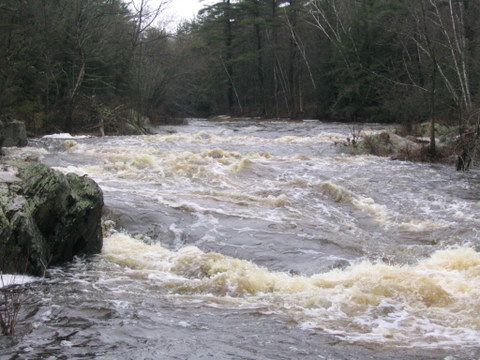
This fairly short reach passes through a steep-walled section. At higher flows there are few eddies and virtually no chance to exit the river (in the event of a swim) within the dells proper. Some fine surfing waves develop at low-to-moderate flows. There is one spot in the dells which may form a somewhat more significant wave/hole at certain levels which may be of concern. This run makes a great companion run for the near-by Trappe River.

At our listed put-in drainage area is about 118 square miles (per former USGS gauge site). At our listed take-out it is 121 square miles (as calculated by USGS StreamStats 4.0 Beta software). That is an increase of only ~3%.
Our reference gauge (Prairie River) has drainage of 184 square miles, so flow on this run *could* be ~0.641 times (or a bit more than 5/8ths) that gauge.
Sep 27, 2014
Make sure to wear some foot protection at the put-in. I saw some dirty needles there last month.
May 2, 2013
I ran this stretch today at really close to 1500 cfs and it was a lot of fun. There was a big wave train through the dells with a number a catch-on-the-fly surfs. About midway through the dells there is a hole that can slow you down if you are not paying attention. The rapid below the dells had some big surf waves and was easily runnable on the left. Everything was read-and run. 750 is also a good level for play although everything has more definition. All still easily boat-scouted and the bottom rapid is still run left.
Apr 1, 2007
That was ... amazing!!!
Aug 21, 2005
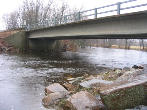
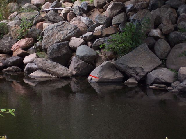
This pile of rocks is under the bridge (on the west side) at the put-in. If you can see the hole, go home. If you cannot see the hole, paddle on. Virtual red line indicates minimum.