San Joaquin
1. Mammoth Pool Dam to Mammoth Pool Powerhouse(Tied For First)
| Difficulty | IV-V |
| Length | 9 mi |
| Avg Gradient | 93 fpm |
| Gauge | San Joaquin - Below Mammoth Pool Reservoir |
| Flow Rate as of 30 days | 49 cfsstale data |
| Reach Info Last Updated | February 14, 2019 |
The San Joaquin River is one of California’s most significant whitewater rivers, flowing from the high Sierra Nevada through the steep granite walls of the San Joaquin River Gorge Special Recreation Area. It is also one of the most intensively developed hydropower rivers in the state. For over two [...]Read More
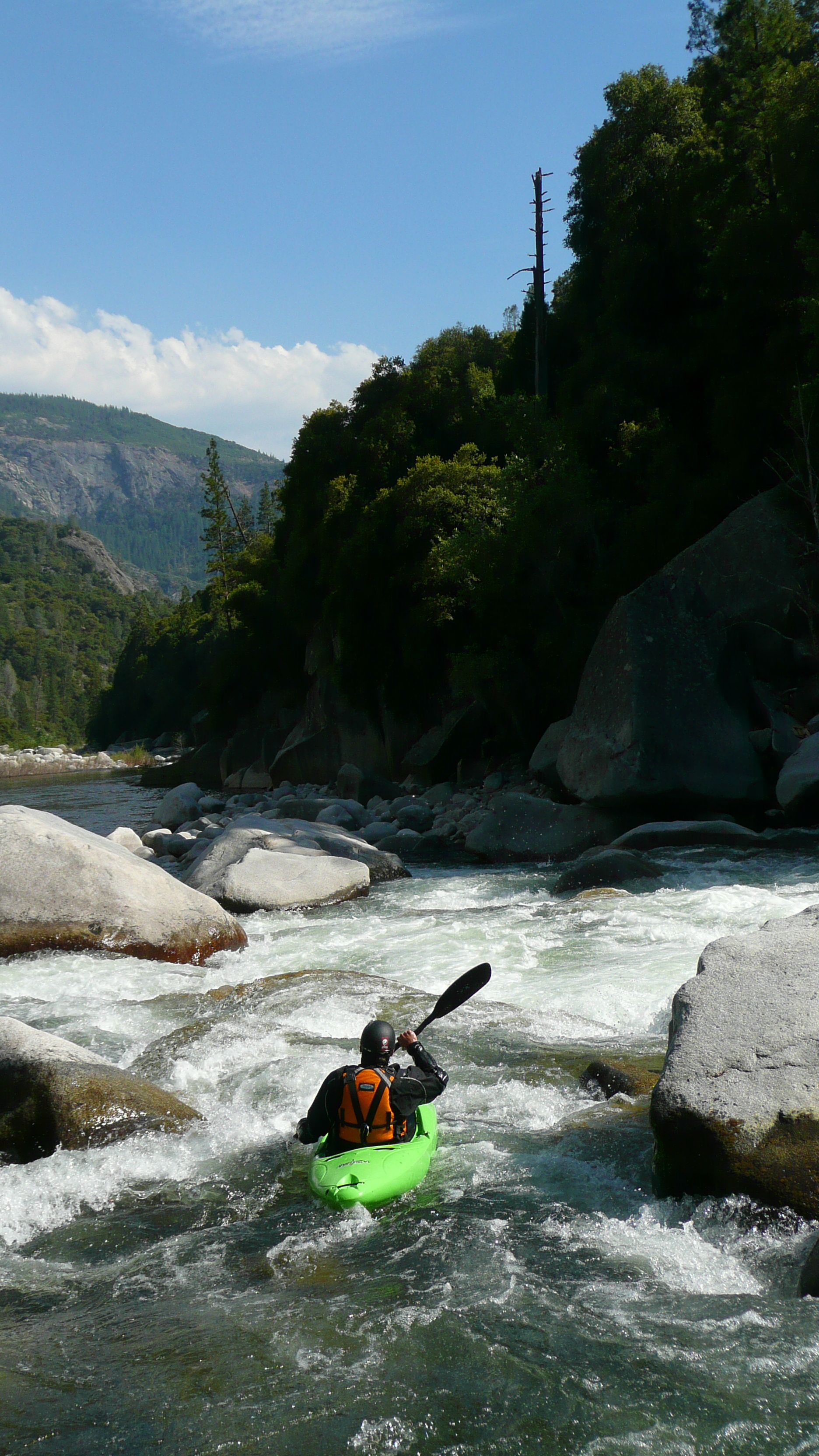
This is another classic section of the San Joaquin River that seldom sees much traffic. The canyon is a deep, impressive, beautiful granite gorge, with 20-30 rapids Class IV or greater. The middle section just below confluence with Rock Creek contains about 1.5 miles of continuous Class IV. Approximately 6 miles into the run the toughest rapid, “Zero to Hero” is encountered. This drop can be portaged on river left by rappelling 30’ to the pool below. TFF is significantly more difficult and serious than Horseshoe Bend but also much easier and less serious than the Chawanakee Gorge.
Boatable flows are available when Mammoth Pool reservoir spills, which happens in 6 out of 10 years according to Southern Calif. Edison. There are no gates on the spillway, so spill starts as soon as the reservoir level reaches 3,330 feet in elevation. In some years prior to spill, up to 1,000 cfs can be released from a valve at the base of the dam. On rare occasions such as the fall of 2011, releases can occur at other times.
Driving Directions: From the south take Highway 99 to Highway 41 north. In the foothills, turn right onto road 200 towards North Fork. Go through North Fork onto Minarets Road towards Mammoth Pool.
From the north, take highway 99 to Madera. Exit at the Millerton Lake - Yosemite turnoff. In Madera turn left onto W. Cleveland Ave, then turn left onto E. Yosemite Ave / highway 145. Follow highway 145 east to highway 41. Turn north and follow the same directions given above.
From Yosemite: Take highway 41 south to the Bass Lake road. Turn left to Bass Lake. Near Bass Lake bear left to the East side of the lake. Continue around the lake to North Fork, then turn left on Minarets Rd. Alternatively, if going directly to or from Mammoth Pool, it may be somewhat
...
Drive across the spillway on a bridge, park immediately, then hike down a road that leads to the base of the dam.
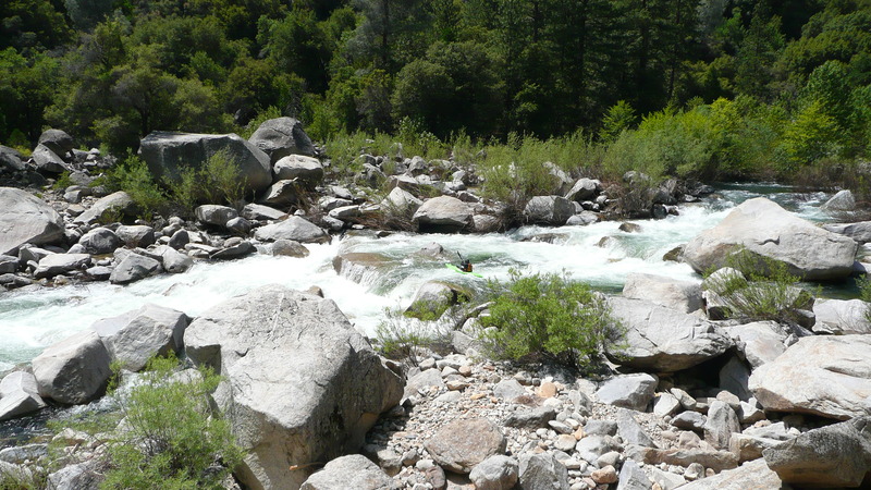
Typical rapids in this section are fairly long class 4 rapids with decent pools in between.

This dangerous rapid has a sieve on the right. Much of the flow pushes into the sieve, so it is a good rapid to portage.
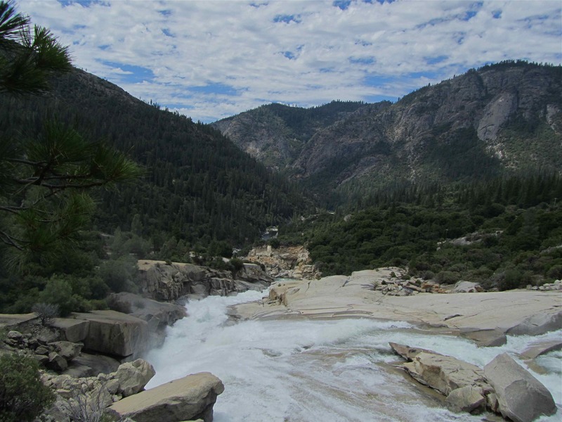
Rock Creek enters from the right just as the river curves to the left. It is obvious, as there is a huge scree slope on either side of the creek. This scree is rock removed from construction of the tunnel between Mammoth Pool and Mammoth powerhouse.
There is road access a short but steep distance up this creek. No doubt there are fishermen's trails from the road to the river. This could be alternate put in during the winter when access to Mammoth Pool is blocked by snow.
Below Rock Creek the class 4 rapids are very continuous for a mile and a half or so.
This is the approximate start of a half mile of continuous class 4 to 4+ moves, creating the most difficult section of the reach.
This hard rapid '.... links class IV+ moves with only small moves. A swim would be worse here than any other spot on the run. In my mind it is the crux of the run. Plus the rapids ends in a hole that swam one in our group, almost swam another. and swam one in Darin's first group. It is a huge hole that feeds into a cave. our swimmer was in the cave for maybe 1 minute before flushing out, same with our almost swimmer who held her breath for that ~minute upside down in her boat.' Daniel Brasuell 2011.
A very big rapid that is usually or often portaged. Portage on the left requires a short rappel into a pool at the end.
Below this point, rapids ease off to the end of the run.
Nov 4, 2011
Edison started releasing 1100 cfs on the morning of Oct 29, 2011. Both turbines at Mammoth Pool Powerhouse are offline for maintenance, so no water can go through the powerhouse. Edison needs to lower the reservoir and deliver water to their downstream powerhouses and to downstream water users. They have to send the water down the river bed. This release is expected to continue through the month of November and possibly into December. Changes in demand for the water could reduce or end the flows earlier.
Jul 11, 2010
Above the spillway......looking down the canyon.....trail to the put-in, is on the left
Jul 17, 2005
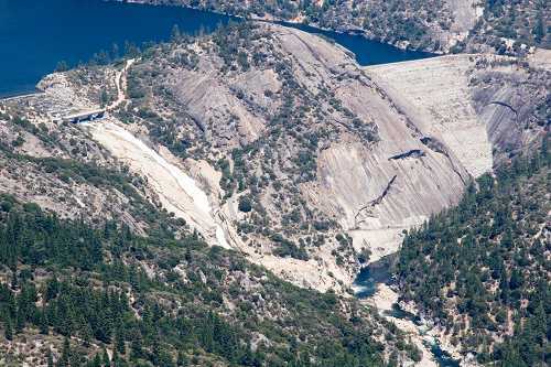
View of Mammoth Pool and dam and the San Joaquin backcountry, from the 'Mile High Overlook'.
Mammoth Pool dam on the right with the spillway on the left side of the dome. A dirt road follows the spillway down then traverses to the base of the dam. This picture is taken from the Mile High Vista on Minarets Road. The river is less than a mile from the road at this point and the dam is less than two miles in a straight line. It is about a 2,500 foot drop in elevation cross country. There is no trail at present, but if a suitable route is found it would make an all year access route and reduce the shuttle by about an hour one way.