Stony
FS Rd 424 to Birch Lake (5 miles)

| Difficulty | II-IV |
| Length | 5.1 mi |
| Avg Gradient | 35 fpm |
| Reach Info Last Updated | December 25, 2021 |
Whitewater action appears early in run (first 3/4 mile), followed by long, flat access paddle out (or a long carry back up).
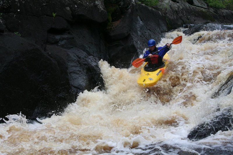
The main drops (at least, as named in the following video) are: Always Right, Triple Drop, The Box, and Desensitization Falls.
https://www.youtube.com/watch?v=8oMKNU6SNWQ
A Minnesota DNR gauge now exists right at the listed putin. We are unable to directly poll this gauge to display data, but you can check it online at:
http://www.dnr.state.mn.us/waters/csg/site_report.html?mode=getsitereport&site=72045001
If you run this river, help your fellow paddlers by providing gauge reading and your evaluation of it via a comment.
Check it out in this video from YouTube: https://youtu.be/GbHstZwGTF8

A MN DNR gauge exists very near our listed put-in, and lists drainage of 210 square miles.
First off, what follows in this listing is NOT based on first-hand knowledge of the run, but solely upon online aerial views. All rapids/feature 'names' used here are NOT meant to be names, but rather are merely descriptors. Anyone having first-hand knowledge of names which correspond to each or any of the features/rapids, and the appropriate class/difficulty rating, is encouraged to 'Add a Comment' or provide a report or other feedback to help your fellow boaters with proper information.
The first action appears to come less than a tenth of a mile downstream of the CR424 put-in bridge.
Rocky outcroppings appear to divert the flow into a combo drop that is likely to have a left-to-right route.
After nearly 1/3rd of a mile of fairly continuous boulderbed (this is the Stony River, after all!), you encounter a significant pool as the river takes a 90-degree bend to the right. This is the start of a loop/hook in the river. Not far out of the pool, the stony boulderbed continues.
The third more significant sequence occurs where more bedrock chokes the stream. It appears that a chute down the left may be a preferred route, though (depending upon flows) a route may open up more center-river.
After a short bit of runout boulderbed, a second pool is encountered. The river takes nearly a horseshoe bend to the left, encountering more light boulderbed rapids.
A much larger pool is encountered. Folks wishing to do the briefest trip may prefer to paddle to the left-far-end of this pool where they may find a trail (or maybe have to bushwack?) back to the road (178) where they may have left a shuttle vehicle, or to walk back up to the put-in bridge.
Those continuing downriver will find that it doubles back hard right, encountering a long narrow island as it departs this pool.
A very large island will be encountered not far out of the just mentioned third pool. To the left is the most direct route (and will be detailed below).
Head right and you encounter some light boulderbed rapids, an area or two of narrowing (possible compression waves?), and will not encounter the left channel (end of the island) until about 1.5 miles. Being a longer route, gradient (of couse) will be reduced as compared to the left route, which is only about 2/3rds of a mile.
As some bedrock is encountered, a fine little left/right sequence is encountered.
It appears a much more minor feature may occur at this point.
After the flows (from around the huge island) rejoin, the river pools up, twists to the right (heading north), and narrows to encounter a fine rocky sequence.
The stony squeeze continues nicely for a bit, encountering what appears to be a bit more concentrated area at this point -- perhaps a 'crux' of the whole sequence.
After about a half-mile of almost entirely flatwater, a bedrock intrusion forms a dike/dam across the stream just below a small island. At the right flows, this may form an interesting (playable?) feature. A short pool leads to another rock dike/dam.
Denly Creek enters from river-right. This will be a welcome sign that the mile-and-a-quarter of flatwater is done, as a fine stony sequence lies just downstream. It should start pretty simply down the middle, but as the river twists left, then right, it encounters a bit more bedrock for a fine finish to this sequence.
A brief recovery pool after the prior drop leads into a minor rock garden, then into a larger pool before the final sequence. The river twists to the left to spill across rock outcropping (probably a left-right-left combination) before the backwaters of Birch Lake are encountered.
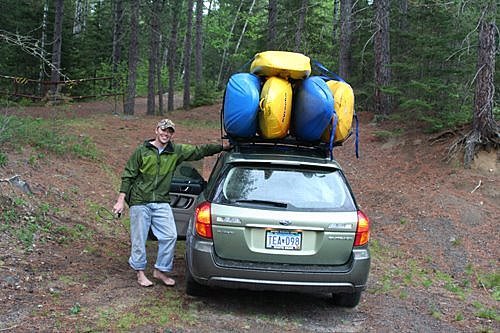
Mean Green takes a load. A summer shuttle can be easily set via a mountain bike FYI.