Neshota/West Twin
Zander Road to Hwy.147 (3.5 miles)

| Difficulty | I-II(III) |
| Length | 3.5 mi |
| Avg Gradient | 15 fpm |
| Gauge | Kewaunee River Near Kewaunee, Wi |
| Flow Rate as of 1 hour | 38 cfsbelow recommended |
| Reach Info Last Updated | March 4, 2025 |
NOTE regarding gauges: On the gauge page, we reference a pair of gauges, which may often disagree on runnability of this reach!
Ideally, you will want BOTH gauges 'showing green' and rising (or at least holding relatively steady) to 'confirm' runnability.
One gauge 'green' and the other 'yellow/orange' should tell you it's a crapshoot -- it could be too low, or it could be sweet -- you have to decide if you're willing to risk the drive.
Quick Facts:
Location: About midway between Manitowoc and Green Bay (~20 miles to each).
Shuttle Length: 4.3 mile
Character: Fine rural trip has a mini-dells early on, and a couple short (6'-1') ledges, and a sweet series of waves/holes where the river slides down sloping bedrock just before the confluence with the Devils River.
Put-in is approximately 674' elevation.
Take-out is approximately 619' elevation.
Thus total elevation change is approximately 55'.
General Overview
A cute, small dells, and short bedrock ledges make a pleasant beginners paddle. This makes a great 'intro to whitewater' run, and is generally well suited for canoes and recreational kayaks. Be aware, however, that if you catch this at high water, the approach to the confluence with the Devil's River will push into class III (or III+) difficulty, and is VERY likely to swamp (capsize) your canoe or kayak. In fact, a couple of the holes will become very 'keepy'! Skirt them and it's a fun run, fail to skirt them and it's an almost certain 'yard sale' for all but the most experienced whitewater boaters!
Note: At the confluence with the Devil's River, the Nashota becomes the West Twin, one of the two rivers which give the town of Two Rivers its name. The 'falls' marked on the topo maps on this reach are either non-existant, or so inconsequential as to be of no concern to all but the most inexperienced of boaters.
Also, while there is a 'falls' mar
...
USGS lists a sampling site about 3 miles (crow-flies distance, not river distance) upstream of our listed put-in, citing drainage at that point as 43.1 square miles.
USGS lists a sampling site on Black Creek about 1.8 miles (crow-flies distance, not river distance) upstream of our listed put-in, citing drainage at that point as 21.7 square miles.
Drainage area at our listed put-in is approximately 71.2 sq.mi. (as calculated via USGS StreamStats Beta software). By our listed take-out, it has increased to 114 square miles (60% increase).
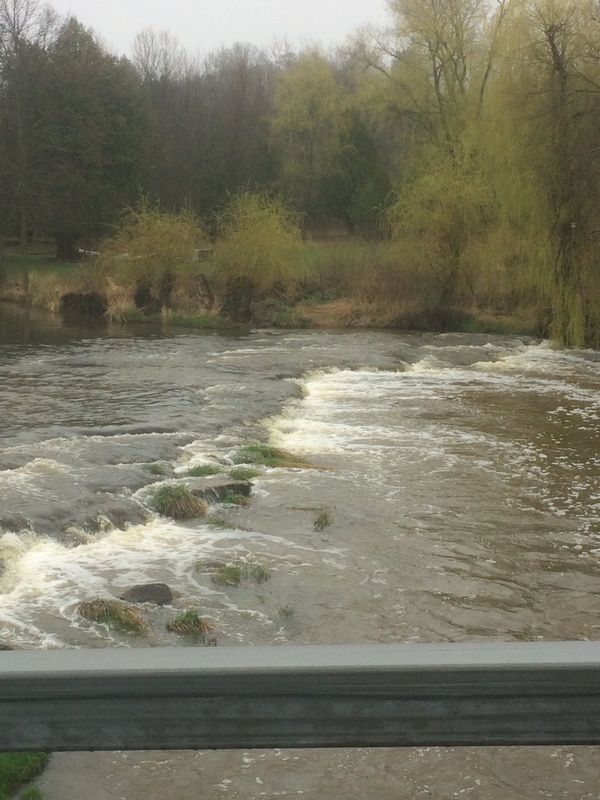
In Southeastern Wisconsin, it does not take much to be labeled a 'falls'. At this location, you will find a 1-2' ledge. At some flows, there may be some minor play possible here, but more likely, it will be little more than a short drop (or minor wave) to excite only those not much experienced in whitewater.
Just downstream of the bridge, a small dells will be encountered. At some flows, minor compression waves may form through here.
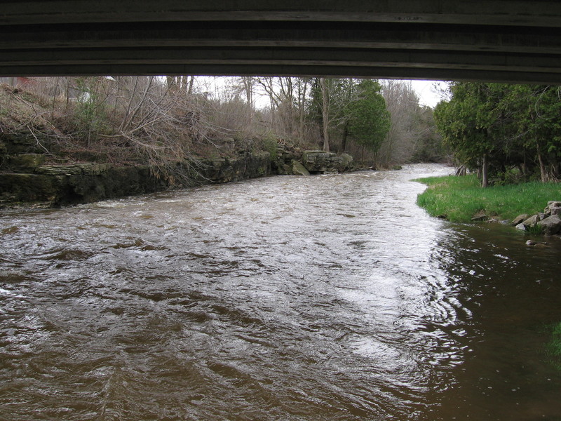
Starting from under the Nachtwey Road bridge, rocky outcroppings first flank river-left, then (just a bit more downstream) river-right.

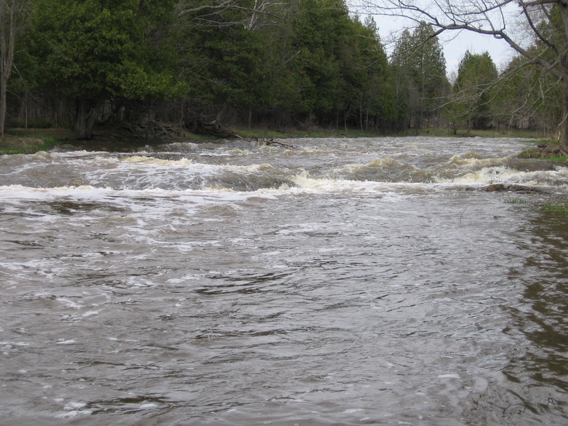
A river-wide ledge precedes a left-hand bend in the river. At most water levels, almost anywhere (across its width) can be run. At some flows, there may be some whitewater 'play' possible here, and at some flows a few spots may become a bit 'keepy'.
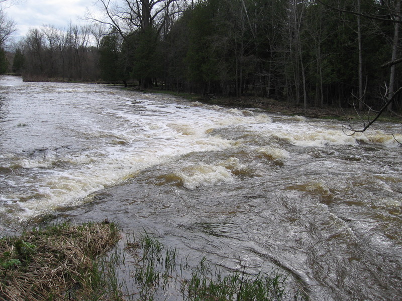
As you round a bend, you head toward the confluence with the Devils River, where the Neshota River ceases to exist, and the combined flow becomes the West Twin. Before the confluence, the Neshota drops over a series of bedrock ledges and waves. At low flows, they are unlikely to cause much problem, and may offer tame possibilities for play. At moderate or higher flows there will be two holes that become rather 'keepy'. They can be skirted by staying far right. Scouting is advised (from river-left shore)! Be very aware as you walk, however, as there are random strands of barbed wire waiting to trip you or rip at your ankles.
A house on river-left has a cement 'ford' in the river, to drive across at low flows. A suspension foot-bridge overhead allows the owners to park on river-left and cross over on foot at times of higher flows. For the boater, this cement 'ford' will cause a few ripples and waves, but should cause no hazard to boating.
Most topographic maps have a 'falls' marked at this location. At all flows and all occasions which I have run this river, I have never been able to identify just what 'falls' they are talking about. There are a few spots which have some minor ripples and riffs, but do not expect (or worry about) any 'falls' on this part of the river.
Apr 22, 2017
The 'falls' at Nachtway Road, at a marginally low-boatable flow.
Apr 19, 2014
UPDATE: A tornado (summer, 2013) reportedly had filled the stretch from Devils
Meet Ledges almost all the way to Hwy 147 with many strainers and trees completely spanning the river. As of 2015.12.14 we can report that the West Twin is substantially clear of that debris.
May 13, 2010
At 266cfs every feature is runnable virtually anywhere and at a low Class 2 level. Excellent run for entry to the sport and for beginners. While the ability to roll is always preferred, lack of a roll should not be the reason to avoid this reach at this level.