St. Francis
3. (Lower St. Francis) Millstream Gardens to Silver Mines (2.3 miles)(Tiemann Shut-Ins)
| Difficulty | II-IV |
| Length | 2.3 mi |
| Avg Gradient | 35 fpm |
| Reach Info Last Updated | July 20, 2020 |
River Description
Gauge Description:
(Also see Gauge FAQ)
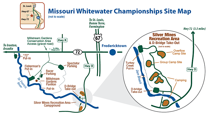
Look for ½' of rain within 6 hours at rain gages in upper watershed (Roselle and above). Dry ground takes more rain but intense rain at any upstream gage can bring a delayed rise in the river as much as 12-24 hrs later. The USGS Roselle gauge is accessible either on-line or by phone at 1-573-546-2502. The Roselle gauge is correlated with the paddler's gauge on the footbridge (old highway D bridge) at the takeout in Silver Mines Recreation Area. The paddler's gauge is on a bridge pier with marks from 0 to 42 inches (top of the bridge). For levels up to the top of the bridge, the approximate conversion is
D-bridge (inches) = 15 * (Roselle – 3)
Levels over the bridge are marked on the road in 1-foot intervals as the road goes up the hill. For levels that are over the bridge, the approximate conversion is
D-bridge (feet over the bridge) = (5/4) * (Roselle – 6)
Since it is pretty much the “only game in town” for regional paddlers, the Lower St. Francis is boated over a wide range of levels. Because of its gradient, the Tiemann Shut-ins section significantly increases in difficulty with greater flow, as shown in the table below:
St. Francis @ Roselle
**(feet)**St. Francis @ Roselle
**(cfs)D-bridge gaugeLower St. Francis rating**
3 - 4
150 - 500
0 - 15 in
II - III
4 - 5
500 - 1000
15 - 30 in
III
5 - 6
1000 - 1700
30 - 45 in (top of bridge)
III+
6 - 8
1700 -
River Features
No river features have been added
Trip Reports
Log in to add a reportNo trip reports yet.