Crane Pond Creek
Crane Lake to County Road 134 (Minimum Rd/Neal Huff Rd) (2.35 miles)
| Difficulty | III-IV |
| Length | 3 mi |
| Avg Gradient | 84 fpm |
| Gauge | East Fork Black River Near Lesterville, Mo |
| Reach Info Last Updated | November 25, 2010 |
Gauge Description:
The USGS gauge is a crude indicator for runnability of this small creek. Better to look for 1-2' of rain within 24 hours at the Glover rain gage and look for a sharp rise in the E Fork Black River. A paddler’s gauge is on the CR 134 low-water bridge at the take-out.
Crane Pond Cr @ CR 134 bridge
(feet)*Minimum0.8*Optimum1.2 - 3.0Maximum3.5
It is not recommended to run Crane Pond Creek below the minimum or above the maximum. Low-water runs entail a lot of boat abuse since the creek bed widens significantly after leaving the gorge. High-water runs present definite pinning possibilities since there is a mile-long section of “willow jungles from hell,” a consequence of the creek bed being dewatered by the upstream reservoir.
River Description:
Park in the parking lot right next to Crane Lake. Put in and paddle toward the gorge in the distance ... about 1/4 mile. (Note: this distance is not included in the gradient numbers cited above). The lake and land surrounding the gorge are public lands (Missouri Dept. of Conservation & Forest Service). After the creek exits the gorge, it's all private until the take-out.
While the run is only 2.35 miles, you'll need to paddle across the lake, carry around the dam which creates Crane Pond, scout the drops (7 in all), pick your way through willow jungles from Hell, and carry around a dam 1/2 mile above the take-out, so it will seem longer.
The gorge drops about 80 feet in 1/2 mile before it ends. Scenery is spectacular in the gorge, with short, catchable eddies. The most serious drop (about the 3rd or 4th one) is recognizable by the cre
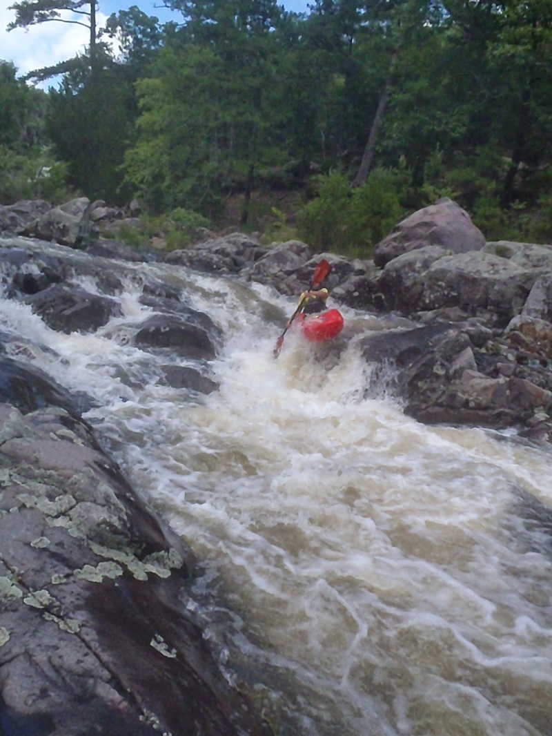
...Jun 25, 2015
Paddler Ryan C. Boofs the first drop. The level was .5 at the take out. Probably the minimum level.
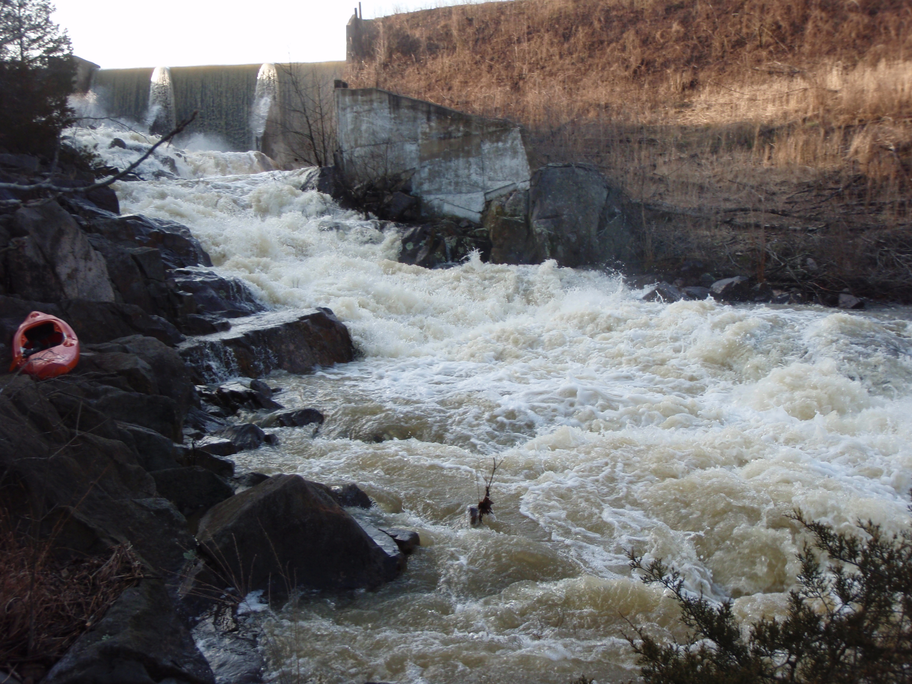
Mar 19, 2008
This is the river right side of the dam. It is runable from the first eddy seen above the boat in the photo. Watch out for the hole right next to where the boat is.
We ran this doing a flare move off the river left tongue toward the center.