Eau Claire (Chippewa trib.)
B) Little Falls to Big Falls (1.4 miles)
| Difficulty | II-III+ |
| Length | 2.2 mi |
| Avg Gradient | 14 fpm |
| Reach Info Last Updated | September 7, 2020 |
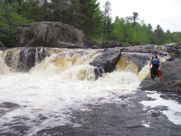
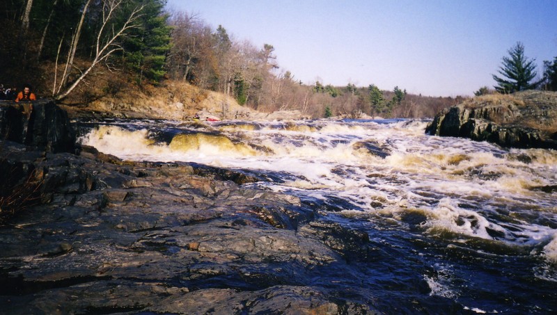
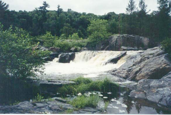
Big Falls provides area boaters a play spot and nice sized drop. The river splits around a small island. River left is pretty much of a sheer drop about 5-6' (practice your 'boof'), while river right is a series of steps and slides which should provide more play possibilities.
Do the full, listed, 1.4 mile run, or just park-and-play at Big Falls. We have no specific info about Little Falls, other than it is just upstream of the bridge on Hwy.K. (Thus, if you put-in right at the bridge, you miss that falls!)
This may provide a fine companion piece for boaters who take advantage of the scheduled releases at Jim Falls on the Chippewa River.

There is a county park each side of the river, with an accesss/parking fee ($3 as of latest information we have). It is a bit of a walk down a good path to the viewing area at the falls.
There is a county park each side of the river, with an accesss/parking fee ($3 as of latest information we have). It is a bit of a walk down a good path to the viewing area at the falls.
USGS lists a sampling site at CTH.K with drainage area of 709 square miles.
Apr 2, 2012
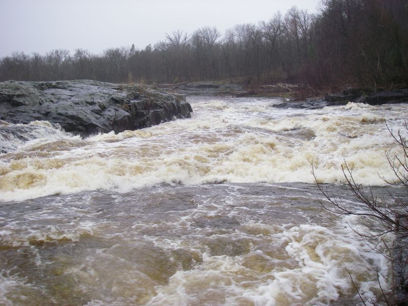
Ran at 5.35ft on the NOAA gauge, 4.9 by visual on the Hwy K bridge. Left side was class IV and the right side was III/III+. Worth it.
\\\**********************************************************************************************
Ran at 2.12ft/471cfs on the NOAA gauge, ~1 by visual on hwy k bridge. Both sides were runnable. On the right side there was a far left 'creeky' line that was clean and fun to run. A pillow formed on a guard rock which helped. The more traditional line in the upper portion, down the right side was getting bony (rock slides) at this level.
May 1, 2011
Left side was runnable with a big boat and a solid boof. Right side was good with the right line and a few key braces. There was an OK line on the left down the right side, but the huge wave at the middle made it a little less enticing. Gauge was visually seen as 4.9ft at the hwy K bridge, but NOAA said 5.35ft.
May 1, 2011
There is a 3$ fee for access to the falls via the county park. And if it is a nice day, you will have a few observers. I use the south side entrance as it is closer to the falls. You can also ferry across to the right side which has a little more of a technical carry up.
Jun 13, 2010
I made a trip up to big falls recently but the water level was very low. Both the left and right side were unrunnable. There is now a large log in the center of the falls on the river left side making it unrunnable. Great little class II-III run if the water is up.
May 23, 2010
Big falls is nice companion for running jim falls just 25mins up the road.
Apr 24, 2010
First time running it but it seemed low. River right was a lot of bumpin and scrapin. Fun run though.
Apr 4, 2010
NOAA still operates the gauge (Eau Claire R near Fall Creek), and USGS still records peak streamflow at this site. The gauge seems to be at Co Hwy K just upstream of Big Falls.
May 9, 2009
The river right side was bumpy but runnable. There is a rock under the falls that bounces you away from the base, just have to hit it straight on at this level.
Jan 1, 1900
This is the route on the opposite side of the island
from Big Falls.