Mississippi
Chain of Rocks (Riverview Drive, north St. Louis) (PnP)
| Difficulty | III-IV |
| Length | 1.4 mi |
| Avg Gradient | n/a |
| Gauge | Mississippi River at St. Louis, Mo |
| Flow Rate as of 34 minutes | 14.02 ftmedium runnable |
| Reach Info Last Updated | March 3, 2022 |
Warnings
From the StreamTeach website, linked below:
Dangers
Can't get out on land that touches the Missouri bank because this is private property owned by the City of Saint Louis (for the water treatment plant). Security is no longer allowing folks to get out of their boats.
There is a nasty low-head dam in the middle of the shoals,100 yards or so below Blockhouse but above the other play features. 'Oil Can Hole' is a dangerous life-threatening hole that is difficult to rescue from.
Detailed information is available at StreamTeach.
Apr 15, 2004
Roolies Hole against river right bank just below the
St. Louis City Water Treatment Plant
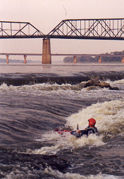
Sep 22, 2001
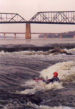
Paul Knobleloch playing Salmon Run Hole at 4 feet.
Dangerous Oil Can Hole in mid-ground. Old Chain
of Rocks Bridge in background.
Aug 26, 2001
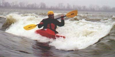
Looking west toward Water Treatment plant from S-
Eddy. Doug Pineo playing Primo with Cobblestone
in background.
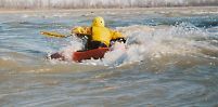
Aug 12, 2001
Highest level for Cobblestone. Below this the wave
collapse and becomes great for virtually any
playboat move.
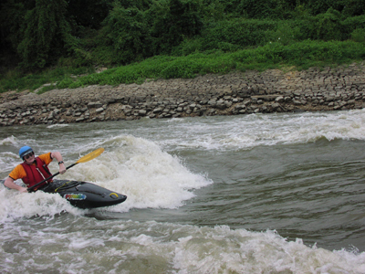
Jan 15, 2001
Good level for Cobblestone. Another view of
Cobblestone at record low 2003 level of minus 3
feet is at:
http://www.umsl.edu/~hsmith/movies/
cobblestone_ref.mov