Pemigewasset
1) Upper Pemi(Profile Lake—Franconia Notch)
| Difficulty | V |
| Length | 3.7 mi |
| Avg Gradient | 200 fpm |
| Gauge | Pemigewasset River at Woodstock, Nh |
| Flow Rate as of 1 hour | 2.36 ftbelow recommended |
| Reach Info Last Updated | September 7, 2023 |
Source: Greg and Sue Hanlon's Steep Creeks of New England, which has more info on this run. Text used with permission.
Directions: Park in The Basin parking area, from I-93 South in Franconia Notch State Park; put in on the North side of the lot.
To takeout: take I-93 South to Exit 1. Follow Rte. 3 South toward Lincoln. The takeout is behind the Indian Head Hotel / Resort on the left. They'll usually allow you to park in the hotel parking lot, but be courteous; we don't want to lose this privilege.
To retrieve a car from the putin, you'll need to drive North on I-93 to Exit 2 (Cannon Mtn. Tramway Exit). Bang an Interstate U-Turn and head South back to The Basin Exit.
The first known descent of the Upper Pemi was April 26, 1992, by Bob Potter, Gary Weiner, Greg Hanlon, and Steve Hyndman. The first run of the North Pole occurred several years later.0
Flow Info:
River-left abutment footing platform on the downstream side of the covered bridge below Flume Brook, behind the State Park visitors' center. Two inches below the platform is minimum; two inches above and a foot above are medium and high, respectively.
Falls into a beautiful Dark Basin which is actually a large pot hole.
There is currently a large log wedged in here that may be hidden at medium or higher flows, please portage this until the hazard is gone.
Narrow Slide though a stronger hole. Get ready to be thrown for a hard brace.

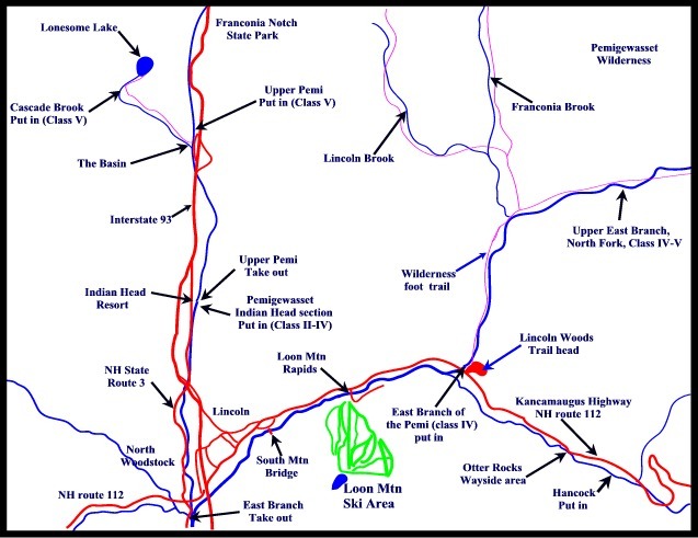
Once you pass under the Rt 93 bridge quickly be on the look out for a significant horizon line within a gap in the boulders signalling the need to get out of the river to scout and more likely portage (on right). The North Pole is frequently portaged due to significant sieve action.
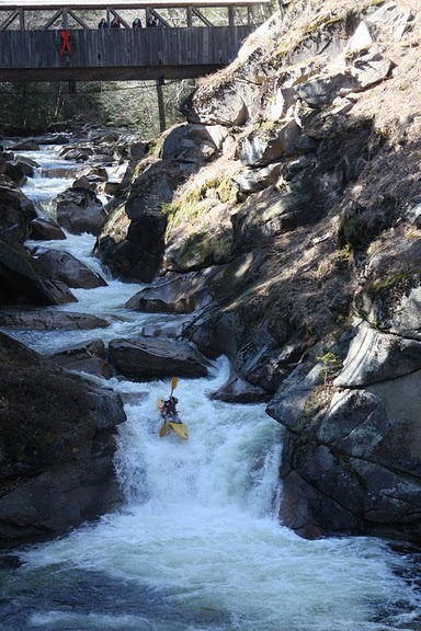
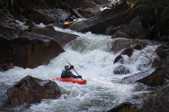
Spectacular Rapid! The highlight of the run.
'Wham' is the Sieve drop directly upstream of the Sentinel Pine Covered Bridge.
'Bam' is the bad hole created by water slamming the Left wall creating bad recirculation into the hole...especially bad at lower flows...deceptively so.
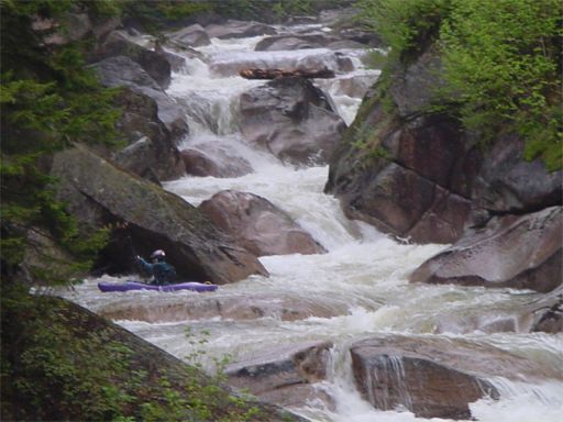
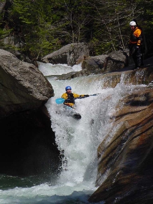
'Thank You Ma'am' is the last beautiful falls dumping into a large calm pool.
All but the most bold of boaters will portage the ugly 'Wham' sieve. Portaging on River Right affords a spicy seal launch just above 'Bam' while others portage directly behind the River Left sieve via a crack with a sketchy walk on the edge of the sieve. Apparently some boaters regularly fire up the narrow hard to hit sieve line at low water but a screw up seems very likely fatal. The Left portage permits a better entry into 'Bam', where as the river right seal launch has you on 'Bam' in all of 2 seconds. (Note: Close up Sieve pic in AW Gallery)
Even more conservatively you can climb down directly off the river right seal launching boulder with great care. The down climb is difficult and easy to fall but you will be able to cross a pool, and climbing over one more boulder. Now you will be downstream of 'Bam' and in a calm spot to put in to run the final waterfall.
6705
View of sieve from upstream approach.
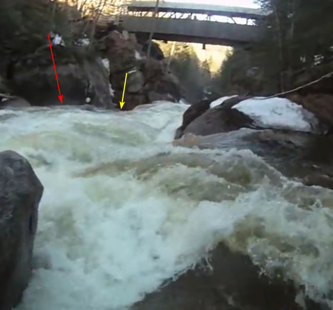
There is a Dangerous Sieve located in Wham, Bam, Thank You, Ma'am, the marquee rapid directly beneath the Sentinel Pine Covered Bridge. An expert kayaker was pinned and lost his life here in September 2012.
The sieve is not readily apparent from on-shore scouting. In the photo at left the longer red line points to the sieve while the shorter yellow line shows the usual route down the rapid.
As of mid-2017 the sieve is still very much in play despite reports to the contrary. Specifically, it's on river left underneath the giant boulder that forms the left shore and alongside the tight 3-4' tall chute that forms the first drop of the rapid. Be careful—it's easier to mistake a second sieve/rock pile on river right as the hazard; but much more difficult to see the fatal sieve on river left. It's definitely there only a few feet to the left of the usual line.
This is a major hazard. Please note that there is a climbing rope attached to the rocks directly underneath the bridge on river right that aids a portage around the top two stages of the drop.
View of sieve from covered bridge.
The second photo at left shows the view from the covered bridge with the longer red line pointing to the sieve with the shorter yellow line the normal route down.
6711
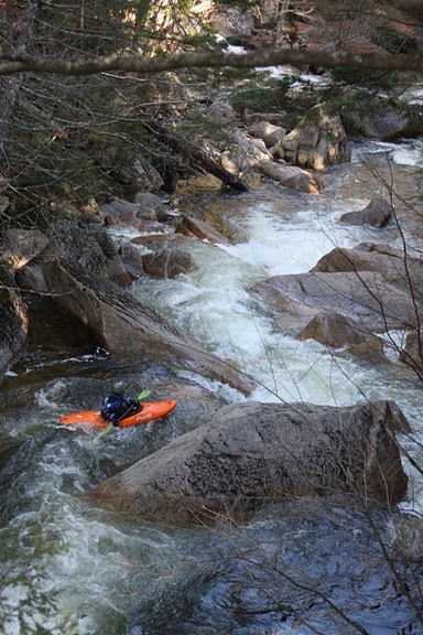
After Wham Bam are Fun Steep boulder gardens. Difficulty of drops vary widely but it is not too out of control. Many boaters will read and run on the fly but keep a good eye out for wood.
After the second covered bridge starts a mile or so of class 3-4 boulder gardens which ramp down towards the end.
Oct 4, 2010
AS OF THE 10-1-2010 High Water Event:
A very experienced boaters reported that Main Sieve hazard known to some as Wham in the Wham-Bam-Thankyou-mame rapid.....IS NOW GONE or so changed to greatly reduce the hazard.
Apr 16, 2010
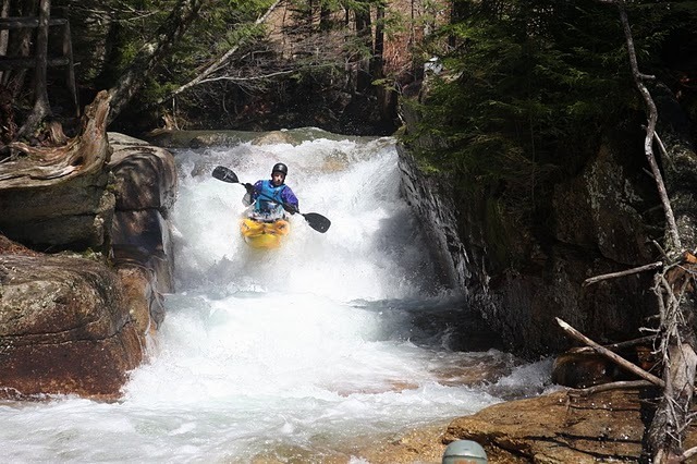
Dropping into the Basin. The Left wall is less in play than it looks.
Apr 16, 2010
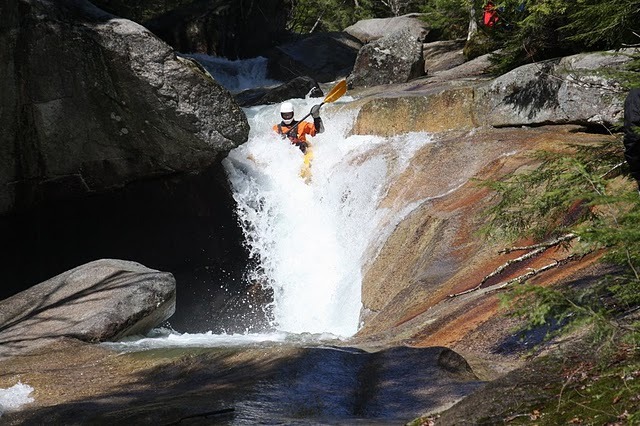
A fun slide that packs a good hole punch.