| Difficulty | I-II |
| Length | 12 mi |
| Avg Gradient | 12 fpm |
| Gauge | Strawberry River Near Poughkeepsie, Ar |
| Flow Rate as of 1 hour | 2.01 ftbelow recommended |
| Reach Info Last Updated | June 1, 2021 |
River Description
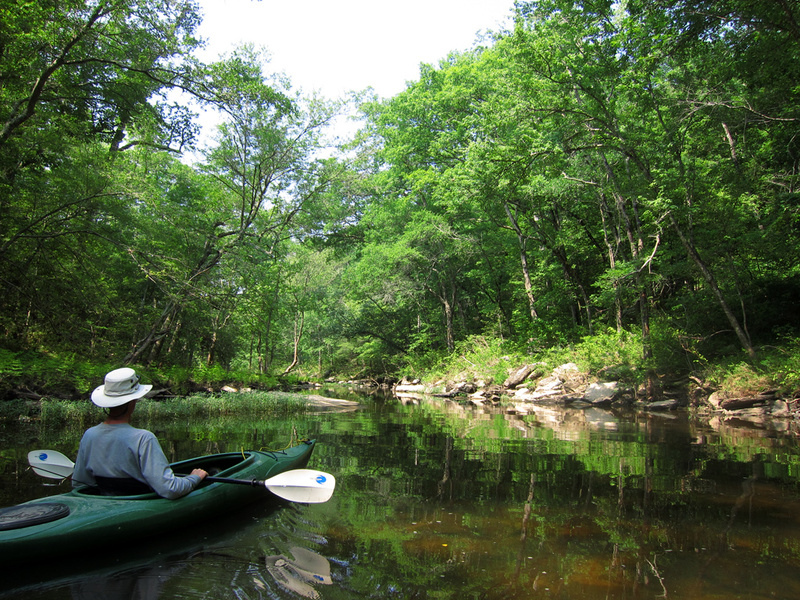
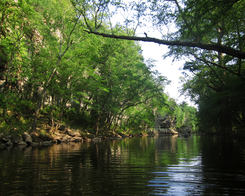
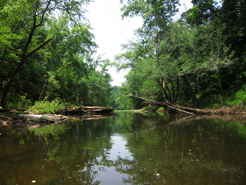
Very scenic trip through a wildlife management area with some nice bluffs. Watch for wood in a few places.
Put-in at low water bridge on Warren Mountain Road. Take-out at iron bridge on McJester Road.
The Strawberry River at Poughkeepsie is 50 miles from here and that's the way the bird flies. If anyone knows a better gauge to reflect actual water level, please edit this description to include it.
River Features
Put In
Access PointDistance: 0 mi
Take Out
Access PointDistance: 12 mi
Trip Reports
Log in to add a reportCS
Colten Shaver
May 31, 2021
Floated all 12mi from low water bridge to the iron bridge at 4ft.
Pros: beautiful scenery, lots of wildlife, several rapids followed by slow flat sections
Cons: the take out at the iron bridge is rough, at 4ft of water we barely were able to float under some of the low hanging trees, if water is much higher you will not make it under the trees, also several technical sections due to cyperous stumps and downed trees.
Advice to other floaters: do not float much higher than 4.25 feet or will not fit under trees (unless someone clears the trees)
?
Untitled
Jun 10, 2011
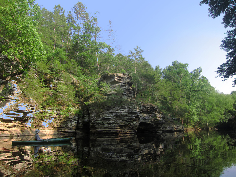
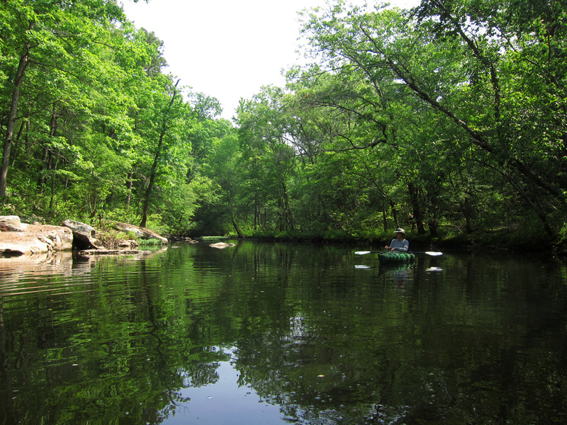
Some of the nice scenery along Big Creek. One of the pools you can kayak through.
?
Untitled
Jun 10, 2011
Some of the nice scenery along Big Creek. One of the pools you can kayak through.
?
Untitled
Jun 10, 2011
Some of the nice scenery along Big Creek. One of the pools you can kayak through.
?
Untitled
Jun 10, 2011
Some of the nice scenery along Big Creek. One of the pools you can kayak through.
?
Untitled
Jun 10, 2011
Some of the nice scenery along Big Creek. One of the pools you can kayak through.
?
Untitled
Jun 9, 2011
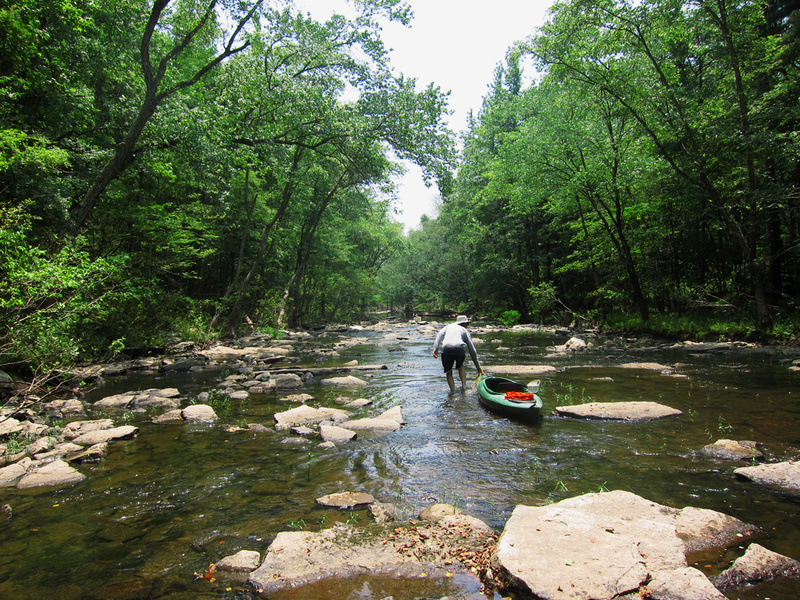
This creek is not runnable at 2.33.
A friend and I did the full 13 miles (by GPS) when the reported gauge reading was
2.33 We probably portaged and walked in the creek 25% of the time.
At least and additional +1 foot is needed to make it at all runnable.
We encountered many hazard that would pose problems at 3.33 feet or higher.
Some very scenic area and lots of fish life.