| Difficulty | IV+ |
| Length | 4.4 mi |
| Avg Gradient | 120 fpm |
| Gauge | Canyon Creek Near Amboy, Wa |
| Flow Rate as of 1 hour | 45 cfsbelow recommended |
| Reach Info Last Updated | January 29, 2026 |
River Description
Just a short distance north of Portland, Canyon Creek is a popular run for the after work crowd once daylight savings time hits. Dedicated paddlers also paddle this run before work in the winter for their morning adrenaline fix, or do multiple laps if they have more time. While it takes a little longer your first time down, you can bomb down the run in an hour once you know the lines. This river is a unique and valued whitewater resource for local paddlers and a destination for paddlers from around the world who make Portland a stop on their whitewater road trips. Consistent flows throughout all but the dry summer months, accessibility to the Portland paddling community, and great rapids make this a unique whitewater resource with significantly more available user days than many comparable runs in the region. The Annual Canyon Creek Extreme Race race is a spring event with a course from Thrasher down to the Hammering Spot that is widely regarded as one of the best sections in the country for a creeking race.
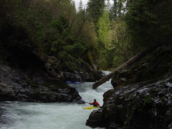
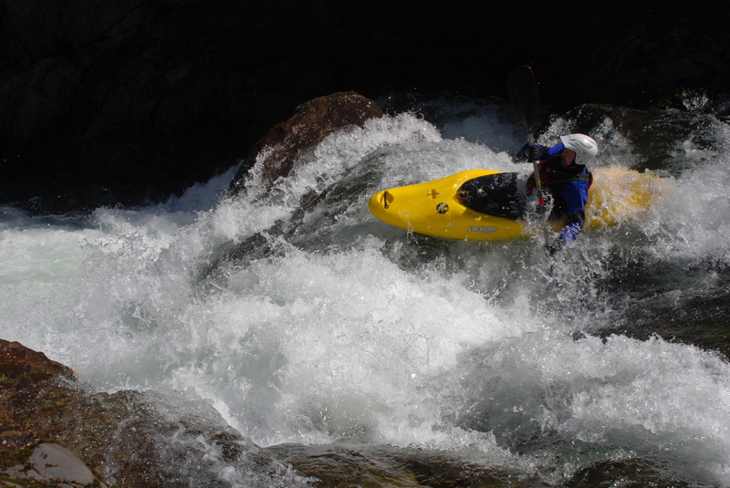
At moderate flows (500-1,000 cfs or so, give or take) most of the drops on this run are IV+. This is a great training run for those getting ready to make the jump to class V. The majority of the rapids are easy to portage or scout and at moderate flows there are good recovery sections to pick up the pieces after any carnage. Once on the river you're committed to the run as the bedrock canyon walls offer few opportunities to exit the river. Use caution at high water water that can signifcantly increase the hazard and challenge of this run.
Paddlers check the flow online or by gauging the river level relative to the bridge piling on river left (measured in inches above 'the unit') and then head off downstream. The first mile or so offers an easy warm-up through class II/III rapids. You can see a bit of this section from the road on the shuttle drive. The action starts as the canyon walls close in and you approach the first horizon line known as Swiz
...River Features
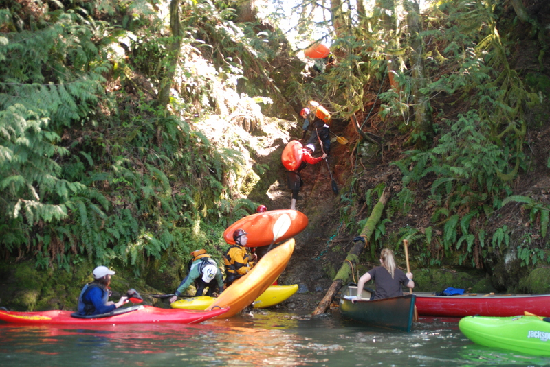
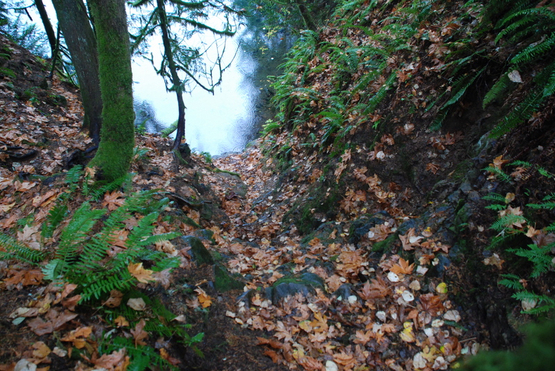
Put In
Access PointDistance: 0.03 mi
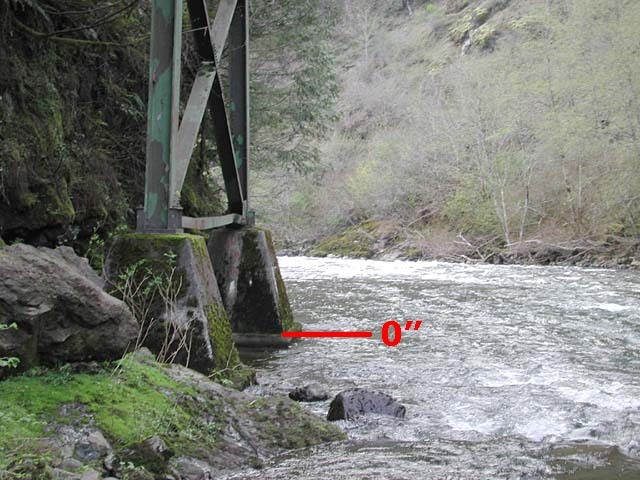
Put-in on upstream river left at the bridge across Canyon Creek at the confluence with Fly Creek. Check flows by measuring inches 'above the unit.'
Swizzle Sticks
RapidClass: IVDistance: 1.26 mi
This is the first significant drop of the run. You can scout from the right or just glance over your shoulder from the eddy on the left above the drop. Lines to the left and right are possible. Harder at low water, Swizzle is sometimes called 50/50 for your odds of making it right side up. Located at river mile 1.9.
Terminator
RapidClass: IVDistance: 1.43 mi

Just as you pass under the bridge you will be at Terminator. Drive around to the left to avoid the hole on the inside corner on the right. Located at river mile 1.7.
Prelude
RapidClass: IVDistance: 1.8 mi
Prelude to Thrasher or simply Prelude can be run to the right side. Located at river mile 1.4.
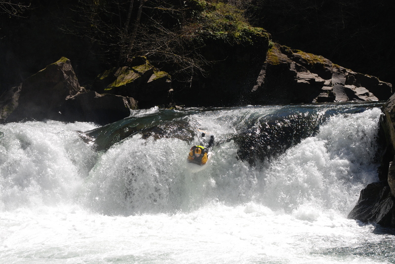
Thrasher
RapidClass: IVDistance: 1.85 mi
It's an easy scout or portage on the left. There are a couple different lines depending on the flow and your skills. A fun boulder garden section follows after Thrasher. Just stick to the left as you hit the last little ledge in the Boulder Garden. Keep your eyes open for the next horizon line at Kahuna. Located at river mile 1.3.
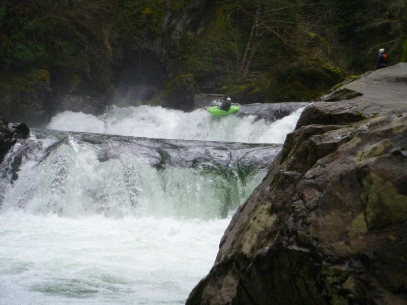
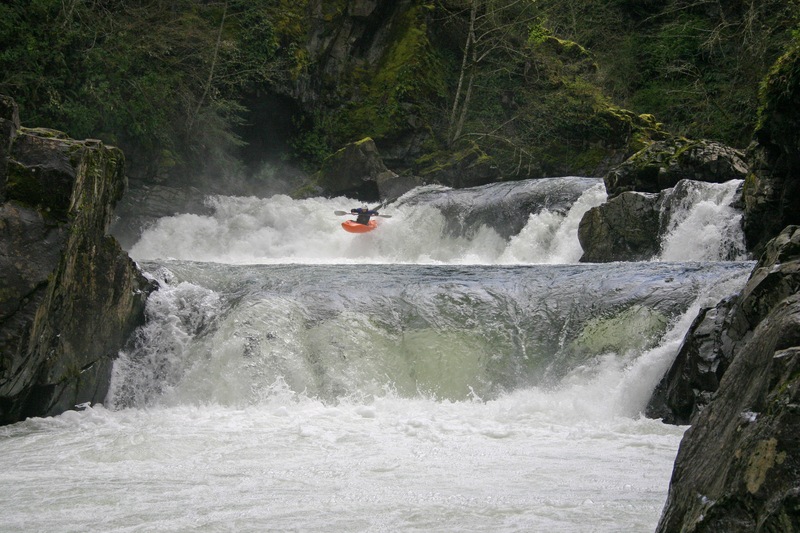
Big Falls/Kahuna
Waterfall / Large DropClass: VDistance: 2.16 mi
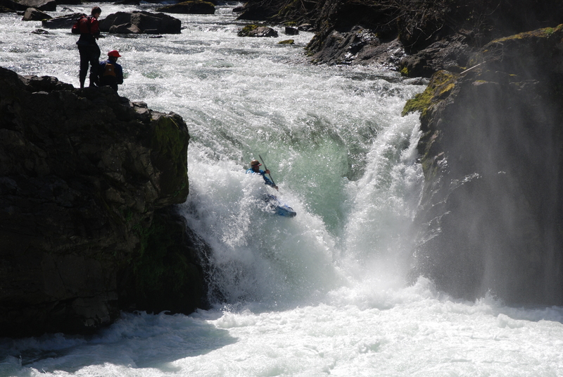
Kahuna is a 17' waterfall that plunges into a nice pool. It's a big drop but the approach is easy and there's a nice auto-boof on the right side. Just stay away from the undercut walls below the drop. River mile 0.9.
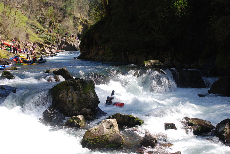
Champagne
RapidClass: IVDistance: 2.44 mi
One of the nicest boofs you can find. Hit the nice flake in the center and then get lined up for the right side of Hammering Spot which follows just below. You can also catch a good eddy on the left between these two drops. Located at river mile 0.45
Hammering Spot
RapidClass: IVDistance: 2.46 mi
Just hit the nice boof flake on the right and you avoid the hole. If you end up to the left prepare to get hammered. Located at river mile 0.4.
Toby's
RapidClass: VDistance: 2.52 mi
This drop can be safely run but it's important to know the hazards. Toby Scarpella drowned running this rapid when he was pinned. There is a left side boof that is an option but make sure you scout the landing zone and don't hit the rocks. Across the center there are dangerous pin hazards. A final option is an S turn move on the right side. If there is any doubt on the line you can always take the conservative route and portage. Located at river mile 0.35.
Yale Bridge Take-Out
Access PointDistance: 4.38 mi
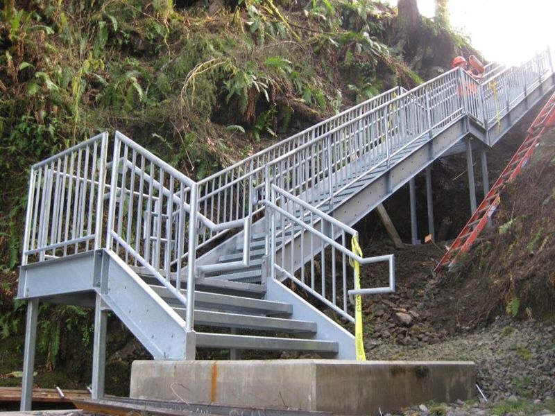
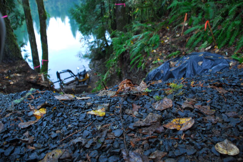
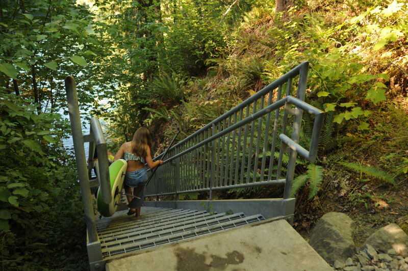
The take-out is at the Yale Bridge across the Merwin Reservoir at mile 28.8 on Highway 503. PacifiCorp manages this area as a recreational site assocaited with their Lewis River Hydroelectric Project and provides a parking area and a set of stairs down to the reservoir.
Trip Reports
Log in to add a reportTO
Take-out Access - Thomas O'Keefe
Aug 21, 2022
American Whitewater negotiated improved access at the Canyon Creek take-out as a condition for the Lewis River Hydroelectric Project. The site is also popular for hand carry craft accessing the reservoir in the summer.
TG
Accident Report - Teresa Gryder
Aug 14, 2021
Another accident should be added to the accidents link on this report. Also I encourage local boaters to report near misses on this stretch as I know they are happening, and would be useful for newcomers to understand. The report about Blaine's drowning at Champagne, high water, can be seen here: https://www.americanwhitewater.org/content/Accident/detail/accidentid/114454