Bluestone
2. Eads Mill to Bluestone State Park(Also includes RF 05050002004 and RF 05050002003)

| Difficulty | II-III |
| Length | 19 mi |
| Avg Gradient | 20 fpm |
| Gauge | Bluestone River Near Pipestem, Wv |
| Flow Rate as of 25 minutes | 3.36 ftbelow recommended |
| Reach Info Last Updated | May 1, 2025 |
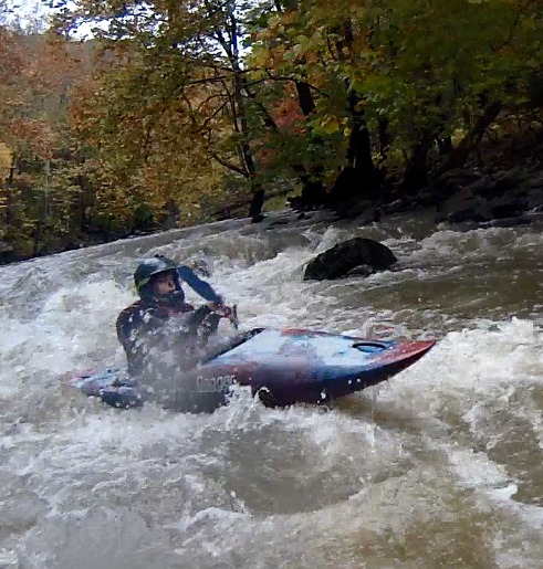
The first mile of this run to just beyond the confluence of Brush Creek which comes in on river right has the most gradient(40'/mile). It is a 10.9 mile paddle to the Tramway at Pipestem State Park. When the Tram is running one may haul boats and bodies out of the gorge by prior arrangement. Call 304- 466 - 1800 ext. 394 at Pipestem Lodge. They usually start operating sometime in April but it is advisable to call because high winds,mechanical problems, inspections, etc., quite commonly shut down operations. If paddling beyond the Tram there is only one or two rapids and then several miles of class 1 water and then miles of flat water caused by the back up of waters from the Bluestone Dam. Take out may be made at boat launching ramps at Old Mill camping area or Meador Camping area in Bluestone State Park or at the WV 20 bridge at the mouth of the Bluestone River. They are all on river left.
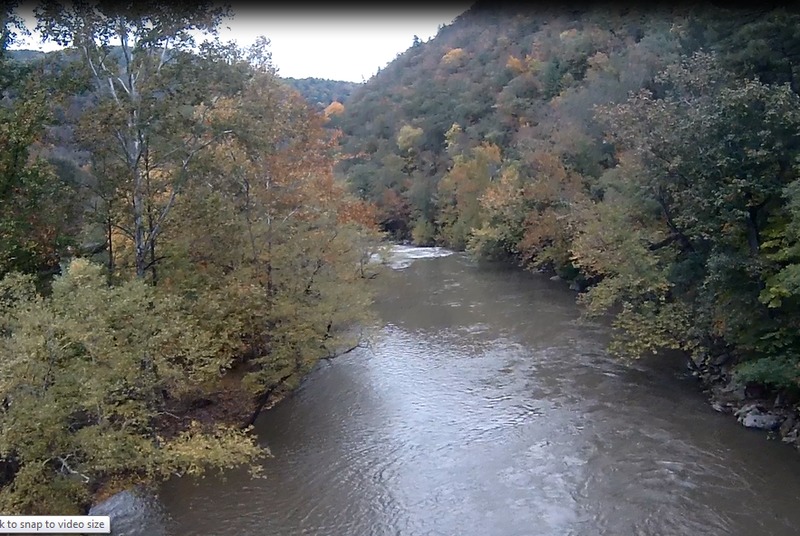
A 10 1/2 mile section of this river is a Scenic River administered by the National Park Service under the National Wild and Scenic River Act
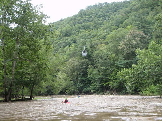
Pipestem State Park tram at Mountain Creek Lodge, river left. Pay fee at store for passengers/cargo. This is the one. Best takeout in West Virginia.
Bluestone State Park, river left. Park at the Turnpike trailhead, which is as far as you can drive upstream. Alternatively, use the Old Mill campground which is adjacent and slightly downstream.
Jul 13, 2020
so three takeout options, tram in park, call first, and the cost depends upon who is working at the lower lodge gift shop, no real consensus what to charge. There is a public access (nps) at Lilly before the lake (not listed here previously or in guidebook) and I have also taken out above the first campground (bluestone state park) you encounter coming into (at the gate at the very end of the road), I consider 800- 1200 cfs the best, still some rocks and ledges but not scrapey.
Jan 17, 2019
Between 5 and 6 feet is a really nice level for the Bluestone- the rapids in the first couple of miles have good surfing/eddy hopping, and there's plenty of flow for the flatter miles to the takeout. Nothing very difficult as no rapid really merits naming, but it's pretty and remote, with a cool takeout at the tram.
Oct 13, 2014
10 mile run, mostly class 2, with the exception of the first mile, which is class 3
Oct 13, 2014
unique end to a scenic trip, chairlift ride out of the gorge
Mar 19, 2011
Ran this 3/17/11 at a level of 4.6. There is a boat eating strainer river left, maybe 100yds after Brush fork comes in. It's a forked tree and the fork is only about 1 foot out of the water at this level, one fork submerges (to pin) and the other is exposed and broken (to push you under). A small boulder that forms the rapid above this hazard hides it pretty well for the unsuspecting......
Also, don't get distracted by the beautiful cliffs that are the backdrop for these rapids.